


|
|
Sierra Nevada &
Owens Valley Place Names: N - P
Sequoia National Forest & Sierra National Forest maps courtesy of Greg Farris |
See USE NOTICE on Home Page
Photo text (unless otherwise noted) is from
Place Names of the Sierra Nevada by Peter Browning |

The Sierra Nevada and Owens Valley are full of fascinating names
garnished over the centuries from Native Americans, trappers,
explorers, surveyors, geologists, packers, fisherman, frontiersman,
and settlers. These pages represent but a few of those names
and their origin. These are some of my favorite gathered from
my packing days with Mt. Whitney Pack Trains. These are names
which, for me personally, evoke wonderful Sierra and Owens Valley
memories - packers, camp fires, Sierra Club girls, nick names
such as Veggie, Manure Man, and Peek-a-Boo, mules with personality,
biting horses, Trail Riders of the Wilderness, countless trips
to the summit of Mt. Whitney, pack train wrecks, bronc shoeing
in the backcountry, rain at night in the Sierra, frozen tie lines,
loves lost and loves gained, and a host of majestic wilderness
scenes painted for all of us by the One Who seeks but to have
our hearts focused on Him.
|

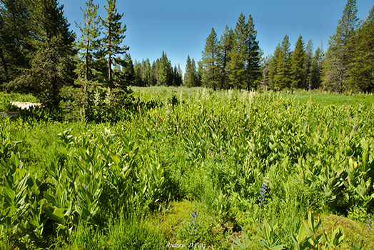
I know this looks like every other corn-plant filled meadow . . .
but according to the photographer this is Naked Lady Meadow
- even though a naked lady is nowhere to be found.
(Photo courtesy of Andrew)
|

Naked
Lady Meadow is a sizable meadow with a spring-fed marshy area
supporting a grove of large aspen trees. On the trunk of one
of the aspens a sheepherder had carved the image of a "naked
lady."
(The information was reported in a letter from N. King Huber of the USGS who mapped the area in the late 1950s]
|
Needham Mountain was named by W. F. Dean for James Carson Needham of Modesto. Needham represented California in Congress from 1899 - 1913. He also accompanied an inspection party on a trip to Mount Whitney in 1899.
[Sequoia Canyon National Park] |
|
 04/24 04/24
The first whites to see the grove may have been some members of the Mariposa Battalion. Galen Clark discovered — or rediscovered — the grove in the fall of 1857. The grove was at first named "Fresno Grove" because it was in Fresno County. Madera County — where the grove is — was not created until 1893.
John A. Nelder, a gold-miner of 1849, settled in the grove when he gave up mining. John Muir encountered him there in 1875. "The Fresno Big Trees covered an area of about four square miles, and while wandering about ... I came suddenly on a handsome log cabin ... Strolling forward ... I found an old, weary-eyed, speculative, gray-haired man on a bark stool by the door, reading a book .... The name of my hermit friend is John A. Nelder, a fine kind man, who in going into the woods has at last gone home for he loves nature truly, and realizes that these last shadowy days with scarce a glint of gold in them are the best of all." Nelder homesteaded 156 acres in 1886.
[John Muir - Our National Parks - 1901]
|
|
|
04/24
|
|
Lafayette H. Bunnell suggested the name when the fall was discovered in 1851. "The Nevada Fall was so called because it was the nearest to the Sierra Nevada, and because the name was sufficiently indicative of a wintry companion for our spring (Vernal Fall). The white foaming water, as it dashed down Yo-wy-we from the snowy mountains, represented to my mind a vast avalanche of snow." "Yo-wai-yi, Nevada Fall. In this word also we detect the root of awaia" — meaning a lake, or body of water. "A literal interpretation of the Indian name, Yo-wi-we, could not be tolerated, Yo-wi-we meaning the 'Squirming or Worm Fall,' from a twist given the water by a curving rock upon which the water strikes during its descent."
[Lafayette Houghton Bunnel - Discovery of the Yosemite, and the Indian war of 1851, which led to that event -1880]
[Lafayette Houghton Bunnel - Biennial Report of the Commissioners to Manage Yosemite Valley - 1889-90] |
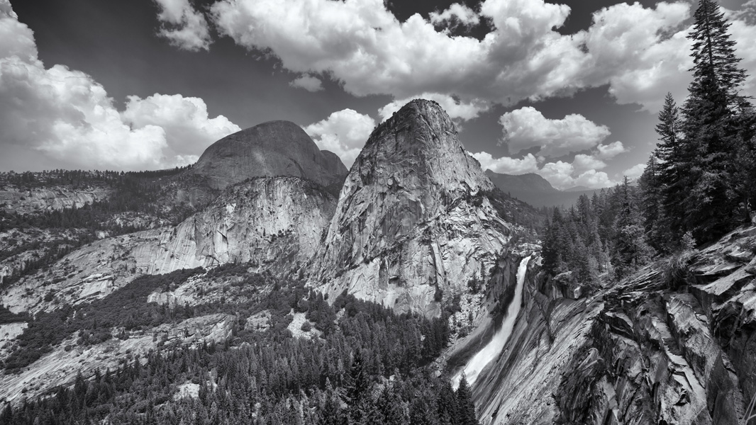
Nevada Falls
(Photo courtesy of fongpei) |
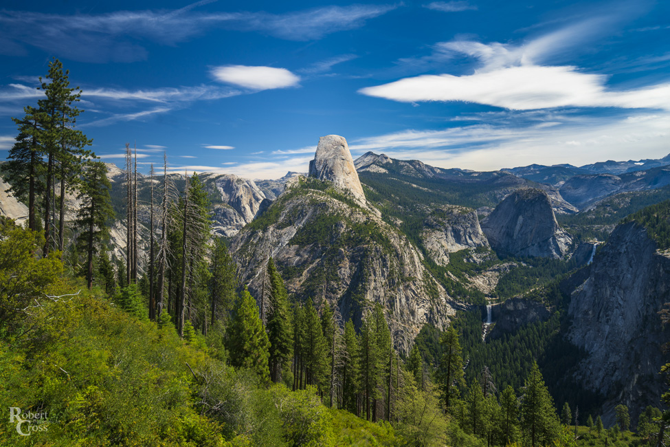 Half Dome, Vernal Fall, Nevada Falls
(Photo courtesy of Robert Cross)
|
04/24

Simon Newcomb (1835-1909), born in Nova Scotia, came to the US in 1853, and became a world-renowned astronomer and policical economist. He published tqables of motion of stars, planets, and the moon, which are used by navigators around the world. The name was proposed by the Sierra Club.
[Sierra Club papers in the Bancroft Library]
|
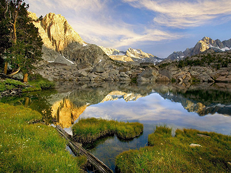
Mount Pickering (L) Mount Newcomb (C)
[Photo courtesy of JFR]
|
04/24
Probably named by the USGS during the 1903 survey for the Tehipite map it is on the first edition, 1905. It was first used in print by a Sierra Club party in 1908.
[Sierra Club Bulletin - 1908]
|
|
|
 Named for Norman Clyde, one of America's leading mountaineers. Hervey Voge first proposed the name for the peak in 1939. The name could not be made official until Clyde died in 1972.
[US Board on Geographic Names decision in 1973]
Named for Norman Clyde, one of America's leading mountaineers. Hervey Voge first proposed the name for the peak in 1939. The name could not be made official until Clyde died in 1972.
[US Board on Geographic Names decision in 1973] |
 L/R: Middle Palisade, Norman Clyde Peak
 |
 Norman Clyde
|
|
04/24

North Lake - naming . . . unknown |
 North Lake - Bishop
(Photo courtesy of 45SURF) |
03/24

Nutter Lake was named for Edward Hoit Nutter, assistant superintendent of the Standard Consolidated Mining Company of Bodie in 1905 by an engineer of the company.
[Farquhar:Nutter] |
 Epidote Peak was probably named by the USGS during the 1904-09 survey for the Bridgeport map. Epidote is a silicate of iron, calcium, and aluminum, often greenish in color.
[Toiyabe National Forest] |
|
04/24
Nydiver Lakes were named for David Nidever, a prospector in the early 1900s.
[Inyo National Forest archives] |
|
|
|
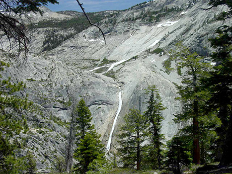
A descriptive name applied by the USGS during the 1903 survey for the Tehipite 30' map.
It was called "Devils Tombstone" on Lt. Davis's map of 1896.
[Sierra National Forest]
|
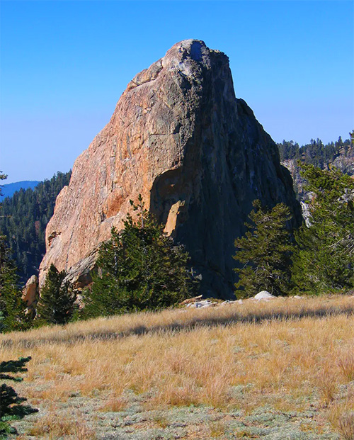
The Obelisk
(Photo courtesy of diggler) |
04/24
|

Charles Olaine propsected here about 1919
[Inyo National Forest] |
04/24
|

The varous "Tioga" features in this area received the name from Tioga County, New York. Perhaps a native of that state thought that one good transplant deserved another; New York State has an Oneida County and a lake and a town of that name. The Oneida Indians were one of the Five Nations of the Iroquois Confederacy. The name means "granite people" or "people of the beacon stone." The name was undoubtedly given to the lake at the time of the Lundy-Bennettville mining excitement in 1879-80.
[Henry Gannett - The Origin of Certain Place Names in the United States - 1902] |
04/24
Ostrander Lake
(Photo courtesy of Ron Wolf) |

The rocks were named by the Whitney Survey for Harvey J. Ostrander, who came to California during the gold rush. In the early 1860s he settled at the junction of the Glacier Point and Old Mono trails. Ostrander was a sheepman; his cabin was near Birdaveil Creek. The King and Gardiner map of 1865 and the Hoffmann and Gardiner map of 1863-67 show "Ostrander's Rocks," and the latter has "Ostrander's" — the cabin. The lake was originally called "Pohono Lake," since it was at the headwaters of Bridalveil (Pohono) Creek. It was ratified as "Ostrander Lake" by the US Board on Geographic Names in 1932.
[Yosemite National Park files] |
|
SEE  |
|
|
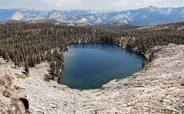
 Ouzel
Creek was named in 1924 by David Starr Jordan for the brook which
flows from Mount Brewer into East Lake. The water-ouzel abounds
here, and it is said that John Muir's account of the water-ouzel,
one of the finest bird biographies ever written, was based largely
on observations made on this very stream. Jordan apparently went
wild naming everything ouzel - Ouzel Basin, Ouzel Pool, Ouzel
Camp etc. Fortunately it only stuck in Jordan's personal sketch
map. Ouzel
Creek was named in 1924 by David Starr Jordan for the brook which
flows from Mount Brewer into East Lake. The water-ouzel abounds
here, and it is said that John Muir's account of the water-ouzel,
one of the finest bird biographies ever written, was based largely
on observations made on this very stream. Jordan apparently went
wild naming everything ouzel - Ouzel Basin, Ouzel Pool, Ouzel
Camp etc. Fortunately it only stuck in Jordan's personal sketch
map.
[Sierra
Club Bulletin, January 1900] |
03/24
See Below
[John C. Fremont, Geographical Memoir Upon Upper California]
|
|
 Owens River
[Photo courtesy of Ed Cisnalis] |
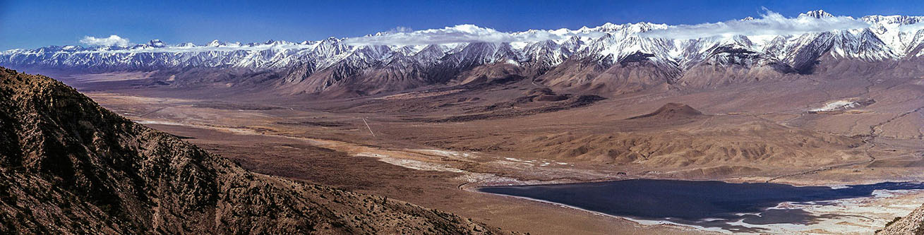 Owens
Valley looking southwest from the Inyo Mountains above Tinemaha Reservoir
[Photo courtesy Unknown]
Owens
Valley looking southwest from the Inyo Mountains above Tinemaha Reservoir
[Photo courtesy Unknown] |
 Owens
Valley, Owens Lake, Owens River, and Owens Point all derive their
name from Richard Owens who was a member of John C. Fremont's
third (1845 - 1846) expedition into the area. "That Owens
was a good man it is enough to say that he and Carson were friends.
Cool, brave, and of good judgment; a good hunter and a good shot;
experienced in mountain life; he was an acquisition, and proved
valuable throughout the campaign."
Owens
Valley, Owens Lake, Owens River, and Owens Point all derive their
name from Richard Owens who was a member of John C. Fremont's
third (1845 - 1846) expedition into the area. "That Owens
was a good man it is enough to say that he and Carson were friends.
Cool, brave, and of good judgment; a good hunter and a good shot;
experienced in mountain life; he was an acquisition, and proved
valuable throughout the campaign."
The party split up at Walker Lake, Nevada. Fremont, Carson, and
Owens crossed the Sierra via Donner Pass. Walker, Kern and others
went south and crossed via Walker Pass. "To one of the lakes
along their route on the east side of the range I gave Owens'
name." The names of the valley, the peak, and the point
are all derived from the lake. The man for whom they were named
never saw any of them.
[John C. Fremont, Geographical Memoir Upon Upper California] |
04/24

See Owens Valley
[John C. Fremont, Geographical Memoir Upon Upper California] |
|
Owens
Valley looking east across Owens Lake from the Horseshoe Meadows Road - 2021
[Photo courtesy of Ray DeLea] |
 Owens
Valley looking east across Owens Lake from the Horseshoe Meadows Road - 2023
[Photo courtesy of Ray DeLea]
Owens
Valley looking east across Owens Lake from the Horseshoe Meadows Road - 2023
[Photo courtesy of Ray DeLea] |
08/24
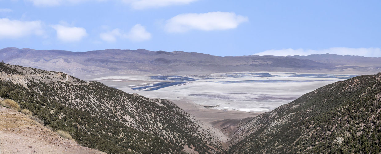
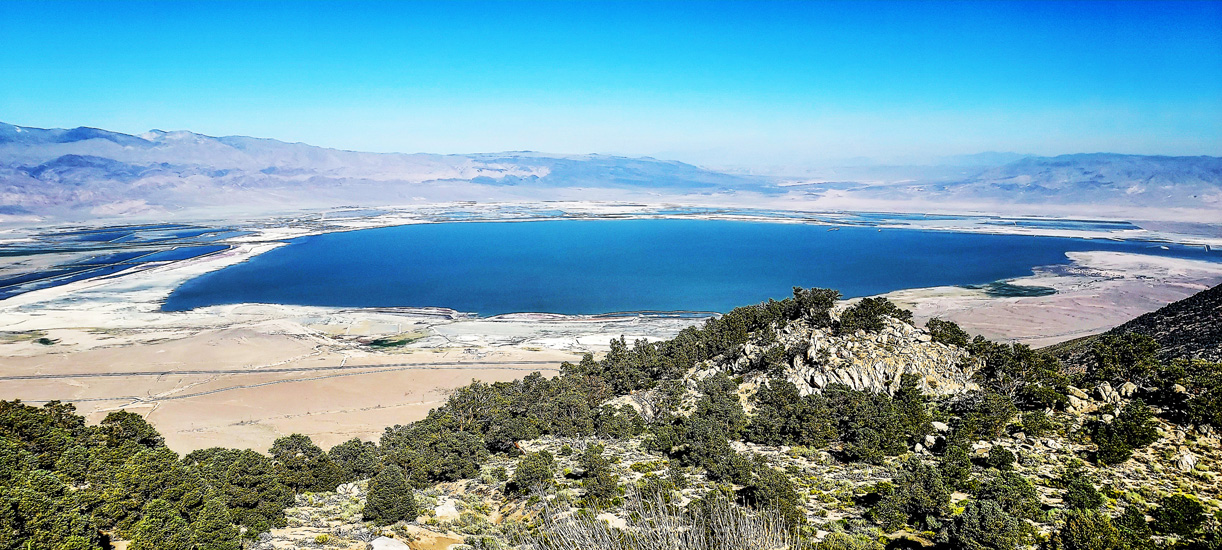
The Palisades were named by the Brewer party of the Whitney Survey in 1864 ". . . along the Main cest of the Sierra, is a range of peaks, from 13,500 to 14,000 feet high, which we called 'the Palisades.' . . . they were very grand and fantastic in shape." Palisade Creek was named by Lil Winchell. All the Palisade features except the lakes and the crest were name on the first editions of the Mt. Goddard and Bishop 30' maps, 1912 and 1913 respectively. The lakes and the crest were first name on the Big Pine 15' quad, 1950.
[Kings Canyon National Park]
|
 |
 Palisade Lakes - Mather Pass off in the distance to the right
[Photo courtesy of Michele D'Amico]
Palisade Lakes - Mather Pass off in the distance to the right
[Photo courtesy of Michele D'Amico] |
10/25
 |
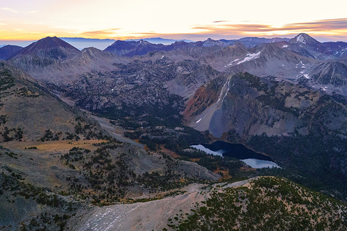
In this particular Sierra Nevada basin of the Mt. Abbot quadrangle are a rash of "Indian" names. Papoose, Warrior, Chief, Squaw. The apparently derive from "Lake of the Lone Indian," a name conferred in 1902. No one has ever confessed the deed, although it is possible that "Papoose Lake" - and perhaps others - were named in 1945 by William A. Dill of the DFG.
[California Department of Fish and Game survey] |
 Papoose Lake and the Lake of the Lone Indian (L)
[Photo courtesy of Michele D'Amico] |
03/24
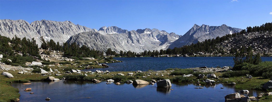
The creek was named for an early settler of Mono County. It has been suggested that the source of all these "Parker" names was Edward A. Parker, a student of Professor Joseph LeConte.
[Sierra Club Bulletin - 1922]
|
|
 Parker Lake
[Photo courtesy of Ed Cisnalis] |
06/24
Pywiack Cascade was called Py-we-ack, "the river of glistening rocks," or more literally, perhaps, "the river-smoothed rocks." The creek was called "Py-we-ack" by the Indians. The dome was remarked on by the Whitney Survey in 1863. "At the head of Lake Tenaya is a very conspicuous conical knob of bare granite, about 800 feet high, the sides of which are everywhere finely polished and grooved by former glaciers." Various names were given to the dome, among them "Murphy's Dome", "Teapot Dome," "Matthes Dome,"
"Ten-ieya Dome," and Turtle Rock." David Brower recommended "Pywiack Dome" in the early 1950s.
[Inyo National Forest]
|
|

Pee Wee Lake was named by Art Schober when he stocked it with fish, because "it's a little tiny bit of a thing."
[Inyo National Forest] |
 Pee Wee Lake
[Photo courtesy unknown]
Pee Wee Lake
[Photo courtesy unknown] |
09/24
Peeler Lake
[Photo courtesy of Ross Hutcheon] |
 Barnabas ("Barney") Peeler, an old resident of Bridgeport, patented 160 acres in section 9.T.4N.,R. 24E. in 1880
[Toiyabe National Forest]
Barnabas ("Barney") Peeler, an old resident of Bridgeport, patented 160 acres in section 9.T.4N.,R. 24E. in 1880
[Toiyabe National Forest]
|
| From a certain angle a natural bridge near the top of the peak creates a window, a "peep sight." On the 15-minute quad it is called "Lookout Peak." It was changed to the present name by a US Board on Geographic Names decision in 1975.
[Sierra National Forest]
|
|
|
|
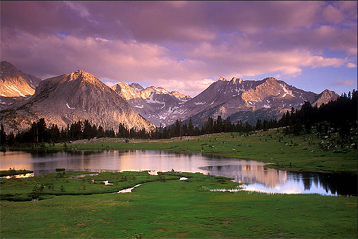
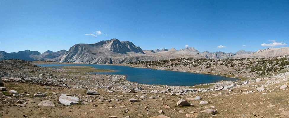
Pemmican
Lake was named in August 1951 by Elden H. Vestal of the California
Department of Fish and Game in reference to the travel food of
some North American Indians.
[Heyward Moore, Fresno, Past and Present - 1984] |
|
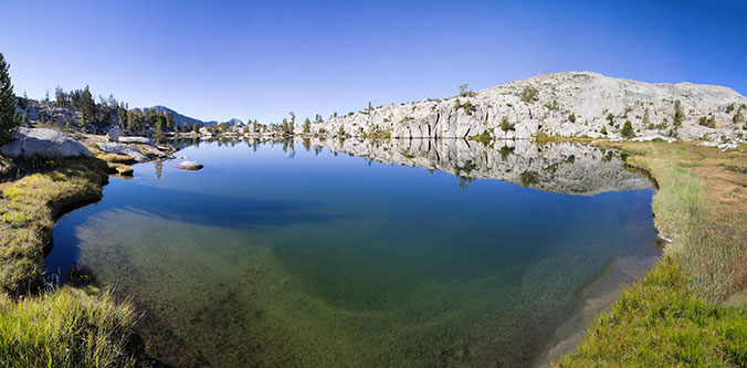 Pemmican Lake - Sierra Nevada
 |
04/24
|
Charles E. Peregoy had a cattle camp on the trail between Wawona and Yosemite Valley. In 1869-70 he enlarged his log cabin into a hotel for sixteen, named it the "Mountain View House," and with his wife operated it until 1878. The King and Gardiner map of 1865 shows "Trail from Peregoy's." The 1884 GLO plat had "Old Peregoy House." McClure's 1895 map had "Old Hotel"; his 1896 map had "Paragor's Meadow." Early editions of the Yosemite map mistakenly used "Paragon Meadow."
[Shirley Sargent - Yosemite & Its Innkeepers]
[Shirley Sargent - Pioneers in Petticoats] |
|
04/24
|
|
|
Named by Col. w. W. Forsyth, acting superintendent of Yosemite National Park, 1909-12, for Col. James Sumner Pettit, commander of the US Fourth Volunteer Infantry in the Spanish-American War.
[Farquhar Forsyth] |
04/24
The name was used informally during the 1930s and 1940s by packers and hikers. It was called "Marily Lake" on the first edition of the 15-minute quad. After Pande died in 1959, his son asked that the present name be made official, which was done by a US Board on Geographic Names decision in 1961
[Sierra National Forest] |
|
|
04/24
 The name first appeared in The Climber's Guide, and was added to the map by the USGS because it was in common use.
[Inyo National Forest]
The name first appeared in The Climber's Guide, and was added to the map by the USGS because it was in common use.
[Inyo National Forest] |
|
|
|
Pioneer
Basin was named by R. B. Marshall of the USGS during a 1907-09
survey for the Mt. Goddard 30' map, when he also named four peaks
for the pioneer railroad builders, Crocker, Hopkins, Huntington,
and Stanford.
[Sierra National Forest]
|

|
Pioneer
Basin
(Christopher Ryerson photo)
|
Pioneer
Basin
(Photos courtesy of Buck Forester)
|
Pioneer
Basin
(Photos courtesy of Buck Forester)
|
|
Buck's hiking companions - Heidi and Sierra
(Photos courtesy of Buck Forester) |
04/24
 From the General Land Office surveyor's field notes, 1877: "Plasse's house bears North about 5.00 chains distant," from the east-west line between sections 8 and 17,T.9 N., R. 17E. Peter R. Plasse homesteaded 160 acres in 1884 — the southwest quarter of section 8. The site of Plasse Trading Post was relocated about half a mile northeast on the 7.5-minute quad. "There never was a permanent structure at the site. Plasse erected a lean-to, and dealt with the emigrant trains for only one season." Research by the USGS established the position of the post in its correct place. This was verified through Maurice Plasse of Jackson, California, great-grandson of the Plasse for whom the site is named.
(USGS, Domestic Name Report) |
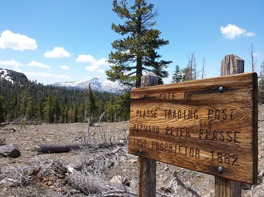
Plasse Trading Post
[Photo courtesy
of unknown]
|
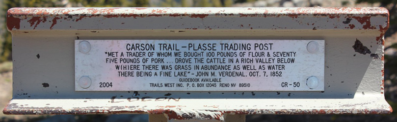
Plasse Trading Post on the Carson Trail
[Photo courtesy
of unknown]
|
|
|
|
|
Polemonium Peak is named after the Sky Pilot (Polemonium eximium)
flower. This flower typically grows only at altitudes above 12,000
feet on rocky ledges and slopes. Polemonium Peak is part of the
North Palisade complex of peaks. The picture below shows
Polemonium Peak nestled between Mt. Sill and North Palisade.
[US Board on Geographic Names decision] |
|
04/24
The name existed when the Brewer party of the Whitney Survey camped at the flat on June 23, 1863, but there is no indication that they named it. "We camped at Porcupine Flat, a pretty, grassy flat, at an elevation of 8,550 feet, surrounded by scrubby pines, and tormented by myriads of mosquitoes."
[William Henry Brewer - Up and Down California in 1860-1864:
the Journal of William H. Brewer]
|
|
04/24
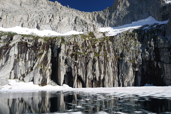
Precipice Lake
(Photo courtesy of Ben Zastovnik]
|
 A descriptive name that has been in use since before 1940. It was ratified by a US Board on Geographic Names decision in 1968. Formerly it was the upper of the three "Hamilton Lakes." That name now applies to only the two lower lakes. The lake is the one just north of Eagle Scout Peak. It has been made famous by the Ansel Adams photograph of the half-frozen lake beneath gray and black cliffs.
[Sierra Club Bulletin - 1933]
|
04/24

|
Puppet Pass (Carol Col) was named for Carol Kassler Ransford (1928-1974). In 1973 she led a group of hikers over a previously unnamed ridge on the northwest rim of Humphreys Basin. Although the name does not appear on the 7.5-minute quad, published in 1982, it was approved by the US Board of Geographic Names in 1978. It is 0.2 miles east-southeast of Roget Lake
[Sierra National Forest]
|
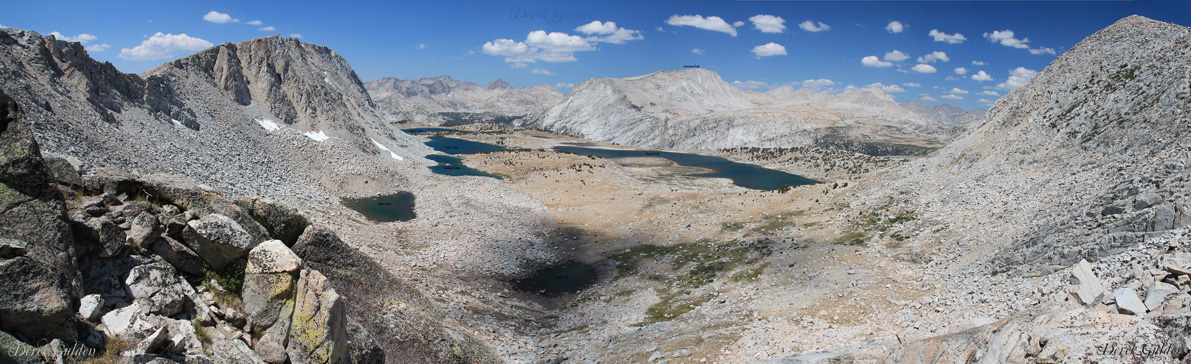 Puppet Basin from Puppet Pass (Carol Col), Puppet Lake is on the right
[Photo courtesy of Photography by Derek] |
|
 Puppet Lake
[Photo courtesy of sriehemann] |
03/24

|
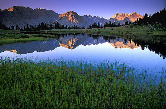
May-hued rocks reflect in its water giving it a purple tint at certain times of the day.
[Sierra National Forest]
|
 Purple Lake
[Photo courtesy of Ed Cisnalis] |
Pywiack Cascade
[Photo courtesy of Johnny Cheng]
|
 Pywiack Cascade and Pywiack Dome
were called "Py-we-ack" by the Native Americans. "The
north or Ten-ie-ya branch of the Merced River, which comes down
the North Canon from the glistening rocks at its source, was
called Py-we-ack, 'the river of glistening rocks,' or more literally,
perhaps, 'the river-smoothed rocks.'" Pywiack Cascade had
an earlier name of Slide Fall.
Pywiack Cascade and Pywiack Dome
were called "Py-we-ack" by the Native Americans. "The
north or Ten-ie-ya branch of the Merced River, which comes down
the North Canon from the glistening rocks at its source, was
called Py-we-ack, 'the river of glistening rocks,' or more literally,
perhaps, 'the river-smoothed rocks.'" Pywiack Cascade had
an earlier name of Slide Fall.
[Bunnell, Discovery, 1911] |
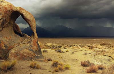
Sierra Nevada Thunderstorm
|