|
|
Sierra Nevada &
Owens Valley Place Names: A - F
Sequoia National Forest & Sierra National Forest maps courtesy of Greg Farris |
See USE NOTICE on Home Page
Photo text (unless otherwise noted) is from
Place Names of the Sierra Nevada by Peter Browning |

The Sierra Nevada and Owens Valley are full of fascinating names
garnished over the centuries from Native Americans, trappers,
explorers, surveyors, geologists, packers, fisherman, frontiersman,
and settlers. These pages represent but a few of those names
and their origin. These are some of my favorite gathered from
my packing days with Mt. Whitney Pack Trains. These are names
which, for me personally, evoke wonderful Sierra and Owens Valley
memories - packers, camp fires, Sierra Club girls, nick names
such as Veggie, Manure Man, and Peek-a-Boo, mules with personality,
biting horses, Trail Riders of the Wilderness, countless trips
to the summit of Mt. Whitney, pack train wrecks, bronc shoeing
in the backcountry, rain at night in the Sierra, frozen tie lines,
loves lost and loves gained, and a host of majestic wilderness
scenes painted for all of us by the One Who seeks but to have
our hearts focused on Him.
|

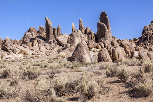
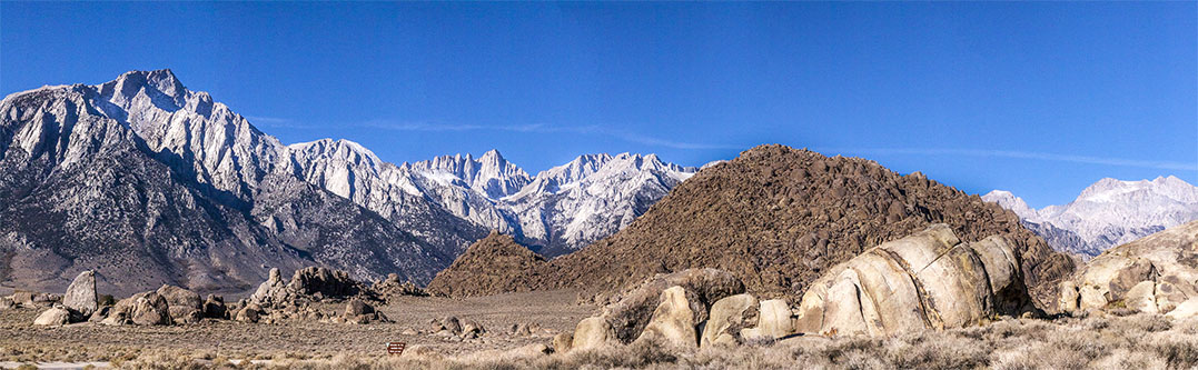 The Alabama Hills, Lone Pine Peak (left) and Mt. Whitney (center background) from off of Movie Road in the Alabama Hills, Lone Pine, CA.
(Photo courtesy of Ray DeLea) |
 "In
the early 1860's the Hitchcock boys discovered a mine in these
hills which they called the 'Old Abe' mine, and they called their
district the 'Alabama District.' They were Rebels and in those
days 'Old Abe' was a term of ridicule. But they named the district
in honor of the Confederate Cruiser 'Alabama.' These hills are
now called the 'Alabama Hills.'"
"In
the early 1860's the Hitchcock boys discovered a mine in these
hills which they called the 'Old Abe' mine, and they called their
district the 'Alabama District.' They were Rebels and in those
days 'Old Abe' was a term of ridicule. But they named the district
in honor of the Confederate Cruiser 'Alabama.' These hills are
now called the 'Alabama Hills.'"
The CSS Alabama was a British-built ship, with Southern
officers and a British crew, that destroyed a total of 64 American
merchant ships in the Atlantic and Indian oceans during the Civil
War. She was sunk by the USS Kearsarge off the port of
Cherbourg, France, in June 1864.
[Thomas
Keough, "Over Kearsarge Pass in 1864"] |
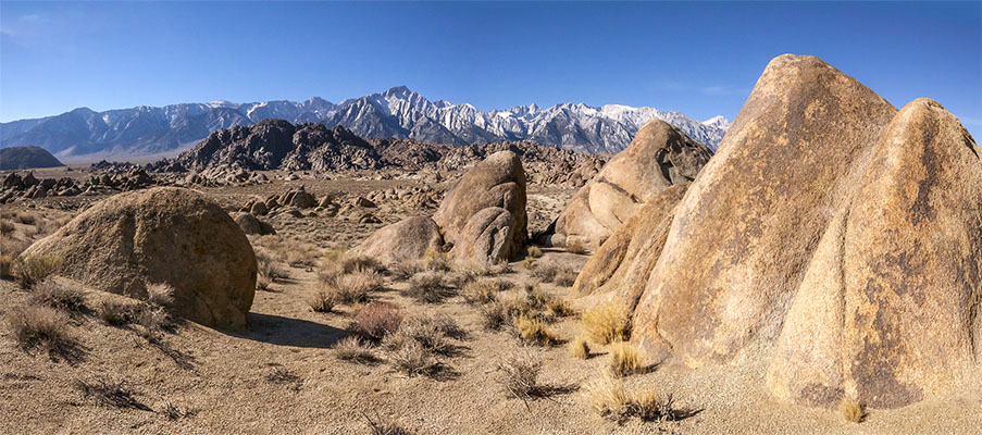 The Alabama Hills and the Sierra Nevada - Lone Pine, CA.
(Photo courtesy of Ray DeLea) |
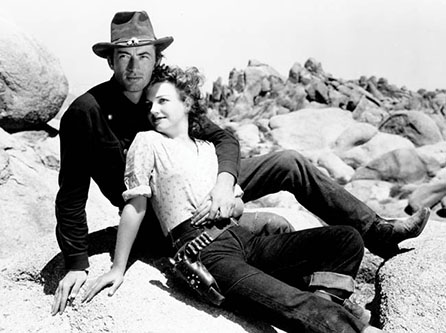 Gregory Peck and Anne Baxter in the Alabama Hills during the
filming of Yellow Sky
(Photo courtesy Unknown) |
 The Alabama Hills - Lone Pine, CA.
(Photo courtesy of Ray DeLea) |
 03/24 03/24
|
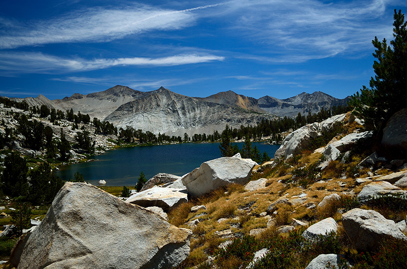
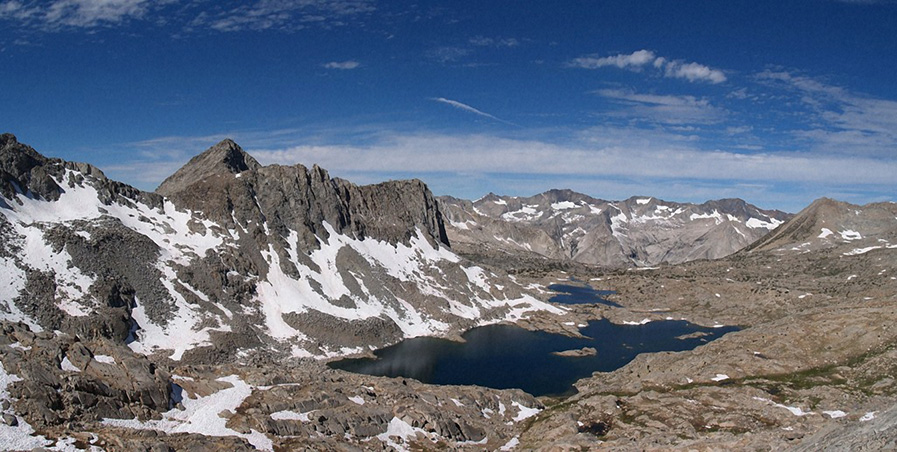
R.B. Marshall of the USGS named the one lake (two lakes narrowly joined) in 1909 for John Alger, a packer for the Geological Survey. The creek name derives from the lakes. It was called "North Fork" on the 1914 Mt. Lyell map.
[Inyo National Forest] |
|
03/24
Mount Anna Mills
[Photo courtesy of jfr] |
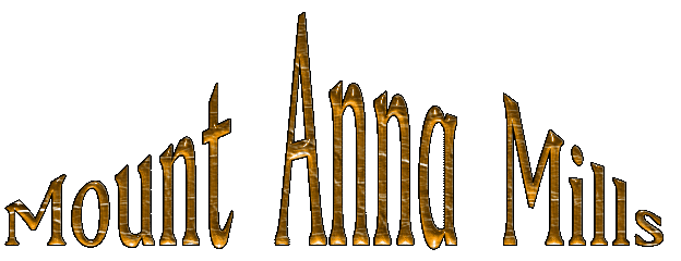
Named by J.W.A. Wright for Anna Mills Johnston, who on August 3, 1878, was one of the first four women to climb Mount Whitney. Leonard Daughenbaugh suggested the name in 1984, and it was approved by the U.S. Board of Geographic Names in 1985. "Walking over to the monument, we planted the Stars and Stripes on the topmost point ... then we sang the 'Star-Spangled Banner' and 'Nearer, my God, to Thee.'"
[San Francisco Daily Evening Post - 1881]
[Anna Mills Johnston, "A Trip to Mt. Whitney in 1878"] |
03/24

Andrew J. Smatko proposed the name "because we looked through a fairly large, roughly circular opening in the blocks and viewed Mt. Agassiz. It was like looking through the aperture of a camera."
[U.S. Board on Geographic Names - 1969]
|
Aperture Peak
[Photo courtesy of jfr]
|
Army Pass was a route originally used by sheepmen. The trail was built in 1892, at a time when the U.S. Army was patrolling Sequoia National Park, by black soldiers from Georgia - Troop K of the Fourth Cavalry. The name first a ppeard on the 1907 Olancha 30' map.
|
|
|
View down to Cottonwood Lakes from Old Army Pass
(Photo courtesy of moosewilliams) |
04/24
03/24
 Bolton Coit Brown named Arrow Peak in 1895 when he made the first ascent. He was wearing boots so worn that his feet "were almost literally on the ground," and he was by himself—but nevertheless he went up the northeast spur. "More than once the ridge narrowed to an actual edge which I had to straddle and hitch along .... A sharp rock cut the bare sole of my foot, but not deeply .... About midday I clambered up the last and summit rock ... and swept my eyes around. It was perfect .... A sense of profound peace came over me. It was so still I heard only the ringing in my ears."
[Sierra Club Bulletin - 1896]
Bolton Coit Brown named Arrow Peak in 1895 when he made the first ascent. He was wearing boots so worn that his feet "were almost literally on the ground," and he was by himself—but nevertheless he went up the northeast spur. "More than once the ridge narrowed to an actual edge which I had to straddle and hitch along .... A sharp rock cut the bare sole of my foot, but not deeply .... About midday I clambered up the last and summit rock ... and swept my eyes around. It was perfect .... A sense of profound peace came over me. It was so still I heard only the ringing in my ears."
[Sierra Club Bulletin - 1896] |
Arrow Peak
(Photo courtesy of Ed Cisnalis) |
08/24
 "My brother John stocked them. There was a bunch of CCC boys on the other side, and they hollered and waved about what way to go. They started in shedding their clothes, and John said they looked like a bunch of baboons going over the rocks."
[Art Schober - Inyo National Forest]
|
|
03/24
|
|

Named in August 1951 by Elden H. Vestal of the California Department of Fish and Game. He said the word refers to a type of Mono Indian back carrier for carrying babies. Two students of the Mono language said they did not know the word, and that the Mono language has no "l."
[Heyward Moore - Freson, Past and Present - 1984]
|
 The namer and the origin of the name are not known. Bolton Coit Brown and his wife Lucy climbed the peak in July 1896, as did J. N. LeConte and W. S. Gould. Brown described it as "the red peak south of the lake." Bolton and Lucy climbed the peak during a thunderstorm and an invisible something passed with tingling prickles and a thin, squeaky, crackling sound through their outstretched fingertips. Lucy's front hair streamed out towards the storm.
[Sierra Club Bulletin - 1897]
The namer and the origin of the name are not known. Bolton Coit Brown and his wife Lucy climbed the peak in July 1896, as did J. N. LeConte and W. S. Gould. Brown described it as "the red peak south of the lake." Bolton and Lucy climbed the peak during a thunderstorm and an invisible something passed with tingling prickles and a thin, squeaky, crackling sound through their outstretched fingertips. Lucy's front hair streamed out towards the storm.
[Sierra Club Bulletin - 1897] |
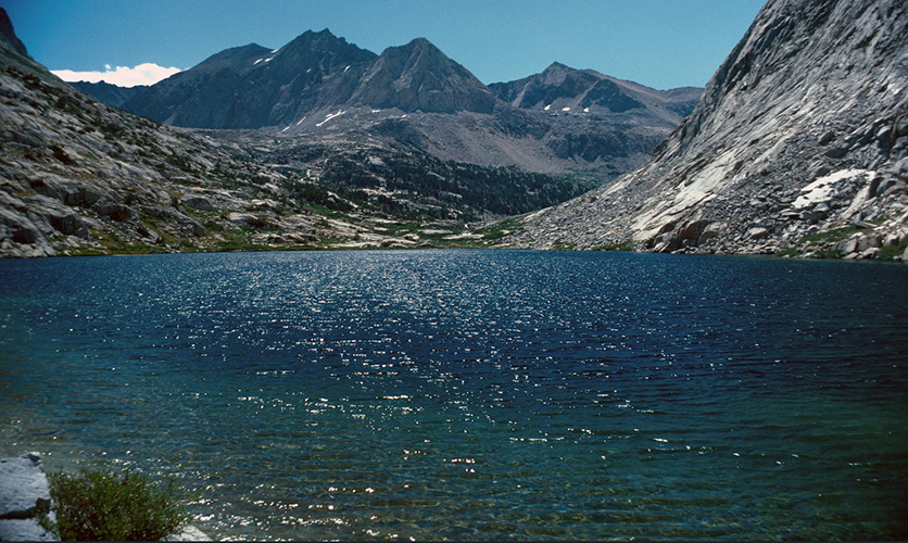
Mount Bago and Bullfrog Lake
(Photo courtesy unknown) |
03/24
 |
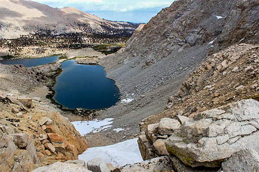
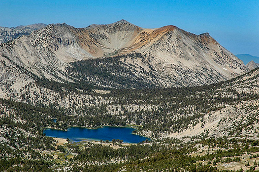
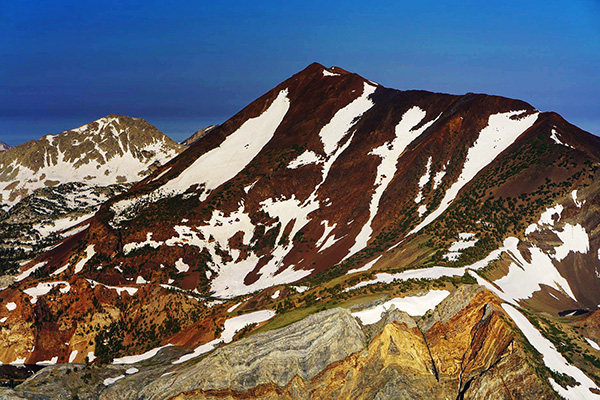
Name origin - unknown. The first ascent of the summit was made July 2, 1928, by Norman Clyde, who is credited with 130 first ascents, most of which were in the Sierra Nevada.
[Sierra National Forest] |
 Mount Baldwin
[Photo courtesy of Ed Cisnalis]
|
03/24
|
 "Named by Willard D. Johnson, USGS topographer, in 1883, on account of cloud-banners streaming from the summit."
[Sierra National Forest]
"Named by Willard D. Johnson, USGS topographer, in 1883, on account of cloud-banners streaming from the summit."
[Sierra National Forest] |
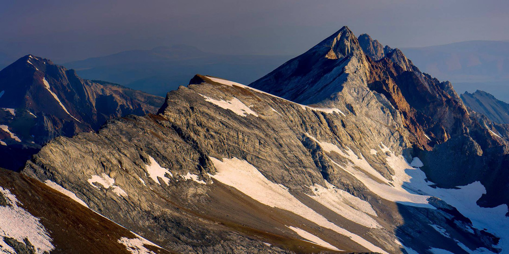
 Mount Baxter
(Photo courtesy unknown) |
 See Baxter Pass
[Joseph N. LeConte - A Summer of Travel in the High Sierra]
See Baxter Pass
[Joseph N. LeConte - A Summer of Travel in the High Sierra] |
04/24
 John Baxter was an Owens Valley rancher. J. N. LeConte and party stopped at Baxter's on their 1890 trip. "Baxter cordially invited us in, showed us the best place to camp, told us to help ourselves to fruit and honey, and did everything in his power to make us comfortable. We were somewhat astonished that a perfect stranger should take such an interest in us dirty tramps, but Mr. Baxter said he had spend many a week in the mountains, and was thoroughly in sympathy with the genus camper." Mt. Baxter was named by George R. Davis of the USGS in 1905.
[Joseph N. LeConte - A Summer of Travel in the High Sierra]
John Baxter was an Owens Valley rancher. J. N. LeConte and party stopped at Baxter's on their 1890 trip. "Baxter cordially invited us in, showed us the best place to camp, told us to help ourselves to fruit and honey, and did everything in his power to make us comfortable. We were somewhat astonished that a perfect stranger should take such an interest in us dirty tramps, but Mr. Baxter said he had spend many a week in the mountains, and was thoroughly in sympathy with the genus camper." Mt. Baxter was named by George R. Davis of the USGS in 1905.
[Joseph N. LeConte - A Summer of Travel in the High Sierra] |
|
|
 Bear Creek Spire was named by J. N. LeConte, James Hutchinson, and Duncan McDuffie in 1908
because it was at the head of the Hilgard Branch of Bear Creek.
[Sierra Club Bulletin - 1909] |
|
04/24
 Benson Lake
Probably the only lake in the Sierra Nevada with an actual sandy beach
(Photo courtesy of Christopher Ryerson] |
 Harry Coupland Benson (1857-1924), army officer stationed in Sequoia 1905-08; in Yellowstone National Park, 1909-10. He was noted for his fanatical devotion to duty, and thus acquired the nickname "Batty" Benson. Benson developed many trails in Yosemite. The old "Hs" on trees throughout the park north of the Tuolumne River were cut by Benson's troops. The names were given in 1895. A biograph and portrait of Benson are in Sierra Club Bulletin 12, no. 2, 1925
[Farquhar: Benson] |
04/24
 In early days, Big Arroyo was called "Jenny Lind Canon;" the stream in the canyon was kown as "Crabtree Creek." "John Crabtree and Bill Corse had a mine on the east side of the Great Western Divide which they named the Jenny Lind Mine; they called the creek Jenny Lind Creek." Crabtree and Corse obviously were afflicted by memories of Jenny Lind, "the Swedish Nightingale" (1820-87), and opera singer of international renown who had been in America from 1850 to 1852.
[Sequoia National Park] |
|
08/24
04/24

Josiah Dwight Whitney (1819-1896), state geologist and chief of the California State Geological Survey, 1860-74 professor of geology at Harvard, 1865-96.
The name "Whitney Creek" was at first applied to what is now named "Golden Trout Creek," because the creek arose near Mt. Langley, which had been thought to be Mt. Whitney. Those who discovered the error tried —in1881—to correct it. "The third day we camped on Whitney Creek, upon which we tried unsuccessfully to impress the name 'Volcano Creek,' as that stream does not rise in the vicinity of Mt. Whitney." But later on, the same party applied the name to the correct stream, where it is today. "We were at an altitude of about 11,500 feet, in a little meadow through which flows the clear, cold water of a creek heading at the foot of the mountain. This is the stream which we thought should have been named Whitney Creek."
When Joseph N. LeConte passed through Big Whitney Meadow in 1890 he referred to it as "Whitney Creek Meadows." It became simply "Whitney Meadow" on the 1907 Olancha sheet the word "Big" was added with publication of the 1956 Kern Peak map. Little Whitney Meadow was called "Long Meadow" on early editions of the Olancha sheet it was changed to its present name in 1938 by a US Board of Geographic Names decision because the name was in common use.
[Peter Browning - Place Names of the Sierra Nevada]
|
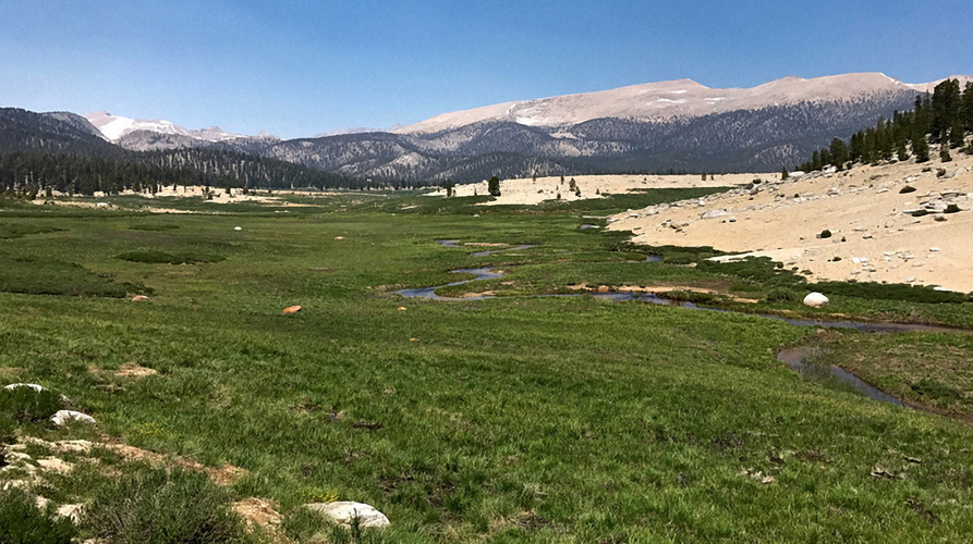
Big Whitney Meadow
(Photo courtesy of Unknown) |
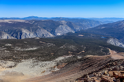
 Bighorn Plateau looking south west towards the Great Western Divide
(Photo courtesy of Michele D'Amico) |
 The Bighorn Plateau was named for the mountain sheep seen in the area. The name applies to an area and to a specific point, where there is a Vertical Angle Benchmark (VABM) - which makes one suspect that the name was given by the U.S.G.S. The plateau was called "Sandy Plateau" on Mt. Whitney 30' maps from 1907 through 1927. It was changed to the Bighorn Plateau in 1933.
[Sequoia National Park]
The Bighorn Plateau was named for the mountain sheep seen in the area. The name applies to an area and to a specific point, where there is a Vertical Angle Benchmark (VABM) - which makes one suspect that the name was given by the U.S.G.S. The plateau was called "Sandy Plateau" on Mt. Whitney 30' maps from 1907 through 1927. It was changed to the Bighorn Plateau in 1933.
[Sequoia National Park] |
Bighorn Plateau looking south west towards the Great Western Divide
(Photo courtesy of Peter Burke) |
03/24
 There are two cabins at Biledo Meadow. The one made of round timbers was built by Thomas Biledo in 1890. (The name was correctly spelled Biledeaux, according to a Yosemite National Park ranger who knew him.) Biledo was a French-Canadian who came to the region in the 1880s, and was employed by the Mount Raymond Mining Company.
[Robert F. Uhte - Yosemite's Pioneer Cabins]
[Sierra Club Bulletin - 1933]
There are two cabins at Biledo Meadow. The one made of round timbers was built by Thomas Biledo in 1890. (The name was correctly spelled Biledeaux, according to a Yosemite National Park ranger who knew him.) Biledo was a French-Canadian who came to the region in the 1880s, and was employed by the Mount Raymond Mining Company.
[Robert F. Uhte - Yosemite's Pioneer Cabins]
[Sierra Club Bulletin - 1933] |
|
 |
"After
crossing Mono Pass, the trail leads down Bloody Canyon - a terrible
trail. You would all pronounce it utterly inaccessible to horses,
yet pack trains come down, but the bones of several horses or
mules and the stench of another told that all had not passed
safely.... It was a bold man who first took a horse up there.
The horses were so cut by sharp rocks that they named it 'Bloody
Canyon,' and it has held the name - and it is appropriate - part
of the way the rocks in the trail are literally sprinkled with
blood from the animals."
[William
Henry Brewer, Up and Down California in 1860-1864] |
Mt. Lewis, Bloody Canyon, Mammoth Peak, Mt. Gibbs
[Photo courtesy of Gary
Heisinger] |
|
03/24
 |
The origin of the name Bloody Mountain is unclear. Some hold it was named for the color of the rocks of the mountain, while others believe it was named for a bloody skirmish between the sheriff and escaped convicts in 1871.
[Peter Massey - Backcountry Adventures Northern California] |
Bloody Mountain
[Photo courtesy of Ed Cisnalis]
|
08/24
 Art Schober said that the lake was commonly known by this name before 1930. It was promoted as an official name by Chester Versteeg in 1936. The name firest appeared on the 15-minute quad, 1948
[Art Schober - Inyo National Forest] |
|
03/24
Bolton Coit Brown, a professor of drawing and painting at Stanford, 1891-1902. Brown often accompanied by his wife, Lucy (for whom "Lucys Foot Pass" is named), made several remarkable exploring and mountaineering trips in the Sierra Nevada between 1895 and 1899. He published half a dozen articles in the Sierra Club Bulletin, accompanying them with a number of superb line drawings.
The peak was named by Chester Versteeg and Rudolph Berls on August 14, 1922, when they made the first ascent" ... the true summit was a knife-edge jutting twelve yards to the east. Alternating on one side and then the other of the knife, the last few steps along a narrow ledge on which two people could not have passed, we stopped, not on, but bsside, the summit-rock. It stood less than shoulder-high above us. It was impossible to stand on this splinter.
[Sierra Club Bulletin - 1923] |
|
Mount Bolton Brown across Palisade Lake
[Photo courtesy of Peter Burke]
|
05/24
|
|
Hutchings claimed that he suggested the name on his first visit to Yosemite, in 1855. "'Is it not as graceful, and as beautiful, as the veil of a bride? to which Mr. Ayres rejoined, 'That is suggestive of a very pretty and most apposite name. I propose that we now baptize it, and call it, 'The Bridal Veil Fall,' as one that is both characteristic and euphonious.'" Another who claimed the honor naming the fall wrote: "We make bold to call it Bridal Veil; and those who may have the felicity to witness the stream floating in the embrace of the morning breeze, will acknowledge the resemblance, and perhaps pardon the liberty we have taken in attempting to apply so poetical a name to this Queen of the Valley."
[James Mason Hutchings - In the Heart - 1886]
There were some who didn't like the name at all. "... in 1856 it was christened 'Falls of Louise' in honor of the first lady of our party that entered the valley. Thank Heaven the cataract wouldn't stand this nonsense; and it seemed to me to be pleading with us to have the 'Bridal Veil' fully thrown aside, that it might be nown forever by its Indian baptism, 'Pohono." Other early names were "Queen of the Valley" and "Cascade of the Rainbow."
[Warren Baer, editor - Mariposa Democrat - 1856]
The Indians did indeed call the fall "Pohono;" the name was still in use in 1863 when the Whitney Survey was there
[William Henry Brewer - Up and Down California in 1860-1864: The Journal of William H. Brewer] |
|
04/24

Bill Garner, a former owner of the Convict Lake Resort, named the lake in the 1930s because it is a bright blue spot—and after his wife, Dorothy Bright.
[Oguk Ouarwe - California Department of Fish and Game] |
Mildred Lake (L) and Bright Dot Lake (R)
(Photo courtesy of Ed Cisnalis) |
|
|
 Bubbs Creek was named for John Bubbs who was part of the Whitney survey party led by William H. Brewer. Brewer met this group of prospectors on the trail between Big Meadows and Kings Canyon in 1864.
[William Henry Brewer - Up and Down California in 1860 - 1864: the Journal of William H. Brewer]
Bubbs Creek was named for John Bubbs who was part of the Whitney survey party led by William H. Brewer. Brewer met this group of prospectors on the trail between Big Meadows and Kings Canyon in 1864.
[William Henry Brewer - Up and Down California in 1860 - 1864: the Journal of William H. Brewer]
|
|
|

Bullfrog Lake was called "Bryanthus Lake" by John Muir, a name that was used as late as 1902. However, J. N. LeConte referred to it as "Bullfrog Lake" in 1890 and made no mention of the earlier name.
[Sierra Club Bulletin - 1903] |
|
|
|
In the Yosemite Research Library files is a copy of a handwritten
note from Doug Hubbard about an Indian who gave him a piece of
root to chew; it tasted like ginseng. The Indian said that when
he was young he gathered large quantities of the root and took
them to the Sioux country to trade for buffalo robes. "He
told me his name was Cloudy Camiaca.... Later... I applied it
to rather a fine peak. I thought I was playing quite a joke on
Californians and at the same time giving Camiaca a final trip."
Although the story is not true it makes for interesting reading.
[Yosemite National Park Survey Notes] |
|
George R. Davis of the USGS named Cardinal Mountain because of the brilliant coloring of its summit - like the red cap of a cardinal. The lake was named from the mountain. Both names appear in the first edition of the Mt. Whitney 30' map.
[Farquhar: J.N. LeConte] |
L/R: Cardinal Mountain, Split Mountain
(Photo courtesy of Ray DeLea) |
04/24
|
Carol Col (Puppet Pass) was named for Carol Kassler Ransford (1928-1974). In 1973 she led a group of hikers over a previously unnamed ridge on the northwest rim of Humphreys Basin. Although the name does not appear on the 7.5-minute quad, published in 1982, it was approved by the US Board of Geographic Names in 1978. It is 0.2 miles east-southeast of Roget Lake
[Sierra National Forest] |
08/24
|
 Christopher (Kit) Carson (1809-1868), a mountain man, scout, soldier, and Indian agent. He was with John C. Fremont on Fremont's second exploring expedition; the party crossed the Sierra at Carson Pass in February 1844. Fremont named the river for Carson; the other "Carson" names derived from that. In the 19th century the Carson Pass route was known as the "Amador and Carson Valley Road." The Carson Range was at one time called the "Rose Mountain Range;" it was changed to its present name by a US Board on Geographic Names decision in 1939.
[Toiyabe National Forest/El Dorado National Forest]
|
The
former town of Cartago was created as a steamer landing on the
southwest shore of Owens Lake to handle shipments of silver bullion
from Cerro Gordo. John Baptiste Daneri, native
of Sardinia and a Lone Pine merchant, built the landing, a large
warehouse, and a store, in 1872. For six months the place didn't
have a name, and was referred to as "Lakeville" and
"Danerisburg." On November 1, 1872, Daneri named it
"Cartago," perhaps - as Lingenfelter suggested - in
the hope that he was creating "the Carthage of the West."
The creek was also called "Carthage Creek" originally
before it was renamed to"Cartago Creek."
[Richard
E. Lingenfelter, "The Desert Steamers"] |
|
|
|
The
creek was named by Frank Lewis, an early stockman and hunter, in the 1870s. "While hunting there with a young friend, Harrison Hill, I wounded a bear and told him to finish it. He became excited and threw all the shells out of his WInchester without firing a shot." Bolton C. Brown called the pass "Red Pass" in 1895. This was the route followed by the John Muir Trail until a trail was built over Mather Pass in 1938.
[Sierra Club Bulletin - 1896]
|
 Unnamed lake below Cartridge Pass
[Photo courtesy of Tom Hilton) |
|
03/24
 View from Cartridge Pass trail towards an unnamed lake
[Photo courtesy of Christopher Ryerson) |
In 1903, John Lacey, then reunning cattle in the Monache country, said the name Casa Vieja was given for an old house or cabin in that locality.
[Douglas Robinson - Inyo National Forest] . |
|
|
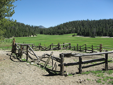
Casa Vieja corral and meadow
(Photo courtesy of Patrick Maloney) |
03/24
|
"Chagoopa
Creek" and "Chagoopa Falls" were named by W. B.
Wallace, J. W. A. Wright, and F. H. Wales in 1881. "We named
the highest of the falls Sha-goo-pah Falls, after an old Pi Ute
chief." "Chagoopa Plateau" was named by William
R. Dudley and party in July 1897 after the falls which bears
the same name.
[Mount
Whitney Club Journal, May 1902]
[Sierra Club Bulletin, January 1898] |
Chagoopa Plateau with Kern River gorge
(Photo courtesy of Chris Ryerson) |
Chagoopa Plateau, Kern River gorge, and Moraine Lake (R)
(Photo courtesy of Chris Ryerson) |
Chalfant Lakes are either named for Pleasant Arthur Chalfant, editor of the Inyo Independent and Inyo Register or his son Willie Arthur Chalfant.
[Inyo National Forest] |
|
Chalfant Lakes
(Photo courtesy unknown) |
03/24
|
 Chalfant Valley
[Photo courtesy of Ed Cisnalis]
Chalfant Valley
[Photo courtesy of Ed Cisnalis] |
The town and valley is named after W.A. Chalfant who moved to the area in 1885 with his family, where they started The Inyo Register newspaper. Chalfant was the editor for 55 years..
[Wikipedia] |
08/24
|
Called "Warrior Lake" on the Mt. Abbot 15' map. That name was moved to another lake by a US Board on Geographic Names in 1969. |
|
04/24
|
|
Clarence King (1842-1901), a member of the Whitney Survey from 1863 to 1866. The peak was named by the members of the Brewer party in 1864. King headed the United States Geological Exploration of the Fortieth Parallel, 1867-78, and became the first chief of the US Geological Survey, 1879-81. The first ascent was made by Bolton C. Brown in 1896. "It is a true spire of rock, and uptossed corner at the meeting of three great mountain walls .... The top of the summit-block slopes northwest, is about fifteen feet across, and as smooth as a cobblestone. If you fall off one side, you will be killed in the vicinity if fall off any of the other sides, you will be pulverized in the remote nadir beneath."
[Sierra Club Bulletin - 1897]
|
Mount Clarence King
[Photo courtesy of Ed Cisnalis] |
|
|
 Cloud Canyon and Cloud Creek were named
after William B. Wallace's mine which bears the same name, The
Cloud Mine, in 1924. William often referred to his mine as being
"up in the clouds." For a while, on some pre 1924 maps,
Cloud Canyon was mistakenly name Deadman Canyon which actually
was a few miles to the west.
Cloud Canyon and Cloud Creek were named
after William B. Wallace's mine which bears the same name, The
Cloud Mine, in 1924. William often referred to his mine as being
"up in the clouds." For a while, on some pre 1924 maps,
Cloud Canyon was mistakenly name Deadman Canyon which actually
was a few miles to the west.
[Sierra Club Bulletin - 1924]
|
04/24
|
|
Named in 1931 by Francis P. Farquhar for Norman Clyde, who discovered this "most beautiful camp-ground I had yet seen in the Sierra."
[Sierra Club Bulletin - 1932]
The two spires were first climbed on July 22, 1933, by a group of Sierra Club members who named them for their leader, Norman Clyde
[Sierra Club Bulletin - 1934]
|
|
03/24
 Cyde Minaret
[photo courtesy of Ed Cisnalis]
Cyde Minaret
[photo courtesy of Ed Cisnalis] |
 The spires were first climbed on July 22, 1933, by a group of Sierra Club members who named them for their leader, Norman Clyde.
[Sierra Club Bulletin - 1934]
|
04/24

Twenty-nine convicts escaped from prison at Carson City, Nevada, on September 17, 1871. Six of them headed south, and murdered a mail rider from Aurora. Posses from Aurora and Benton caught up to the convicts near "Monte Diablo Creek" - now Convict Creek. Robert Morrison (for whom Mt. Morrison is namet), a Benton merchant and leader of the posse, was killed in the encounter. The convicts escaped, but three of them were captured a few days later. Two of those were lynched while being returned to the jail at Carson City.
[W.A. Chalfant - The Story of Inyo]
Mrs. A. A. Forbes, of Bishop, said that the Indian name for Convict Lake
was "Wit-sa-nap."
[Sierra Club Bulletin - 1913] |
|
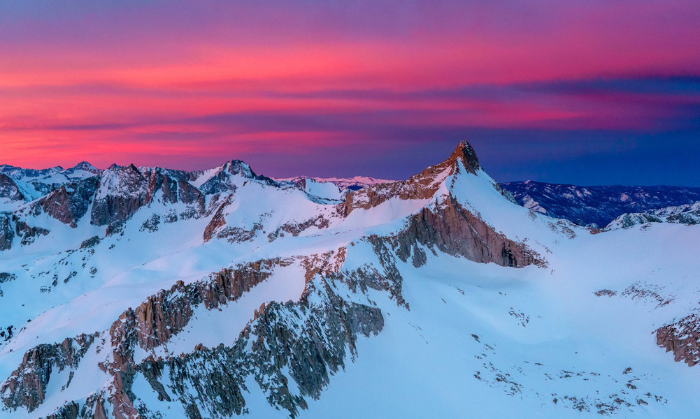
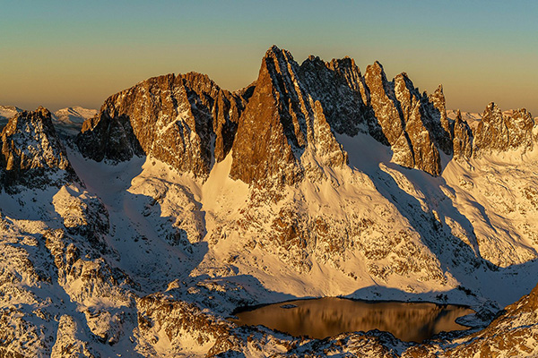
 These are old names. Undoubtedly the creeks were named first. Their names were derived in 1890 from cottonwood trees which grew along the lower reaches.
[Joseph LeConte - A Summer of Travel in the High Sierra]
These are old names. Undoubtedly the creeks were named first. Their names were derived in 1890 from cottonwood trees which grew along the lower reaches.
[Joseph LeConte - A Summer of Travel in the High Sierra] |
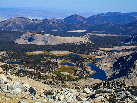 Looking east from Old Army Pass at Cottonwood Lakes
[Photo courtesy unknown]
Looking east from Old Army Pass at Cottonwood Lakes
[Photo courtesy unknown] |
03/24
 The lake is named after Fr. John J. Crowley, "the desert Padre", who was a key figure in Owens Valley history and a local hero. When it became obvious that the city of Los Angeles's appropriation of the water supply had made agriculture impossible in the Owens Valley, many of the residents of the Valley lost all hope. Father Crowley traveled the Valley, convincing many of them that it could become a tourist destination. Father Crowley was killed in 1940 in an automobile accident.
[Wikipedia]
The lake is named after Fr. John J. Crowley, "the desert Padre", who was a key figure in Owens Valley history and a local hero. When it became obvious that the city of Los Angeles's appropriation of the water supply had made agriculture impossible in the Owens Valley, many of the residents of the Valley lost all hope. Father Crowley traveled the Valley, convincing many of them that it could become a tourist destination. Father Crowley was killed in 1940 in an automobile accident.
[Wikipedia] |
Crowley Lake
[Photo courtesy of Ed Cisnalis] |
08/24
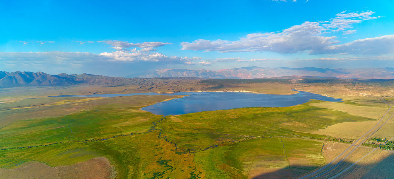
Mount Dana and it's associated lakes were named in 1863 by the Whitney Survey for James Dwight Dana, professor of natural history and geology at Yale, 1849 - 1890. Dana was considered the foremost geologist of his time. He provided the first comprehensive summary of North American geology.
In 1889, J.N. LeConte copied from a record he found on the summit; "State Geological Survey, June 28, 1863. J.D. Whitney, W.H. Brewer, Charles F. Hoffmann, ascended this mountain June 28th and again the 29th. We give the name of Mount Dana to it in honor of J.D. Dana, the most eminent American geologist.
[Sierra Club Bulletin - 1922] |
|
03/24

Dana Meadows - see Mount Dana
|
|
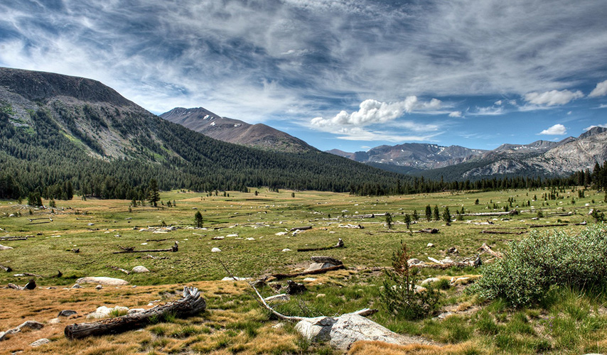
Dana Meadows and Tuolumne Meadows
[Photo courtesy of Doug Santo] |
Dragon
Peak was named because its outline as seen from Rae Lakes resembles
a dragon. The Dragon Lake was named from the peak.
[Inyo National Forest] |
|

Dragon Lake and Dragon Peak.
[Photo courtesy of Dave Coppedge] |
 Dragon Lake and Dragon Peak.
[Photo courtesy unknown]
Dragon Lake and Dragon Peak.
[Photo courtesy unknown] |
03/24
|
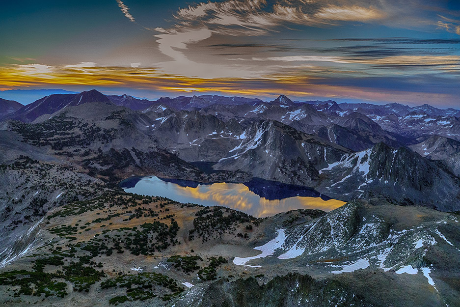
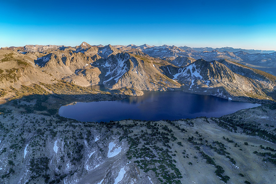
Duck Pass and Duck Lake were named by Rae Crabtree and Bill White sometime in the 1940s because they saw a duck on the lake.
[California Department of Fish and Game Survey]
|
Duck Lake
(Photo courtesy of Ed Cisnalis) |
 Duck Lake
(Photo courtesy of Ed Cisnalis) |
|
Duck Pass and Duck Lake were named by Rae Crabtree and Bill White sometime in the 1940s because they saw a duck on the lake.
[California Department of Fish and Game Survey] |

Dunderberg Peak, locally called Castle Peak, but which was named in 1878 after Dunderberg mines on its northerly slope. The mine was probably named after the Union man-of-war Dunderberg, launched in 1865, which had probably been named after Dunderberg Mountain in New York state.
[Erwin G. Guddle - California Place Names] |
|
 First it was over hard-frozen snowfields, and then over huge granite fragments to the margin of a lonely lake. This, from its shape, we called Dumbell Lake. The lakes were thus named by J. N. LeConte in January of 1904.
[Joseph N. LeConte - Sierra Club Bulletin - 1904] |
 Dumbell Lakes
[Photo courtesy unknown]
Dumbell Lakes
[Photo courtesy unknown] |
03/24
|
|
Frank Dusy (1836-1898), born in Canada, came to California in 1858 and to Fresno County in 1864. He was a sheepman who took his stock into the mountains in the region of the North and Middle Forks of the Kings River. He discovered Tehipite Valley in 1869, and explored the Middle Fork as far as the Palisades in 1877.
Dusy took the first photographs of Tehipite in 1879, carrying a bulky portrait camera, studio tripod, wet plates, and chemicals. L.A. Winchell, in 1879, gave Dusy's name to the branch of the Middle Fork north of the Palisades.
The lakes in what is now Dusy Basin were called "Dusy Lakes" on the Mt. Goddard map
[W.W. Elliott - History of Fresno County]
[Sierra Club Bulletin - 123]
|
Dusy Basin
[photo courtesy of JFR] |
03/24

I named that. I had a rifle at the time and was hunting deer. I shot across the darned lake, and things just seemed to vibrate. Named by Art Schober in the 1930s or 1940s.
[Inyo National Forest]
|
|
04/24

I have named a grand wide-winged mountain on the head of the Joaquin Mount Emerson. Its head is high above its fellows and wings are white with ice and snow." (John Muir) Muir made a mistake in location he was putting Emerson's name on Mt. Humphreys, which had already been named by the Whitney Survey. The present Mount Emerson was probably designted by the USGS in 1907-09 during the survey for the Mt. Goddard map, first published in 1912. Emerson Lake was originally called "Tobe Lake," after Tobe Way, the packer who first stocked it. (Art Schober)
[Inyo National Forest]
|
Mount Emerson
[Photo courtesy of Ed Cisnalis] |
Mount Emerson
[Photo courtesy of Ed Cisnalis] |
|
Scylla (left)
and Charybdis (right) guarding the upper entrance to the Enchanted Gorge
[Photo courtesy of Joel Guenther)
 This name, Enchanted Gorge, was given in July 1895 by Theodore
S. Solomons to the gorge on Disappearing Creek, with its head
between Scylla and Charybdis. The Enchanted Gorge was so named
because of the many remarkable features it possesses, and the
weirdness of its scenery.
[MS of Solomons, 1896, in Farquhar Papers]
This name, Enchanted Gorge, was given in July 1895 by Theodore
S. Solomons to the gorge on Disappearing Creek, with its head
between Scylla and Charybdis. The Enchanted Gorge was so named
because of the many remarkable features it possesses, and the
weirdness of its scenery.
[MS of Solomons, 1896, in Farquhar Papers]
|
|
|
08/24
In July 1895 Theodore S. Solomons named six peaks at the headwaters of the San Joaquin River for the foremost exponents of the theory of evolution: Mounts Darwin, Fiske, Haeckel, Huxley, Spencer, and Wallace. At the same time he named Evolution Lake. The peaks are often referred to as the "Evolution Group." Evolution Creek was named by J. N. LeConte in 1904. The "Evolution" names for the valley, basin, and meadow were added by the USGS to the third edition of the Mt. Goddard 30' map, 1923.
[Kings Canyon National Park] |
|
|
|
11/24
|
|
 Evolution Creek and Valley
(Photo courtesy of John Schwarz] |

Fin Dome was named by Bolton C. Brown in 1899. On a sketch map he depicted the features between Rae Lakes and Sixty Lake Basin as a south-facing monster. "The Sea Serpent." Of the names of the serpent's parts. "The Fin" is the only one that stuck. The serpent's head is to the left in the photo and the serpent's tail is the long ridge to the right of the fin.
[Sierra Club Bulletin - 1900]
|
 Fin Dome
[Photo courtesy of Dave Coppedge]
Fin Dome
[Photo courtesy of Dave Coppedge] |
04/24

Named on August 18, 1929 by Frank Cunningham, then supervsor of Sequoia National Forest, for the foresters (of whom he was one) who had discovered the pass. The John Muir Trail was completed across the pass in 1931, thus eliminating the former route via Shepherd and Junction passes, which went east of the Sierra crest. The name was approved by the U.S. Board on Geographic Names in 1938.
[Sequoia National Forest files]
|
 Forester Pass and the trail leading up to it
[Photo courtesy of Michele D'Amico]
Forester Pass and the trail leading up to it
[Photo courtesy of Michele D'Amico] |

So named because
it is out of the way and "forgotten" by most backpackers.
It is located in the lower Rock Creek drainage between Funston
Lake and Mt. Guyot.
[Sequoia National Park - 1927]
|
|
 |
SEE — |
|
|