


|
|
Sequoia National Forest & Sierra National Forest maps courtesy of Greg Farris |
See USE NOTICE on Home Page Photo text (unless otherwise noted) is from Place Names of the Sierra Nevada by Peter Browning |
The Sierra Nevada and Owens Valley are full of fascinating names garnished over the centuries from Native Americans, trappers, explorers, surveyors, geologists, packers, fisherman, frontiersman, and settlers. These pages represent but a few of those names and their origin. These are some of my favorite gathered from my packing days with Mt. Whitney Pack Trains. These are names which, for me personally, evoke wonderful Sierra and Owens Valley memories - packers, camp fires, Sierra Club girls, nick names such as Veggie, Manure Man, and Peek-a-Boo, mules with personality, biting horses, Trail Riders of the Wilderness, countless trips to the summit of Mt. Whitney, pack train wrecks, bronc shoeing in the backcountry, rain at night in the Sierra, frozen tie lines, loves lost and loves gained, and a host of majestic wilderness scenes painted for all of us by the One Who seeks but to have our hearts focused on Him. |
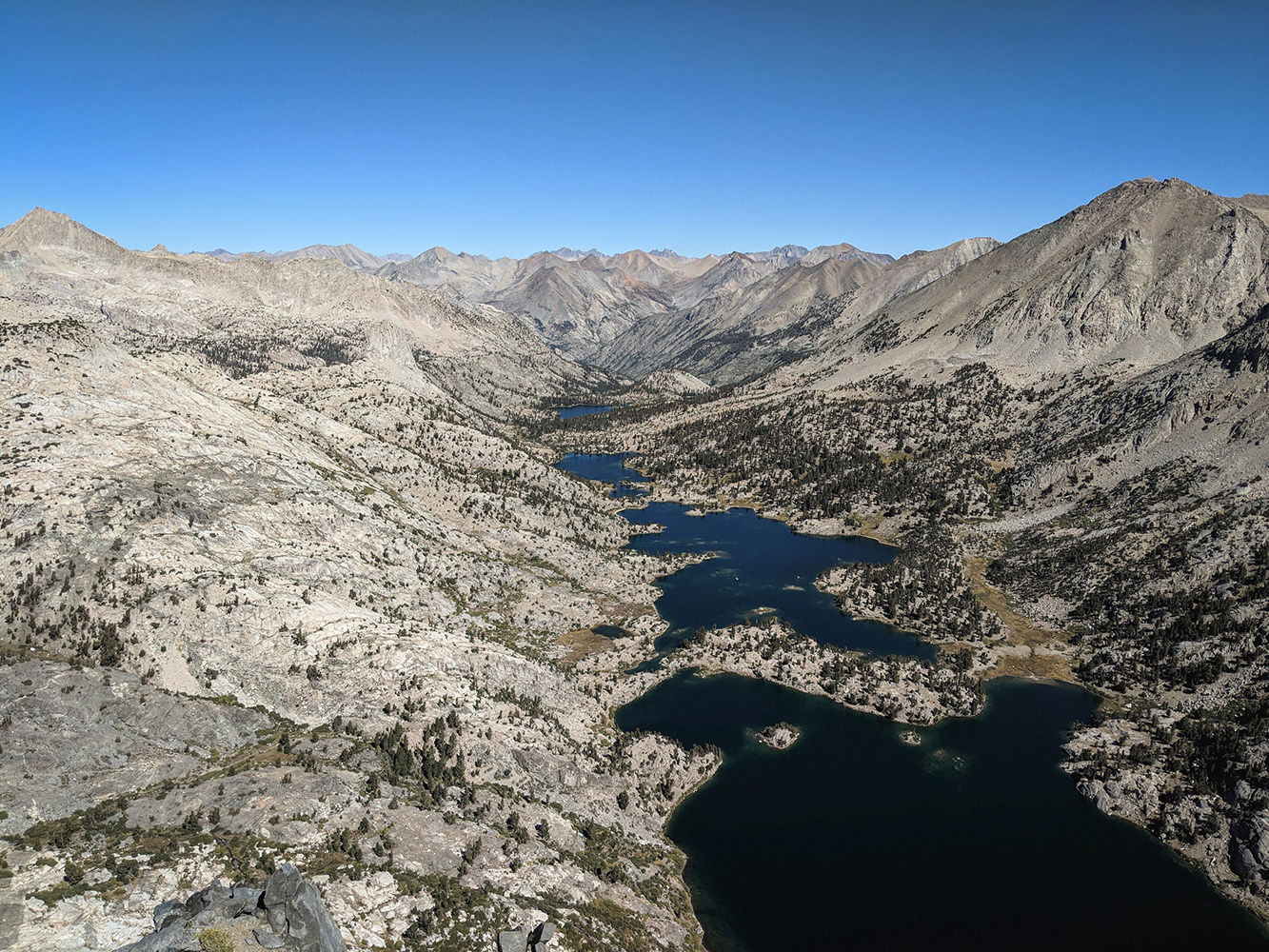
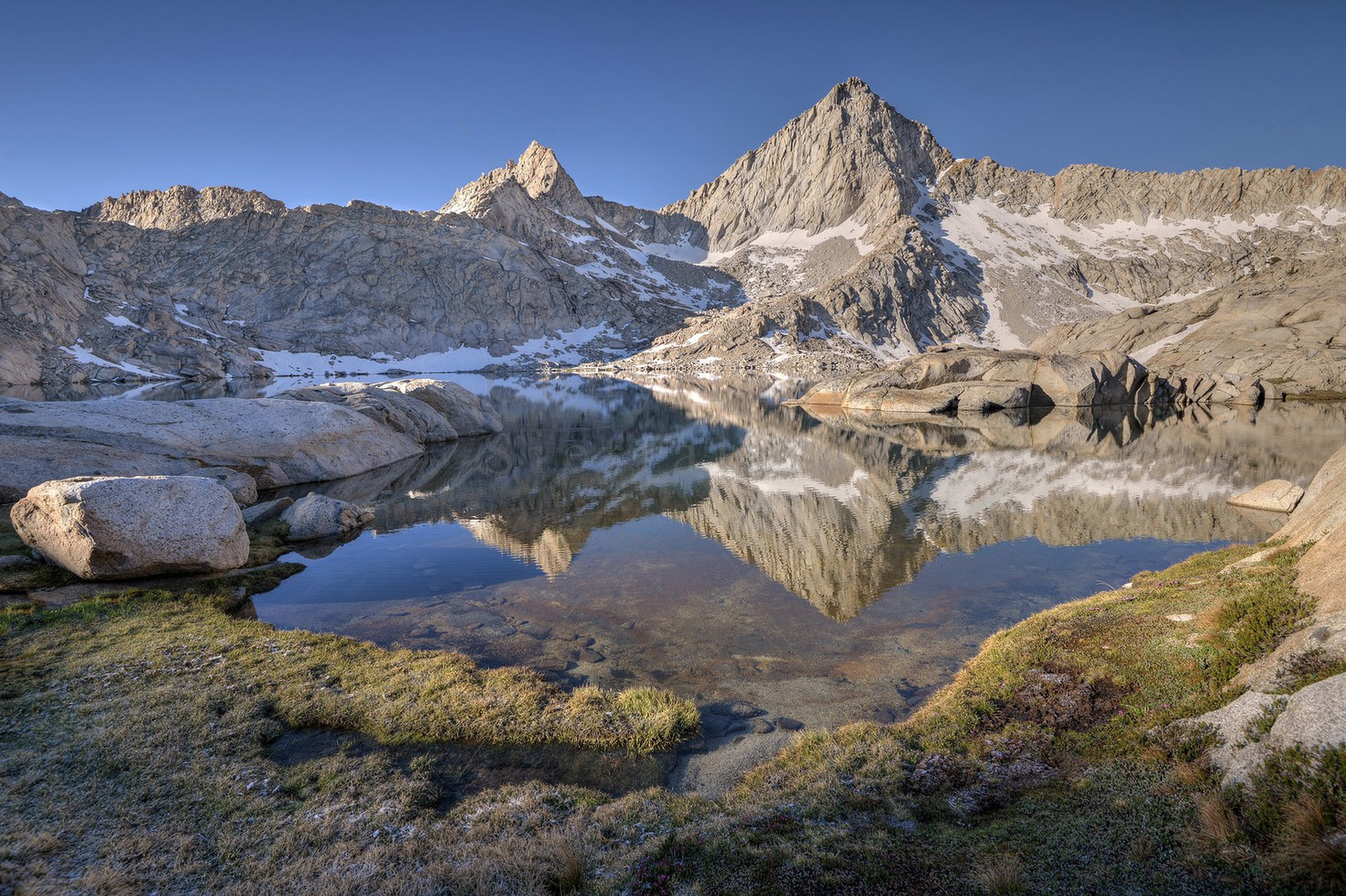
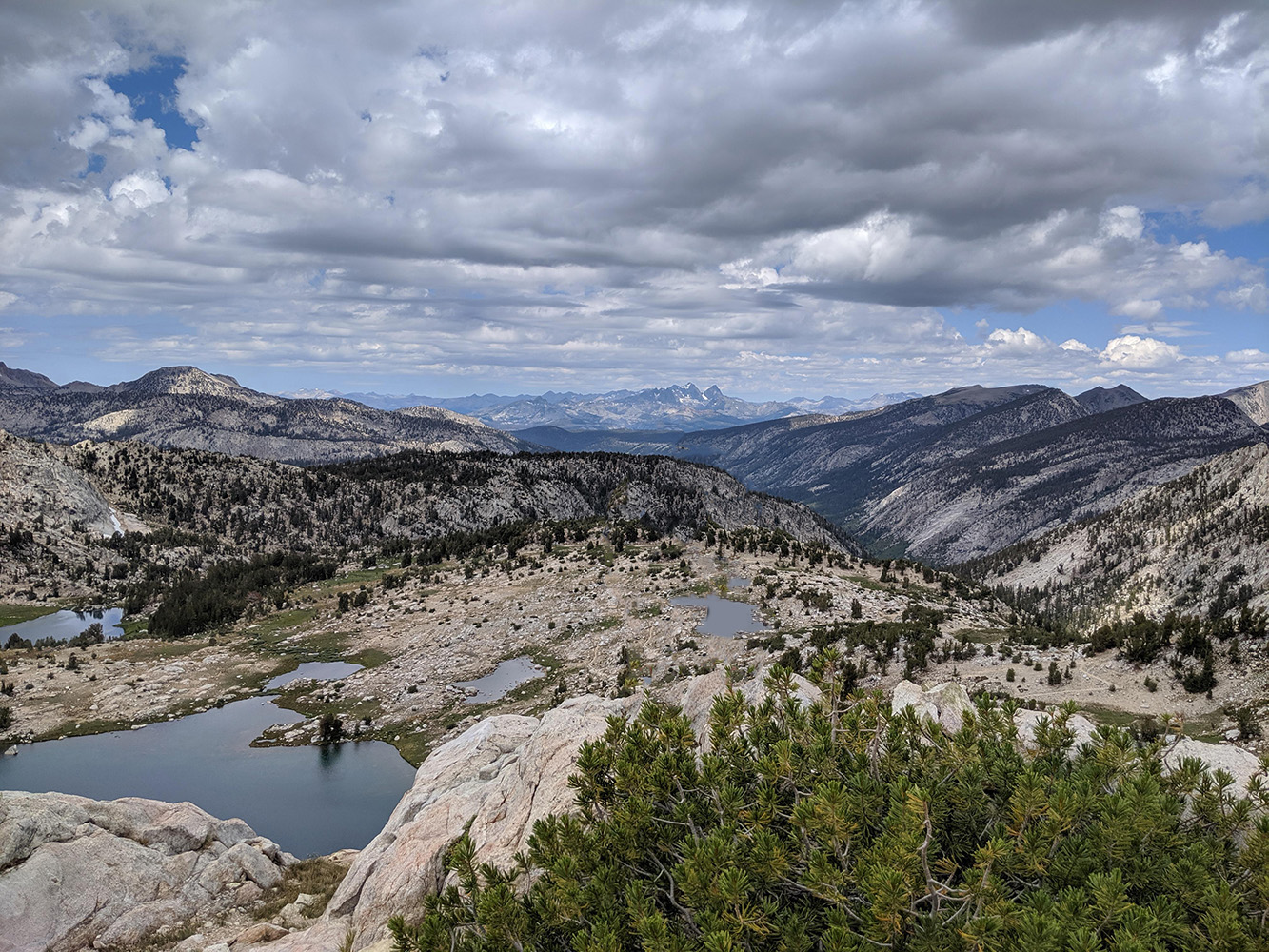
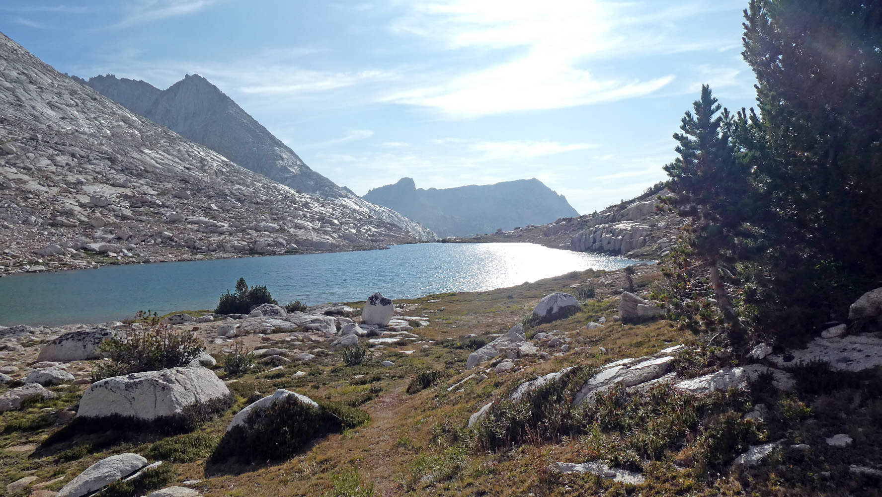
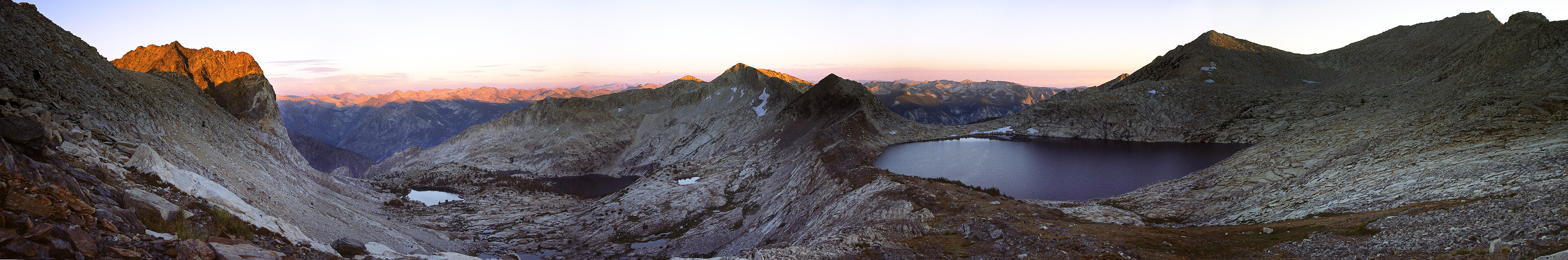
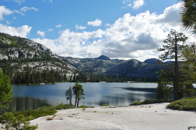
 Rae Lakes were named in 1906 by R. B. Marshall for Rachel ("Rae") Colby, wife of William E. Colby. In 1899 Bolton C. Brown named the southernmost lake for his wife - "Lake Lucy." icy waters. (Sierra Club Bulletin - 1900) |
|
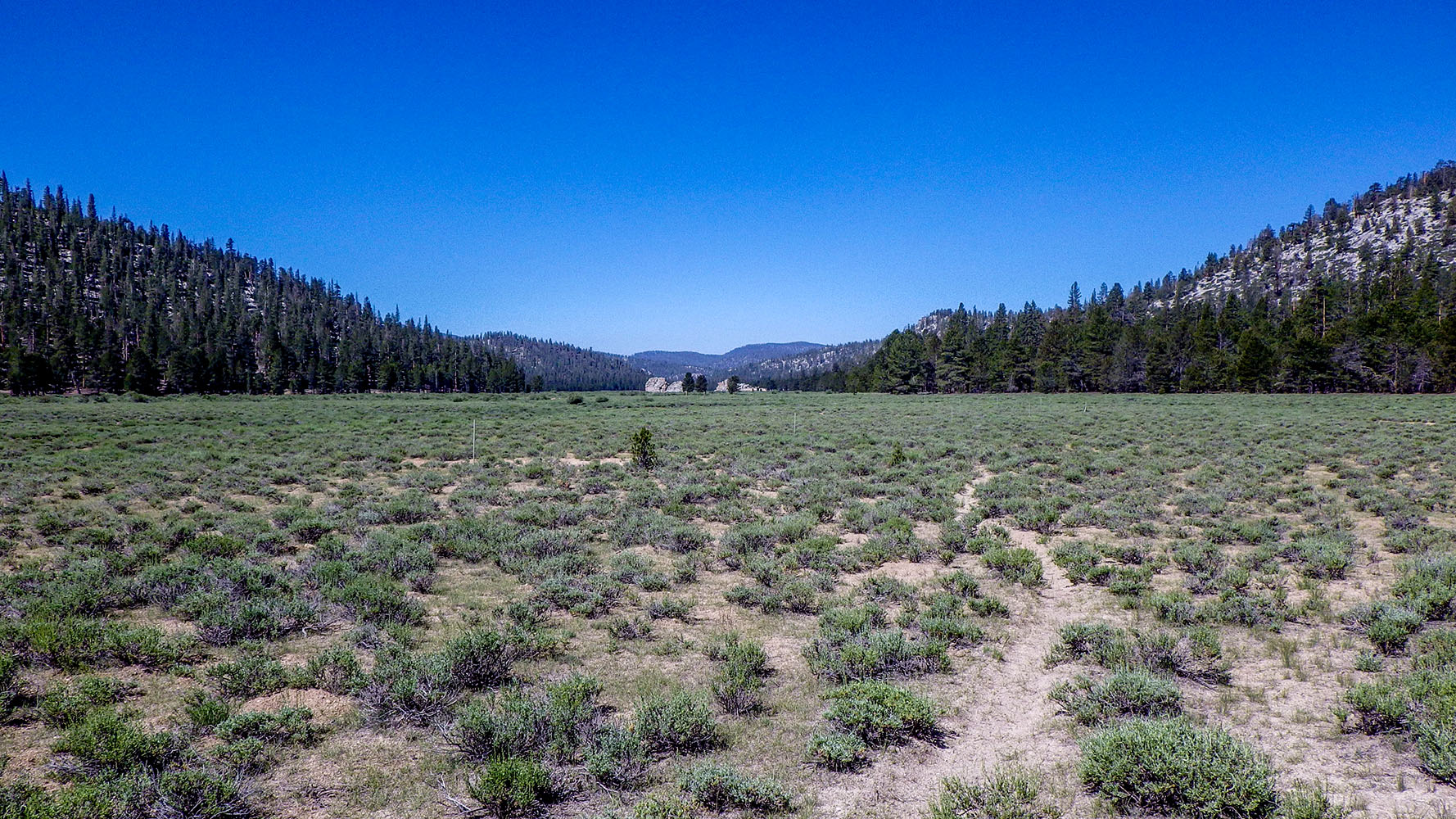
 Ramshaw Meadows was named for Peter Ramshaw, a stockman in this region from 1861 to 1880. icy waters. (Inyo National Forest) |
 |
|
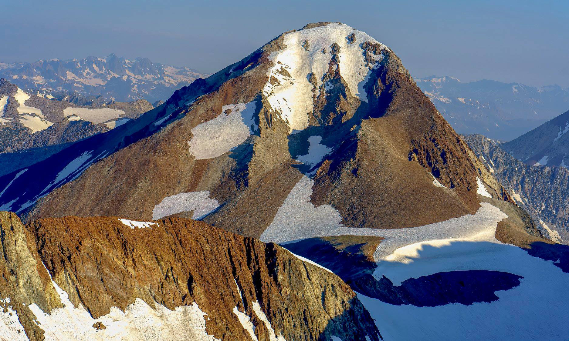
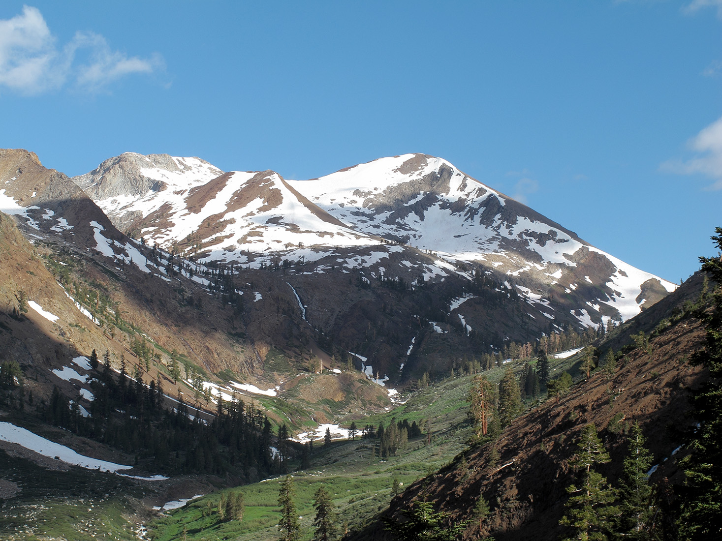
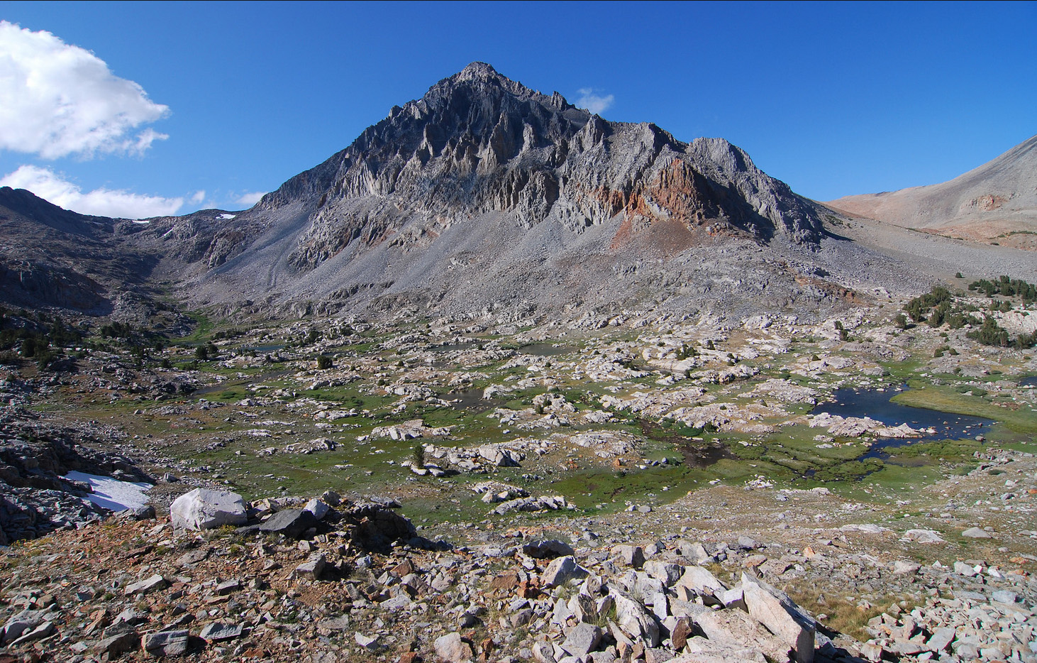
Red and White Mountain
was named by Theodore S. Solomons in 1894. "The name has
gained a place in the maps, and it ispeculiarly descriptive
of the great peak of red slate fantastically streaked with seams
of white granite. The name identifies the mountain." [Sierra Club Bulletin - February 1903] |
|

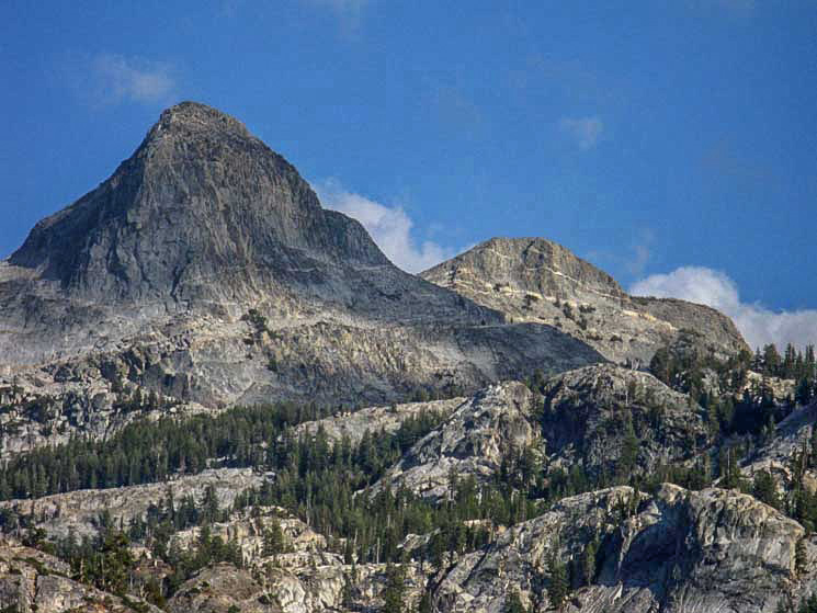
 Regulation Peak (Photo courtesy of William Peters] |
 Regulation Peak and Regulation Creek were named after Lt. Harry C. Benson and a trumpeter named McBride who, in 1895, placed copies of Yosemite National Park regulations on trees throughout the park. McBride suggested the name "Regulation Peak" for a mountain between Smedberg Lake and Rodgers Lake. Benson put the name on his map of 1897. "Regulation Peak" was also called "Volunteer Peak" at one time and "Regulation Creek" was often called "West Fork Return Creek." (Farquhar: Benson) |
 |
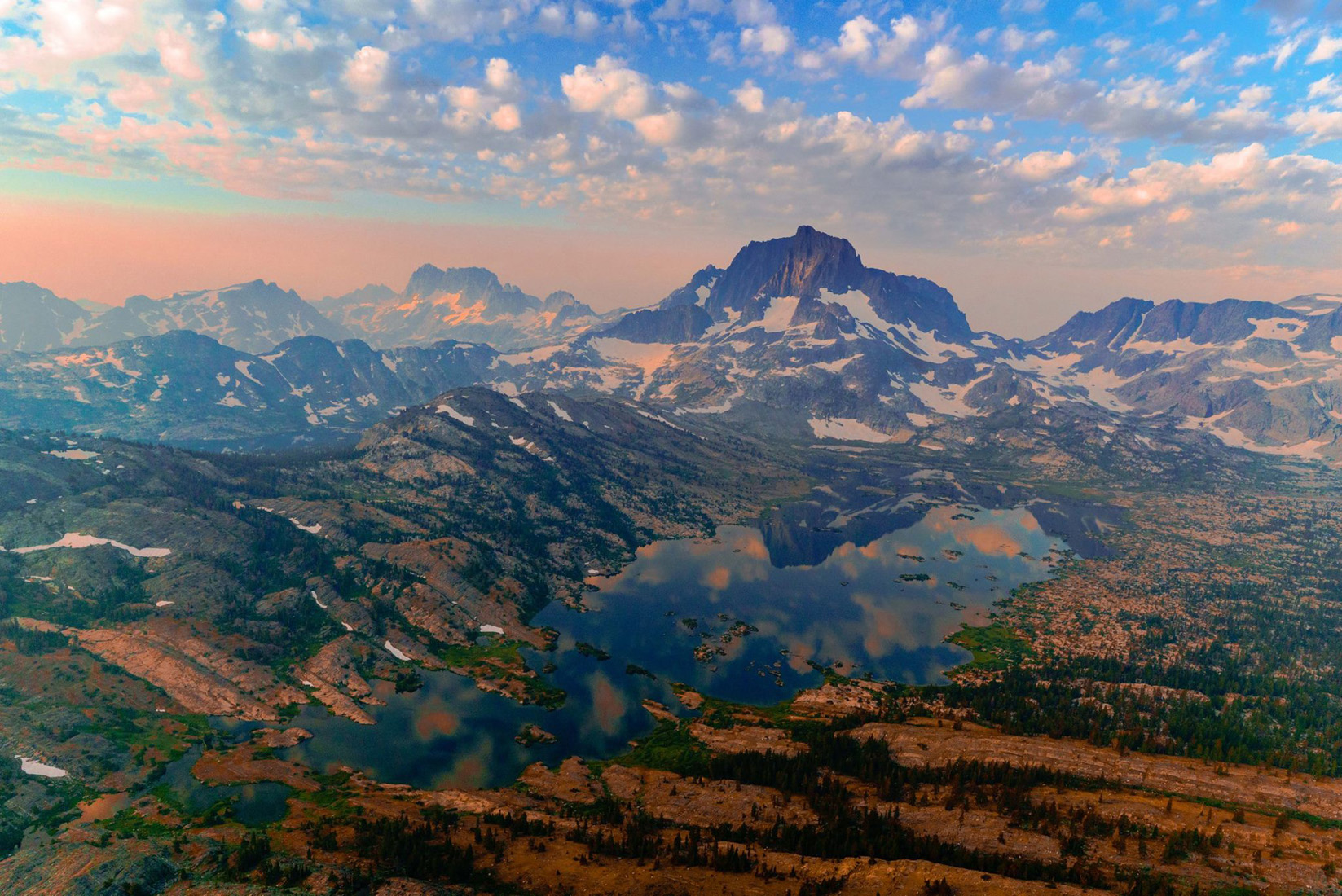
 Mt. Ritter (left)and Mt. Banner (right) (Photo - unknown) |
Mount
Ritter and the Ritter Range is named for the great German geographer
and founder of the science of modern comparative geography -
Karl Ritter (1779 - 1859). It was named by the Whitney Survey
in 1864. Karl Ritter was a professor of history at the University
of Berlin in the 1840s when Whitney was a student at the university. icy waters. (Josiah Dwight Whitney - The Yosemite Guide Book) |
|
 |
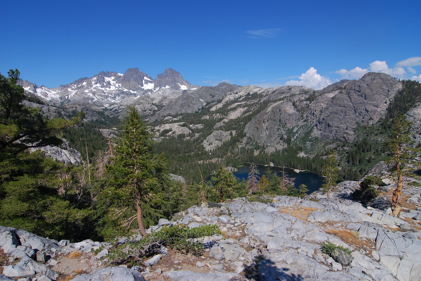
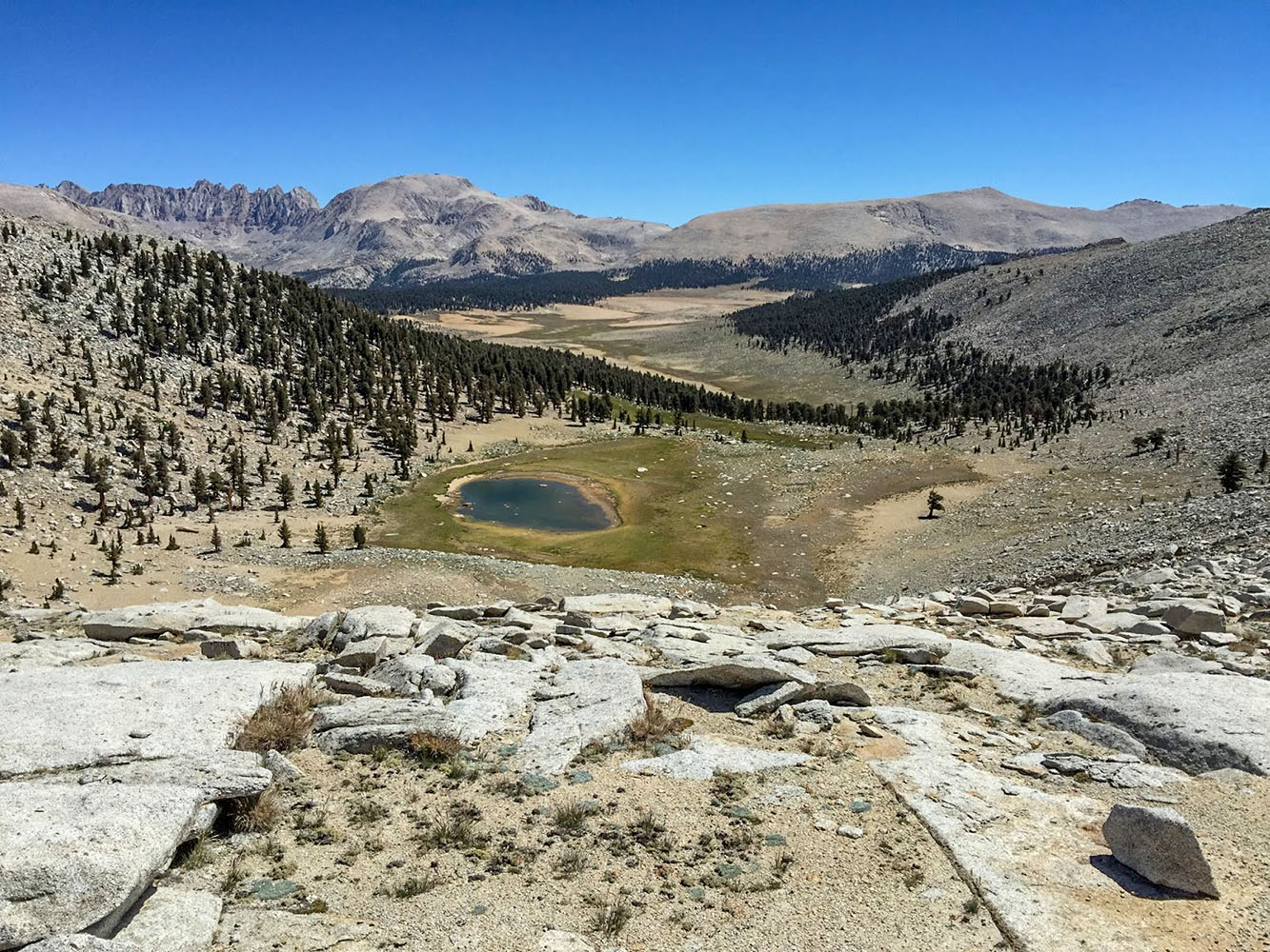
 View east up Rock Creek drainage from the summit of Mt. Guyot. Mt. Langley is off in the left horizon and Olancha Peak to the right. [photo courtesy of Yosemite Steve] |
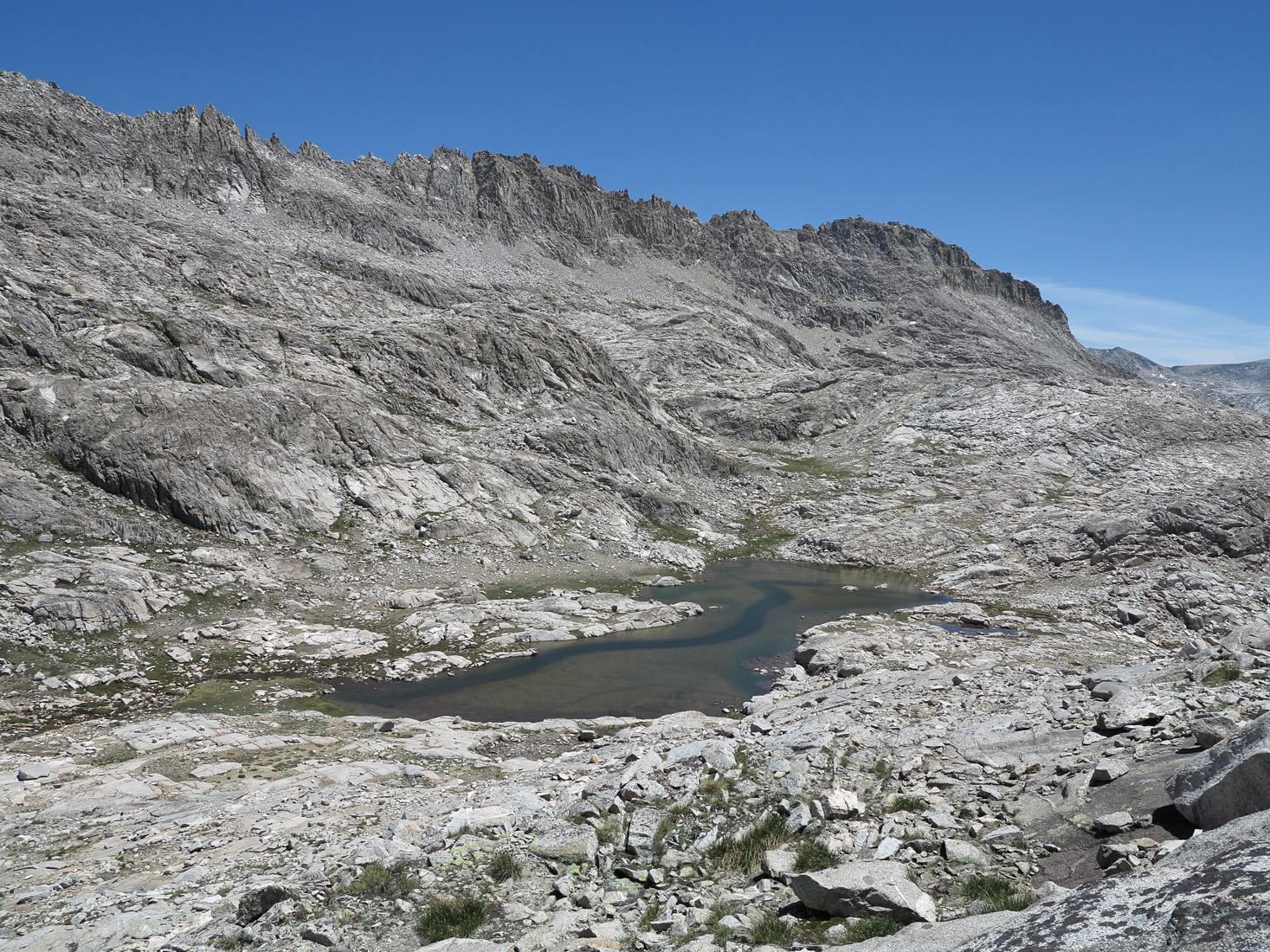
 A General Land Office surveyor provided the name simply by describing the area as a "rock Basin Containing Five Lakes" on the 1873 plat. (Inyo National Forest) |
 [photo courtesy Bob Steele] |
 |
Rovana was established in 1947, when the US Vanadium corporation purchased the former Foreman Ranch near the mouth of Pine Creek Canyon as a housing site for workers at their high-altitude Pine Creek Mine, which had expanded due to military demand for tungsten during World War II. By 1951 there were 85 houses in Rovana and later another 50, all still in use. Most were transported there from further up the canyon, where earlier mine-worker housing was vulnerable to heavy snow, avalanches, earthquakes, and mud slides. The name came from "Ro" for Round Valley and "vana" for US Vanadium. The streets were named from states of the Union matching the letters in "Vanadium" (such as Nevada, Utah, and Montana). [Wikipedia] |
 Rovana (left side bottom corner), Mt. Tom, and the glacial moraines of Pine Creek (Photo courtesy of Ed Cisnalis) |
|
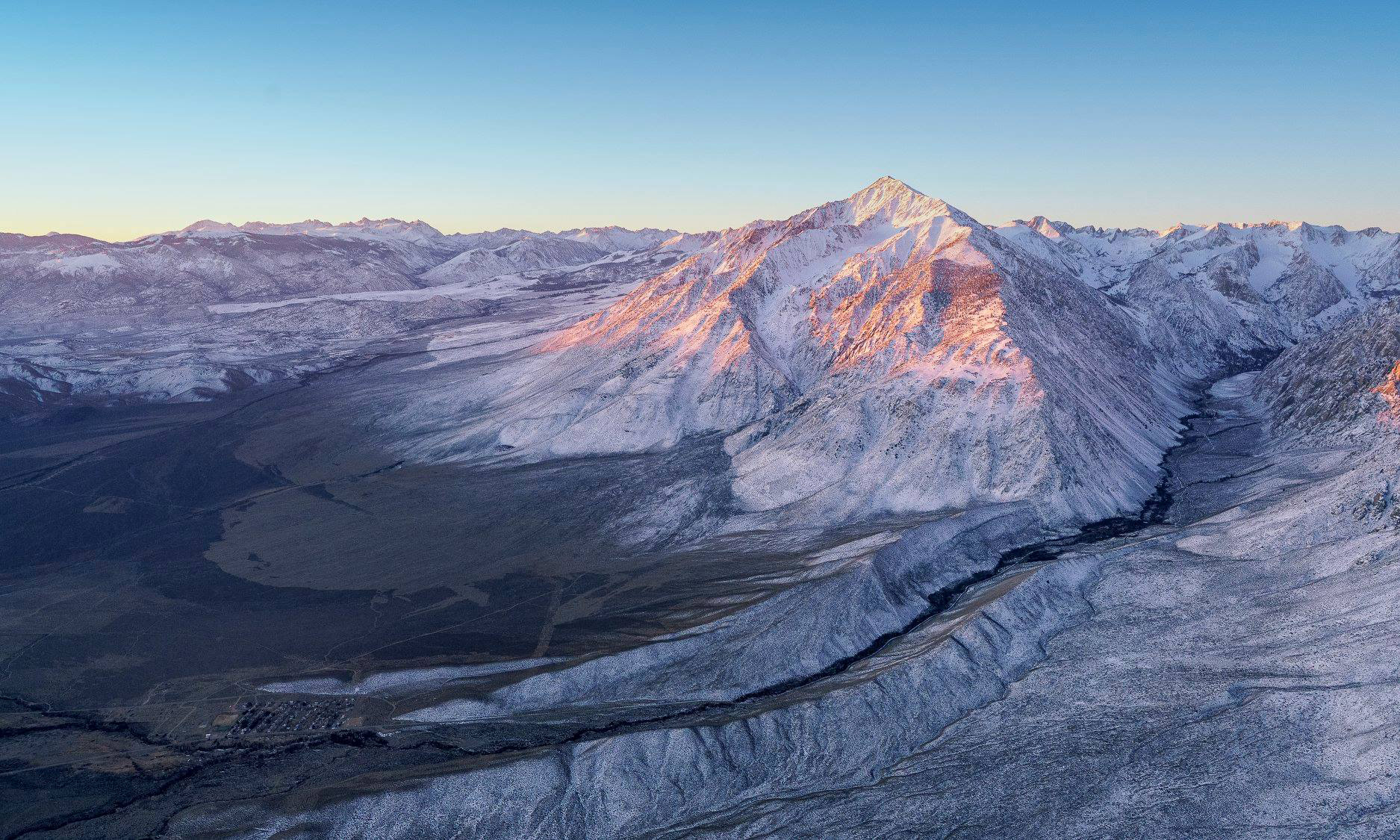
This is one of the older names on the east side of the Sierra, et its origin is unknown. It appears on the Hoffmann and Gardiner map of 1863-67 and in Whitney's Yosemite Book, 1868. On A. W. Von Schmidt's plat of 1857 it is called "Lake Creek," possibly because of e many lakes at its headwaters. [Inyo National Forest] |
 |
 Rush Creek with one of its many waterfalls (Photo courtesy of Ed Cisnalis) |
|
 |
Lake Sabrina was named for
Sabrina Hobbs, whose husband,Charles M. Hobbs, was the first
general manager of the Nevada California Power Company, which
dammed the lake during 1907-1908. |
 I hailed Bodie with an inqiry as to the reason for the name, and receied his illuminating reply n one word, "Canned." I later learned that years ago an ill-fated mule bearing a cargo of the delicacy consigned to a merchant in some mining-camp of the Walker River region had fallen off the trail, and after a series of spectacular revoutions had vanished in the icy waters. (Joseph Smeaton Chase - Yosemite Trails) |
James W. Smith had a sawmill on the creek in the 1870s. Frank M. Lewis, a sheepman, came up to Sawmill Pass from the west in 1875, and crossed it in 1878. The creek, pass, and point were named on the first Mt. Whitney map in 1907. (Farquhar: Versteeg) |
 |
 Mule Lake, Sawmill Lake and Sawmill Pass (Photo courtesy of Ed Cisnalis) |
|
The early name for the mountain was "Miners' Peak," a name used by J. W. A. Wright in 1881 and on his 1883 map. Wright also gave "Saw Tooth" as an alternative name in the 1881 article. William R. Dudley, in July 1896, called it "Miner's Peak," but added that it was "locally known at present as 'Sawtooth,' from its peculiar beak-like form.". (Sierra Club Bulletin - 1898) |
 |
 |
|
The origin of the name Shadow Creek is unknown. On Solomons' map of 1896, Shadow Lake is called "Garnet Lake," and the name "Shadow Lake" is on what is now Rosalie Lake. [Inyo National Forest] |
|
 |
Shepherd Pass was named for John Shepherd. He was born in Illinois and came to California in 1852 and to Owens Valley in 1863. In 1873 he built a house 1/2 mile west of the Manzanar crossroads. It was said to be the first two-story frame dwelling in Owens Valley. [Historic Spots] |
 J. N. LeConte crossed Siberian Pass in 1890, before it was named. "The summit (Siberian Outpost) was an immense flat area covered with loose slabs of granite piled on top of one another in sharp pinnacles. Many dead pines stood around. Still more lay prostrate, all barkless, limbless, and bleached by the winds and snow, but not a living tree in sight." The name "Siberian Outpost" was given in 1895 by Harvey Corbett, for the area's bleak appearance. [Joseph N. LeConte - A Summer of Travel in the High Sierra] |
|
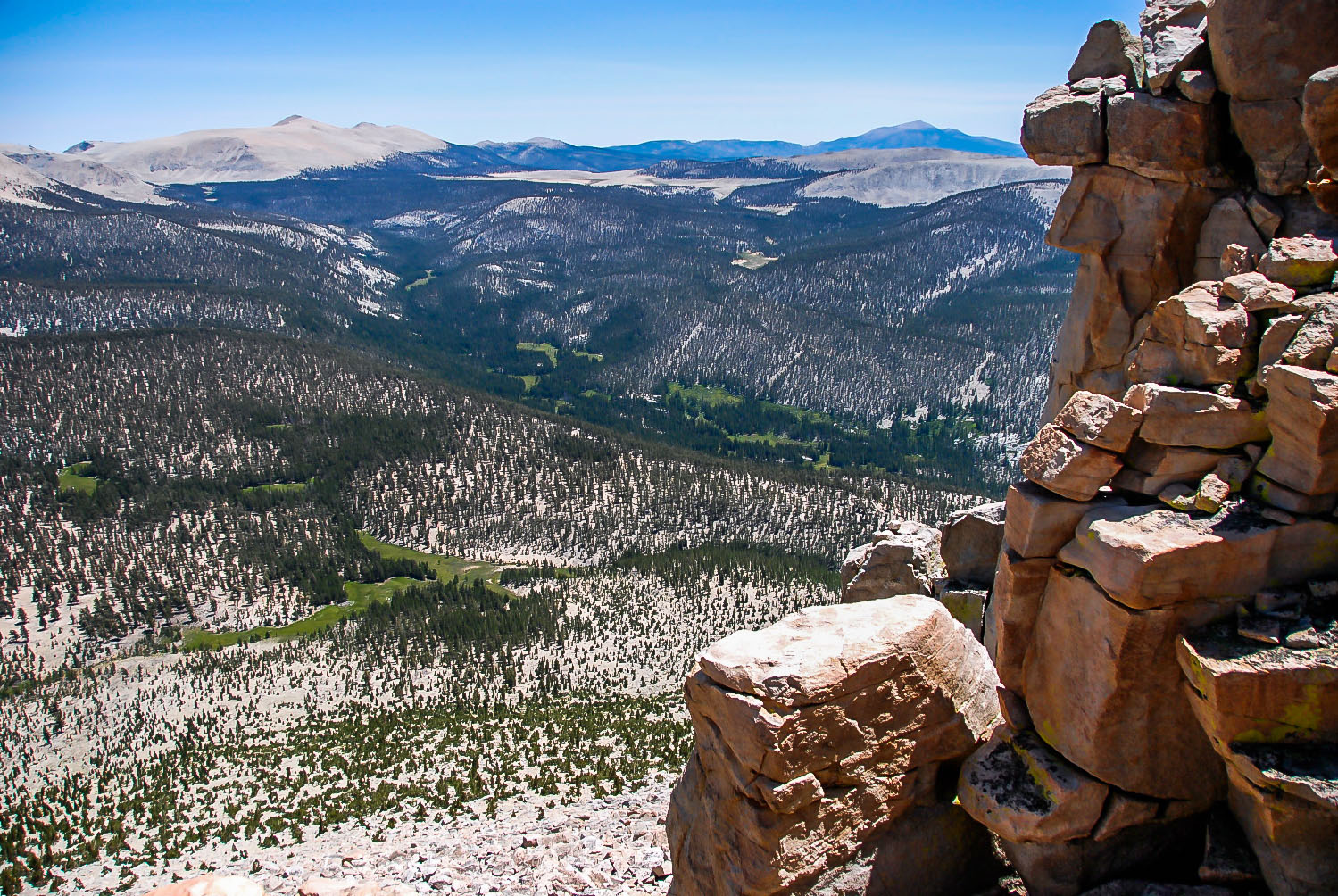
 Looking northeast across the Siberian Outpost from the pass leading over into Rocky Basin Lakes |

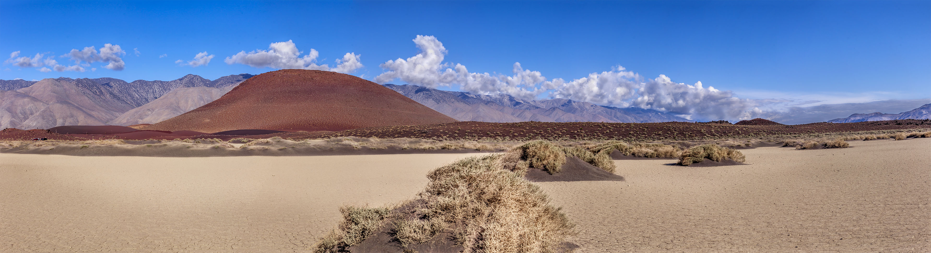
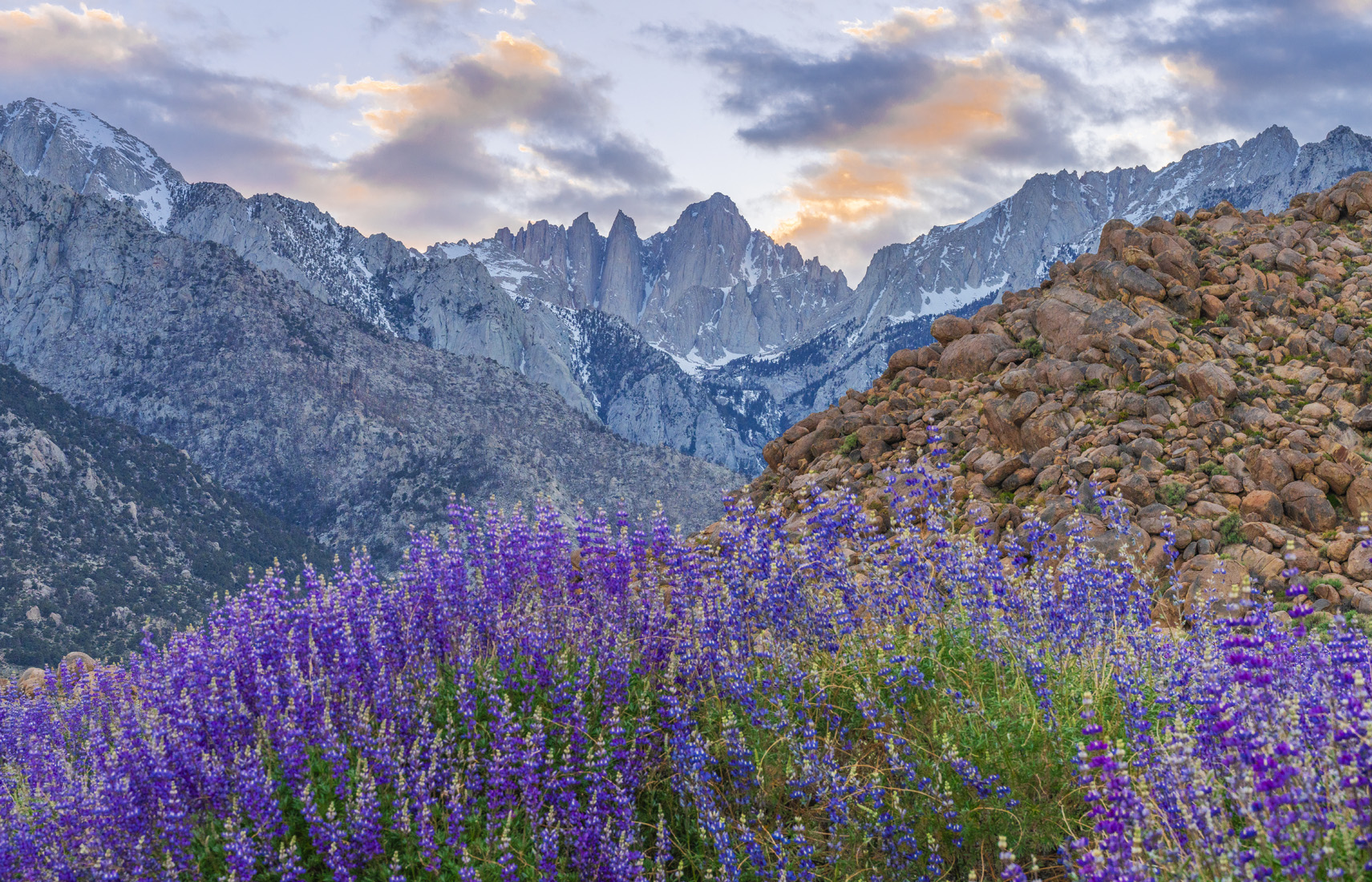
Sierra Nevada is Spanish for "snowy mountain range." Sierra is the word for "saw," and when used in this way means a jagged range of mountains - the teeth of the saw being similar to a row of mountain peaks. The Spanish used the name Sierra Nevada with abandon - any time they saw a mountain range with snow on it. As early as 1542, Juan Rodriguez Cabrillo gave that name to what we now know as the "Santa Lucia Range," south of Big Sur. Our present Sierra Nevada received its name from Fray Pedro Font, who saw it from a hill east of the contemporary town of Antioch in April 1776. "If we looked to the east we saw on the other side of the plain at a distance of some thirty leagues a great Sierra Nevada, white from the summit to the skirts, and running diagonally almost from south-southeast to north-northwest." [Francis P. Farquhar, History of the Sierra Nevada] I LOVE THE SIERRA NEVADA A video by David Wheat
|
 Theodore S. Solomons named Silver Creek in 1892 for its silvery appearance, and he later named the peak from the stream. The pass and the divide apparently were named by the USGS during the 1907-09 survey for the 1912 Mt. Goddard map. [Named by the USGS during the 1907-09 survey for the Mt. Goddard map] |
 Looking down from Silver Pass [Photo unknown) |
 |
|
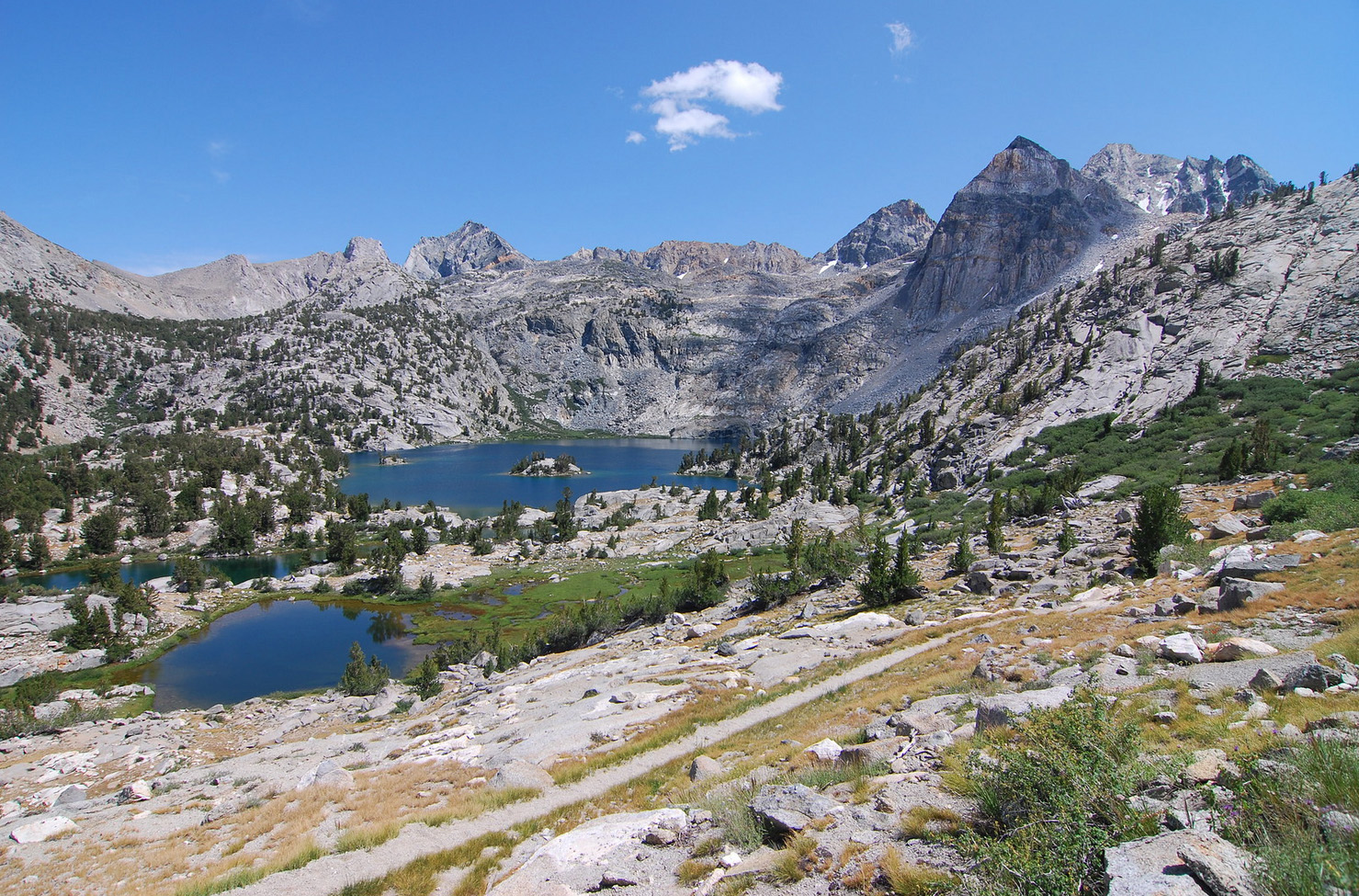
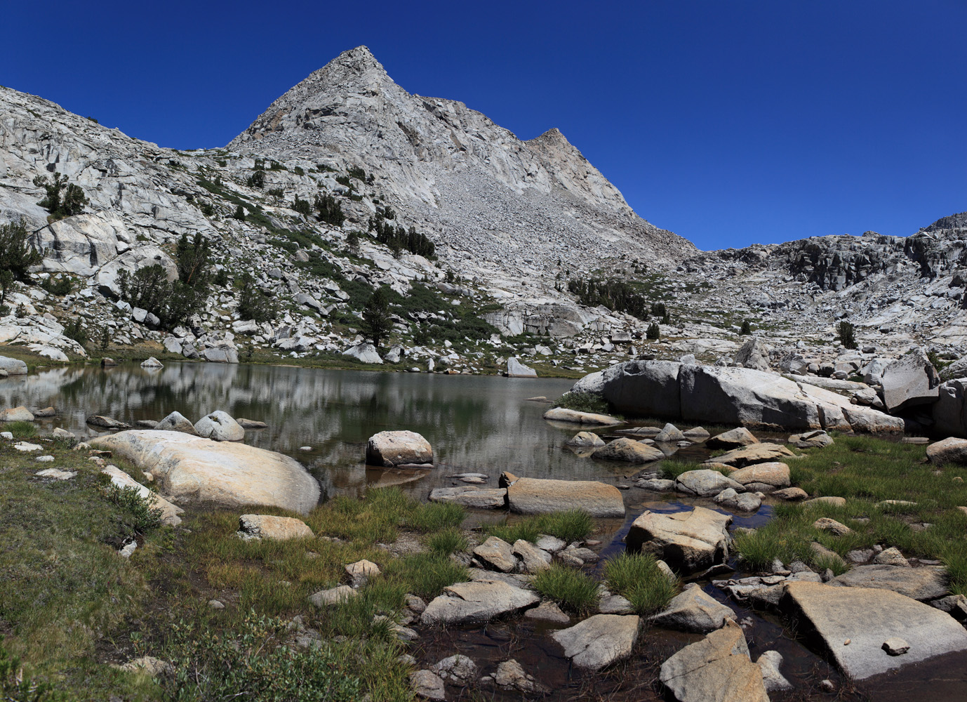
Bolton C. Brown visited the basin in 1899, and almost named it—but not quite. ". . . ah, the lakes!—in every variety, form, and position—fifty of them if there is one ...." The name probably was given by the USGS during the 1905 survey for the Mt. Whitney map. [Sierra Club Bulletin - 1900] |
|
The name Sky Parlor Meadow apparently came into general use in the Sierra Club in the early 1920s. Before then, this meadow was called "Funston's Kaweah Meadow" on William R. Dudley's sketch map of 1898. [Sierra Club Bulletin - 1898] |
 |
 "To the north of this gap the crest rises into a huge mountain with a double summit . which I called Split Mountain." The Wheeler Survey called it "Southeast Palisade" and it was also known as "South Palisade," although it is not actually part of the Palisades. Theodore Solomons used the latter name on his 1896 map. [Bolton C. Brown - Sierra Club Bulletin - 1895] |
 Split Mountain (photo courtsey of Ed Cisnalis) |
 Mount Starr is named in honor of Walter A. Starr, Jr., a renowned mountain climber and author of Guide to the John Muir Trail and the High Sierra Region. Starr was killed in August 1933 while climbing in the Minarets. The first ascent of the mountain was on July 16, 1896, by Walter A. Starr, Sr. and Allen L. Chickering, who gave it a name of their own. "...a large cloud passed over us. Suddenly everything began to buzz like an electric car in motion. The camera tripod, our fingertips, and even our hair, which stood out straight, seemed to exude electricity. We were badly frightened, and got off the peak as rapidly as possible. We called this point 'Electric Peak.'" [U.S. Board on Geographical Names decision in 1939] |
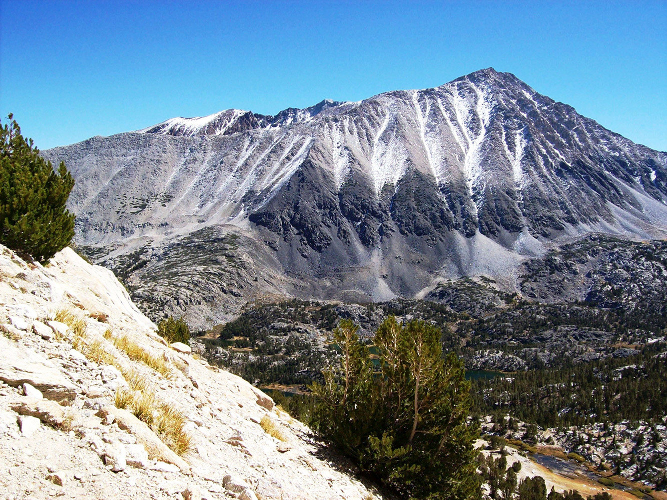
 See Table Mountain |
 This flat-topped mountain was briefly described — and almost named — by Clarence King when he and Richard Cotter made the first ascent of Mt. Tyndall in July 1864. "At one place the ridge (the Great Western Divide) forms a level table." The name "Table" was on Hoffmann's map of 1873. In 1881 the mountain was named "Mt. Hazen" in honor of General Hazen, Chief Signal Officer of the US Army, by Captain Michaelis, the officer in command of the signal service on the scientific expedition to Mt. Whitney. "Table Mountain" and "Table Creek" were on the first editions of the Mt. Whitney and Tehipite maps in 1907 and 1905, respectively. [Josiah Dwight Whitney - Geology - 1865] [J.W.A Wright - Mining and Scientific Press - 1883] |
|
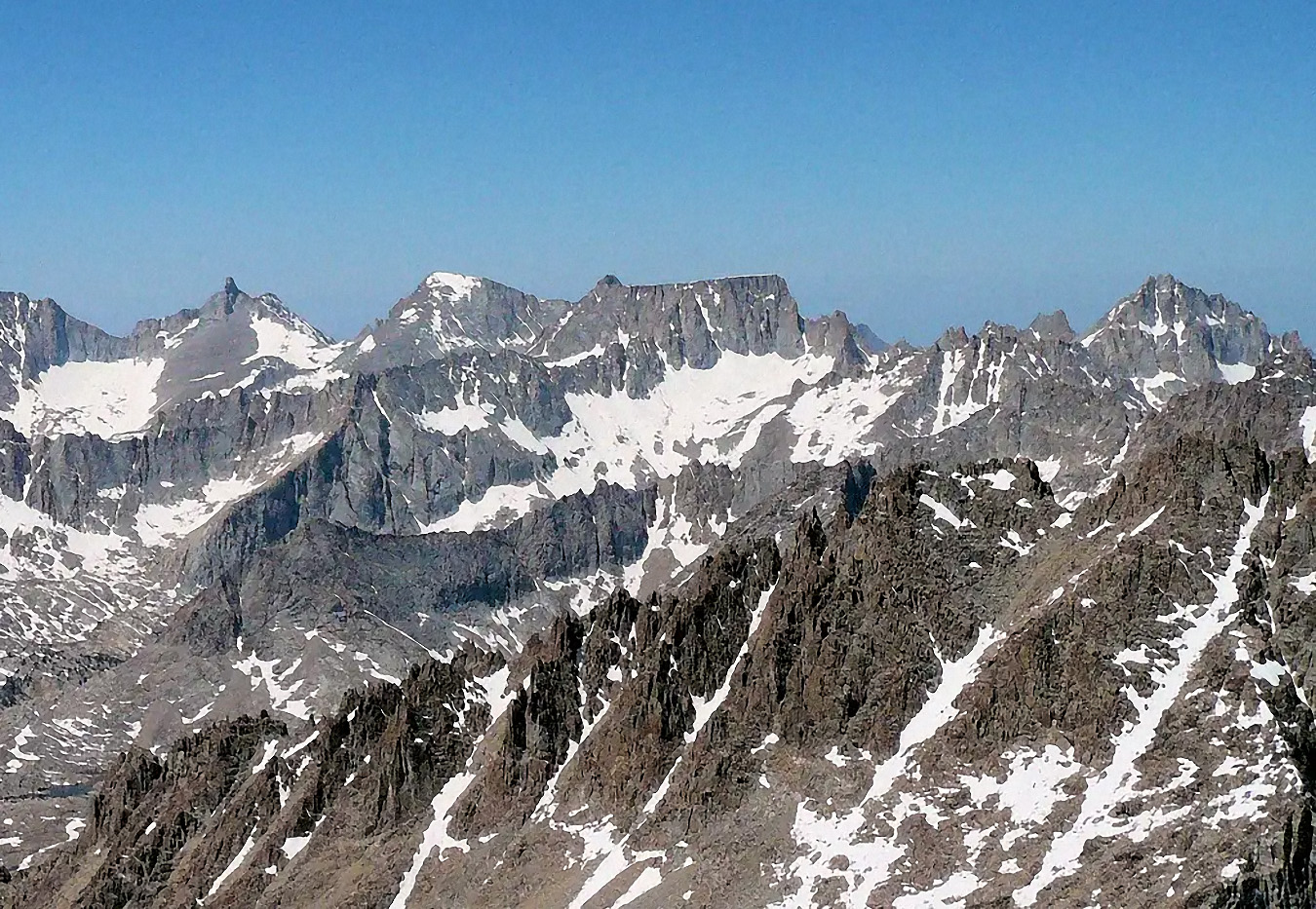 Table Mountain (Photo courtsey unknown) |
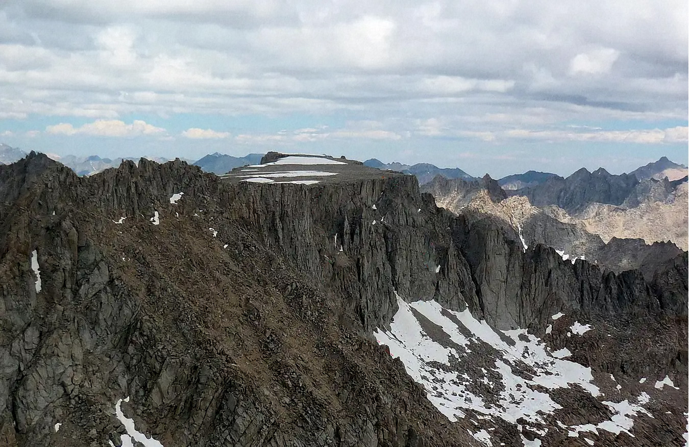 Table Mountain (Photo courtsey unknown) |
 |
Taboose
Pass comes from the Piute Indian word "Taboose" which
is a small edible groundnut found in Owens Valley. There was
a "Taboose Ranch" about 12 miles north of Independence
in the 1870s. Apparently the USGS surveyors borrowed the word
for the pass and creek. Bolton C. Brown called the pass "Wide
Gap" in July 1895 [Dorothy Clora Cragen - The Boys in the Sky-Blue Pants] |
 Looking east over Taboose Pass (photo courtsey of Chris Ryerson) |
|
 Looking west over Taboose Pass - Arrow Peak in the back center and Bench Lake right below it. (photo courtsey of Chris Ryerson) |
|
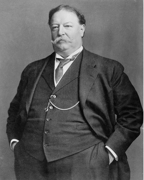 |
 Named by R. B. Marshall, USGS, for William Howard Taft (1857-1930) the 27th president of the United States, 1909-13, and chief justice of the Supreme Court, 1921-30. Taft visited Yosemite National Park in the fall of 1909 [Farquhar: Marshall] |
 The name "Tawny Boy" was suggested by Chester Versteeg in 1953. The USGS added "Tawny Point" to the map in 1956 because it was in common use. [Sierra Club papers - Bancroft Library, Berkley] |
|
 Tawny Point overlooking Wright Lakes to the south and the Bighorn Plateau (photo courtesy of Ed Cisnalis) |
|
 Named by Elden H. Vestal of the California Department of Fish and Game in 1952 [Sierra National Forest] |
| |
 Templeton Meadows and mountain were named for Benjamin Stuart Templeton who ran sheep in the area from 1877 to 1885. [Inyo National Forest] |
 Lafayette H. Bunnell of the Mariposa Battalion named the lake on May 22, 1851. "Looking back to the lovely little lake, where we had been encamped during the night, and watching Ten-ie-ya as he ascended to our group, I suggested ... that we name the lake after the old chief, and call it 'Lake Ten-ie-ya' .... At first, he seemed unable to comprehend our pourpose, and pointing to the group of glistening peaks, near the head of the lake, said: 'It already has a name; we call it Py-we-ack.' Upon my telling him that we had named it Ten-ie-ya, because it was upon the shores of the lake that we had found his people, who would never return to it to live, his countenance fell and he at once left our group and joined his own family circle. His countenance as he left us indicated that he thought the naming of the lake no equivalent for the loss of his territory." "The Ten-ie-ya Canon was known as Py-we-ack, meaning the stream of the glistening rocks, from the dazzling brightness of the glacial groound peaks at Lake Ten-ie-ya, its source." [Lafayette Houghton Bunnell - Biennial Report of the Commissioners to Manage Yosemite Valley - 1889-90] |
 |
Probably named by Theodore S. Solomons the name is on his map of 1896. "Next morning we passed down the slope of the mountain to the lake, with its hundred islets...." John Muir called it "Islet Lake" in August 1873. [Solomons in Sierra Clubulletin - 1894] |
 Thousand Island Lake (photo courtesy of Ed Cisnalis) |
|
Thunder and Lightning Lake was probably named by Halliday, a South Fork packer, who got caught in a storm while planting fish in the lake during the 1920s. [Inyo National Forest] |
 |
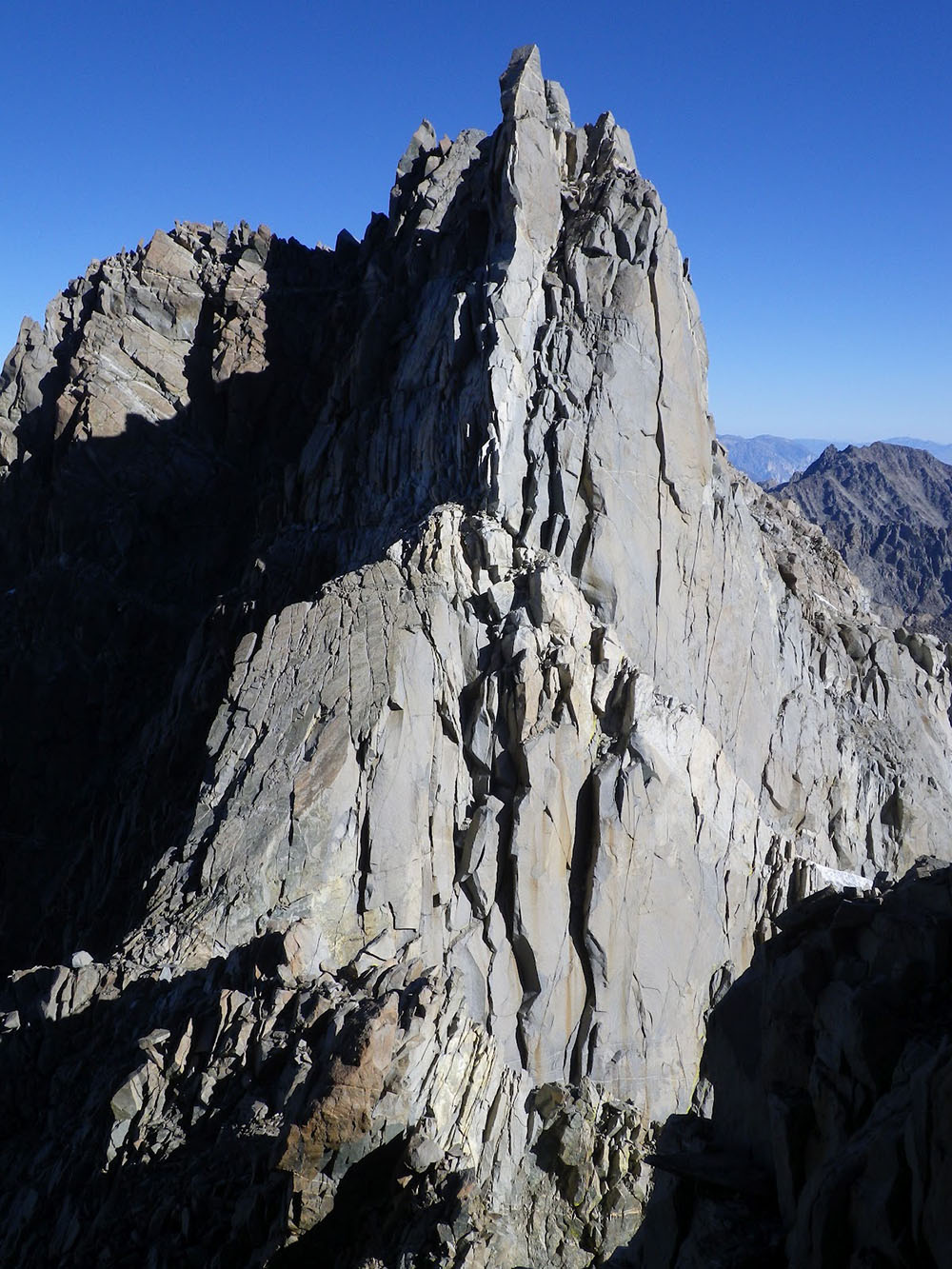
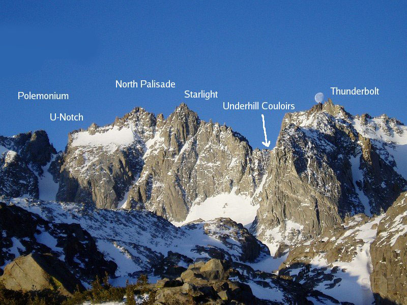
 Thunderbolt Peak was named by Francis P. Farquhar and sixothers when they made the first ascent of the mountain on August 13, 1931. "...shortly after the party reached the summit a violent thunderstorm drove all precipitately to a place of safety. So rapidly did the storm gather that Eichorn, last man to leave the ridge, was dangerously close to a lightning flash that appeared to strike the mountain. The importance of immediate retreat as soon as the rocks begin to 'sing' was strongly impressed upon the members of the party." [Sierra Club Bulletin, February 1932] [Scotty Strachan photo] |
 Thunderbolt Peak [photo: unknown] |
 Palisade Peaks [photo courtesy unknown] |
 Thunderbolt Peak [photo courtesy unknown] |
 Tokopah Falls [Photo courtesy of Chris Price] |
 The name is Yokut Indian for "high mountain valley." It was suggested to John R. White by George W. Stewart about 1923. The valley is named on the fourth Tehipite map, 1929. The name was extended to the falls on the 15-minute quad in 1956. [John R. White - Sequoia and Kings Canyon Natioal Parks - 1949] |
 Named for Thomas Clark, a resident of the pioneer town of Owensville, who is credited with having made the first ascent, in the 1860s. He said he was guided to the top by Indians [Saga of Inyo County - 1977] |
|
 Mount Tom and the glacial moraines of Pine Creek Canyon (photo courtesy of Ed Cisnalis) |
|
 Named in 1950 by Elden H. Vestal of the California Department of Fish and Game because from the air the lake's outline looks like the head of a tomahawk. [Sierra National Forest]
|
 Tomahawk Lake [Photo courtesy of Ed Cisnalis] |
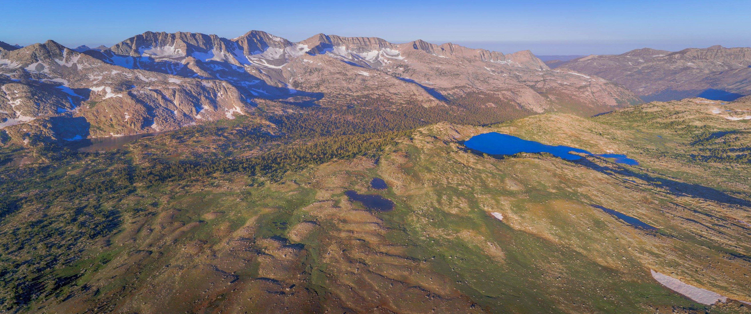
 "I recognized also several other well know peaks, one of which was a lofty castellated peak south of the Sonora and Walker River Immigrant Road, named the Castle Peak, and whose position I had determined when on the Railway Exploration under Lieutenant Moore, U.S.A., in 1853. "The grand mass of Tower Peak is a prominent and most remarkably picturesque object. This is one of the three points in the Sierra to which the name of 'Castle Peak' has been given, and is the first and original one of that name, having been called so by Mr. G.H. Goddard .... By some unaccountable mistake the name was transferred to a rounded, and not at all castellated, mass about eighteen miles a little south of east from the original 'Castle Peak,' where it has become firly fixed. Hence we have been obliged to give a new name to Mr. Goddard's peak, which we now call 'Tower Peak.'" [Josiah Dwight Whitney - The Yosemite Guide-Book - 1869] |
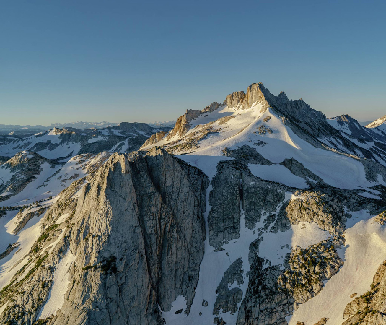 Tower Peak [Photo courtesy of Ed Cisnalis] |
 Tragedy Creek [Photo courtesy of t_camuti] |
 Tragedy Creek - July 19, 1848: "Made only five or six miles and encamped at the spring near the fresh grave; determining to satisfy ourselves, it was soon opened. We were shocked at the sight. There lay the three murdered men robbed of every stitch of clothing, lying promiscuously in one hole about two feet deep.... The blood seemed fresh still oozing from their wounds." July 20, 1848: "We cut the following inscription on a balsam fir that stood near the grave: 'To the memory of Daniel Browett, Ezrah H. Allen, and Henderson Cox, who were supposed to have been murdered and buried by Indians on the twenty-seventh of June, A.D. 1848.' We called this place Tragedy Spring. Bigler, his companions, and the murdered men were members of the disbanded Mormon Battalion, on their way back to Great Salt Lake. [Erwin G. Gudde - Bigler's Chronicle of the West, 1962] |
 |
[Inyo National Forest] |
 With Horseshoe Meadow in the foreground — Trail Pass (L), Trail Peak [Photo courtesy of Ray DeLea) |
|
 Donald B. Tresidder, husband of Mary Curry Trssidder, was president of the Yosemite Park & Curry Company 1925-48, and president of Stanford University, 1943-48. During Tressider's reign as head of the Curry Company, he built the Ahwahnee Hotel, the cafeteria and dining room at Camp Curry, and the Big Trees Lodge in Mariposa Grove. He was also responsible for beginning a skiing program in Yosemite and for constructing the High Sierra Camps. [U.S. Board on Geographical Names - 1959] |
Tresidder Peak [Photo courtesy of Robert Cross) |
 |
The falls Indian name is Tu-ee-u-la-la. From the brow of the cliff it leaps, clear and free, for a thousand feet; the half disappears in a rage of spattering cascades among the boulders of an earthquake talus. There is no explanation of what the name means. Despitee its early use by John Muir, the name did not get onto a map until publication of the 15-minute Lake Eleanor quad in 1956. [Overland Monthly - 1873] |
 n wampama fall_OK_sml.jpg)
 A composite name, created out of Tulare and Inyo, coined by R.B. Marshall, USGS, during the 1905 survey for the Mt. Whitney map. It s a snow-melt lake, in a depression, with neither inlet nor outlet and, although close to the county line, is entirely within Tulare County [Sequoia National Park] |
|

|
|
There was once a "Tunemah Pass" and a "Tunemah Trail" — long abandoned. It was the latter that gave birth to the dreadful name, as a herd of sheep belonging to Frank Dusy and Bill Coolidge was forced down a precipitous trail ito Simpson Meadow in 1878. "Two Chinese herders—appaled by the awful chasm confronting them — worked to a point of exhaustion by their desperate efforts to force the massed and balking sheep onward — cursed the sheep, the dogs, the trail and all other related factors, in the most forcible epithets known to the celestial vocabulary. Above the bleating of the sheep and barking of the frantic dogs, from the enveloping clouds of dust, there repeatedly and wrathfully resounded 'Teu-na-mah-ne! muck-a-hai! Yeu-nicky-shee-fut! Teu-na-mah-ne! Teu-na-mah-ne!' — a thousand times .... Peck and Nye (Dusy's head packers) agreed to call the sheep plunge 'Teu-na-mah-ne.'" And what doess it mean? It means something as horrible as "You sleep with your grandmother." It might even mean something worse than that. Consult your local authority. [Kngs Canyon National Park] |
|

 |
George R. Davis, USGS, made the first ascent in August 1905 during the survey for the Mt. Whitney map. He apparently named the peak at this time. There is no explanation of the meaning of the Indian-sounding name. Possibly Shoshonean, Mono dialect. The name appears on the map in 1907, but is not in J.N. LeConte's "Elevations." [Sierra Club Bulletin - 1903] |
 Golden Trout Creek and the South Fork of the Kern River come within a few hundred feet of each other near a trail junction north of the guard station. About 1883 or 1884 some enterprising South Fork ranchers dug a diversion tunnel to take water from the creek to irrigate the meadows lower down the river. The tunnel was plagued by cave-ins, and was converted into an open cut about 1891. That too had a cave-in problem, and the project was abandoned about 1899. Tunnel Meadow, Tunnel Air Camp (formerly owned and operated by Bob White out of Lone Pine, and Tunnel Guard Station all garnish their name from those 1800s ranchers. [Los Tulares, August 1984] |
|
 Tunnel Airstrip (Photo courtesy of Ray DeLea) |
|
 Tunnel Meadow [photo courtesy of Unknown] |
|
 The peak was named by the Whitney Survey in 1863. "A very prominent peak, with a peculiar horn-shaped outline, was called 'Unicorn Peak.'" But then Whitney added an apologetic footnote for the romantic/mythical name. "Names are frequently given to prominent objects, by parties like ours, for convenience; as where peaks are used for topographical stations. If not named, they would have to be numbered, which would be both awkward and inconvenient." [Josiah Dwight Whitney - Geology - 1865] |
 Named in 1949 by William A. Dill of the California Department of Fish and game because the lake appeared to be "useless for anything — even for frogs." It is the tiny lake just west of Sedge Lake and south of Shorty Lake [Sierra National Forest] |
 William Vandever (1817-1893), a general in the Civil War, member of Congress from Iowa, 1859-61, and from the sixth district of California, 1887-91. In 1890 he introduced the bills establishing Yosemite, Sequoia, and General Grant national parks. (Farquhar -Mount Whitney Club Journal - 1903] |
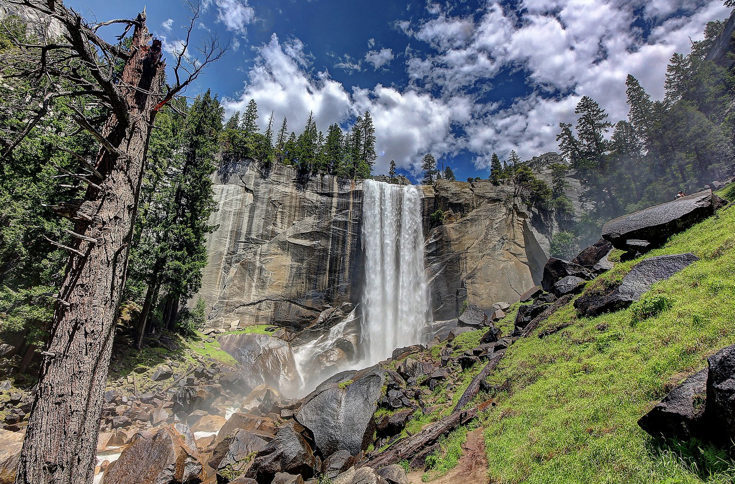
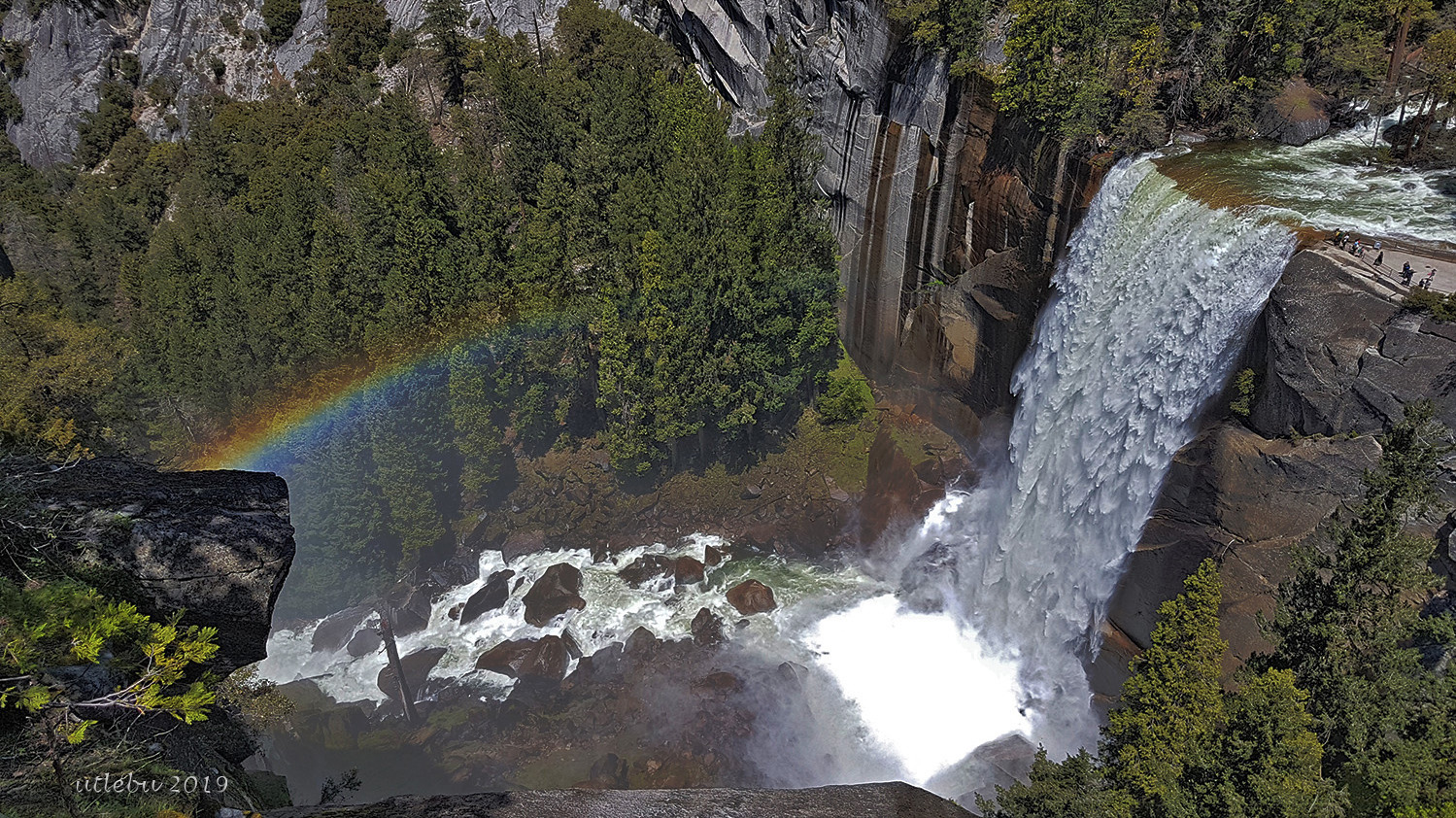
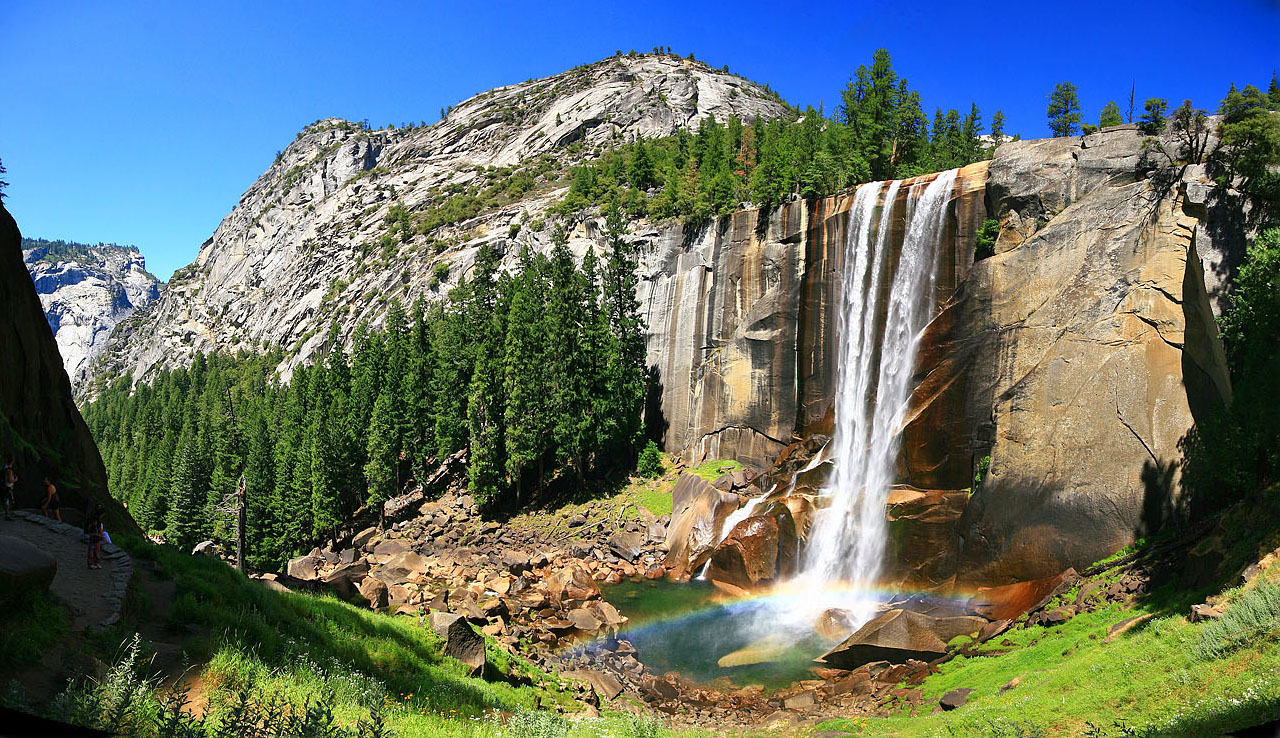
Named in 1851 by Lafayette Bunnell. "The Vernal Fall I so named because of the cool, vernal spray in contrast at midday with summer heat, reminding me of an April shower, and because of the blue grass curiously growing among dark rocks and gay, dripping flowers, making it an eternal April to the ground. The Indian name is Yan-o-pah, meaning a little cloud, because of the spray through which the old trail passed, and because of the circular rainbow, nowhere else seen in the mountains." (Lafayette Houghton Bunnell - Biennial Report of the Commissioners to Manage Yosemite Valley - 1889-90] |
 |
 The lake was named sometime before 1879 by sheepmen, for one of their own. "... a very pretty sheet of water on Hetch Hetchy Creek, called Lake Vernon by the sheep-owners, on whose range it is this is the principal reservoir from the Hetch-Hetchy Fall." (Yosemite National Park] |
 The "Virginia" name probably originated among early miners from Virginia. Virginia Creek was named on Hoffman's map of 1873. The Wheeler Survey atlas sheet 56D, 1878-79, has "Virginia Creek Trail" running up what is now name Cold Canyon. Lt. McClure had "return or Virginia Canon" on his 1896 map. "Virginia Lake" was on the third edition of the Mt. Lyell map, 1910. Virginia Peak was originally called "Red Peak," but was changed to its present name because there was already another "Red Peak" within Yosemite National Park. (US Board on Geological Names - 1932] |
 |
|
Farquhar stated the Col. Benson named these features for Alexander Theodore Vogelsang, president of the California State Board of Fish and Game Commissioners, 1896-1901. However, Charles Adolphus Bogelsang (a brother) wrote Farquhar that Benson named the peak for him, in 1907. He was the executive officer of Fish and Game, 1901-10, 1919-22. In 1932 the US Board of Geographic Names ratified these names and also "Vogelsang Pass," which is generally known by that name but is not on the map. It is 1/2 mile south of Vogelsang Lake. "Although named for a man, the name is singularly fitting to the beautiful place; it means in older German 'a meadow in which birds sing.'" (Erwin G. Gudde - California Place Names] |
|
 |
Named by Theodore S. Solomons in 1894. (Farquhar: Solomons] |
Lt.
Davis used the name "Volcano Creek" on his 1896 map,
and called the nearby falls "Whitney Falls." On the
first edition of the Olancha 30' topographical map in
1907, the USGS named the creek "Golden Trout Creek"
and the falls "Volcanic Falls." In 1927 the falls was
officially named "Volcano Falls." Volcano Meadows,
Volcano Creek, and Volcano Falls all lie in the vicinity of two
extinct volcanoes and an enormous expanse of lava. Volcano Falls
actually lies on Golden Trout Creek just before the creek flows
down the Kern River gorge to meet the Kern River at lower Funston
Meadow. |
 |
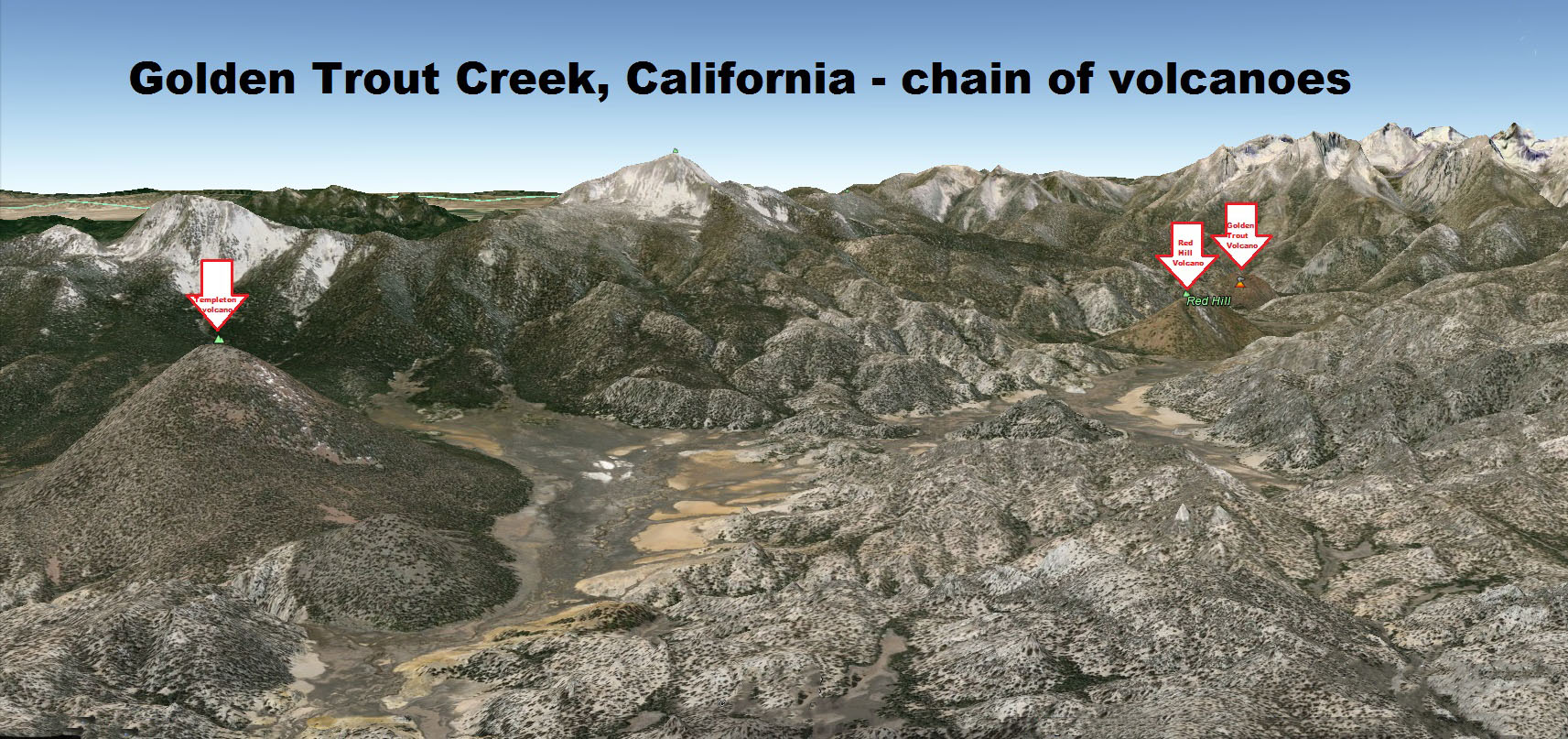 Golden Trout Creek chain of valcanoes |
|
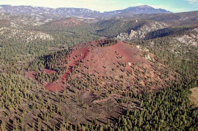 Golden Trout Creek volcano (Photo unknown) |
 Golden Trout Creek - Volcano Falls - off to the right Photo 2, Photo 3 (Photo courtesy of Valerie Norton) |
 |
The peak was named by the USGS in 1911: "Replaces the former name, Regulation Peak, which was given by Lt. H. C. Benson in 1895 and transferred by mistake to another peak by the USGS." (Erwin Gudde, California Place Names] |
|
Volunteer Peak (Photo courtesy of tahoetowhitney] |
 |
|
Named by Art Schober. There was a man named "Hobby" Hobson who used to come to Parcher's resort. Whenever he caught a fish he would holle out "Wahoo!" (Sierra National Forest] |
|

 Possibly named in 1948 by Jack Criqui of the California Department of Fish and Game. No reason is given for the name. Possibly named in 1948 by Jack Criqui of the California Department of Fish and Game. No reason is given for the name.[California Department of Fish and Game Survey] |
 Judge William B. Wallace (1849-1926), a mountaineer and explorer of the southern Sierra Nevada. Wallace "spent twenty consecutive summers in the mountains .... He climbed Mount Whitney and other high peaks, traversed wild canons, discovered passes, blazed trails, traveled through trackless forests, and named several streams, lakes, meadows, and mountains." The names were proposed by the Sierra Club in 1925, and approved by the US Board on Geographic Names. [George W. Stewart - Sierra Club Bulletin - 1927] |
 |
|
Named in August 1951 by Elden H. Vestal of the California Department of Fish and Game "after bead money as one of several means of exchange among Indians." [Heyward Moore - 1984] |
|
 |
|
This was named "Bobs Lake" on the Mt. Abbot 15 minute map; changed to "Warrior Lake" by a US Board on Geographic Names decision in 1969. The former "Warrior Lake" was changed to "Chief Lake." The reason for the changes was not explained. [Sierra National Forest] |
|
 Joseph R. Walker (1798-1876), leading a party of Bonneville's men, made the first east-to-west crossing of the Sierra Nevada, in 1833. On the return journey, in 1834, he crossed via the pass that is now named for him. Walker was a guide on Fremont's third expedition, 1845-46. It was Fremont who named the pass. He also named the river and Walker Lake, Nevada. Walker Mountain was first named on the 1911 Bridgeport map. It is at the headwaters of the Little Walker River. [Joseph R. Walker Memoirs] |
 Named by Al Gardisky in 1932 after the town in which a close friend of his lived. (Inyo National Forest] |
Waterwheel
Falls, formerly Le Conte Falls and sometimes called California Falls, was originally named in 1895 by R. M. Price
and derives its name from a set of cascades called the "Rocket
Cascades." Here the water strikes the edges of the great
plates of granite and is spun off continually in great arches.
The columns, or waterwheels, of water rise fifteen to 20 feet
high. [Sierra Club Bulletin, May 1895] [photo: unknown] |
 |
 Waterwheel Falls - Yosemite |
|
 Named by the Forest Service in memory of Clark Waterhouse, who had been in charge of the Angora Lookout. He was killed in the First World War (Erwin G. Gudde - California Place Names] |
 |
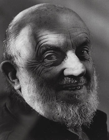 Ansel Adams |
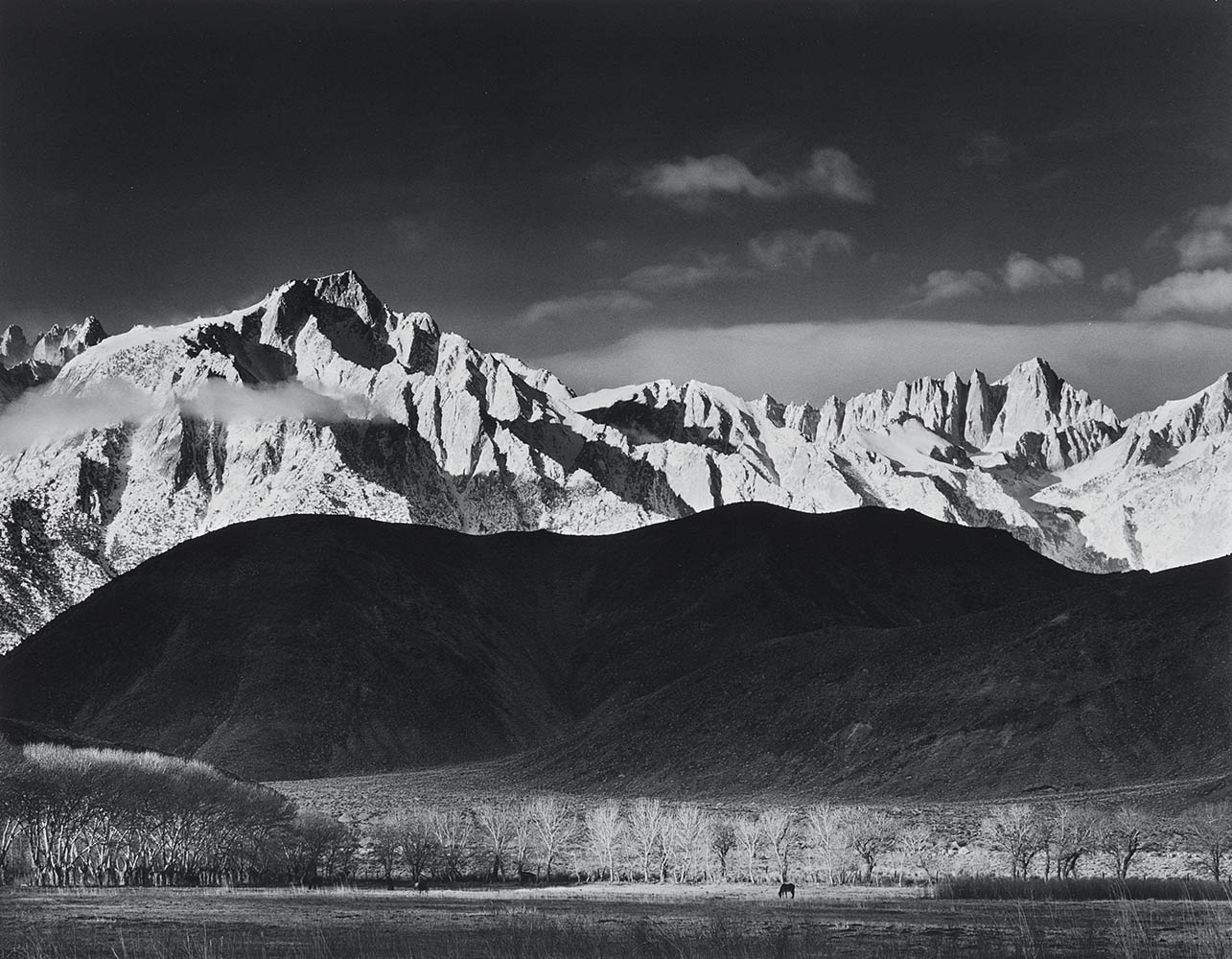 Mt. Whitney, the high peak on the right of the picture, was named in July 1864 by Clarence King and Richard Cotter of the Whitney Survey team in honor of Josiah Dwight Whitney. [photo courtesy of Ansel Adams] |
|
 Whitney Portal Falls [photo courtesy of Brad Wright] |
 The original name of Whitney Portal was "Hunter Flat" or "Hunter's Camp," given many years ago for WIlliam L. Hunter, and early pioneer of Owens Valley and one of the two men who made the first ascent of Mt. Williamson, in 1884. The name "Whitney Portal" was applied at the official opening of the new automobile road to the flat in June 1936. [USGS] |
 Alexander Winchell (1824-1891), for many years the state geologist of Michigan and professor geology at the University of Michigan. In 1868 Elisha C. Winchell, Alexandeer's cousin, honored him by giving the name "Mount Winchell" to what is now named "Lookout point." Unaware of the naming Lilbourne A. Winchell, the son of Elisha, in 1879 gave the same name to a peak south of the Palisades. The name "Mount Winchell" apparently was transferred to its present locaton by the USGS during the survey for the Mt. Goddard map, although J.N. LeConte contradicts L.A. Winchell by saying that it was Winchell who applied the name to the present Mount Winchell. (Sierra Club Bulletin - 1904] Louis Agassiz (1807-1873), a naturalist, geologist, and teacher. He was born in Switzerland, came to the United States in 1846, and became a professor of zoology at Harvard in 1848. Lilbourne A. Winchell, in 1879, gave the name "Agassiz Needle" either to this peak or to what is now Mount Winchell, a truly needlelike peak 0.7 mile southeast of Mount Agassiz. The name change from "Agassiz Needle" to "Mount Agassiz" was proposed by the Sierra Club in the 1930s. (Sierra Club Records in the Bancroft Library] |
 Mount Winchel (L) and Mount Agassiz (R) (Photo courtesy of Ed Cisnalis] |
 |
 |
Mount Wynne was named for Sedman W. Wynne, former supervsor of Sequoia National Forest, who lost his life while on duty. |
The first white men known to have entered Yosemite Valley were members of Major Savage's Mariposa Battalion. The date was March 27, 1851. The valley and many of the major features in or near it werer named by these men during trhe first four or five days. "Some romantic and foreign names were offered ... a very large number were canonical and scripture names. As I did not take a fancy to any of the names proposed, I remarked that ... 'I could not see any necessity for going to a foreign country for a name for American scenery—the grandest that had ever yet been looked upon ... that the name of the tribe who had occupied it, would be more appropriate than any I had heard suggested.' I then proposed 'that we give the valley the name of Yo-sem-i-ty, as it was suggestive, eiuphonious, and certainly |
 |
| American; that by so doing, the name of the tribe of Indians which we met leaving their homes in this valley, perhaps never to return, would be perpetuated.' I was here interrupted by Mr. Tunnehill, who impatiently exclaimed: 'Devil take the Indians and their names! Why should we honor these vagabond murderers by perpetuating their name?' Another said: 'I agree with Tunnehill:" ——the Indians and their names. Let's call this "Paradise Valley.'" The question of giving it the name of Yo-sem-i-ty was then explained, and upon a viva voce vote being taken, it was almost unanimously adopted. "While we most willingly acquiesce in the name of Yo-Semite ... as neither that nor Yo-Ham-i-te, but Ah-wah-ne, is said to be the pure Indian name, we confess that oour preferences still are in favor of the pur Indian being given; but until that is determined upon (which we do not ever expect to see done now), Yo-Semite, we think, has the preference." "In the first place the aborigines never knew of any such locality as Yosemite Valley. Second, there is not now and there has not been anything in the valley which they call Yosemite. Third, they never called 'Old Ephraim' himself Yosemite, nor is there any such word in the Miwok language. The vallley has always been known to them, and is to this day when speaking among themselves, as A-wa'-ni." Lafayette Houghton Bunnel - Discovery of the Yosemite, and the Indian War of 1851, which led to that event - 1911] [James Mason Hutchings - Scenes of Wonder and Curiosity in California - 1862] [Stephen Powers - Tribes of California - 1877] |
|
 Daniel Kindle Zumwalt (1845-1904), land agent and attorney for the Southern Pacific Railroad. Zumwalt was one of the iportant figures in the creation of Sequoia and General Grant national parks in 1890 (Kings Canyon National Park] (Sierra Club Bulletin - 1962] |
 Zumwalt Meadows (Photo courtesy of Tom Hilton] |
RECOMMENDED READING |
|
|
Trans-Sierra Highway | |
|
|
Slim Randles "Night Ride" | |
|
|
Olancha | |
|
|
More
Sierra Place Names |
|
|
George Brown, Native American |
|
|
|
To the Top of Mt. Whitney by Rena Moore |
|
Sign Guestbook View Old Guest Book Entries Oct 1999 - Feb 2015 (MS Word) |
 CONTACT the Pigmy Packer |
View Guestbook View Old Guest Book Entries Oct 1999 - Feb 2015 (PDF) |