 |
See USE NOTICE on Home Page. |
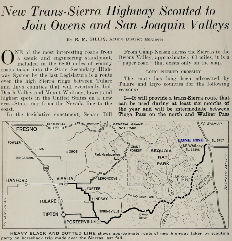
STATE AND COUNTIES JOIN TO CUT $1,000,000 ROAD THROUGH HIGH SIERRAS*
The "Roof of the United States" Will Open to Motorists When This Road Opens Up Great Virgin Country
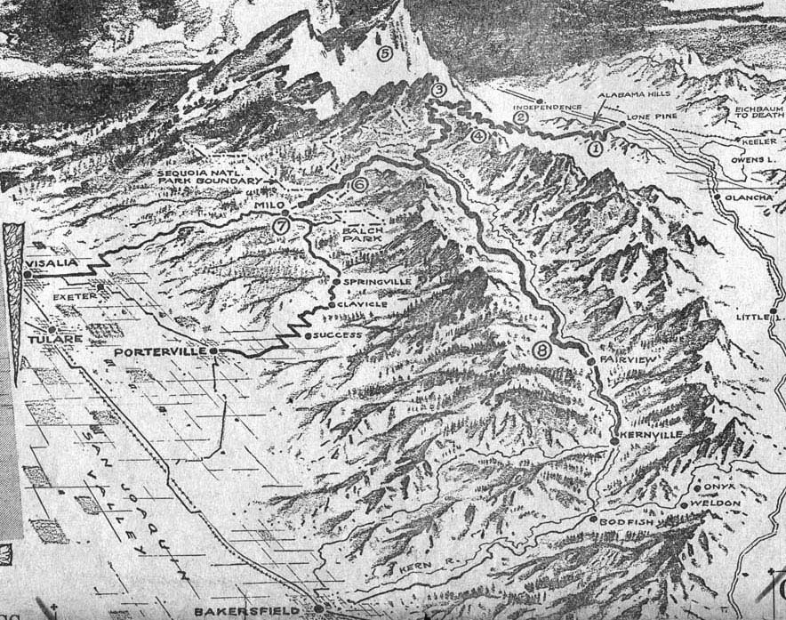
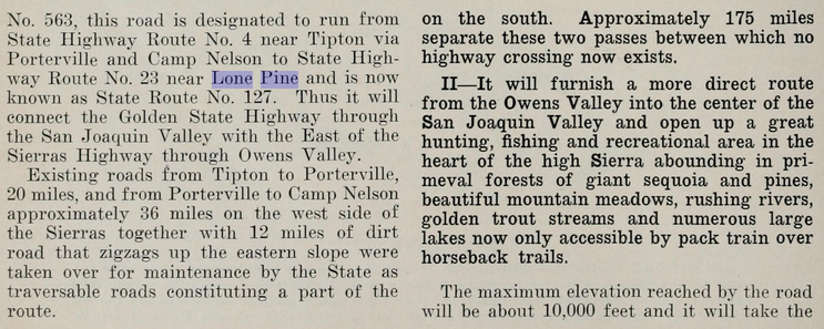
A million-dollar road running to the "Roof of the United States," with a lateral to Mt. Whitney, the highest point in the United States, will be ready for service to motorists [shortly], according to definite plans which have been drafted by State, county and city officials. The new road, which is to run from Lone Pine in the Owens Valley, up into the high Sierras through Carroll Creek and over Mulky Pass, going westward to the heart of the Kern River country, will have three western terminals; Porterville, Visalia and Bakersfield. The road from Lone Pine to Porterville will be 115 miles long. It is to be a dirt road, twelve feet wide. The highest altitude of the main artery will be 11,300 feet at Mulky Pass, 1359 feet higher than Tioga Pass. This will be the first road to bisect the Sierras in Southern California, and will be an important link in another transcontinental highway, connecting with the famous Lincoln Highway and the Sierra-to-the-Sea lateral. It will open to motorists from both sides of the continent the Mt. Whitney region, hitherto accessible only by pack train and trail, and will provide a valuable outlet to both Southern and Northern California through the Owens Valley and San Joaquin Valley.
Today the Sierras proper are locked, except for short roads running into the sides from the two valleys. To cross from the Owens Valley to the San Joaquin Valley, the motorists must either go across from the Midland Trail above Randsburg through Onyx, Weldon and Bodfish to Bakersfield, or go more than 200 miles northward and cut across Tioga Pass. Ever, since man first scaled Mt. Whitney in 1873 and by scientific calculation determined it to be the highest peak in the Sierra range, engineers have drawn plan after plan to build a road through the wonder country that lies below it, so that the scenic beauty of this vast empire might be made available to the public. But the cost always was considered prohibitive, and plan after plan was pigeon-holed. However, three years ago William Skinner, surveyor of Lone Pine, agreed with Frank Chrysler of the Mt. Whitney Pack Train, P. W. Smith and G. W. Dow of Lone Pine, to make a preliminary survey of the entire range, to find the most feasible course a road might follow. These men, together with other Lone Pine citizens, subscribed to a fund of thousands of dollars so the work might be carried on. The report of this survey started the program which has been finally worked out, and construction work is to start next spring. Joining in the plan are the Inyo, Kern and Tulare county supervisors, State Highway Commission engineers, and department heads of the city of Los Angeles - for the city owns much property through which the road will pass. The Auto Club is also helping the project.
With the aid of the city of Los Angeles, Inyo county is expected to build the road to the county line at Mulky Pass, starting from Carroll Creek. This unit alone will cost $170,000. Of the total cost to fall on the three counties involved Kern and Tulare are each to pay 45 percent and Inyo county 10 percent. Inyo's percentage is low because it has only about $10,000,000 in taxable property. In the present plan Inyo county is represented by Supervisor Amos Hancock; Tulare by F. M. Pfrimmer and Kern by D. McFarland. |
Rolling northward and over the Midland Trail
for 225 miles with the straightened Mojave-Lone Pine unit unfolding
itself like a silver ribbon under the desert stars, a touring
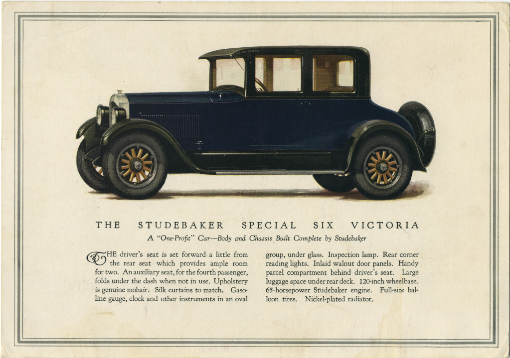
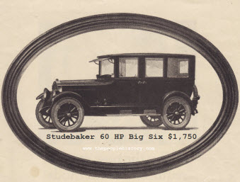
party from the Paul G. Hoffman Company, local Studebaker distributors,
traveled in big-six comfort the other night. This is the road
over which the Mt.
Whitney-Death Valley Transportation Company, using Studebaker big sixes, has just started operating
a daily stage service both ways between Los Angeles and Lone
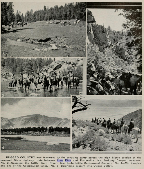
Pine. This is the first stage line to serve this country. As the car nosed into Carroll Creek Camp, at 6800 feet, the last point a car can climb on the way to Mt. Whitney, the party was cheered by a crowd of deer hunters and vacationists who were just preparing to "turn in" for the night in tents, and bed rolls. Dawn and the party left motor car behind. Led by Ted Cook, famous guide and joint owner of the Mt. Whitney Train, the cavalcade of horses and pack mules started up the long, steep trail. What the part saw from the backs of sterling, sure-footed ponies bred for the mountain trail, the motorist is scheduled to see in the fall when the Lone Pine-Porterville road is an accomplished fact, and he can nose his car over a mountain road that will have not more than an 8 percent grade anywhere along its course.
To the northeast and south lies Owens Valley, goal of the pioneers of '49 who risked the torrid bowl they named Death Valley. Snowy clouds rode over the Sierras range; a bright blue sky banked the tips of the Panamints to the east; and the rising sun painted fantastic pictures in color in the semidry bed of Owens Lake, lying directly below - colors vivid, and unmatched elsewhere because of the brilliant mineral deposits. Eastward the highly mineralized Panamints, mighty in themselves, look small and squat. And under the canopy of purple haze that lies still further east, one sights the Funeral Range, and realizes that between the two is that inferno - Death Valley - which too, is giving way to a courageous man and his trail-blazing Studebaker big six - H. W. Eichbaum of Catalina. A few miles further, the pack train stops on the top of a ridge. Ahead to the west lies the great Cottonwood basin, rimmed in by the "Roof of the United States" - the highest peaks in the country. When the road brings the motor car up here, this basin will prove as fascinating as Yosemite, or any view in our national parks.
Down a way is the last outpost of civilization - Golden Trout Camp, operated by Mr. and Mrs. C. E. Towler. This is the supply post for the vacationist and the sportsman. Combined with a general store, supplies for which come up by pack train for eleven miles, the hospitable Towlers operate a tent city for callers; furnish meals from the camp store kitchen; supply completely equipped tent houses for living, sleeping and cooking, with floors and board walls; furnish horses and have available the last telephone connection with the outside world over the United States Forest Service wires which tap in here. Today there is a rough log cabin. Tomorrow when the road comes Mr. Towler plans a modern mountain lodge with cabins, on the banks of Cottonwood Creek, which babbles by the whole year 'round. For in this sheltered spot, open now only in spring and summer, will rise a winter city where snow and ice sports may be enjoyed for practically six months of the year; where the ski runner will be able to start almost on the "Roof of the United States," and ski downward into the great Cottonwood basin. For nature already has created a natural series of runways for toboggan and ski. |
This high country, when the mountain road is finished up from Lone Pine, will be a winter country for half the year, reached through the warm Owens Valley by an easy six or seven hours' drive from Los Angeles. And in summer this country will still be more popular, because it will bring vacationists within about twenty-one miles of horseback travel from Mt. Whitney, 14,501 feet high, now reached only after thirty-five miles of four-footed transportation. And when the side lateral toward Mt. Whitney is built, the motorist will have to travel only about twelve miles to get to the highest peak in the United States. In going to Mt. Whitney the pack train passes by the lakes. The five were named for the first time this summer as Lakes Idabel, Merl, Towler, Chrysler and Cook, the latter three in honor of the men who have been pioneers in this country for many years. The Studebaker next climbed over Army Pass. Army Pass is the farthest eastern point on the new boundary line of the recently enlarged Sequoia National Park. The park line has been extended from west of the district known as the Great Western Divide, the former eastern boundary, for approximately fifteen miles, so that the park now takes in Mt. Whitney itself.
The new park boundaries now embrace all the district around the headwaters of the Kern River, and all of the famous picturesque country included in the precipitous Kern River Canyon, within about three miles of Kern Lake. The new Lone Pine-Porterville road will enter the Sequoia National Park only at the southeast corner of the old park boundaries, entering near the rangers' station at Quinn's Horse-camp, and coming out again at the north fork of the Middle Fork River and entering Balch Park. this unit of the road will run to Milo, where the present road goes westward to Exeter and Visalia. The other road, from Balch Park to Porterville, is already in use. the third unit of the western connections will bear off the main road to be built at Deadman's Canyon the Kern River, about at the halfway point, and will follow the north fork to meet the present road at Fairview. Helping preserve the lure of the kingdom of the golden trout in the Cottonwood Basin, Chrysler and Cook with the aid of Towler this last spring stocked the Cottonwood lakes and the upper streams with 150,000 baby golden trout, and with no remuneration for themselves. And within a few days they will take into the Rock Creek lakes region 40,000 more baby golden trout.
Volumes of words and pictures could only outline the history, the glory and the beauty of this high country. Yet the Studebaker party, riding home again over the desert, with pale stars overhead and a golden moon hanging above the crown of the Sierras, realized that from these men who have pioneered they had been given to understand the spirit that prompted them to stick and fight. For they are true westerners. And they will help other true westerners, who are to come with dynamite, shovel and truck to blast a new trail through the grizzly Sierras for commerce, where these men blazed winding trails for pony caravans carrying sportsmen, scientists and engineers. The pony trails will only be widened in this new Lone Pine-Porterville road, but rubber will crush the twelve-foot trail where the pony's steel-shod hoof has only covered inches in helping man go to "The Roof of the United States." |
![]()
![]() 08/23
08/23
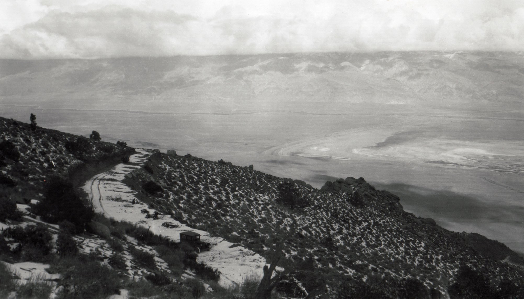 The "Porterville-to-Lone Pine" - aka: Horseshoe Meadows Road (Photo courtes of Tales Along El Camino Sierra) |
![]()
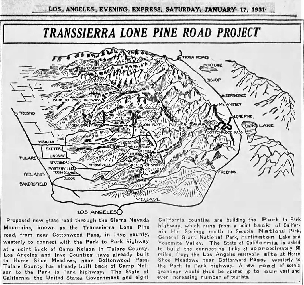
Porterville-to-Lone Pine Road Proposal
(Article courtesy of Hal Eaton Archives)
| Pam Milligan Vaughan writes: My grandfather who was supervisor at the time was a big proponent of this road. Tulare County was supposed to pay 90% of the cost and Inyo 10%. Both sides ran out of funds thank goodness! I was just up there for the first time last year. March 2020. |
![]()
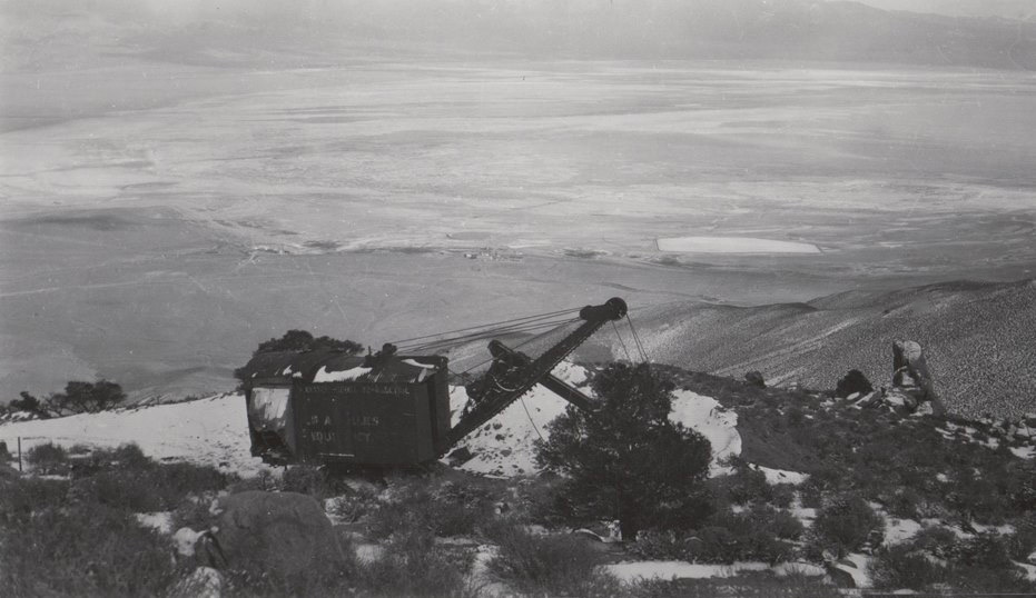
Horseshoe Meadows Road construction
(Fotocard courtesy of Inyo County Sesquicentennial)
![]()
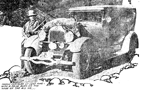 Frank Chrysler of the Mt. Whitney Pack Train with a prize buck on the nose of his Studebaker "Big Six" |
Proposed Route of the New Lone Pine-to-Porterville High Sierra Road
|
*This article was first published in the Sunday Morning, November 7, 1926 Automobile Section of the Los Anglese Times. The "shortly" mentioned above, was 1928! Thanks to Rich McCutchan for loaning me the article. |
California Highways and Publics Works - April 1934
Cover, Page1, Page 2, Page 3, Page 4
Thanks to Rich McCutchan for loaning me the magazine.
Article courtesy of Hal Eaton |
     |
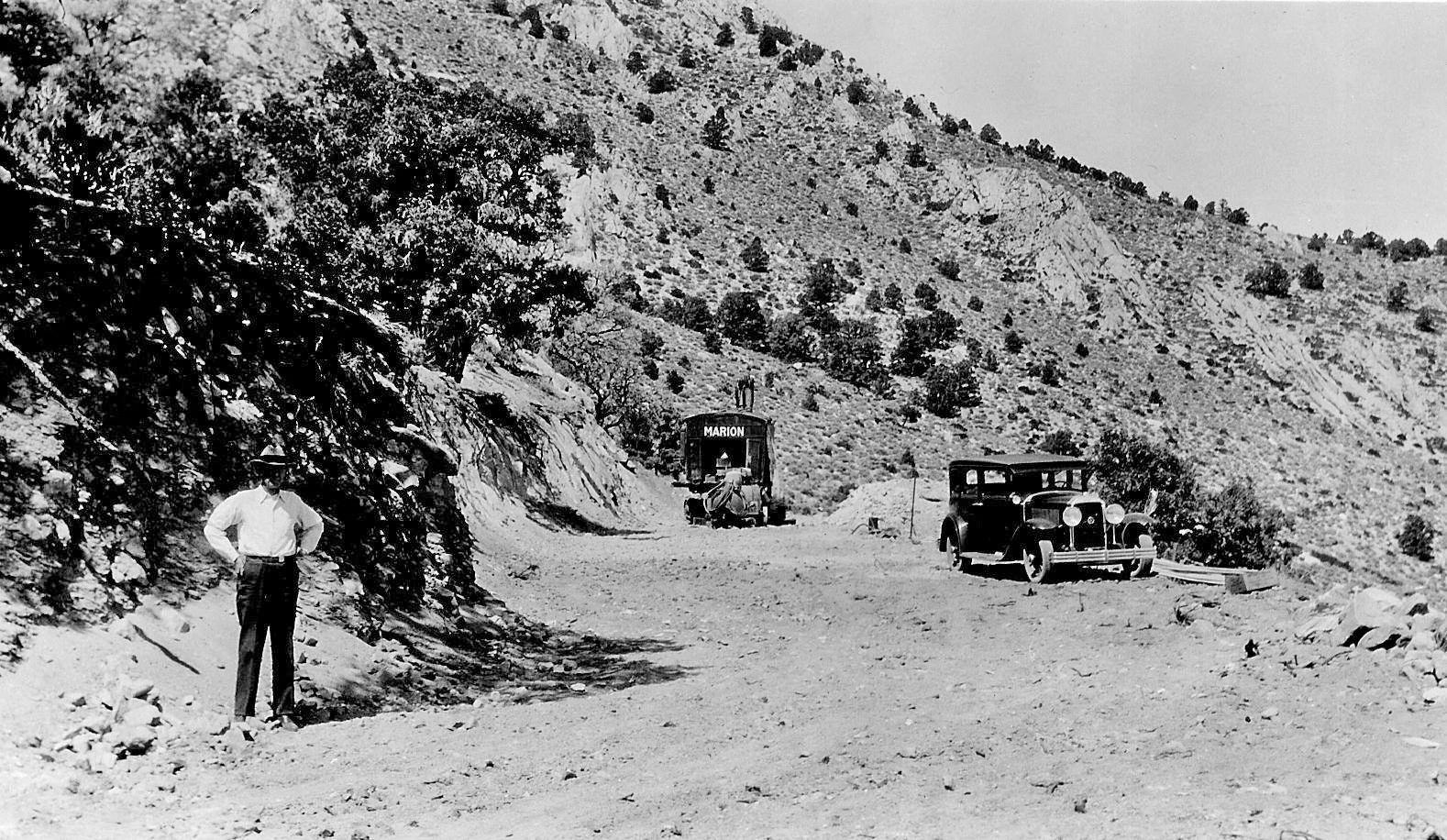 Lone Pine-to-Porterville road under construction - 1930's My grandfather, Charles Partridge, stands to the left. His Buick is to the right. This was to be the Porterville-Lone Pine Road. It was not to be even though Tulare County would have paid 90% of the costs, Inyo- 10%. Both sides ran out of funds. However, it is now the Horseshoe Meadow Road, an excellent mountain road. Photo is from my grandfather's photo album. (Photo courtesy of Pam Milligan Vaughan) |
|
|
Manzanar Town | |
|
|
Norman Clyde | |
|
|
Fr. John J. Crowley | |
|
Slim Randal's "Night Ride" |
||
|
Olancha |
||
|
Sierra Place Names |
Sign Guestbook View Old Guest Book Entries Oct 1999 - Feb 2015 (MS Word) |
 CONTACT the Pigmy Packer |
View Guestbook View Old Guest Book Entries Oct 1999 - Feb 2015 (PDF) |