|
|
Sequoia National Forest & Sierra National Forest maps courtesy of Greg Farris |
See USE NOTICE on Home Page. |
All of the text accompanying the photos on this page was taken from Spanish and Indian Place Names of California - Their Meaning and Their Romance by Nellie Van De Grift Sanchez unless otherwise noted. |
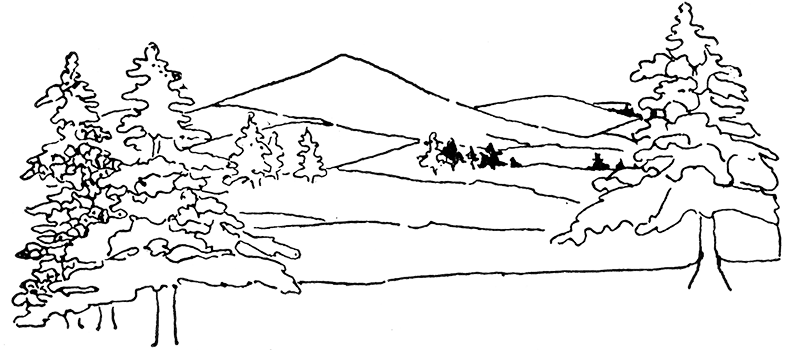
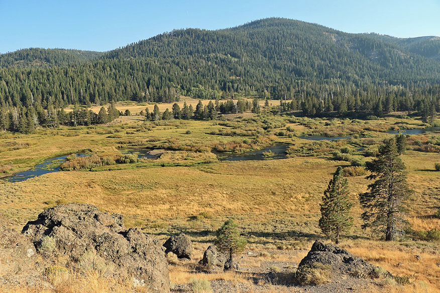
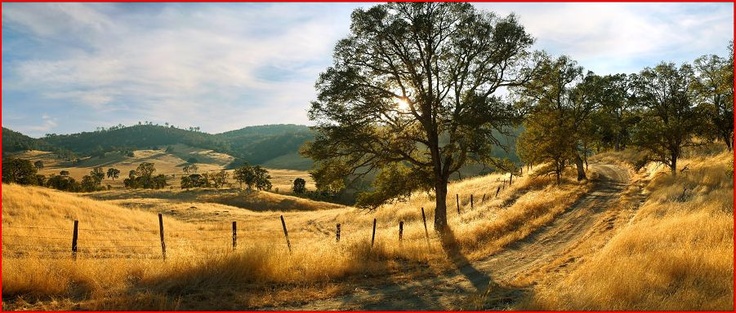
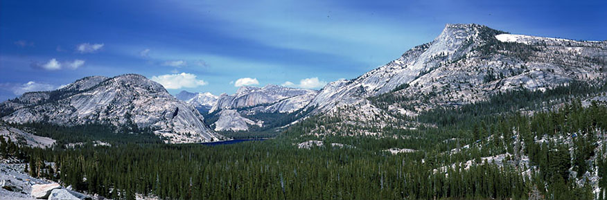
 The Sierra Nevada |
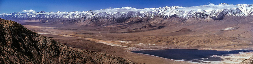 |
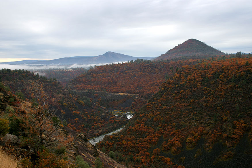
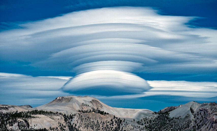
The Sierra Nevada Mountains, California's wonderland, derive their name from sierra, saw, and nevada, snowy, descriptive of the saw-toothed outlines of the summits of the range, and the mantle of perpetual snow that covers the highest tops. The term Sierra Madre, absurdly translated by some persons as "Mother of Christ," means, of course, "Mother Sierra," that is, the largest mountain range personifieq as the mother of the smaller ranges. "The Sierra Nevada is generally considered to extend from Tehachapi Pass in the south to Lassen Peak in the north, and constitutes the dividing ridge between the great basin on the east, to which it falls abruptly, and the San Joaquin and Sacramento Valleys on the west. It is characterized by deep and narrow valleys, with almost vertical walls of rock thousands of feet in height, and its scenery is of surpassing grandeur, much more imposing than that of the Rockies. Many of its higher summits are covered with perpetual snow." - (Lippincott's Gazetteer.) |
 Pit River |
 |
Among the many tributary streams that carry the waters of the Sierra Nevada down the western slope into the Sacramento, the Pit, often incorrectly spelled Pitt, is one of the most important, and, although not properly belonging in these pages, is included for the sake of the information to be gained concerning Indian customs. The natives along this river were in the habit of digging pits near the banks to catch bear and deer, and, on occasion, even their human enemies. The pits were dug in the regular trails of animals, twelve to fourteen feet deep, conical in, shape, with a small opening at the top, covered with brush and earth. Signs, such as broken twigs, were placed as a warning to their own people, and sharp stakes were placed in the bottom to impale any creature that might fall in. Another account of this custom is given in Miller's Life Among the Modocs: "Pits from ten to fifteen feet deep were dug, in which natives caught man and beast. These man-traps, for such was their primary use, were small at the mouth, widening toward the bottom, so that exit was impossible, even were the victim to escape impalement upon sharpened elk and deer horns, which were favorably placed for his reception. The opening was craftily concealed by means of light sticks, over which earth was sea ttered, and the better to deceive the unwary, travelers' footprints were frequently stamped with a moccasin in the loose soil." It was from these Indian pits that the river received its name. |
 Feather River |
 |
Plumas (feathers) is the name of a county in the northeastern part of the state. It is drained by the Feather River, which flows through one of the deepest and most picturesque canyons in California. The county is characterized by its wild and rugged scenery, its deep canyons and extensive forests of evergreen trees. In the northwest corner Lassen Peak, now an active volcano, rises to a height of 10,437 feet. The county derives its name from its principal stream, which now appears under its English form of The Feather, but which was originally named El Rio de las Plumas (the river of the Feathers), by Captain Luis A. Arguello, who led an exploring party up the valley in 1820, and whose attention was attracted by the great number of feathers of wild fowl floating on the surface of the river. Even to this day the valley of the Feather has remained a favorite haunt of the wild ducks and geese, as will be attested by the many hunters who seek sport there during the season. By an inconsistency, the county has retained the original Spanish name, Plumas, while that of the river has been Americanized. An erroneous and extremely far-fetched explanation of the name has often appeared in print to the effect that it was derived from a fancied resemblance between the spray of the river and a feather. |
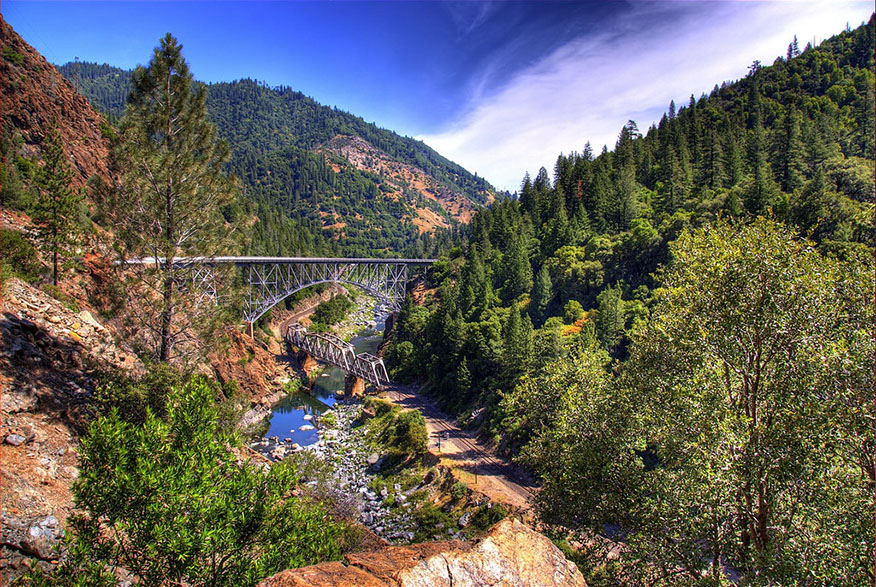
 The American River |
 |
The American River, another of the names which have been translated from the original Spanish, is formed by three forks rising in the Sierra Nevada, and empties into the Sacramento at the site of the city of that name. The three branches forming it run in deep canyons, sometimes two thousand feet in depth, and the seenery along its course is of rugged and striking character. The river was originally called El Rio de los Americanos (the river of the Americans), probably from the presence on its banks of a company of western trappers, who lived there from 1822 to 1830, and not "because it was the usual route of travel by which Americans entered the state," as is stated by Bancroft and others. In Fremont's time it was still known by its Spanish name, by which he refers to it in the following paragraph: "Just then a well-dressed Indian came up, and made his salutations in very well-spoken Spanish. In answer to our inquiries he informed us that we were upon the Rio de los Americanos, and that it joined the Sacramento River about ten miles below. Never did a name sound more sweetly! We felt ourselves among our countrymen, for the name of American, in these distant parts, is applied to the citizens of the United States." |
 El Dorado County |
 |
El Dorado (the gilded man). Although it is known to most people, in a vague, general way, that the name El Dorado was given to this county on account of the discovery of gold there, the romantic tales connected with the name are probably not so well known. The Indians of Peru, Venezuela, and New Granada, perhaps in the hope of inducing their oppressors to move on, were constantly pointing out to the Spaniards, first in one direction, then in another, a land of fabulous riches. This land was said to have a king, who caused his body to be covered every morning with gold dust, by means of an odorous resin. Each evening he washed it off, as it incommoded his sleep. and each morning had the gilding process repeated. From this fable the white men were led to believe that the country must be rich in gold, and long, costly, and fruitless expeditions were undertaken in pursuit of this phantom of El Dorado. In time the phrase El Dorado came to be applied to regions where gold and other precious metals were thought to be plentiful. According to General Vallejo, one Francisco Orellana, a companion of the adventurer Pizarro, wrote a fictitious account of an El Dorado in South America, "a region of genial clime and never-fading verdure, abounding in gold and precious stones, where wine gushed forth from never-ceasing springs, wheat fields grew ready-baked loaves of bread, birds already roasted flew among the trees, and nature was filled with harmony and sweetness." Although old Mother Nature has not yet provided us with "bread ready-baked" or "birds ready-roasted" in California, her gifts to her children have been so bountiful that they may almost be compared to the fabulous tales of El Dorado, the gilded man. |
 Placer County |
 |
Placer, the county in the Sierras famous for its surface gold-mining, has a puzzling name for which no satisfactory explanation has yet been found. Although it has been used in Spanish countries for centuries in the sense of surface mining, dictionaries remain silent upon the subject. The theory often advanced that the word is a contraction of plaza de oro (place of gold) bears none of the marks of probability, and another that it means "a river where gold is found" is not supported by adequate authority. One old Spanish dictionary gives the meaning of placer as "a sea bottom, level and of slight depth, of sand, mud, or stone," and states also that the word is sometimes used to designate places where pearl diving is carried on. It may be that the word was extended from this usage to include placer mining, since in that case the gold is found in shallow pockets near the surface. This theory is offered here as a mere suggestion. Placer County has some of the most striking mountain scenery in the state, and has been the theatre of many remarkable events in its history, particularly those connected with the "days of '49." In the town of Placerville, the county-seat of El Dorado County, there is an instance of a change of name from English to Spanish for the better, for this place was originally called Hangtown in commemoration of the hanging of certain "bad men" on a tree there. |
 The Truckee River |
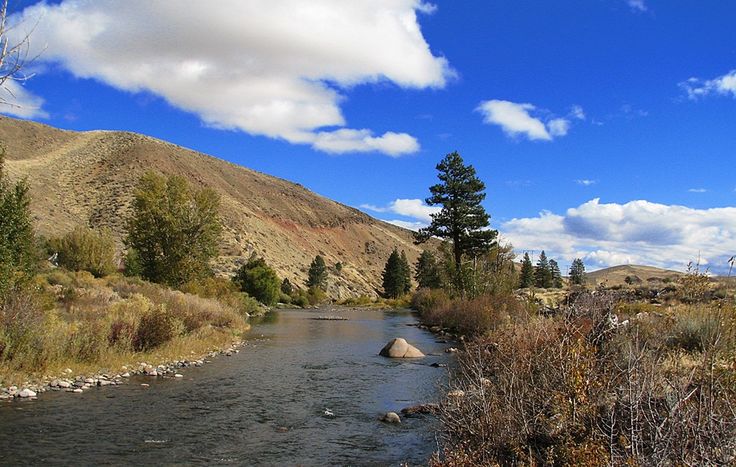 |
The Truckee River rises on the borders of El Dorado and Placer counties, and is the outlet of Lake Tahoe, discharging its waters into Pyramid Lake in Nevada. This mountain stream is justly celebrated for the wild charm of its scenery. There is a village bearing the same name, in Nevada County, well-known to travelers through being on the regular route to Tahoe. At this place winter sports, tobogganing, skiing, skating, etc., are provided for San Franciscans, who need to travel but a few hours to exchange their clime of eternal spring for the deep snows of the Sierras. The explanation generally accepted for the name of Truckee is that it was so called for an Indian, definitely known to be a northern Paiute chief, who guided a party of explorers in 1844 to its lower crossing, where the town of Wadsworth now stands. The party, who were suffering from thirst, felt themselves to be under such obligations to the Indian for having guided them to this lovely mountain stream, with its crystal waters and abundance of fish, that they gave it his name. Of this Indian it is said that "he joined Fremont's battalion, and was afterwards known as Captain Truckee; he became a great favorite with Fremont, who gave him a Bible. When he died he asked to be buried by white men in their style. The miners dug a grave near Como, in the croppings of the old Goliah ledge. Here he was laid to rest, with the Bible by his side." - (History of Nevada County.) |
 Lake Tahoe |
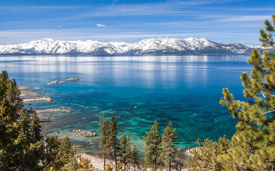 |
Tahoe is another of the Indian names whose meaning can not be ascertained with any degree of certainty. The definition "Big Water," the one usually given, is considered doubtful by ethnologists. The statement has been made by intelligent Indians now living on the banks of the lake that the word, pronounced Da-o by them, means "deep" and "blue." Yet it is much to know that this pearl among all lakes has at least been fortunate enough to receive an indigenous name, escaping by a narrow margin the ignominious fate of being called Lake Bigler, for a former governor of the state. It appears that Fremont was the first to give to this body of water a name, and it is shown upon his map under the rather indefinite title of Mountain Lake. Afterward it was known for a short time as Lake Bigler. The story goes that in 1859 Dr. Henry de Groot, while exploring the mountains, learned that tah-oo-ee meant "a great deal of water," and from this Tahoe was evolved as an appropriate name, but did not become attached to the lake until the period of the Civil War. During that time the Reverend Thomas Starr King, the famous "war" clergyman of San Francisco, visited the lake, and inspired by indignation against the Democratic Governor Bigler, whom he regarded as a secessionist, he definitely christened it Tahoe, for which we may be grateful to his memory, regardless of the motives by which he was actuated. Tahoe is partly in Placer, and partly in El Dorado, at the eastern base of the Sierra Nevada, a portion of its waters also extending into the state of Nevada. It is twenty-two miles long and ten wide, and has an elevation of 6,225 feet above sea level. It is especially remarkable for its great depth, being over 1,500 feet deep. |
 Amador County |
 |
Amador, literally "lover," but in this case a surname. Amador is the long, narrow county lying between Calaveras and El Dorado, and was probably named in honor of the Amador family, either Don Pedro Amador, or his son, Jose Maria. Pedro Amador is said to have been a "soldier of fortune" in the Spanish army, who came to California in 1771. His son, Jose Maria, was also a soldier and a renowned Indian fighter, and was known to be living as late as 1883. |
 Calaveras |
 |
Calaveras (skulls) is the name of a county in the central part of the Sierra Nevada, on the eastern border. This county is famous for its gold and copper mines, and its Giant Sequoias. The river, to which the name of Calaveras was first given, rises in the foothills of the Sierra Nevada and flows southwest, emptying into the San Joaquin about fifteen miles below Stockton. The river received its rather lugubrious name at the hands of Captain Moraga, who led the first expedition up the Sacramento and San Joaquin rivers. In his diary, Moraga says that the river tribes fought against those of the Sierra for possession of the salmon in the stream, and that in one battle as many as three thousand were said to have been killed and left on the field. A great number of skulls, relics of this bloody conflict, were found by Moraga sea ttered along the creek bed, and caused him to give it the name of Las Calaveras. We find in Fremont a corroborating reference to the salmon as a cause of dissension among the Indians of that region: "This fish had a large share in supporting the Indians, who raised nothing, but lived on what nature gave. A 'salmon water,' as they named it, was a valuable possession to a tribe or village, and jealously preserved as an inheritance." Particular interest was aroused in the Indian relics of this county some years ago by the finding of the celebrated "Calaveras skull," purporting to have been taken from the Tertiary deposit, a stratum in which no human remains had ever before been discovered. A close examination into the circumstances, however, caused scientists to look with great doubt upon the assertion that the skull had been taken from the Tertiary deposit. In the Handbook of American Indians, published by the Smithsonian Institute, the following reference appears: "Remains of aborigines are plentiful in this county, embedded in ancient river gravels, from which gold was washed. By some scientists these remains were thought to belong to the Tertiary Age, but their resemblance to the modern Indian makes this doubtful. The Calaveras skull, still preserved in the Peabody Museum of Archaeology and Ethnology, at Cambridge, Massachusetts, was said to have come from the gravels of Bald Mountain, at a depth of 130 feet, but there are good reasons for suspecting that it was derived from one of the limestone caves so numerous in that region." |
 Tuolumne |
 |
Tuolumne is the name of the county in the Sierras just east of Calaveras, and of the river which rises at the base of the Sierra Nevadas, and flows into the San Joaquin, twenty-five miles south of Stockton, a part of its course running through a deep canyon. Here we have another of the river names ending in umne, already discussed under the heading of Cosumne. As stated before, umne probably means "people of," and it is held by some authorities that the meaning of Tuolumne is "peop,le of the stone houses, or caves." Bancroft maintains this theory, holding that the name is a corruption of talmalamne, "a group of stone huts or caves, or collection of wigwams." Objection has been raised to this theory on the ground that the Indians of California were not cave-dwellers, but universally lived in flimsy huts made of sticks and grass. This objection is cleared away in some measure by a very interesting paragraph in the diary of Padre Pedro Munoz, who accompanied the Gabriel Moraga expedition of 1806 into that region. The passage in question relates: "On the morning of this day, the expedition went toward the east along the banks of the river, and having traveled about six leagues, we came upon a village called Tautamne. This village is situated on some steep precipices, inaccessible on account of their rough rocks. The Indians live in their sotanos (cellars or caves); they go up and come down by means of a weak stick, held up by one of themselves while the one who descends slips down. They did not wish to come down from their hiding-places, and for me the ascent was too difficult. This village probably has about two hundred souls, judging by the considerable mass which we repeatedly made out among the rocks and corridors [or ledges] in the manner of balconies, which the precipice made." This meeting with the cave-dwellers occurred at a spot about six leagues from the Guadalupe River, after the expedition had left the Merced. It is not, of course, to be inferred from this circumstance that the California Indians were genuine "cliff "dwellers," but rather that, at least in the mountainous parts of the state, they may have had the habit of taking refuge in natural caves from inclement weather' or attacks of enemies. As to the pronunciation of the word, it is said that the Indians called it Tu-ah-lum-ne, rather than Tuolumne, which is the general usage. |
 Mariposa |
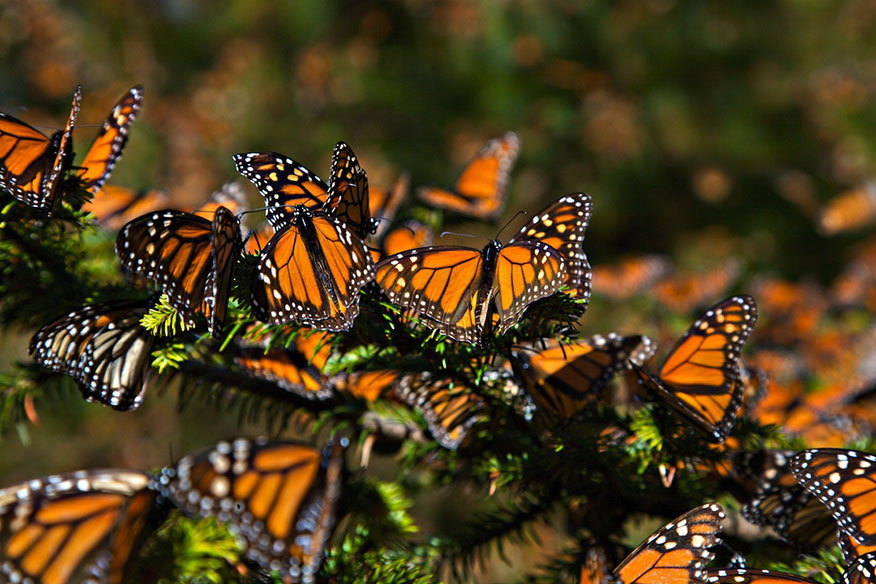 |
Mariposa (butterfly) is famous as the county that holds within its borders two of the wonders of the earth, the Yosemite Valley and the Giant Sequoias. Some of these trees are three hundred feet high, thirty feet in diameter, and 2,400 years old, having unfolded their feathery fronds before Christ came upon the earth. According to Professor Jepsen, "they are the direct descendants of the species dominant in the Tertiary Period," and thus are a living reminder of the plant life of that dim and distant past of which the animal life is pictured for us in the fossil remains of the mammoth and saber-tooth tiger of the La Brea asphalt beds. Nearly every writer who has attempted to account for the name Mariposa has fallen into the error of ascribing it to the charming little flower called the Mariposa lily. Fremont, with his intense appreciation of the beauty of the wild flowers covering the whole country with a carpet of many hues at the time of his passage over the Sierra, says: "On some of the higher ridges were fields of a poppy which, fluttering and tremulous on its long thin stalk, suggests the idea of a butterfly settling on a flower, and gives to this flower its name of Mariposa (butterfly), and the flower extends its name to the stream." It is almost a pity to demolish such a pretty story, yet it is unavoidable, for the true explanation is at hand in the diary of Padre Munoz, who accompanied the Gabriel Moraga expedition of 1806 into the Sierra. He says: "This spot [not far from the Merced River] was called Las Mariposas (the butterflies) on account of their great multitude, especially at night and in the morning, so much so that they became excessively annoying, carrying their desire to hide from the rays of the sun so far that they followed us everywhere, and one even entered into the ear of one of the leaders of the expedition, causing him a great deal of annoyance, and not a little trouble in getting it out." This story is corroborated by the fact that at the present day equally great numbers of butterflies, equally annoying, swarm through the mountain forests during a certain part of the autumn. |
 Yosemite |
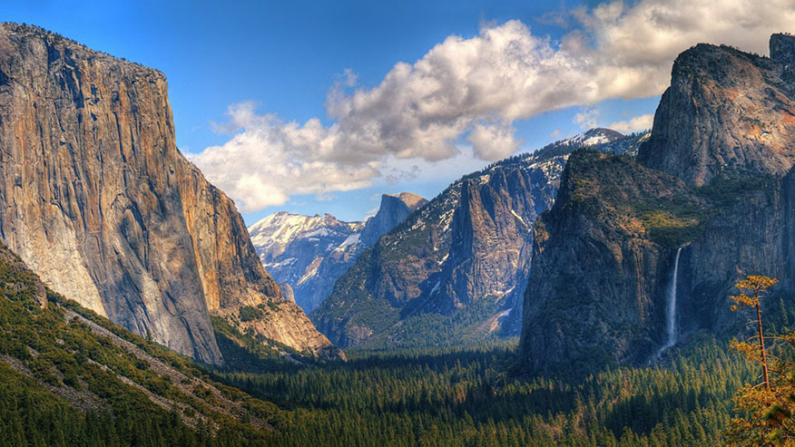 |
Yosemite (grizzly bear, not large grizzly bear, according to the scientists), said to have been called Yohamite by the natives, is one of the few Indian names whose meaning has been ascertained with a reasonable degree of certainty. It must be remembered that Yosemite, like most Indian words, has been greatly corrupted from its original form, which was u-zu-mai-ti, o-so-mai-ti or uh-zu-mai-ti, according to the tribe using it, and the valley was never known by this name to the Indians, but always as A-wa-ni, from the name of their principal village. Considering the great alteration of the name from its native form, it does not seem to be a matter of vital importance whether it shall now be used as one word, Yosemite, or in two words, Yo Semite, although the latter form was at one time the more general usage, and is greatly. preferred by some persons. The valley was discovered in 1851 by Major James D. Savage of the United States army, while chasing the Indians, who had a bad habit of sallying forth from their hiding place in the valley to commit depredations. The name was chosen by Dr. L. H. Bunnell, surgeon of the expedition, who tells the story in his Discovery of the Yosemite. He gave it the name of an Indian tribe living there and to whom this name had been given by other tribes, they calling themselves Ah-wah-nee. Their chief, Ten-ei-ya, said that when he was a young man the name Yosemite, or Yohamite, had been chosen because the tribe lived in the mountains and valleys which were the favorite resorts of the bears, and because his people were expert in killing them. He also said, perhaps in a spirit of boasting, that the name was bestowed upon his tribe to express the idea that they were held in as much fear as the bears. This band of Indians was said to have been originally composed of outlaws or refugees from other tribes, and may have well deserved their evil reputation. Indian names, few of which can be scientifically defined, have been given to many peaks and waterfalls in the valley. In the folder printed by the Southern Pacific Railroad Company more or less fanciful definitions are given for these names, for which there is no foundation in fact except in the case of Yosemite itself and Hunto, which really does mean "eye," though not "watching eye." Tenaya Peak was probably named for the Yosemite chief, Ten-ei-ya. The definition of Pi-wa-ack as "cataract of diamonds" is absurd on its face, for a moment's thought will remind any one that diamonds were wholly unknown to the Indians of that time and place. "Ma-ta (the canyon), a generic word, in explaining which the Indians held up both hands to denote pependicular walls." - (Powers' Tribes of California) "Tis-se-yak is the name of an Indian woman who figured in a legend. The Indian woman cuts her hair straight across the forehead and allows the sides to drop along her cheeks, presenting a square face, which the Indians account the acme of female beauty, and they think they discover this square face in the vast front of South Dome." - (Powers' Tribes of California.) Cho-ko-nip-o-deh, translated as "baby basket" in the Southern Pacific folder, means literally "dog-place" or "dog-house." - (Powers' Tribes of California." |
 Mono |
 |
Mono is the name of a county on the eastern border of the state, and of the lake near the eastern base of the Sierra Nevada. This lake is fourteen miles long and nine miles wide, and is peculiar in having no outlet, its waters being strongly saline and alkaline. It lies 6,730 feet above sea level and is almost completely destitute of animal life. This name, corrupted from Monache, the name of the Indians of this region, through its resemblance to the Spanish word mono (monkey), has been the cause of considerable confusion, and of a number of extravagant theories, such as the supposed existence of monkeys in that country, or the resemblance of the natives to those aninmals, but the similarity between the two words is regarded by ethnologists as purely accidental. The meaning is obscure, but it is said that the name was applied to some Shoshonean tribes of southeastern California by their neighbors on the west. |
 Inyo |
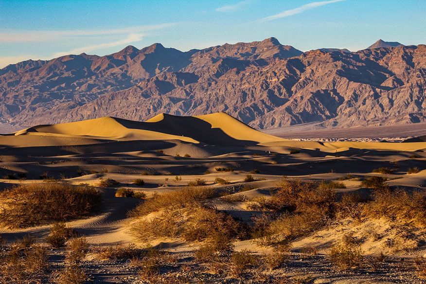 |
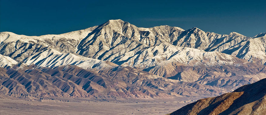
Inyo, a word of unknown meaning, was the name of a tribe of Indians in the Sierra. Inyo County is on the eastern border of the state, adjacent to Nevada. Its largest stream is the Owens River, which flows into Owens Lake, another body of saline water having no outlet. This county has the unenviable distinction of containing within its borders the terrible "Death Valley," where the bones of so many unfortunates have been left to whiten under the desert sun, and which still claims a victim now and then. This desolate valley is forty miles long, lying far below the level of the sea, is destitute of all vegetation, totally without water, subject to terrific heat, and in all respects well deserves its funereal name. Inyo is unique in containing the highest and lowest points in the United States, Mount Whitney and Death Valley, within sight of each other. In other parts of the county the mountain scenery is of remarkable grandeur, and the gold mines in which it is unusually rich are still worked with profit. |
 Amargosa River |
 |
Amargosa (bitter) is the very appropriate name of a river of Nevada and southeastern California which flows into Death Valley, sometimes known also as the Amargosa Desert. The mountains lying northeast of the river's upper course are sometimes called the Amargosa Mountains. Fremont gives a characteristic picture of this dreary country in the following paragraph: "We traveled through a barren district, where a heavy gale was blowing about the loose sand, and, after a ride of eight miles, reached a large creek of salt and bitter water, running in a westerly direction, to meet the stream bed we had left. It is called by the Spaniards Amargosa, the bitter water of the desert." |
 Cerro Gordo |
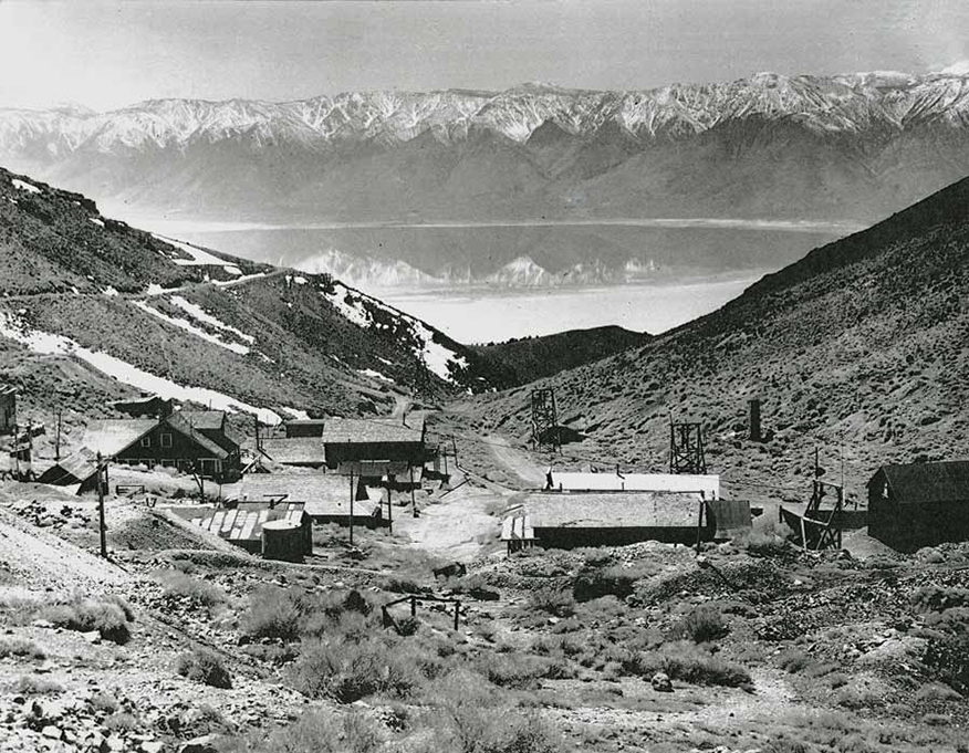 |
Cerro Gordo (large, thick hill) is the name of the famous mining camp in Inyo County. |
 Hetch Hetchy |
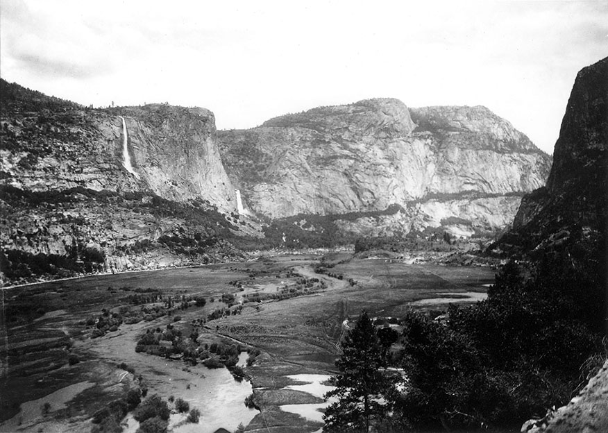 |
Hetch Hetchy is the Indian name of a deep valley in the Sierra, lying north of the Yosemite, which will some day cease to be a valley and become a lake, as the people of San Francisco have succeeded in obtaining the permission of the United States Government to turn it into a reservoir for the city's water supply. An explaination of the meaning of the word Hetch Hetchy has been obtained through the Ifindness of John Muir, who says: "I have been informed by mountaineers who know something of the Indian language that Hetch Hetchy is the name of a species of grass that the Tuolumne Indians used for food, and which grows on the meadow at the lower end of the valley. The grain, when ripe, was gathered and beaten out and pounded into meal in mortars." The word was originally spelled Hatchatchie. |
 Moquelumne |
 |
Moquelumne is the name of a river which rises in the high Sierra in Alpine County, flows southwesterly and empties into the San Joaquin. The word is a corruption of the Miwok Wakalumitoh, the Indian name of the river. The Moquelumne family was made up of an aggregation 'of tribes which occupied three sections, one lying between the Cosumnes and Fresno rivers, another in Marin, Sonoma, and Napa counties, and a third occupying a small area in the south end of Lake County. - (A. L. Kroeber, in American Anthrop. VIII, No. 4, 1906.) The Miwoks constituted the great body of this family, the different branches of which were connected by a similarity of languages. The Miwoks are described as being quite low in the scale of civilization, and "it has been asserted that this tribe of Indians ate every variety of living creature indigenous to their territory except the skunk. The skins of jack-rabbits were rudely woven into robes, and they bought bows and arrows from the mountain Indians for shell money. Cremation of the dead was usual, and all possessions of the departed were burned with them. Their names were never afterward mentioned and those wo bore the same names changed them for others. Widows covered their faces with pitch, and the younger women singed their hair short as a sign of widowhood." (Handbook of American Indians.) Muk-kel was the name of the principal village of this tribe, and if umne does in fact mean "people of," Moquelumne may be "people of the village of Muk-kel." |
 Panamint Range |
 |
Panamint Range of mountains was named for the Panamint tribe, who belonged to the Shoshonean family, and lived around the Panamint Valley, in Inyo County, southeastern California. Many unfortunate seekers after gold have lost their lives in this desolate mountain range. |
 Sonora |
 |
Sonora, named for the province of Sonora in Mexico, is the capital of Tuolumne County, and is situated ninety miles southeast of Sacramento. It received its name from the large number of Sonorans from the Mexican province who mined there in the very early days. This is a mining period name and has no real connection with Spanish names. |
 Tenaya Peak |
 |
Tenaya Peak in Yosemite Valley is named for Ten-ei-ya, chief of the Yosemite Indians. |
  Camino Real |
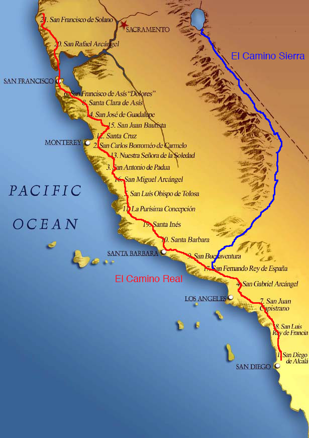 |
Camino Real (royal road, or the King's highway). The Camino Real was the road connecting the missions, and was the chief means of intercourse between the different settlements during the early years of the state's history. After American occupation the road fell into disuse, but at present is being reconstructed along the old route, with many extensions and branches, and will, when finished, be one of the finest in the United States. El Camino Sierra (the saw road) is that portion of U.S. 395 that runs along the eastern face of the Sierra Nevada. |
RECOMMENDED READING |
|
Trans-Sierra Highway | |
|
Slim Randles "Night Ride" | |
|
Olancha | |
|
More
Sierra Place Names |
|
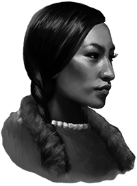
George Brown, Native American |
|
|
To the Top of Mt. Whitney by Rena Moore |
|
Sign Guestbook View Old Guest Book Entries Oct 1999 - Feb 2015 (MS Word) |
 CONTACT the Pigmy Packer |
View Guestbook View Old Guest Book Entries Oct 1999 - Feb 2015 (PDF) |