|
|
See USE NOTICE on Home Page. |
Fotocards courtesy of the Rich McCutchan Archives unless otherwise indicated |
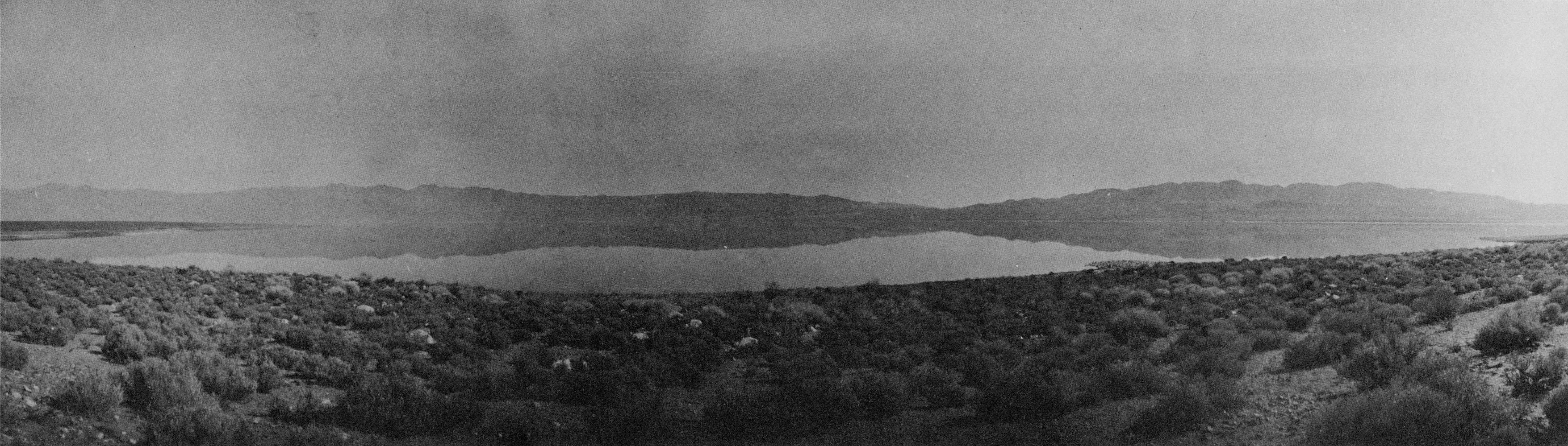
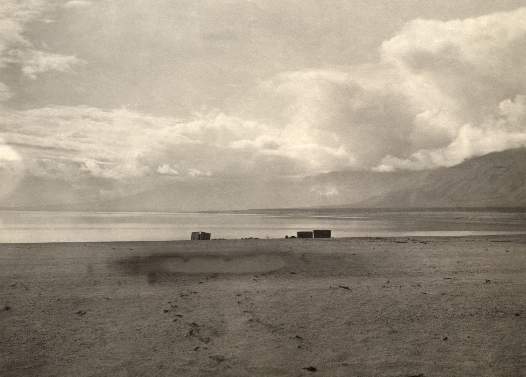
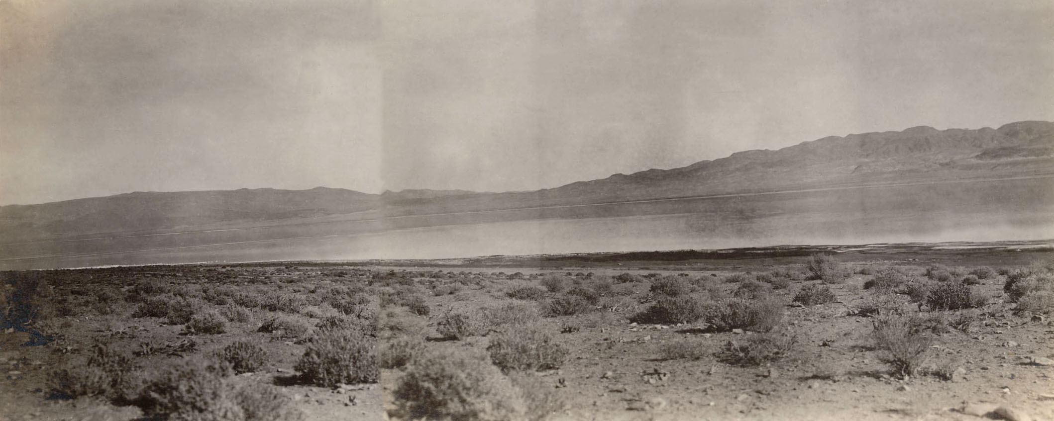
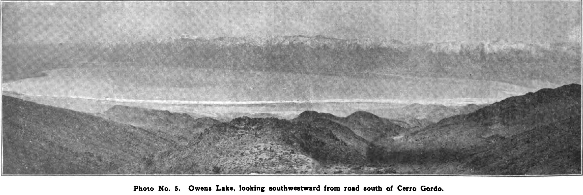
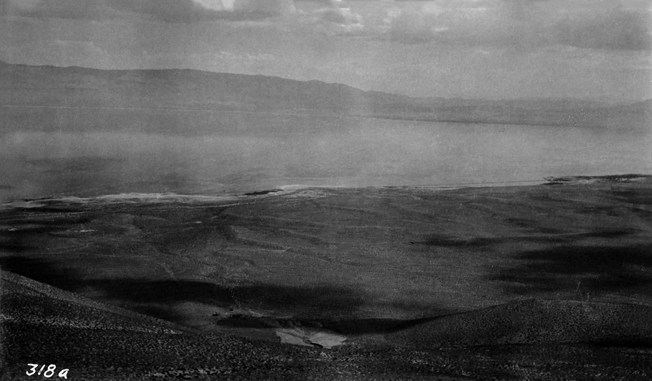
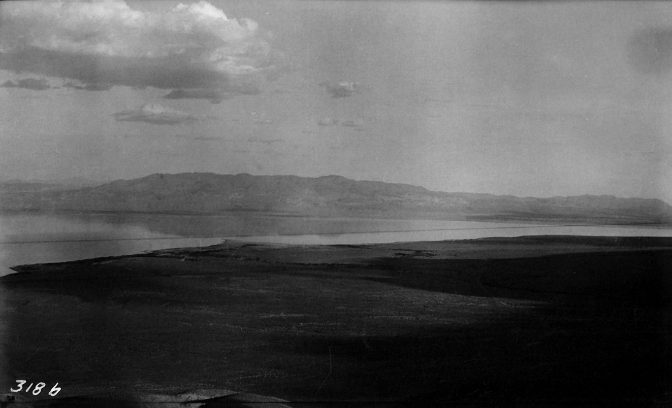
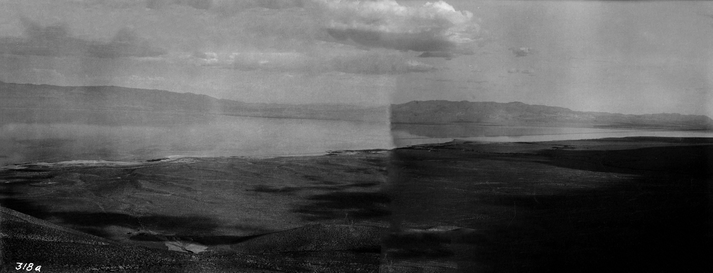
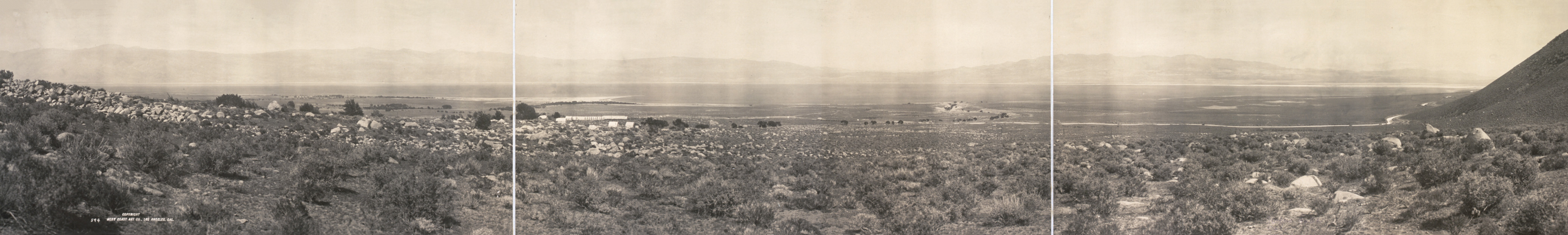 Sectional panorama of Owens Lake taken during the construction of the Los Angeles Aqueduct - Circa 1910 (West Coast Art photograph courtesy of the Library of Congress American Memory Project) |
A Glimpse of Owens Valley
From the Los Angeles Herald, Saturday Morning, November 11, 1893
The Great He-Cloudburst of 1922 at Sand Canyon near Brown & Pearsonville
Los Angeles Times Article
Page 1, Page 2
Where the Bottom Fell Out of the Sky - in 1922
By John Edwin Hogg - From Popular Science Monthly
Page 1, Page 2
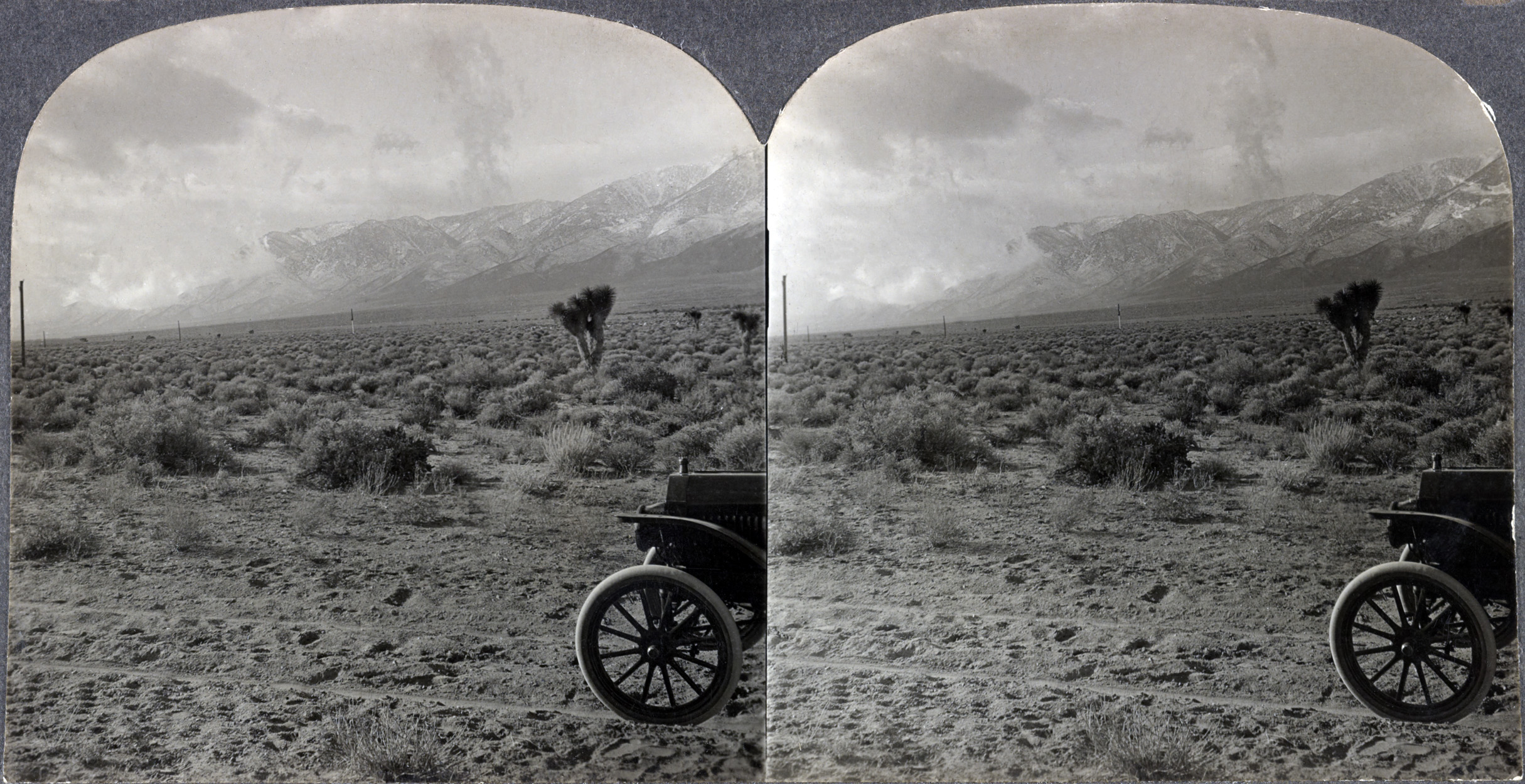 Stereogram from the Keystone View Company - Circa 1920 - Storm Approaching Owens Valley (Photo courtesy of the Library of Congress) |
Owens Lake Photos & Text Courtesy of Kurt Lawson |
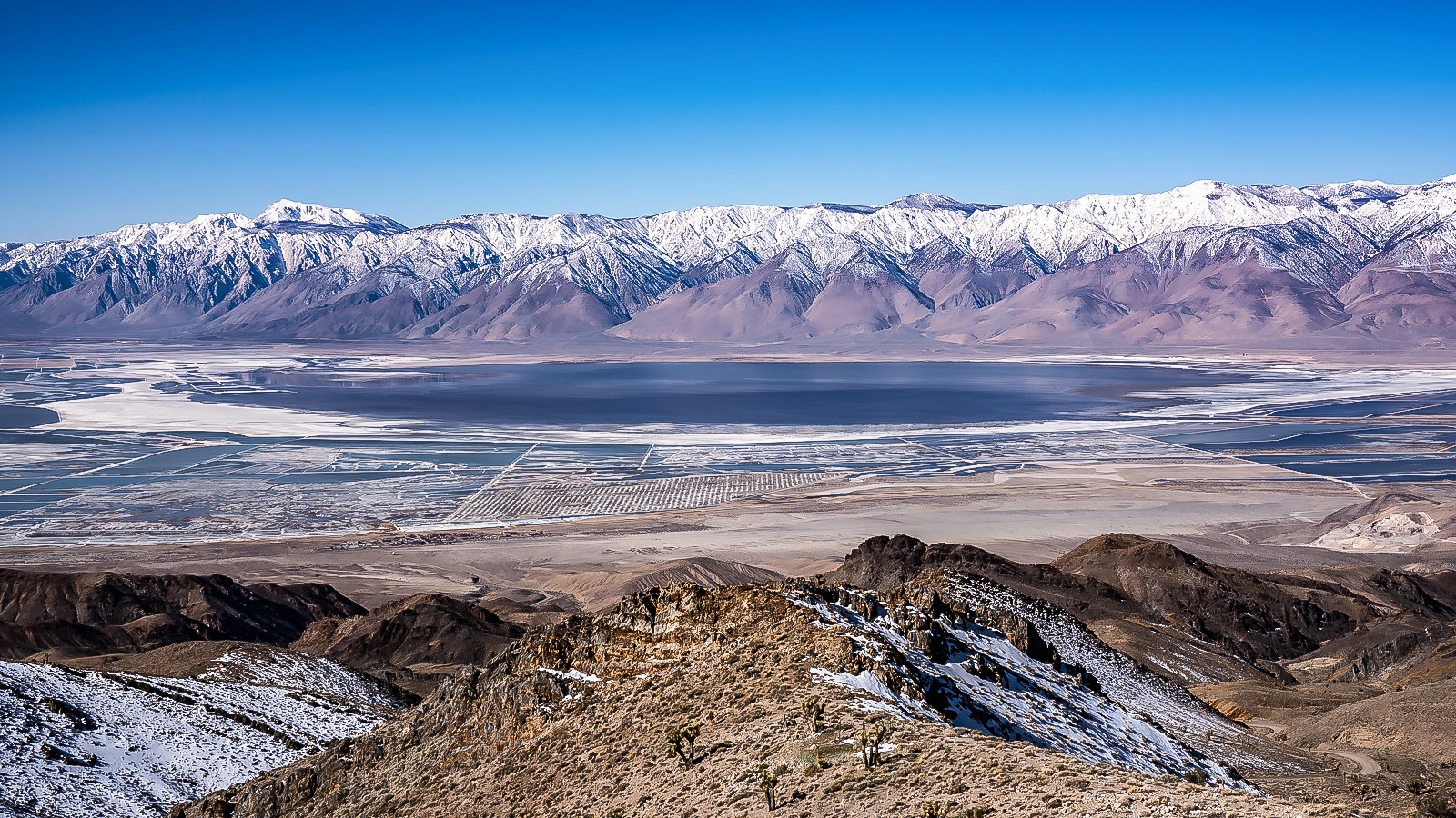
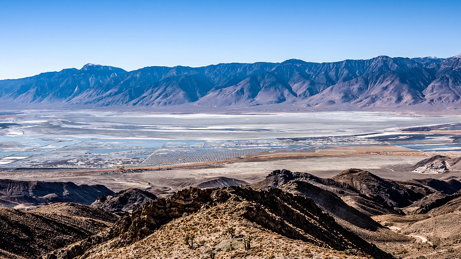
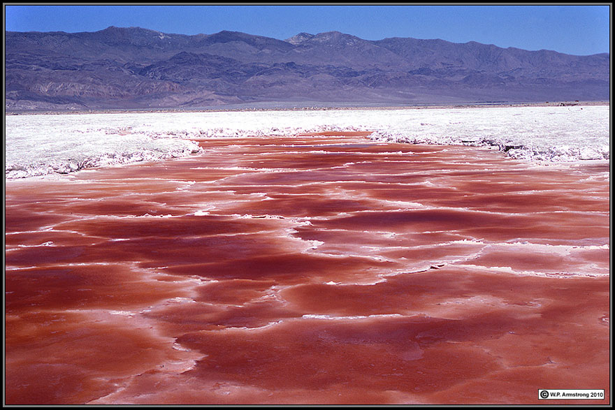
| In all my visits to this valley, never have I seen this lake look more like an actual lake. When driving by I’ve always tried to imagine an enormous lake here, some eighty or more feet deep, even with steam ships hauling ore from one side to the other some 120 years ago before the long straw from Los Angeles sucked the lake literally dry. Decades and billions in lawsuits forced an immense system to be built to keep the dust on the ground after this one lake bed created the worst air quality in the nation. So the lake such as it has been, is an odd patchwork of ponds controlled by berms and plumbing, providing some habitat too thankfully for the wildlife and especially migrating birds that frequented here before people ruined the lake. The great winter of 2022-2023 has brought something I never thought I would see. The lake looks more like a lake than I have ever seen it. A broad circular looking swath of the lake bed, normally appearing devoid of water, has been reborn into an actual lake. Instead of a salt flat surrounded by weird rectangular patches of water, now it looks like a lake surrounded by strange irrigation channels. The transformation is remarkable. I don’t know how long it will last, but for now what a treat it is to see. From the western shore it truly looks like the lake has come back, though to stand there is to be assaulted by millions of gnats which had this photographer literally running away. |
 Owens Lake - March 2023 |
 Owens Lake - November 2021 |
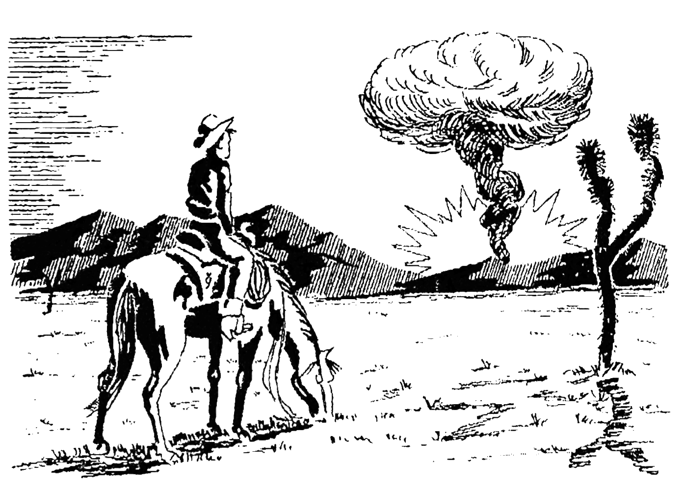
Atomic Tests in Nevada
United States Atomic Energy Commision - 1957
The Pamphlet handed out to every resident of Owens Valley in 1957
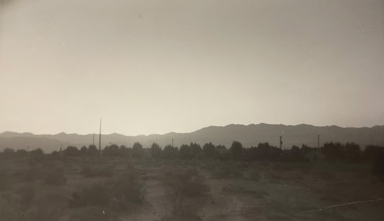 This photo was taken approximately one hour and fifteen minutes before sunrise in Searles Valley, near Trona, during Operation Ranger (1951). Noted on back of the photo: "sky totally dark again 1 sec later.". (Photo and text courtesy of Bryan Cocoran) |
John K. Lutzow writes: |
| Deb Drew-Goodman writes: My grandmother told me she remembers seeing the cloud rise above the Coso range south of Lone Pine December 2025 |
| Mary Anne Mairs writes: I remember the flash of lights and a huge cloud. My aunt said she remembered hearing the boom. December 2025 |
| Dave Fields writes: My dad had a job there filling in holes with heavy equipment. He died in 1966 at the age of 42. I remember he had a jar of dirt from one of the holes , it never settled it looked like a dust storm in a jar. December 2025 |
| Donelle Samorano writes: We watched from the high school classrooms. Or stood outside and watched the cloud. December 2025 |
| Tom Chapman writes: On that day I was fishing at Little Lake with my dad and we saw the sky light up. December 2025 |
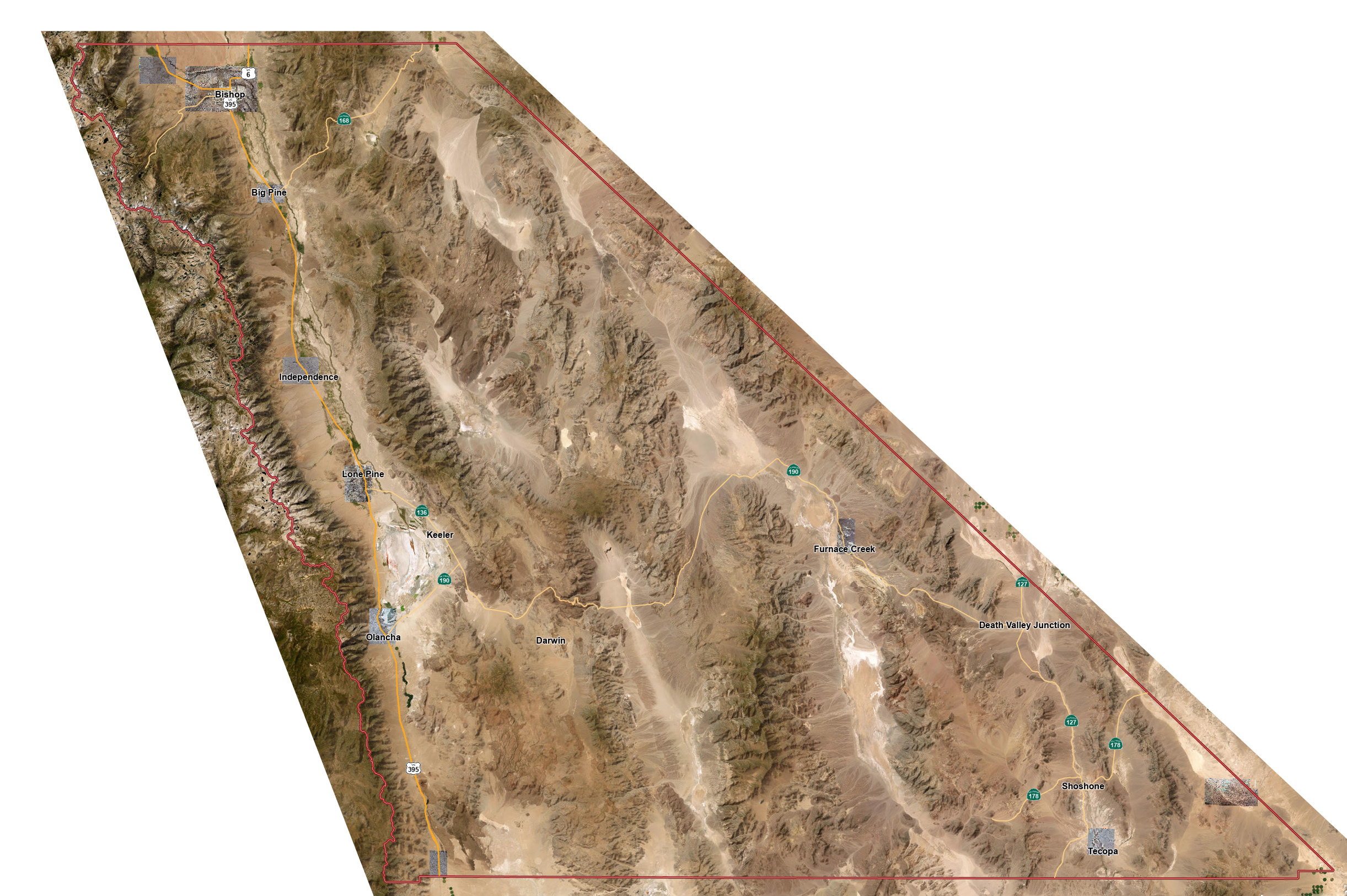
Inyo County GIS Data Map
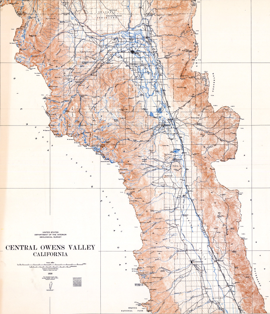 Central Owen Valley - 1950 (Map courtesy of David Soller of the USGS) |
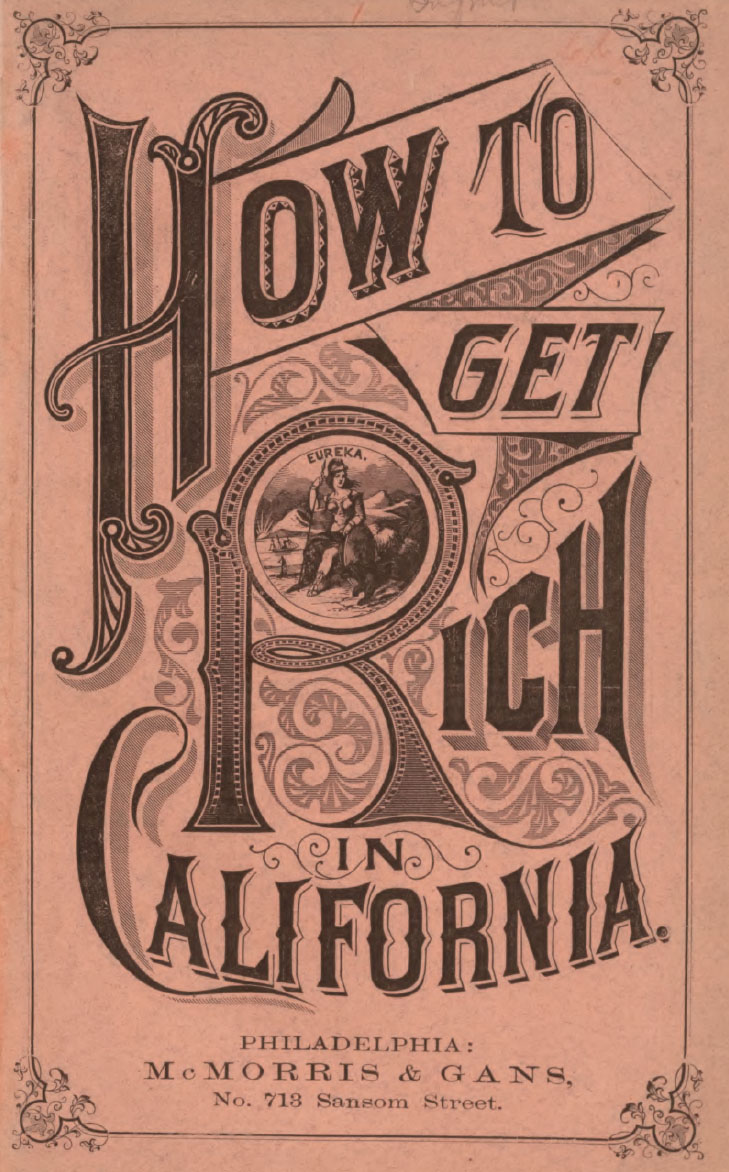
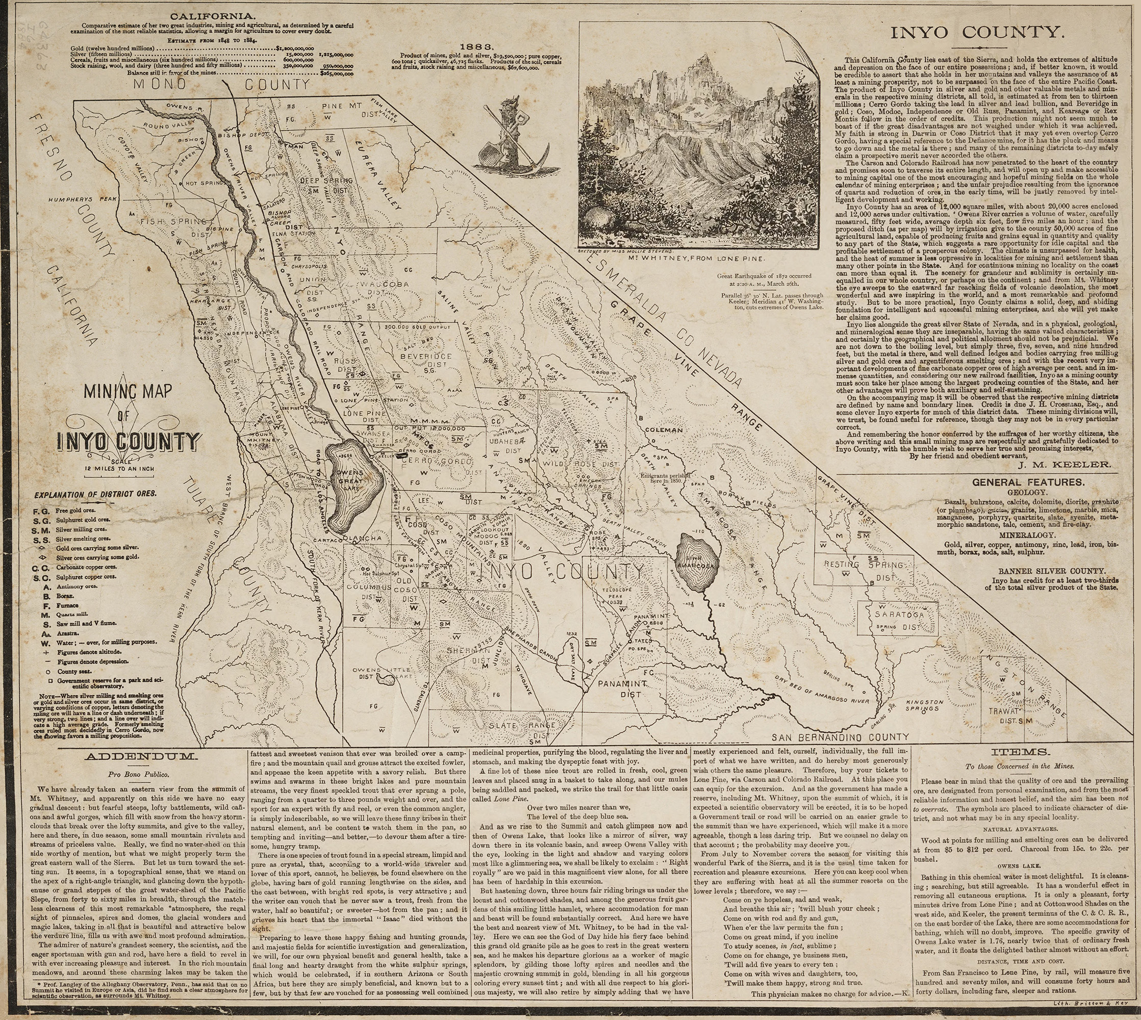
How to Get Rich in California By McMorris & Gans - 1876 |
|
 |
 |
![]()
![]()
Miner's Guide from the Los Angeles Sunday Times - 1905
A Map of the California and Nevada Deserts
(Courtesy "Southern Nevada History in Maps)
![]()
![]()
Mojave & Colorado Deserts & Death Valley Map - 1930
(Courtesy "Southern Nevada History in Maps)
![]()
![]()
Map of the Desert Area in Southern Nevada and Southeastern California - 1955
(Courtesy "Southern Nevada History in Maps)
![]()
![]()
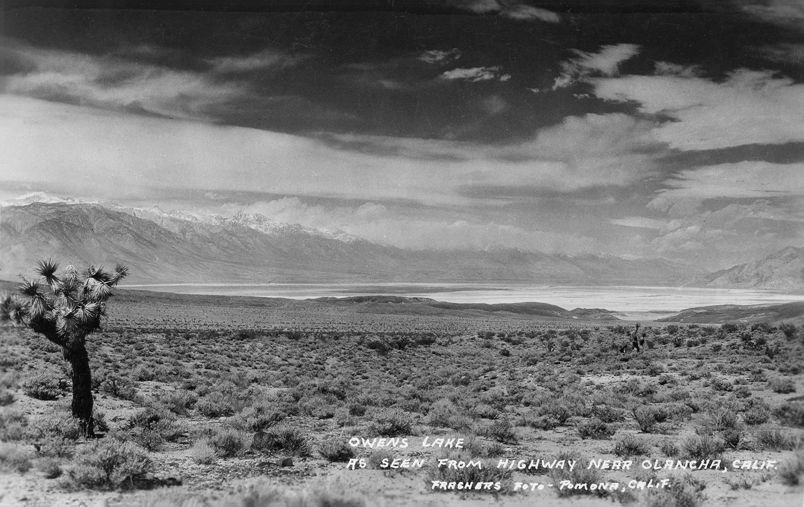
 OWENS LAKE The Los Angeles Examiner - May, 1874 |
From the Visalia Times: - Little is apparently known of this lake. It is ninety miles in length and fourteen miles wide, and its greatest depth of thirty feet. The bottom is apparently smooth and level. It is supplied by Owens River and numerous springs, and has no visible outlet. It is highly charged with alkali, borax and other elements, and is so strong that it will cut cloth, leather, destroy soap or grease. On the west side are the highest mountains in the United States: Mount Whitney being but a short distance off. Owens River flows from the north through a narrow valley, between two ranges, and enters the north end of the lake. Rugged, broken mountains rise upon the east. From the south extends a narrow, dry valley. The surrounding scenery is picturesque and grand. |
 |
Owens Valley Rock Art
by Jay C. von Werlhof
Paiutes and Shoshones in Owens Valley, California
by Lawrence F. Van Horn
Some Early History of Owens River Valley
by J. M Guinn
The Story of Owens River
Page 1, 2, 3, 4, 5, 6, 7, 8
by Allen Kelly
 Map of Owens Valley - circa 1910? Map courtesy of the Claremont Colleges Library, Special Collections |

The Owens Lake Monster
From the annals of the Los Angeles Daily Herald - July 21, 1868
From the annals of the ...

Saturday - August 24, 1889 LOCAL INTELLIGENCE An old Indian tradition has it that Owens Lake is inhabited by a monster sea serpent over thirty feet in length, and there have been white men and Mexicans who claimed to have seen it. |
Saturday - November 29, 1884 It has been found that there is an excellent shampoo to be obtained in using Owens Lake water. Under the title of "Castilian" it is being put up in barrels and shipped. Last week a carload of fifty empty barrels arrived at Keeler from San Francisco, to be filled with water from the lake and returned to that city. A firm has started a business for the sale of the water, and will extend its correspondence and shipments to the East. |
Vintage Newspaper Articles Courtesy of Hal Eaton |
|

Official Paper of Ormsby County Wednesday, January 23, 1888 Deluging a Desert H. M. Yerrington, President of the Carson & Colorado Railroad, and his associates, D. O. Mills, Nicholas Luning and other capitalists, have just concluded an arrangement with Professor Thomas M. Chatard of the United States Geological Survey, to take charge of their soda works at Owens Lake, Mono County. Mr. Chatard was sent last summer by the government to examine soda deposits throughout the West, as he was considered a leading authority on this and similar questions. He has been induced by this syndicateto resign his position under the government, and will leave for the West on the 1st of March. The scheme of the capitalists is one of the most stupendous ever undertaken in the West They propose diverting the waters of Owens River, allowing the lake to dry out, and carrying the waters beyond the lake into Death Valley, thus making a garden of the most desolate wilderness of the West, and opening thousands of acres for settlement. They then propose to extend the Carson & Colorado Narrow Guage Railroad to a connection with the Atlantic and Pacific, in this manner making a very profitable railroad out of the C. & C. |
Evening Chronicle VIRGINIA CITY NEVADA Wednesday, January 23, 1888 Deluging Death Valley The Project Impracticable Unless Water Will Run Up-Hill H. M. Yerrington arrived from Carson this morning. To a CHRONICLE representative he stated empathically that the press dispatch from New York announcing that D. O. Mill, Nicholas Luning and himself "propose diverting the waters of Owens river, allowing the lake to dry out, and carrying the waters beyond the lake into Death Valley, thus making a garden of the most desolate wilderness of the West, and opening up thousands of acres for settlement" was never entertained or even suggested by him or the above name capitalists. He says the project is utterly impracticable, unless water can be made to flow up hill, as any one familiar with the topography of Inyo county is aware tha the Inyo mountains, a lofty range through which there are no passes that are not several hundred feet higher than Owens river, intervenes between that body of water and Death Valley desert. Mr. Yerington remarked that it would be practicable to irrigate the Mojave desert with water from Owens river by excavating a canal, which would cost not less than $150,000, but after the canal was cut there would be no water as the flow of Owens rivers is diverted for irrigating the land along its course by ranch owners. |
Vintage Newspaper Articles Courtesy of Hal Eaton |
Fortunes in Apples in Owens Valley, Inyo County - California
by Owens Valley Improvement Company

BIG LAUNDRY SCHEME
Owens's Lake as a Place to Wash the World's Dirty Clothes. Carson Appeal. While H.M. Yerington was in San Francisco a few days ago some parties called on him to ascertain how much he would charge a car-load to take dirty linen from San Francisco to Owen's Lake. They said their idea was to do all the washing for San Francisco at Owen's Lake, as they had heard that the borax and saltpeter in the water would make an old dirty shirt as white as the driven snow in Winter. They had founded a stock company with $100,000 capital, called the San Francisco and Owen's Lake Natural Laundry Company (limited). Mr. Yerington told them that there was no doubt about the cleaning qualities of the water. "Why," said he, "once when out looking for a new railway route I was obliged to wear a pair of socks three weeks, and when set up in the sand they would stand alone. I cast them into the lake and in five minutes they were as white as a shirt bosom." "You bet, Bill, this is the boss scheme," said one of the trustees of the new company. "But," continued the narrator, "when I went to pull the socks on they came all to pieces, because there is some mineral substance in the water that acts like blue vitriol. Once I left a shirt in there over night, and the tail and the buttons were all eaten off. If you could chemically eliminated the stuff that ate the buttons off the shirt you'd have a big thing, and if you ever do, put me down for a thousand shares." Before he had finished the turstees of the new company had left the room and were fighting for the first call on the elevator. |
Vintage Newspaper Article Courtesy of Hal Eaton |
Inyo County California - Sunset Magazine: June 1912 by G. Yoell Parkhurst (NOTE: If the pdf photos don't disply properly CLICK HERE) |
|
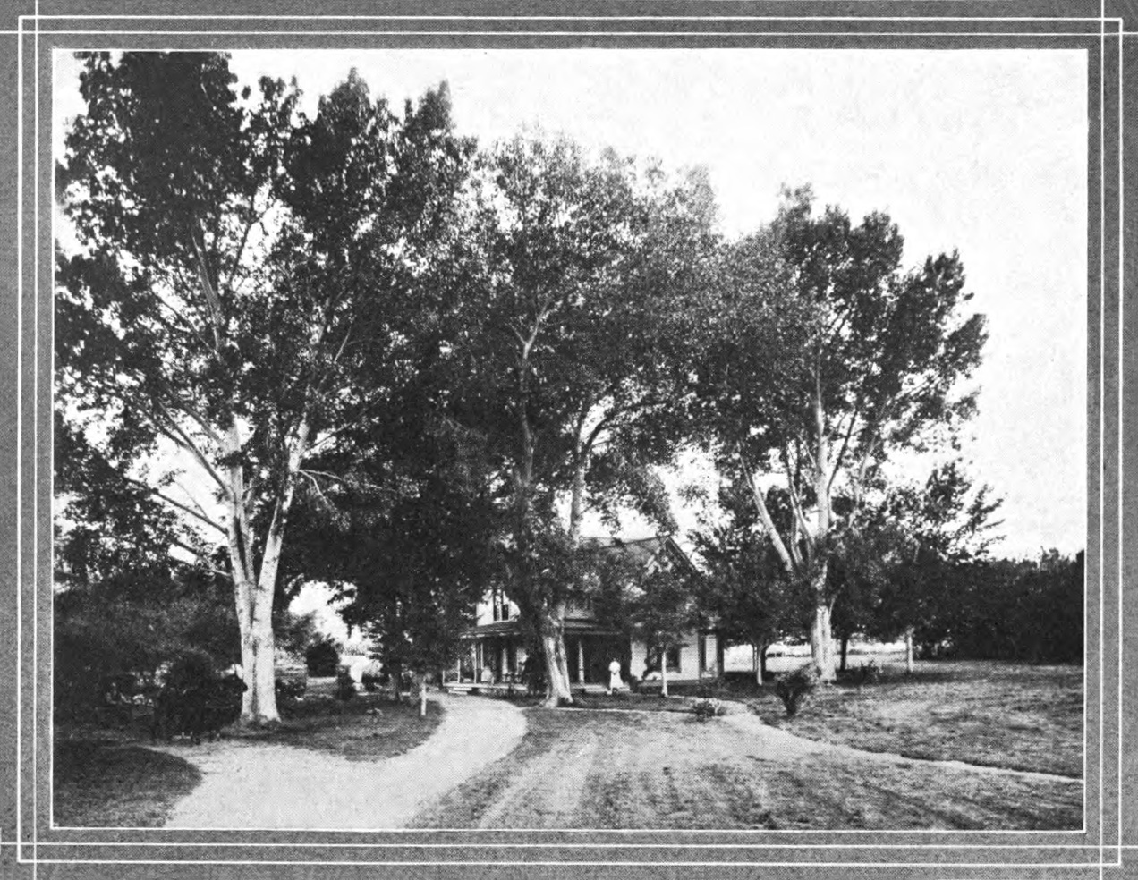 Bishop, CA home |
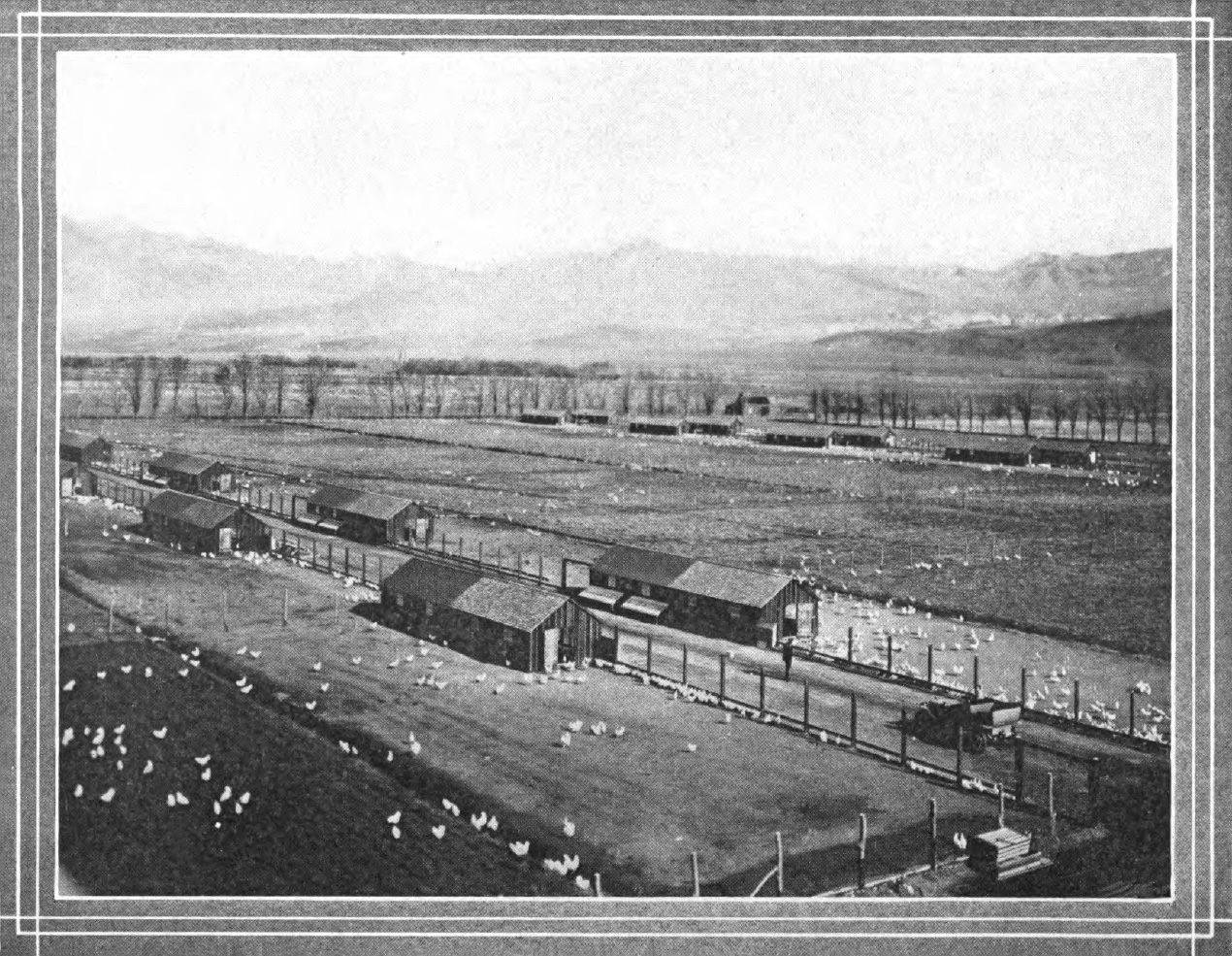 Big Pine, CA chicken ranch |
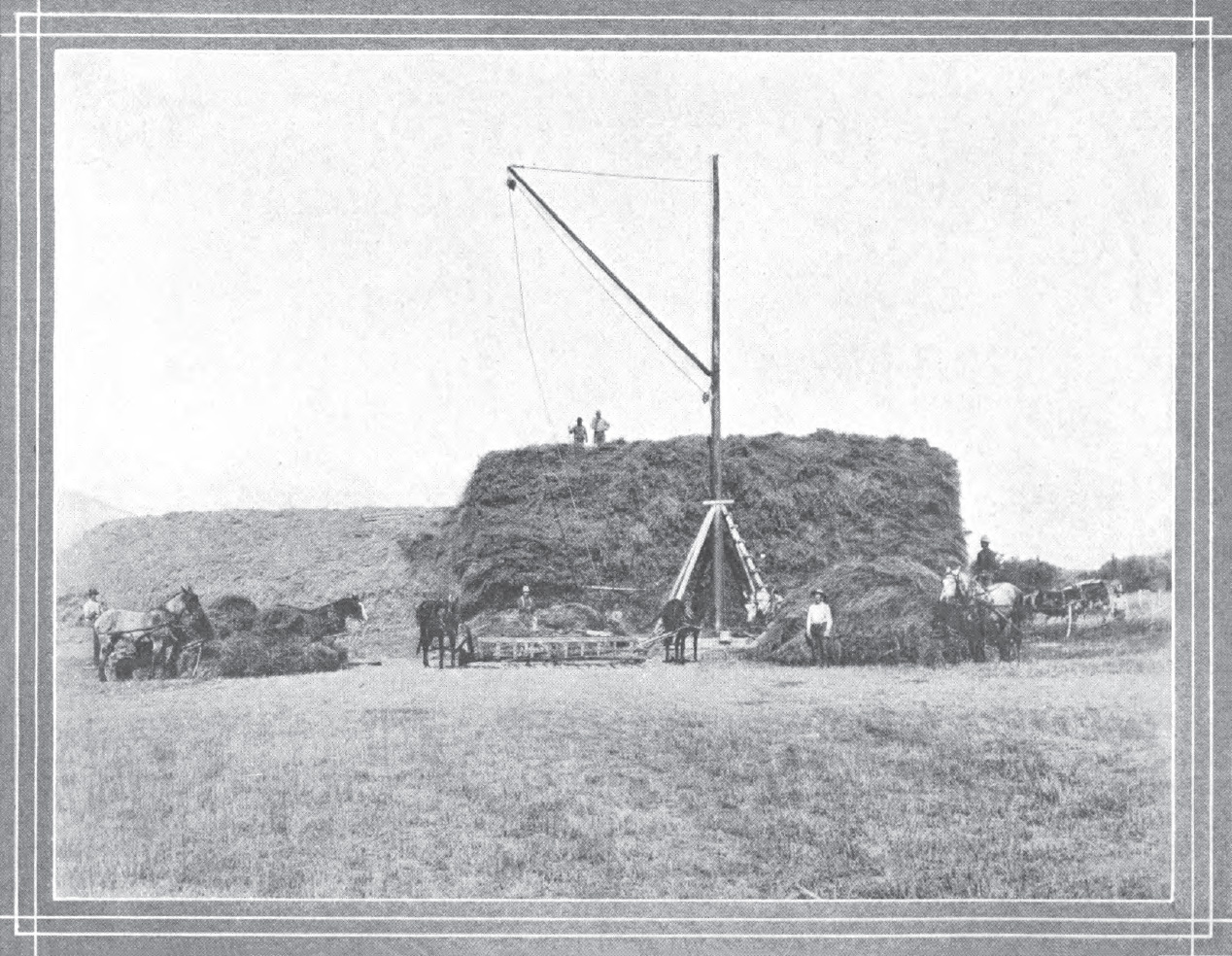 Stacking alpha in Owens Valley |
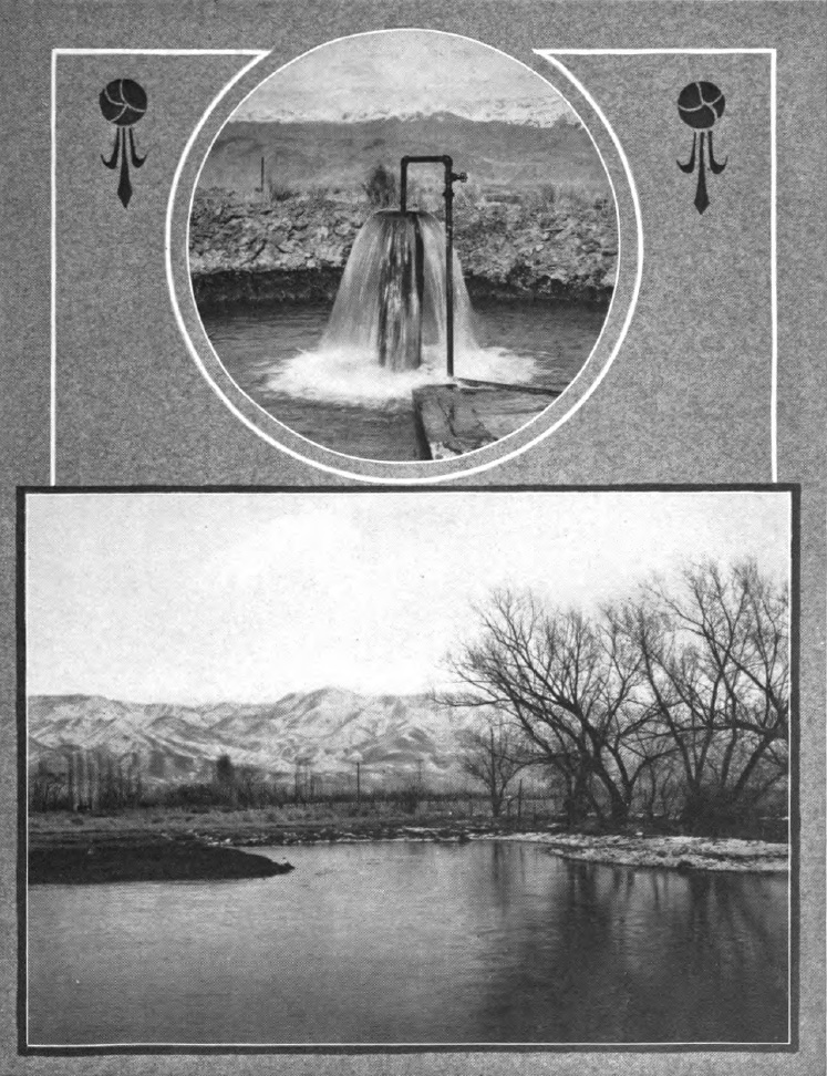 Artesian well near Independence, CA and irrigation canal |
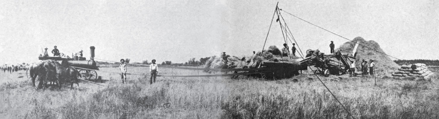 Threshing grain near Independence, CA |
|
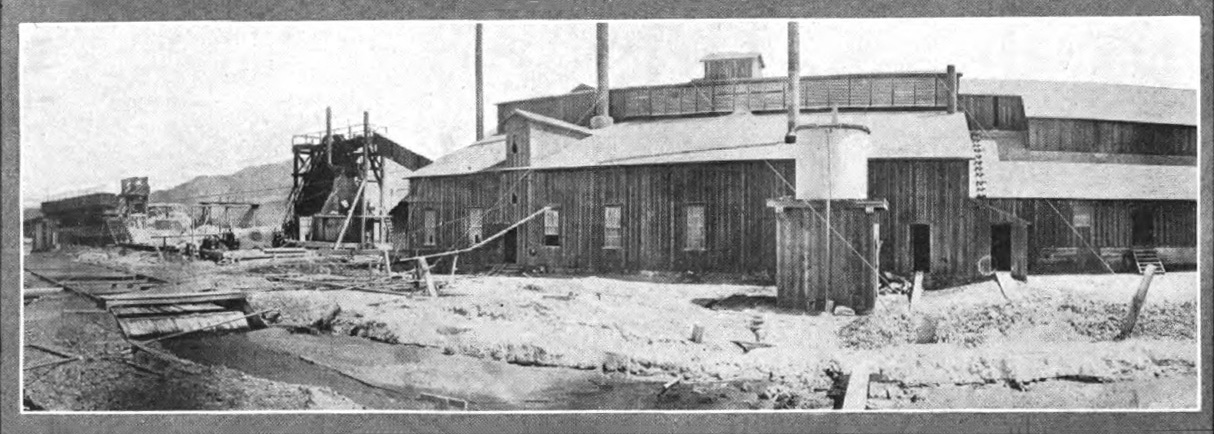 Inyo Development Company Soda Works on the shores of Owens Lake |
|
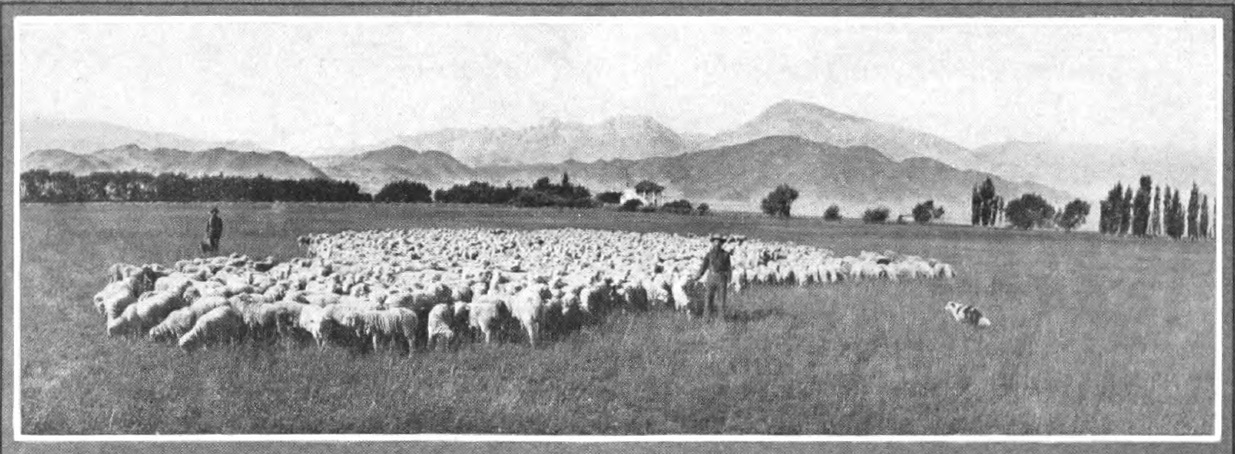 Sheep in Owens Valley on their way to market |
|
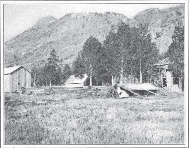 Bishop Creek gold camp |
 Railroad routes in the southwestern United States |
 Owens Lake in 1902 |
|
Into the Desert - Darwin, Cerro Gordo, Owens Lake and Owens River Valley
by Samuel D. Woods
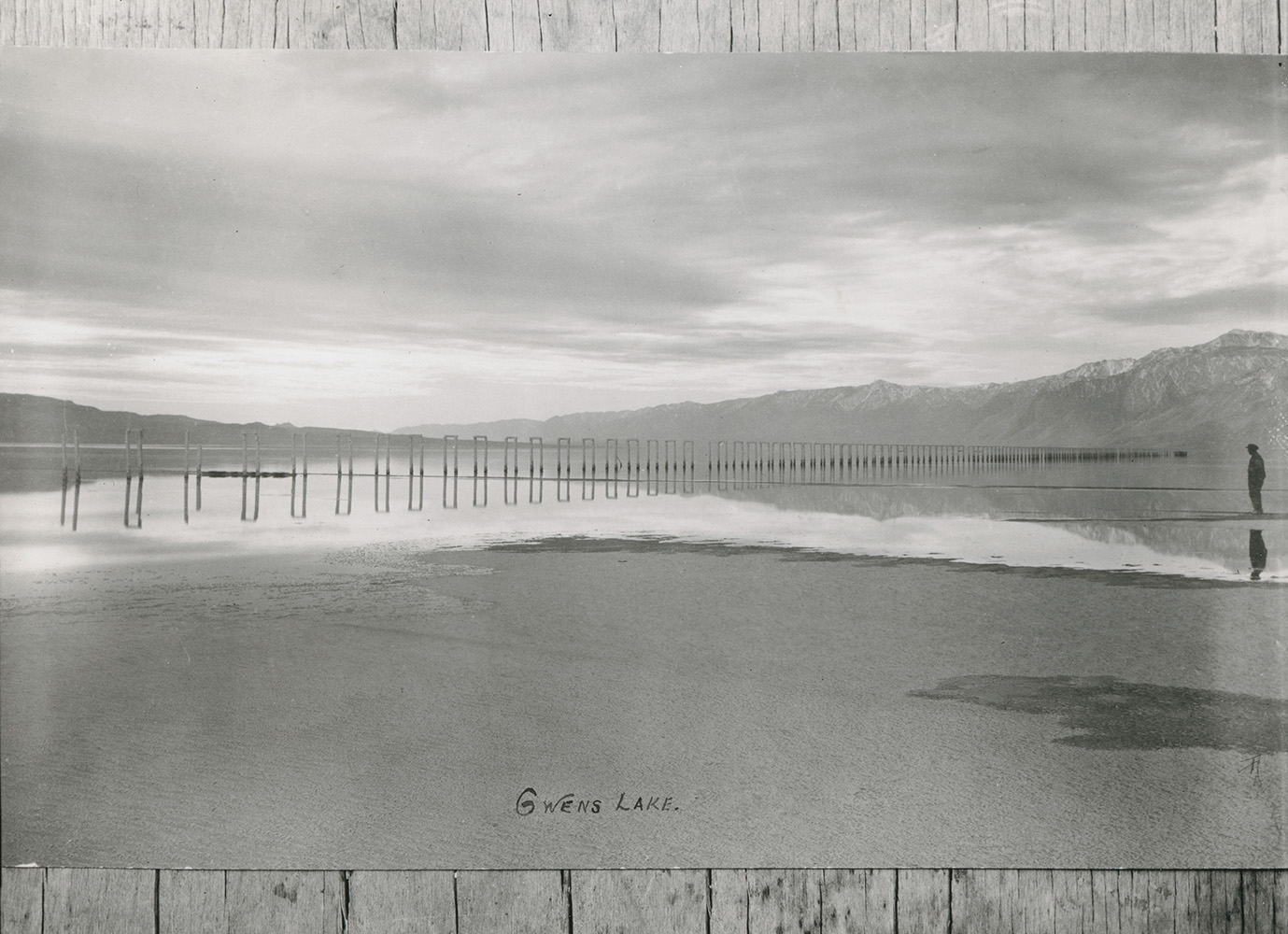 View of Owens Lake with a double row of piling seen extending across middle of picture. (photo courtesy of California History Section Picture Catalog) |
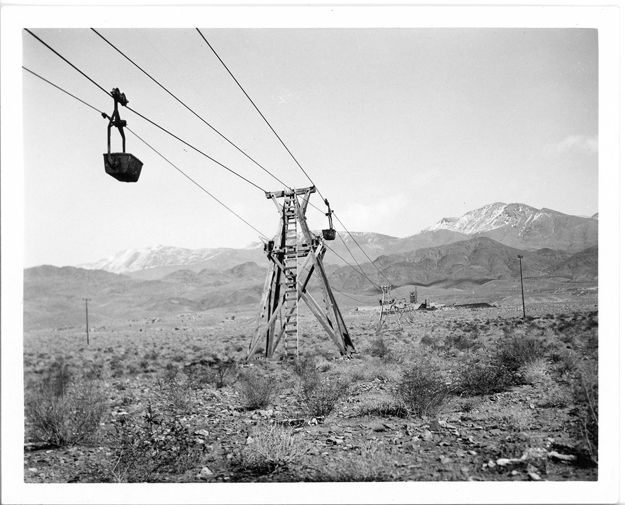
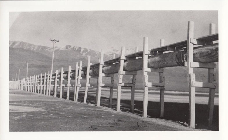 Elevated pipeline across Owens Lake from the Natural Soda Products operation at Keeler (Eastern California Museum photo) |
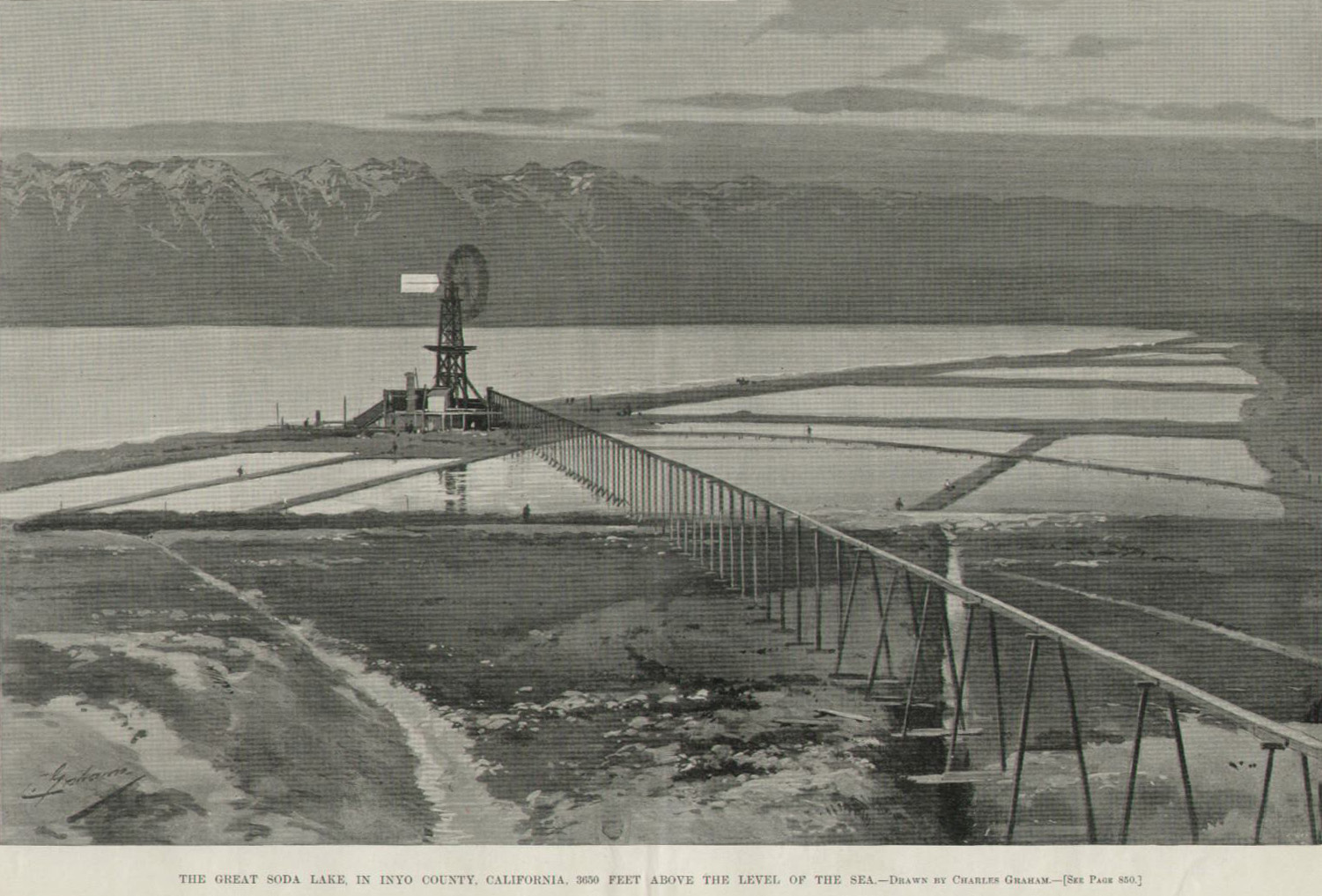 The Great Soda Lake in Owens Valley - 1894 Harper's Weekly photo (Photo courtesy Inyo County Sesquicentennial) |
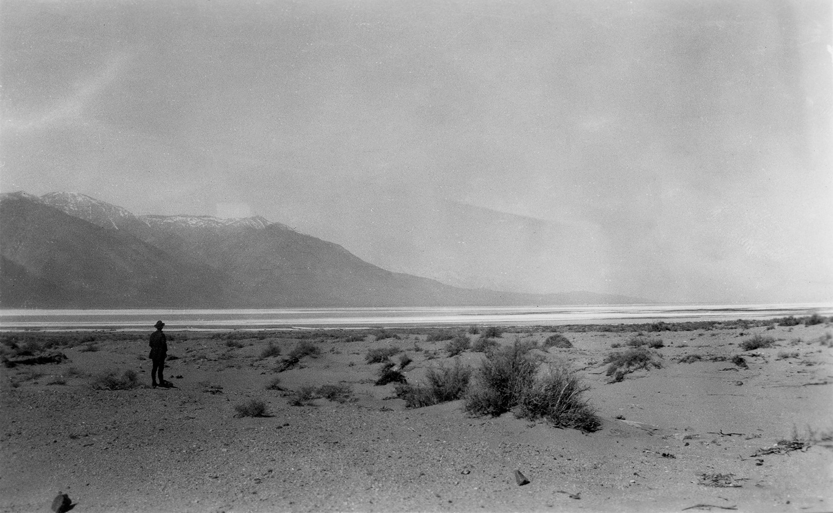
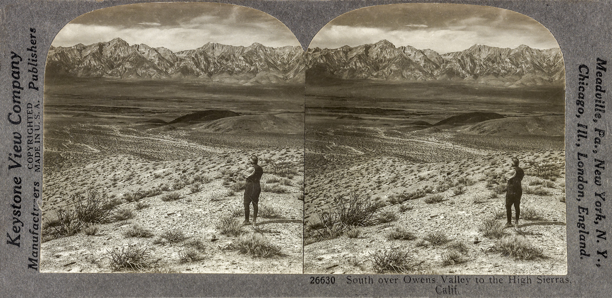 Stereogram of Owens Valley and the Sierra Nevada (Photograph courtesy of the Library of Congress American Memory Project) |
The Owens Valley Committee (OVC)
The OVC is a party to the 1997 Memorandum of Understanding (MOU) to the EIR of the 1991 Inyo-LA Long Term Water Agreement.
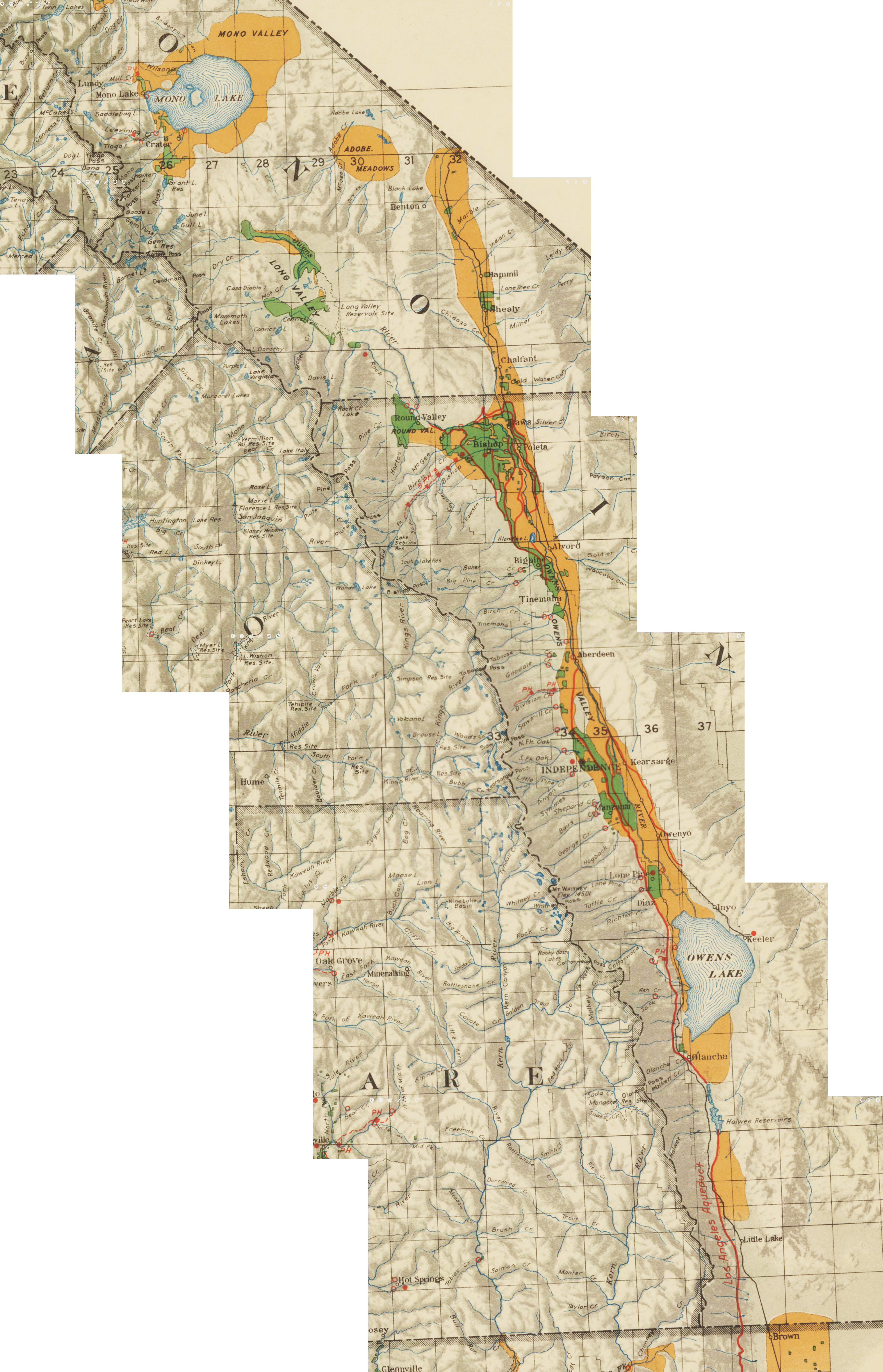
Owens Lake and Vacinity
1939 USGS Topographical Map
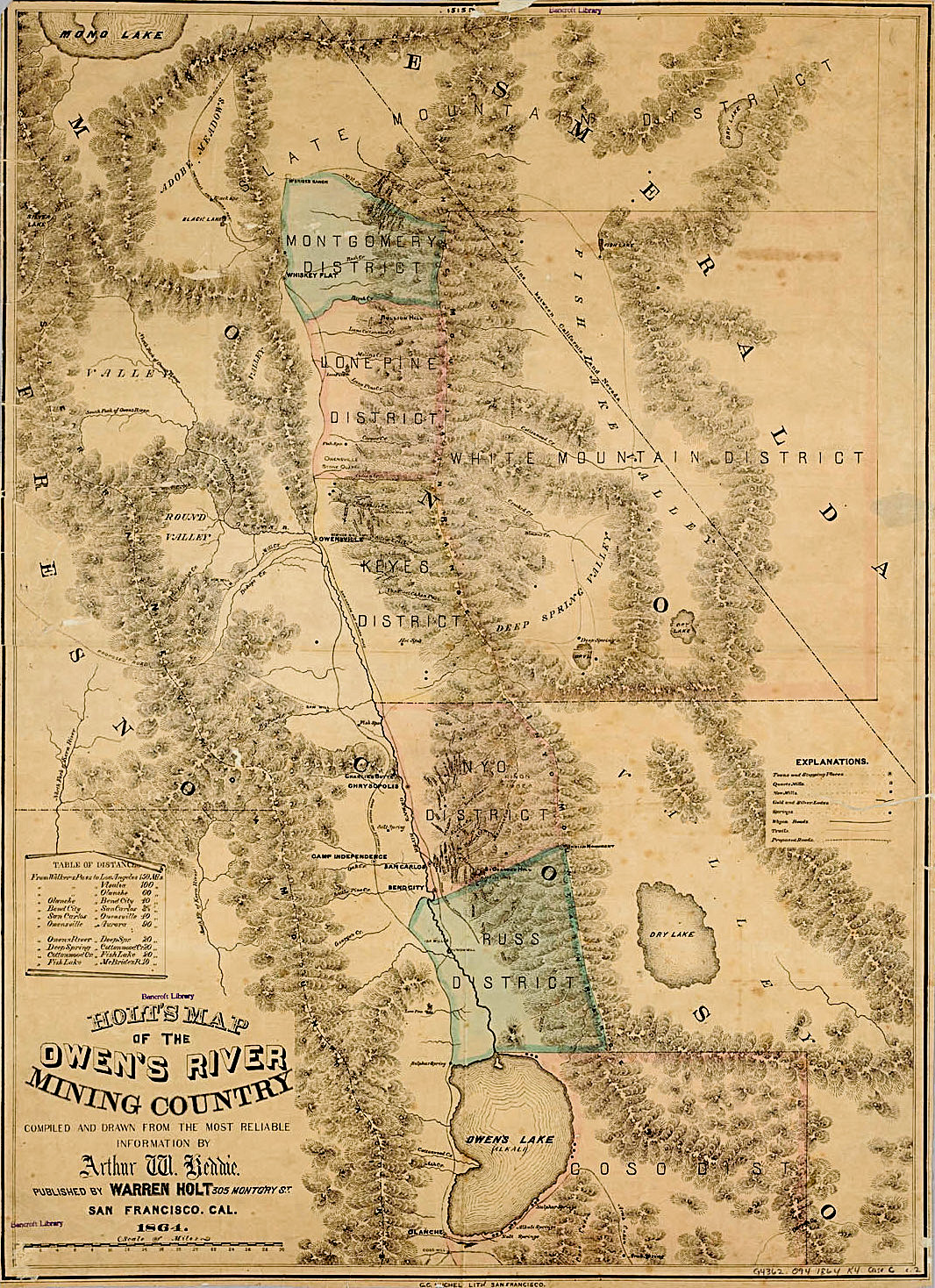
Holt's 1864 Map of the Owen's River Mining Country
Xtra Large Blowup of map
Fotocards courtesy of the Rich McCutchan Archives unless otherwise indicated |
|
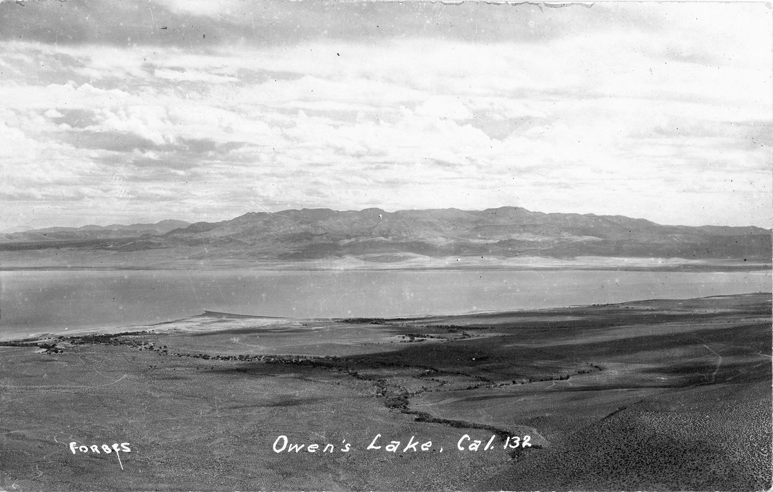
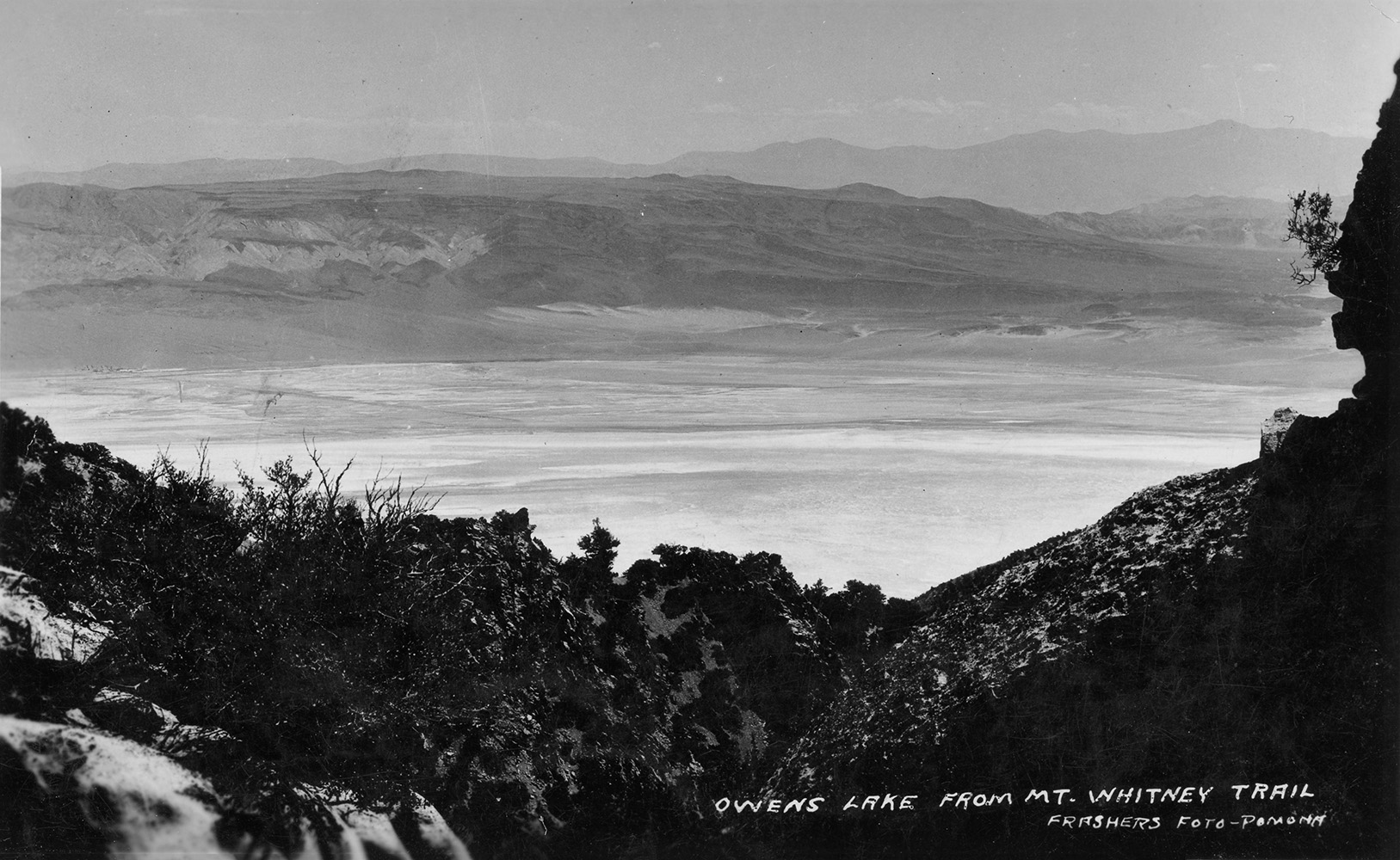
 Owens Lake, CA |
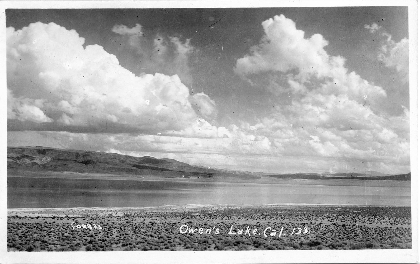
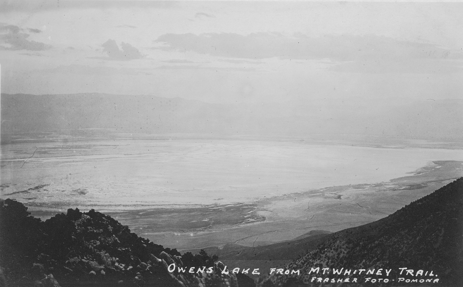
 Owens Lake, CA |
 Owens Lake, CA |
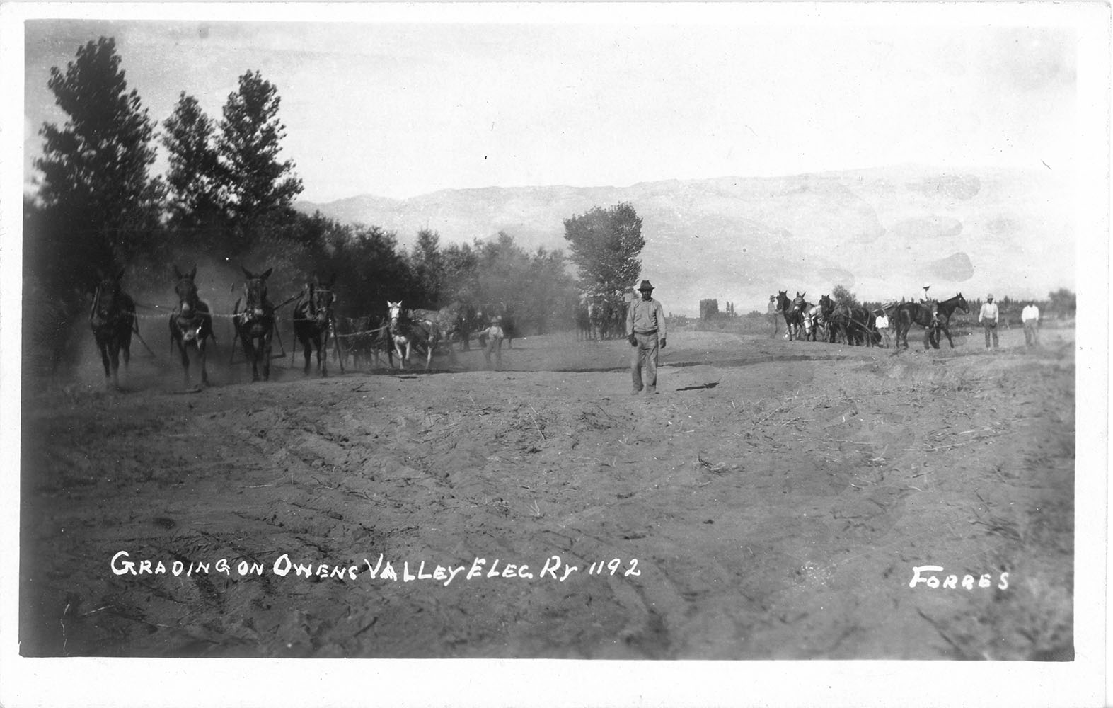 Grading on the Owens Valley Electric Railway in Bishop - Inyo County |
 Owens Valley circa 1924 |
 Owens Valley circa 1930 |
 Owens Valley circa 1930 |
 Cerro Gordo to Owens Valley tram circa 1930 |
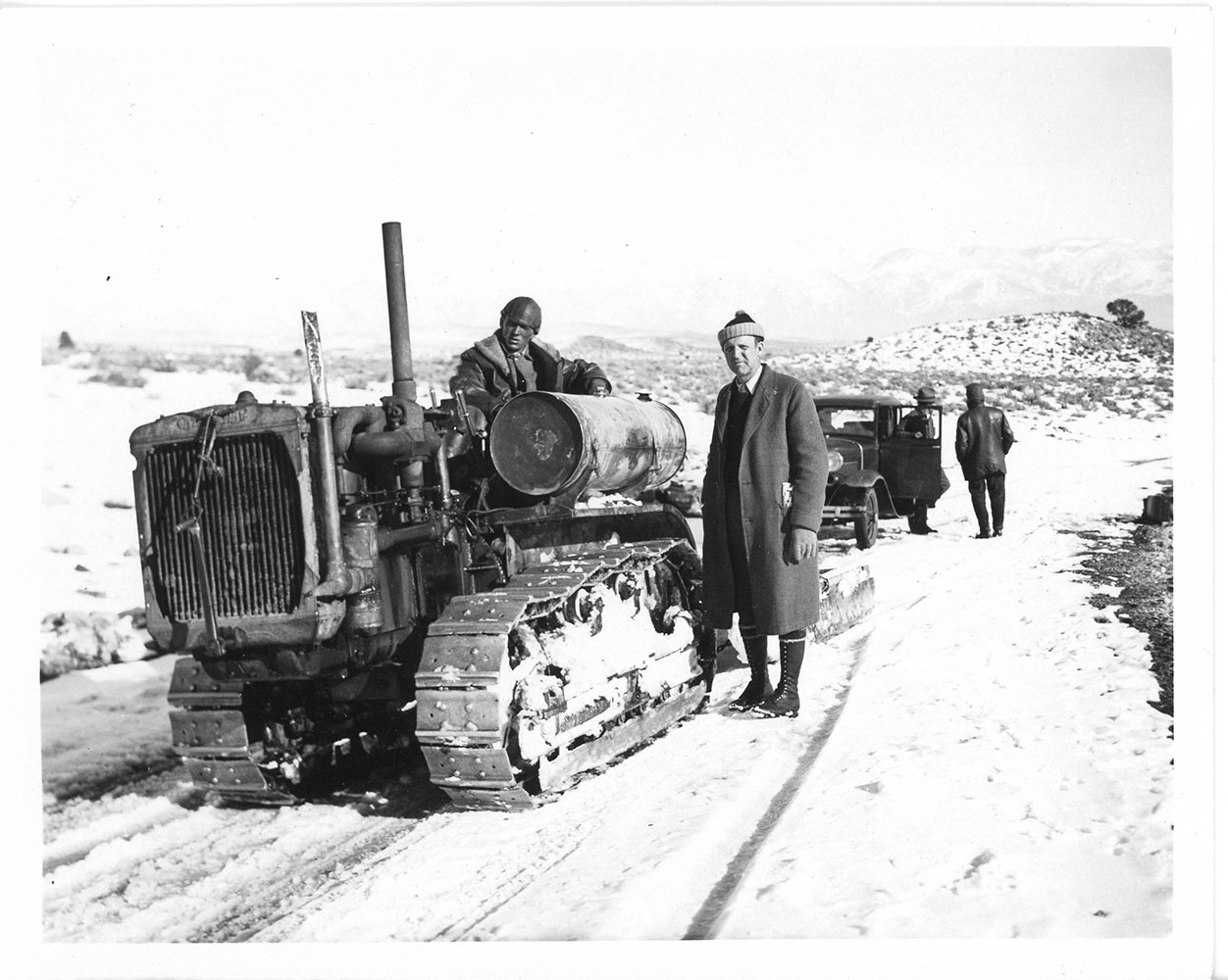
 Road construction in Owens Valley (probably the El Camino Sierra) with Owens Lake in the background (Photo courtesy of Hal Eaton) |
 The El Camino Sierra along the eastern flank of the Sierra Nevada (Photo courtesy of Hal Eaton) |
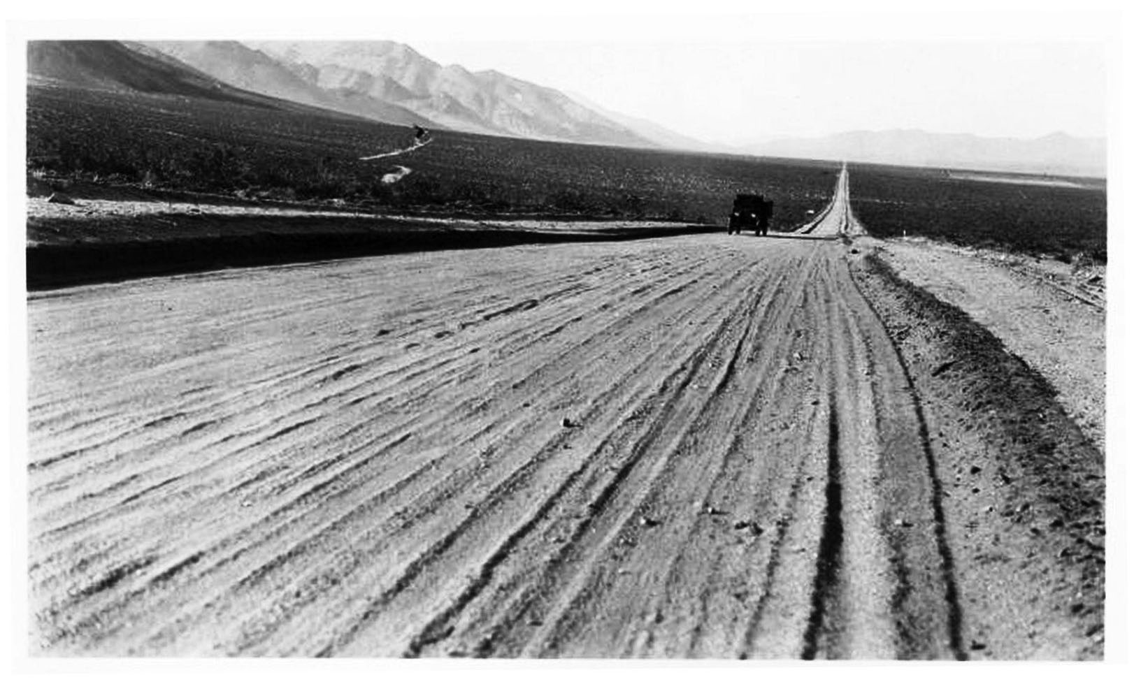
Owens Lake photo from "Men, Medicine & Water" by friends of the LACMA Library Photos were taken by Raymond G. Taylor, M.D. on the occasion of the construction of the Los Angeles Aqueduct |
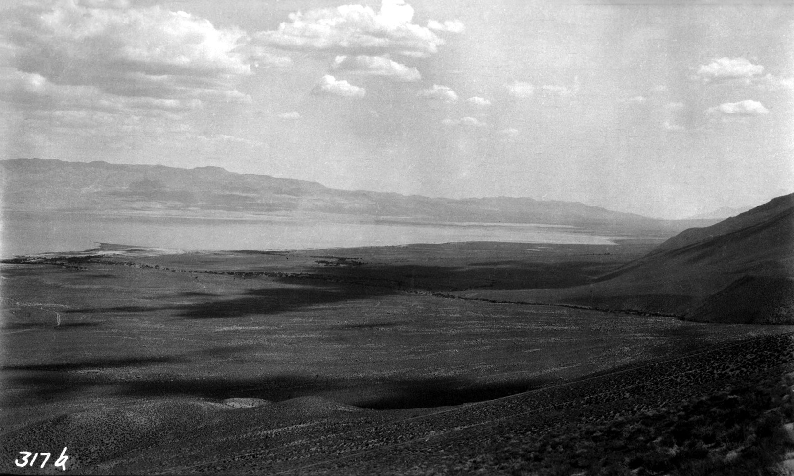
 Owens Lake near the middle - 1909 |
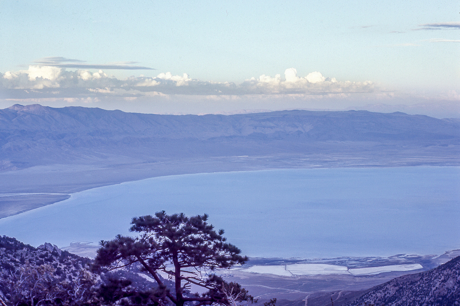
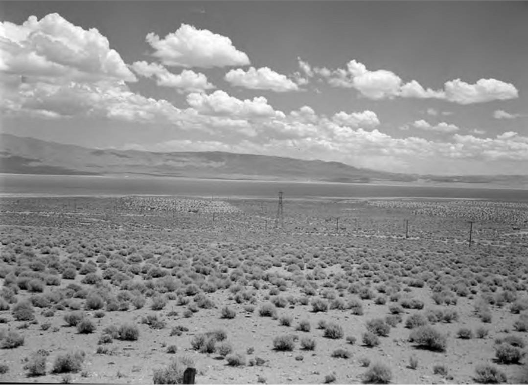
Photos of Owens Lake from wet winters |
|
 Owens Lake - August 1969 (Photo courtesy of Ray DeLea) |
|
My dad was a chemical engineer who worked at the PPG Bartlett Plant located on the shores of Owens Lake. He worked there from the late '50s until the plants closing in 1968. My understanding is the plant made soda as (Sodium Carbonate) - a compound that was used by PPG's glass division to make glass. There used to be a calciner (big rotating cylinder where a heating process took place to cook off the water from the liquid salt slurry taken from Owens Lake. I see that the calciner is gone now. My dad explained to me that the brine taken from the lake had to be fully saturated at 10.0 ppg density for the extraction and manufacturing process to be even marginally profitable. In the winter of 1967 - 68, the Sierra Nevada took an abnormally high volume of snowfall. When the spring of '68 came around, there was strong speculation that the aqueduct, which was uphill from several small towns on the east side of the Sierra, would overflow and decimate a town. It was decided to purposely breachthe aqueduct directly above Owens Lake and let the excess water from the snow runoff drain into the lake basin. The large volume of fresh water from the aqueduct draining into Owens Lake dropped its salinity to the point that every day the plant stayed ope was another day it lost money. The plant was shut down in the summer of '68 and Lone Pine was indeed decimated - not by water but by the loss of those jobs at the plant. For a ten year old boy and his three sisters, it was a hard transition to move from hiking and fishing in the Sierra to the swamps of Lake Charles, LA. There wasn't a mountain or a hill for 200 miles. My dad finished his career with PPG at the LC Plant in 1980 and immediately moved back to California. (Text courtesy of Dean Oneal, Houston, TX - 06 June, 2013) |
|
 Owens Lake as seen from Cerro Gordo - summer 2023. (Photo courtesy of the Friends of Cerro Gordo) |
|
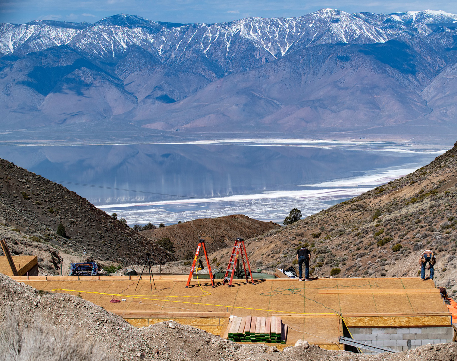
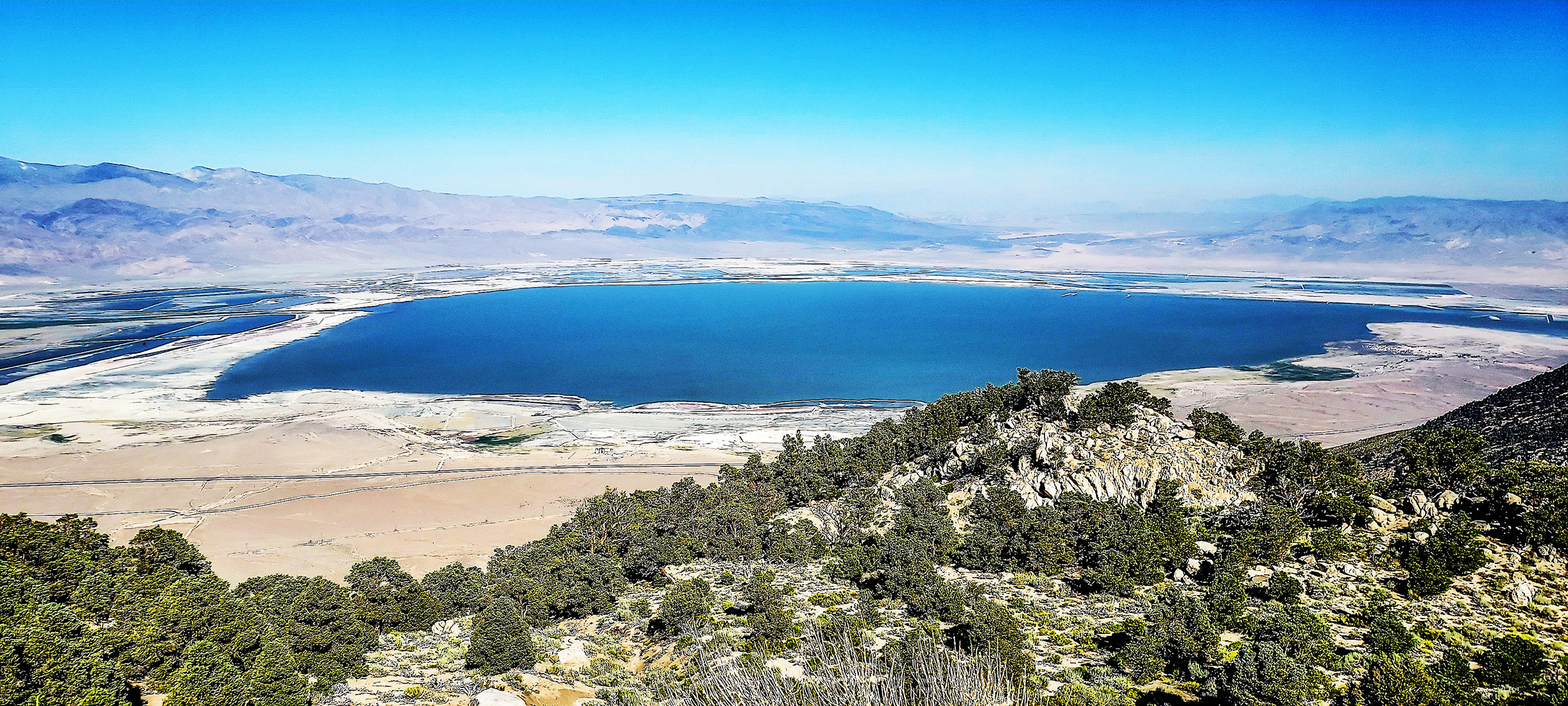
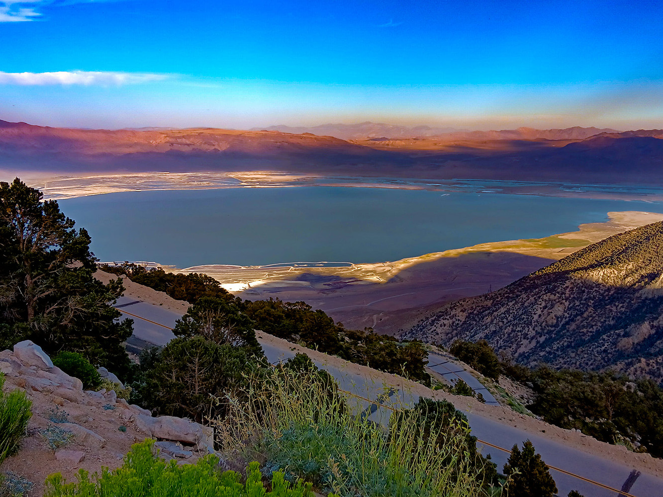
 Owens Lake as seen from Horseshoe Meadows Road - June 2023. (Photo courtesy of Andrew Valiunas) |
|
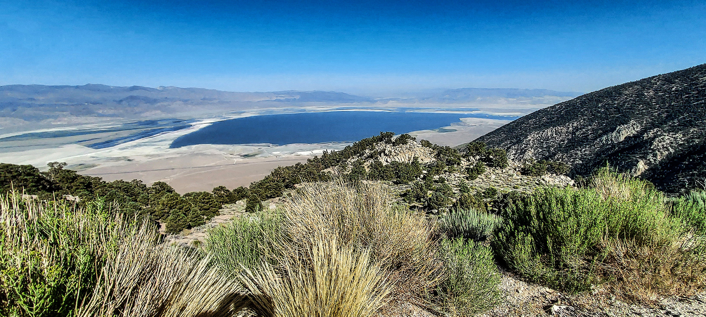
 Owens Lake as seen from Horseshoe Meadows Road - June 2023. (Photo courtesy of Michael Prather) |
|
 Owens Lake as seen from Horseshoe Meadows Road - August 2023. (Photo courtesy of Ray DeLea) |
|
 Owens Lake as seen from Horseshoe Meadows Road - August 2023. (Photo courtesy of Ray DeLea) |
|
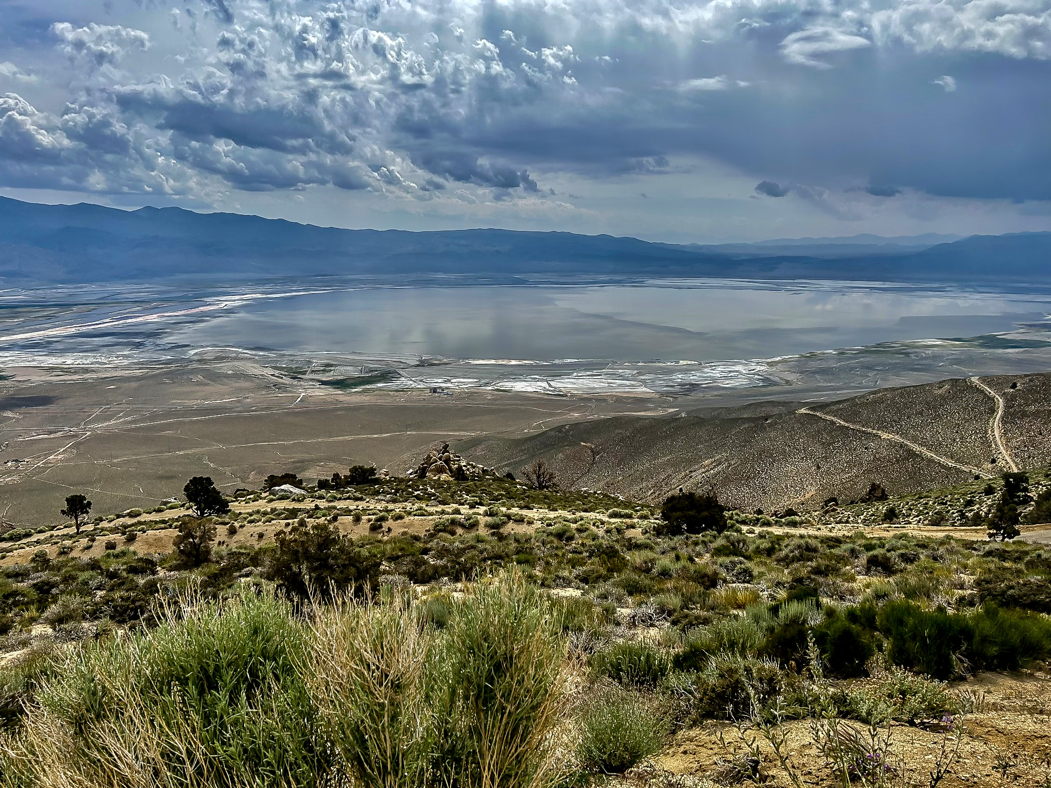
 Owens Lake as seen from Olancha Peak - July 2023. (Photo courtesy of PiTownPi) |
|
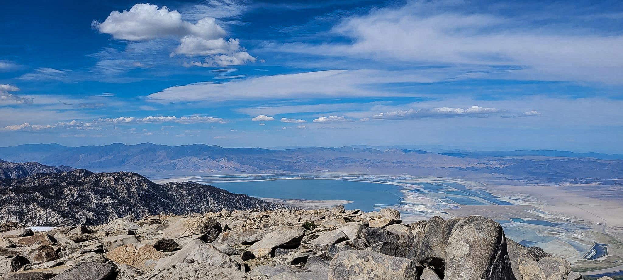 Owens Lake as seen from Olancha Peak - July 2023. (Photo courtesy of PiTownPi) |
|
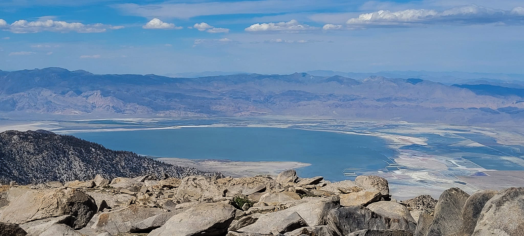
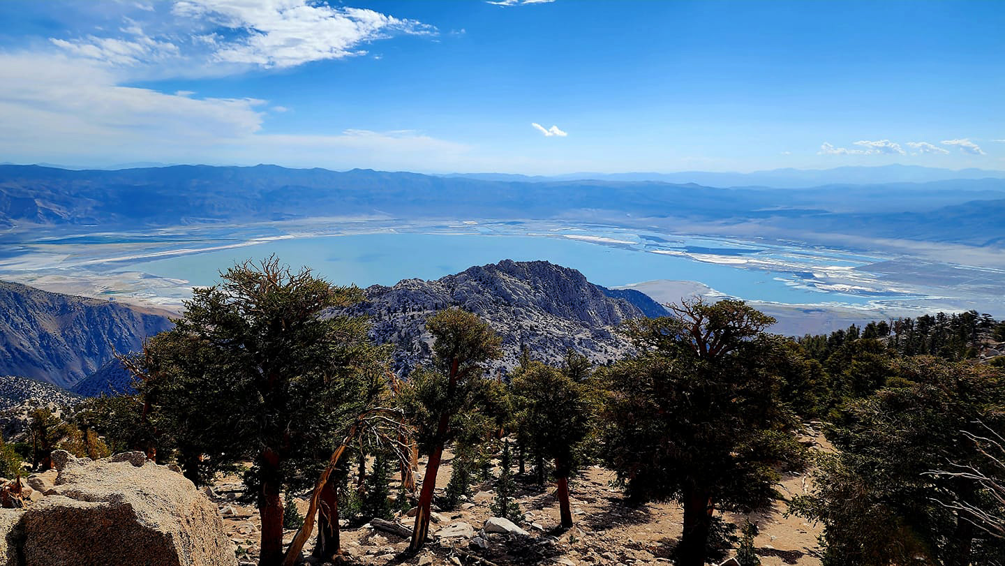 Owens Lake as seen from Muah Mountain Summit - July 2023. (Photo courtesy of Tao Zhang) |
|
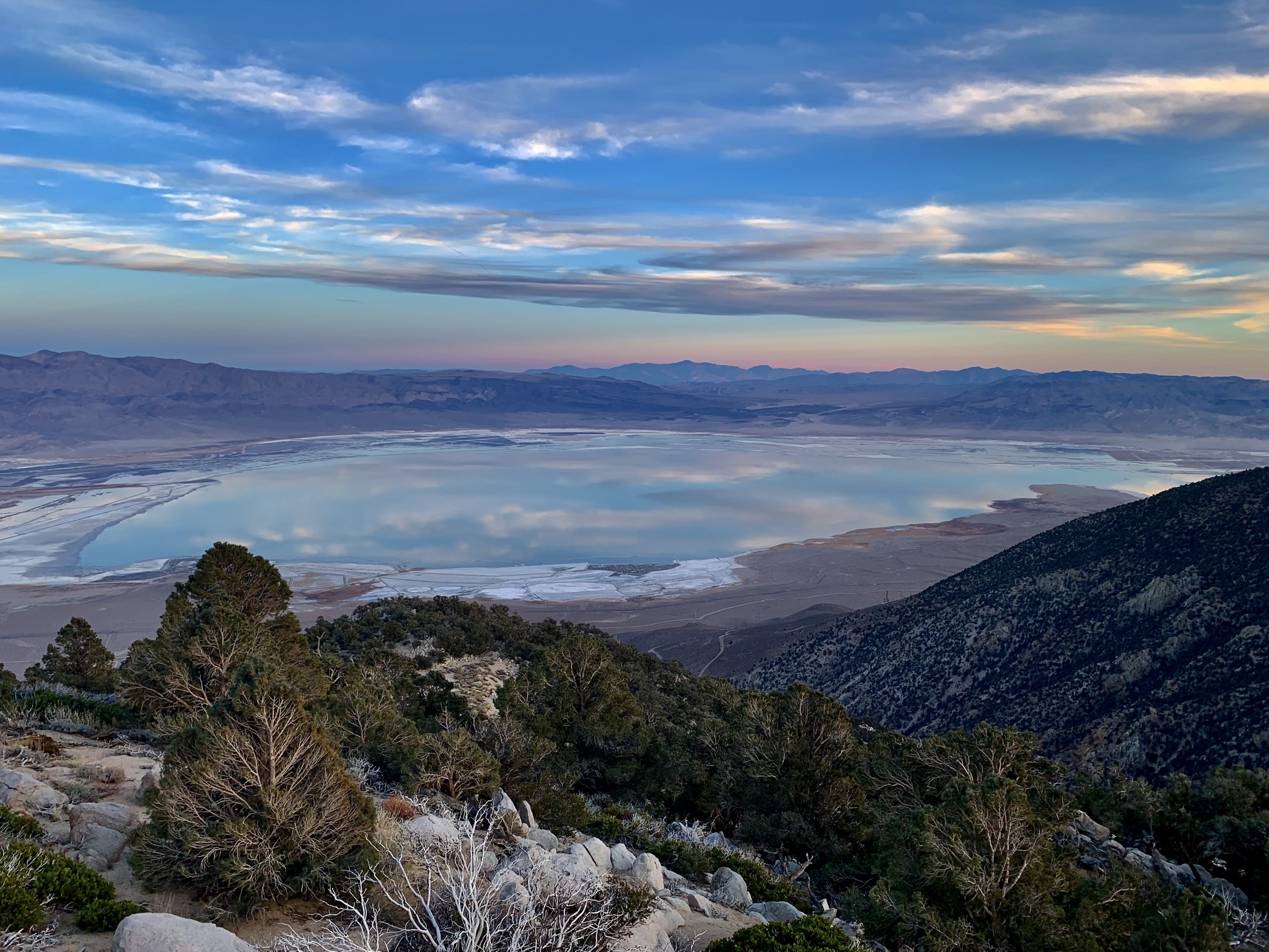 Owens Lake as seen from the summit of Wonoga Peak (10,371') above Lone Pine - December 2023. (Photo courtesy of Michael Prather) |
|
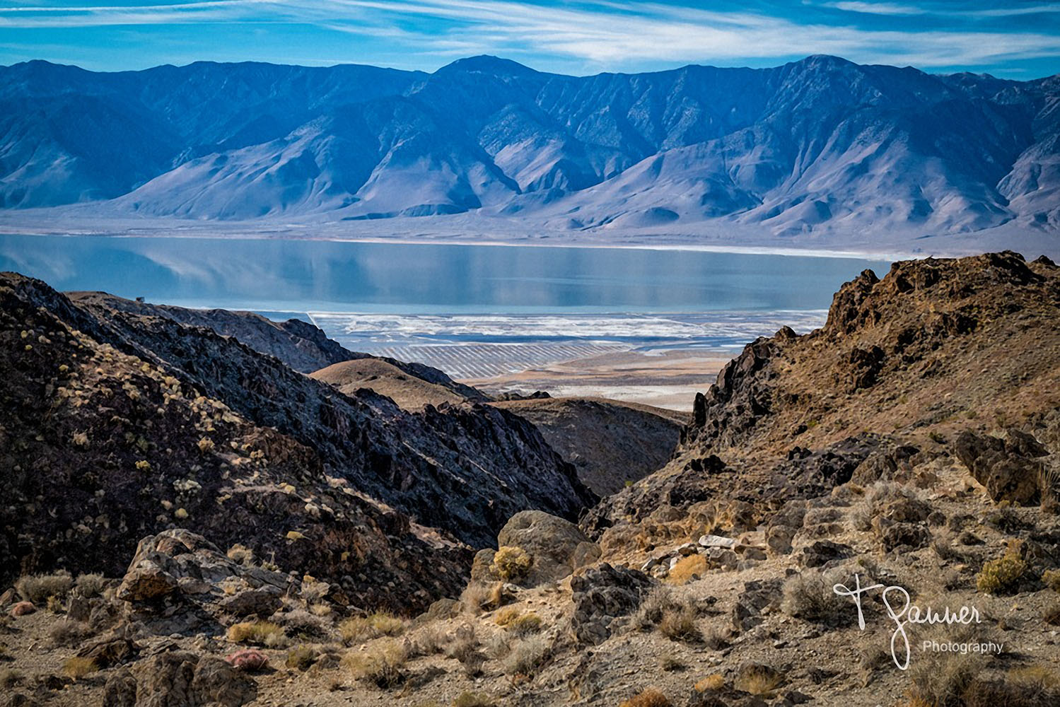 Owens Lake at sunset from the road to Cerro Gordo (Photo courtesy of Tom Ganner) |
 Owens Lake at sunset from the Horseshoe Meadow Road (Photo courtesy of Paul Fretheim) |
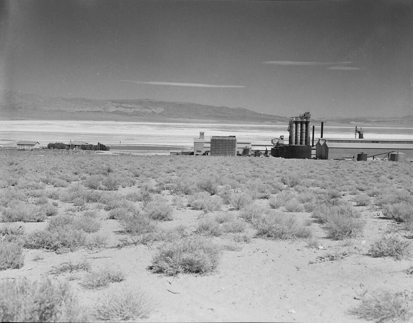
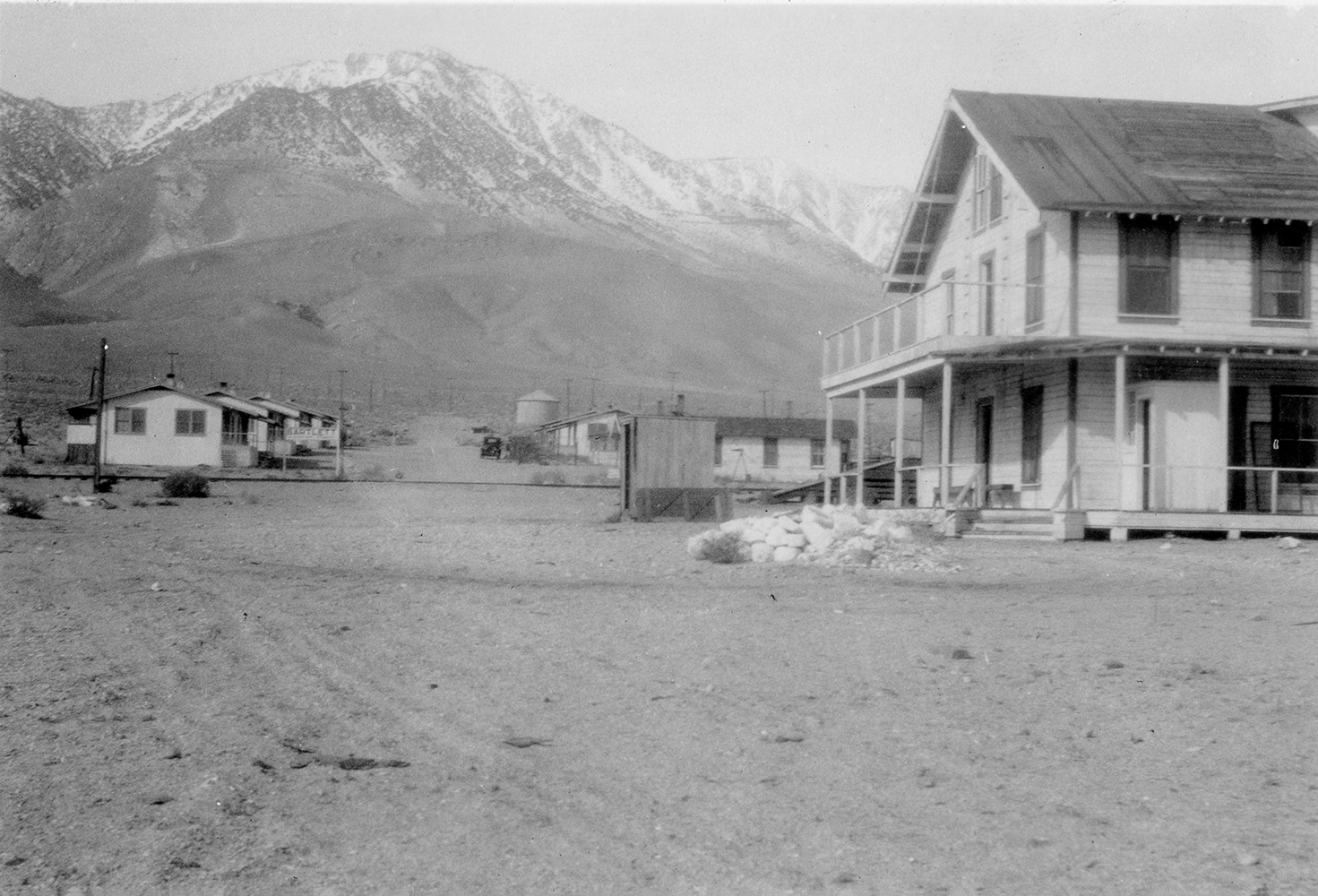
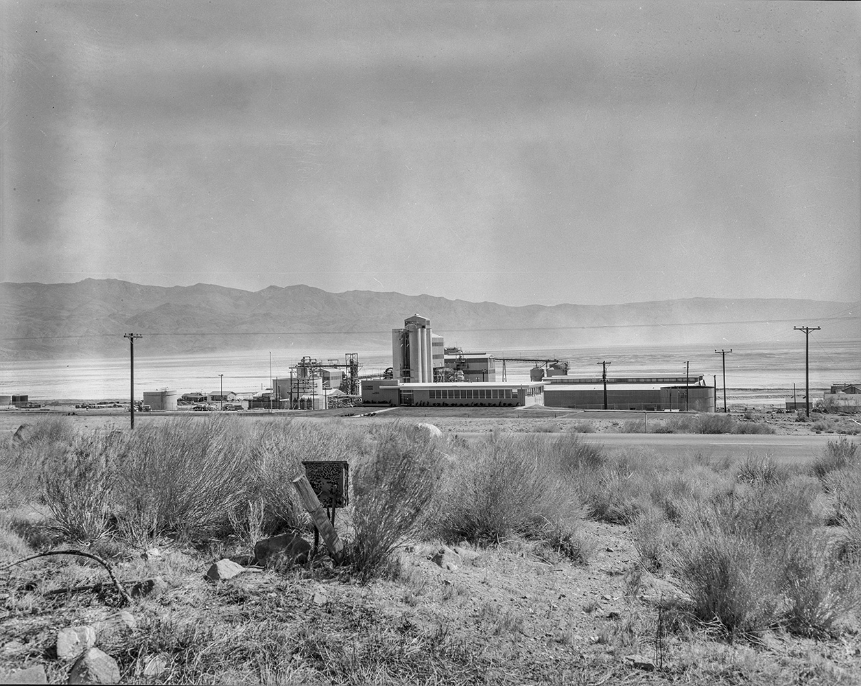
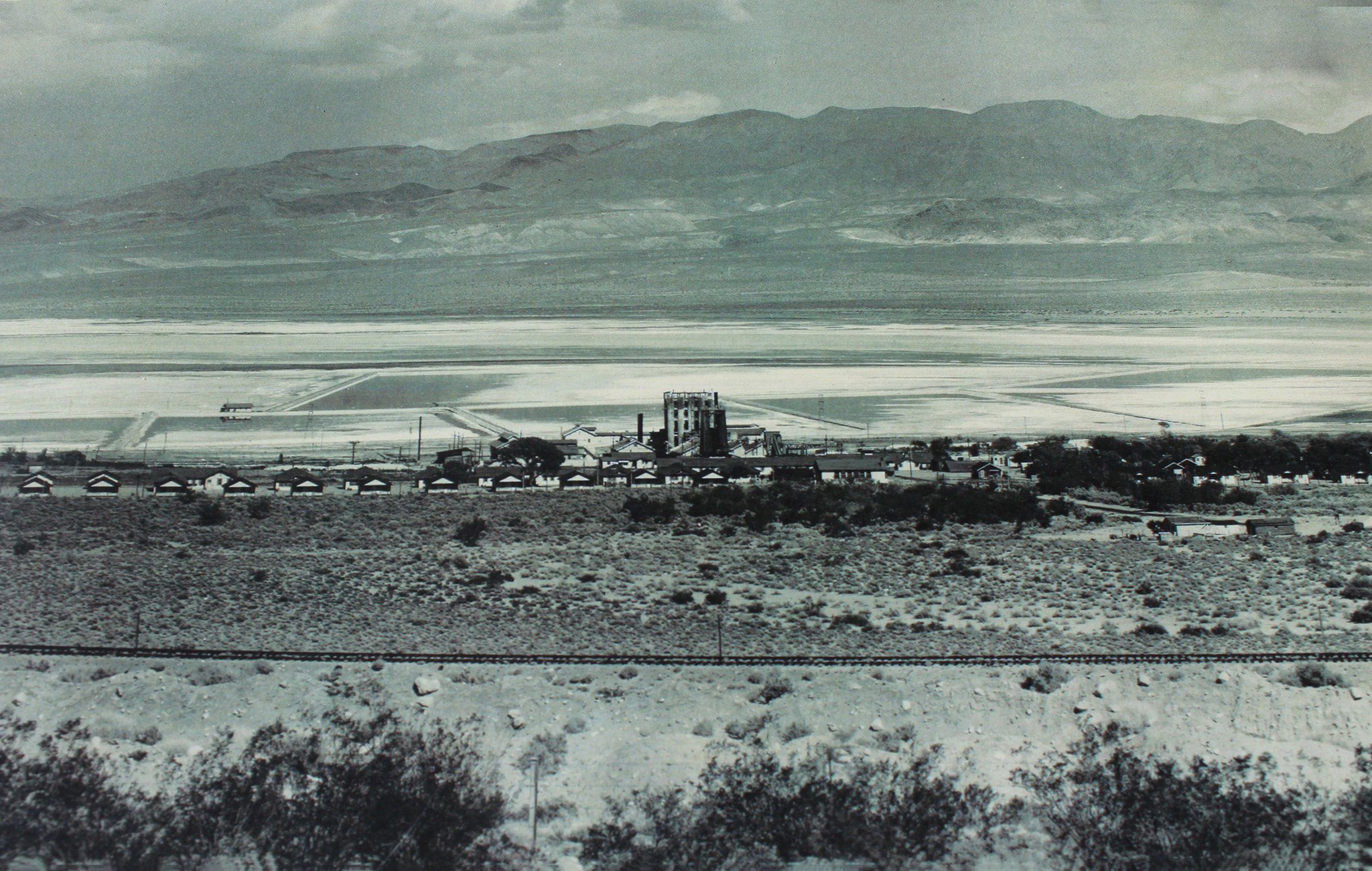
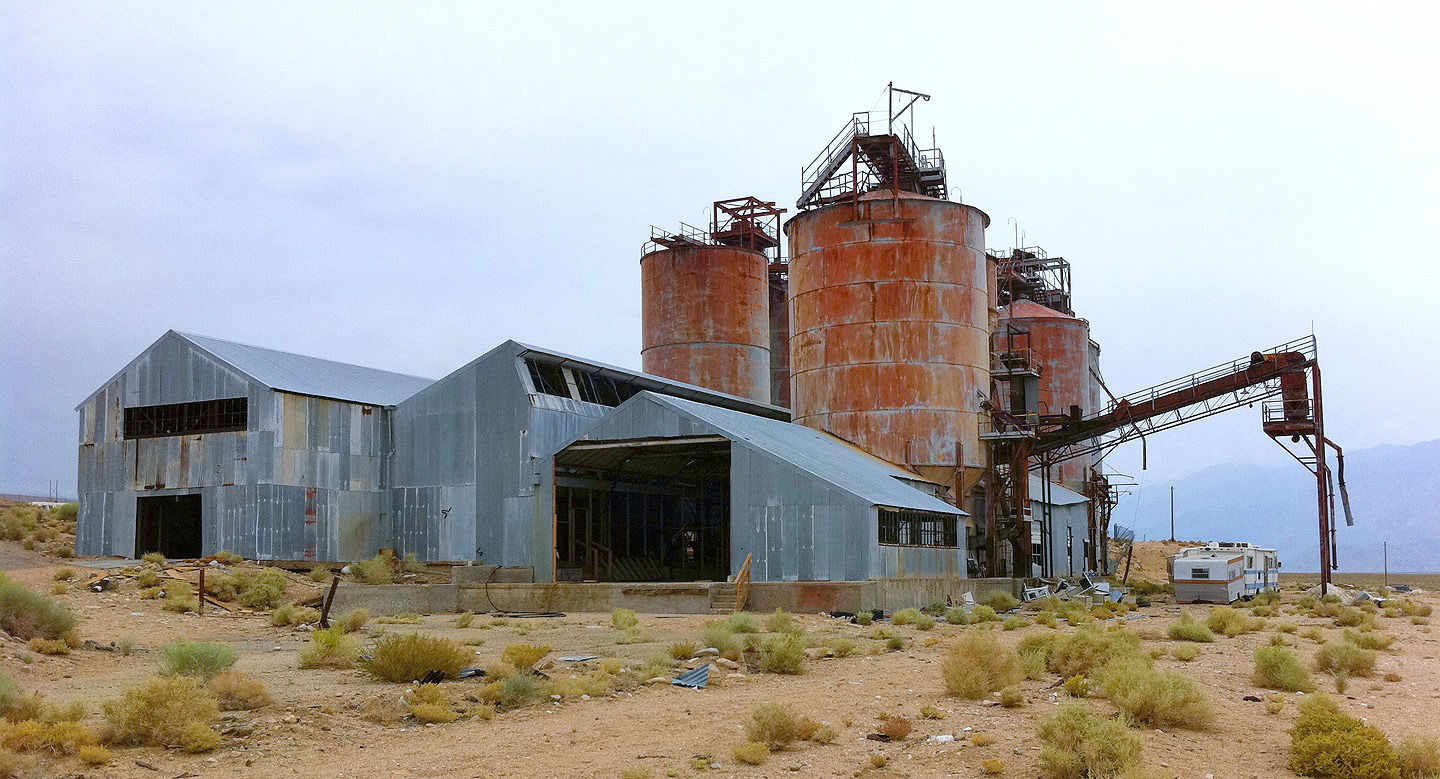
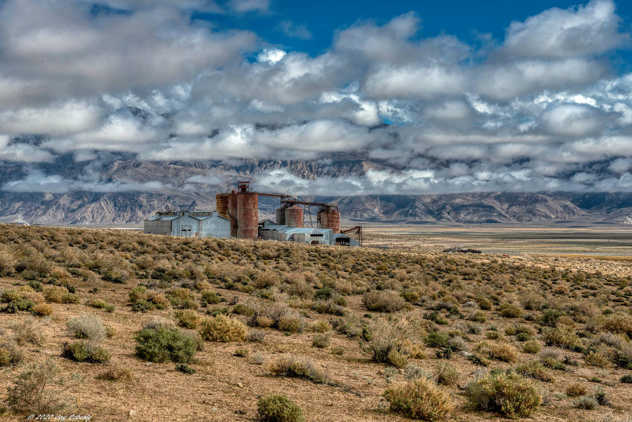
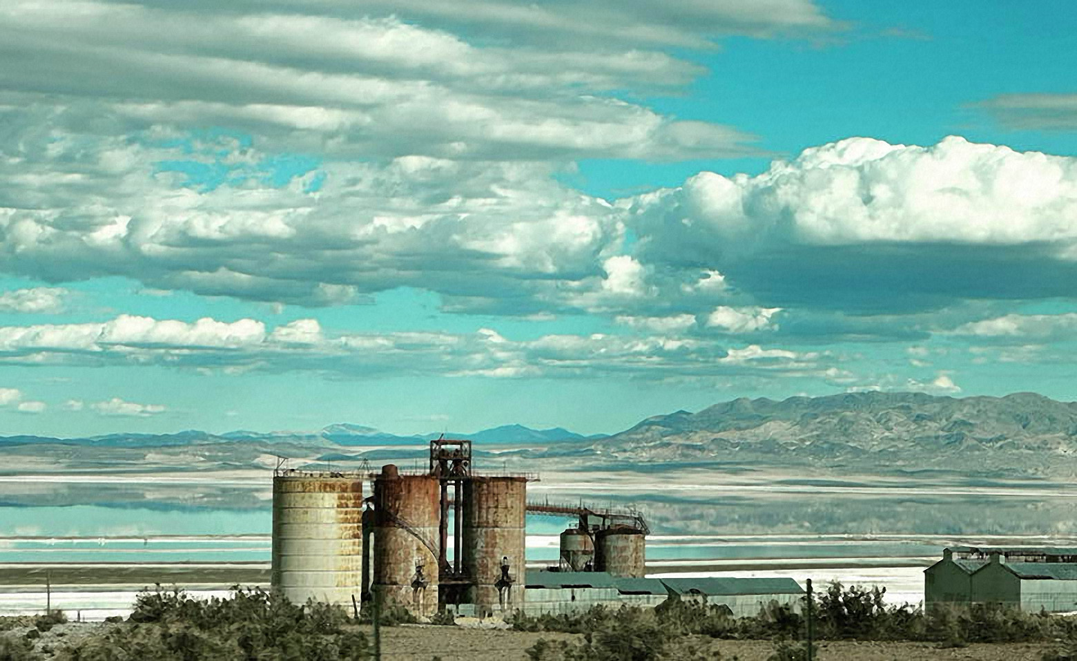
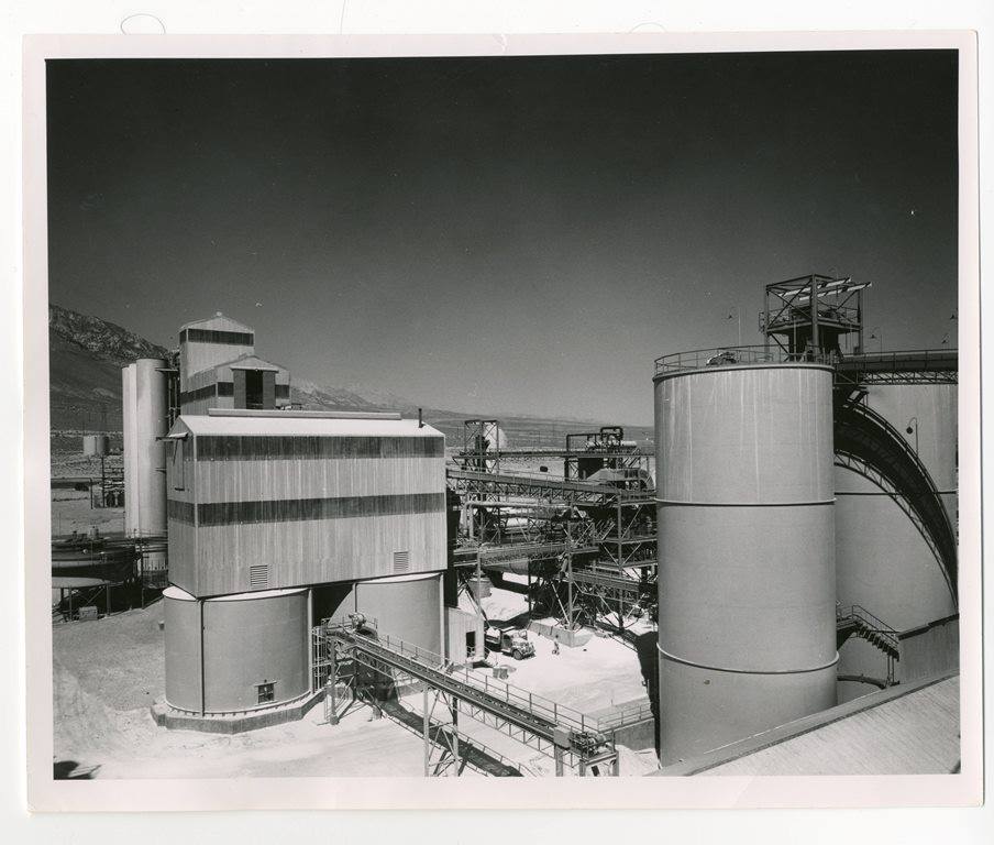 Pittsburg Plate Glass Company plant on the western shores of Owens Lake at Bartlett (Inyo County Sesquicentennial photo) THEN |
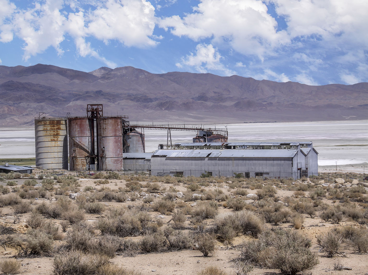 Pittsburg Plate Glass Company plant on the western shores of Owens Lake at Bartlett (Photo courtesy of Ray DeLea) NOW |
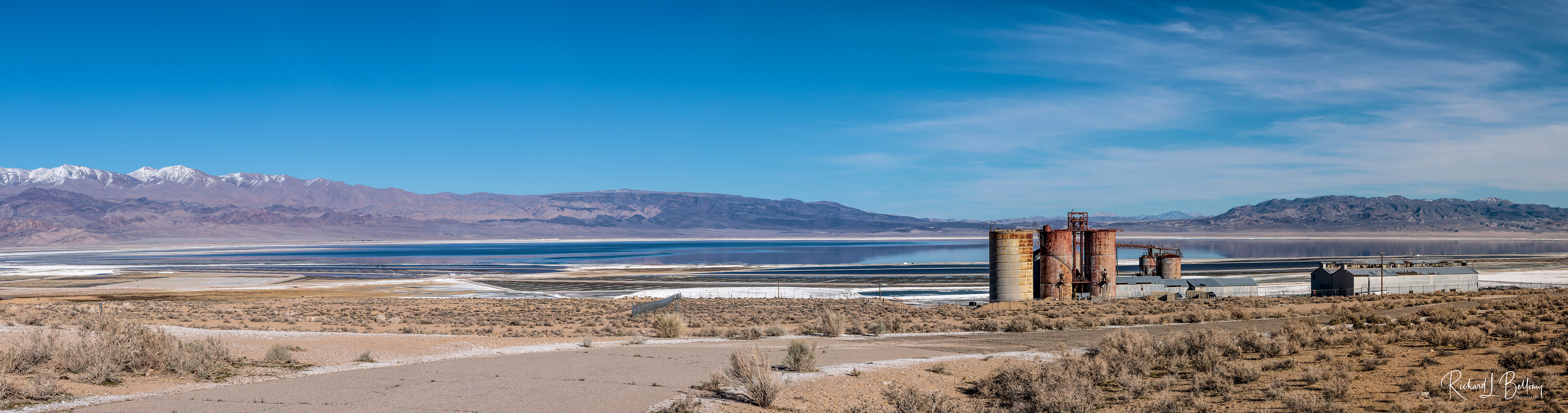 Pittsburg Plate Glass Company plant on the western shores of Owens Lake at Bartlett - 2023 (Photo courtesy of Richard Bellomy) |
|
 Sherman Stevens charcoal kilns on the western shores of Owens Lake (Photo courtesy of David Woodruff) |
 Owens Lake (Photo courtesy of eBay) |
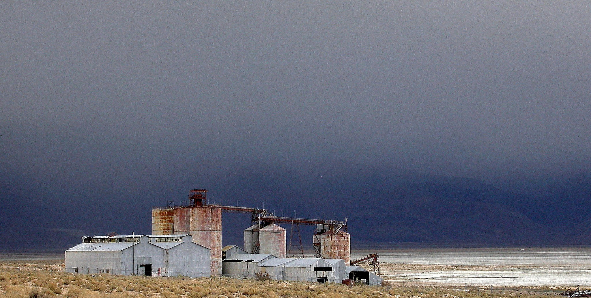 Pittsburg Plate Glass Company plant on the western shores of Owens Lake at Bartlett - Monsoonal thunderstorms over the Inyo Mountains - July 2022 (Photo courtesy of Michael Prather) |
|
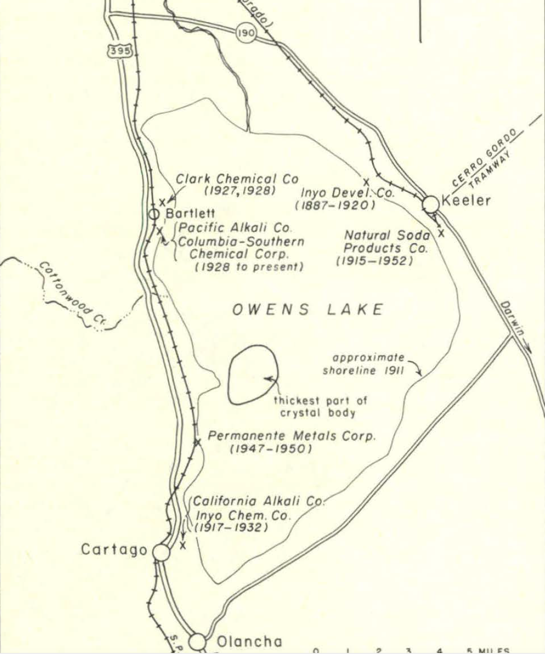 Soda Ash operations on Owens Lake over the decades. California Alkali Company: 1917-1932 Clark Chemical Company: 1927-1928 Inyo Development Company: 1887-1920 Inyo Chemical Company: 1917-1932 Permanente Metals Corporation: 1947 - 1950 Natural Soda Products Company: 1915-1952 Pacific Alkali Company / Columbia-Southern Chemical Corporation: 1928 to present . |
|
 Soda Ash operations on the shores of Owens Lake near Cottonwood Creek circa 1906 (Photo courtesy of University of Nevada, Reno - Online Digital Collections) |
 I believe this particular operation was either the Permanente Metals Corporation operations just north of Cartago or the California Alkali Corporation operations out of Cartago. The Inyo Mountains are off in the distance to the east. circa 1940 (Photo courtesy of USC Libraries Special Collections) |
Owens Lake Land Use
Soda Ash Industry of Owens Lake - 1959
by Mineral Information Service
Eastern Sierra Commitments and Issues - 2006
by Los Angeles DWP
Owens Lake Soda Ash Company
Soda Ash Mining and Processing Project - 1994
by County of Inyo Planning Department
California State Lands Commission
U.S. Department of the Interior, Bureau of Land Management
Owens Valley Land Management Plan - 2010
by Los Angeles DWP
The Development and Decline of Agriculture in Owens Valley
by Peter Vorster
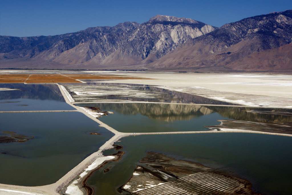 Dust mitigation efforts on Owens Lake, Owens Valley, CA (Los Angeles Times photo) |
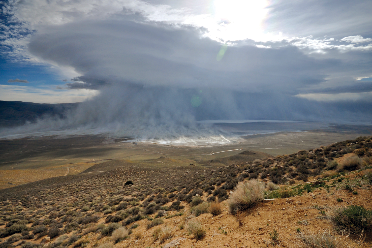 Alkali dust cloud coming off of Owens Lake, Owens Valley, CA (Brian Russell photo) |
Owens Lake photo from the Water Resources Archives - Orbach Science Library On the occasion of the construction of the Los Angeles Aqueduct |
 Owens Lake - November 1906 |
 Owens Lake |
 View of Owens Lake on the road that leads to Darwin - 1928 |
 Bartlett, CA |
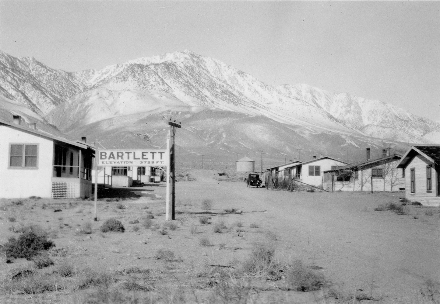 Bartlett, CA |
 Bartlett, CA (Photo courtesy CA State Archives, Richard Olsen Negatives Collection) |
 The Desert Rat (Photo courtesy The Huntington Library Digital Collections) |
 Owens Lake |
 Owens Lake |
 Owens Lake |
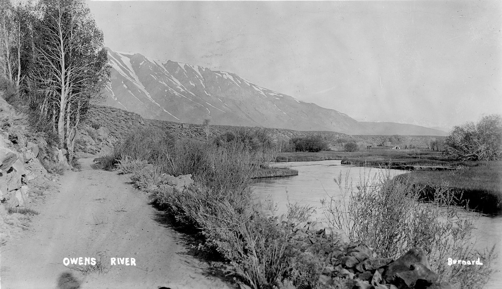
 Owens River |
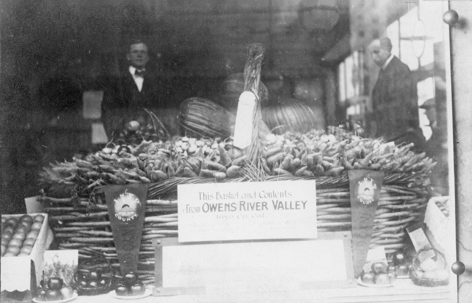 Produce from the Owens River Valley |
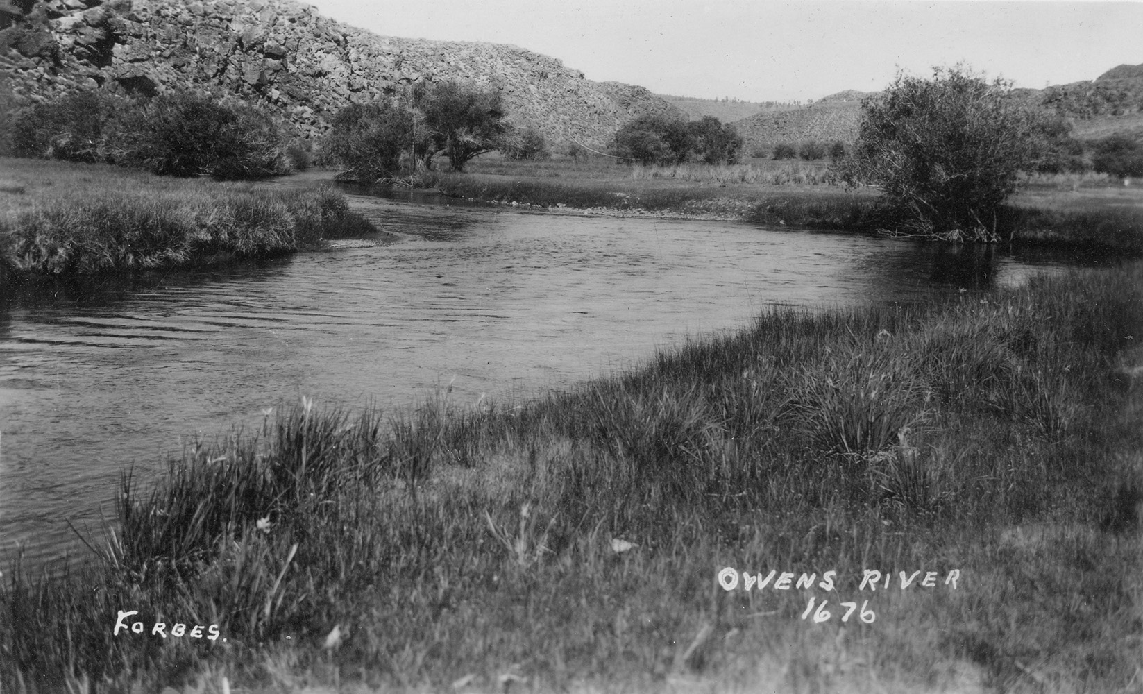
 Owens River |
 Owens River |
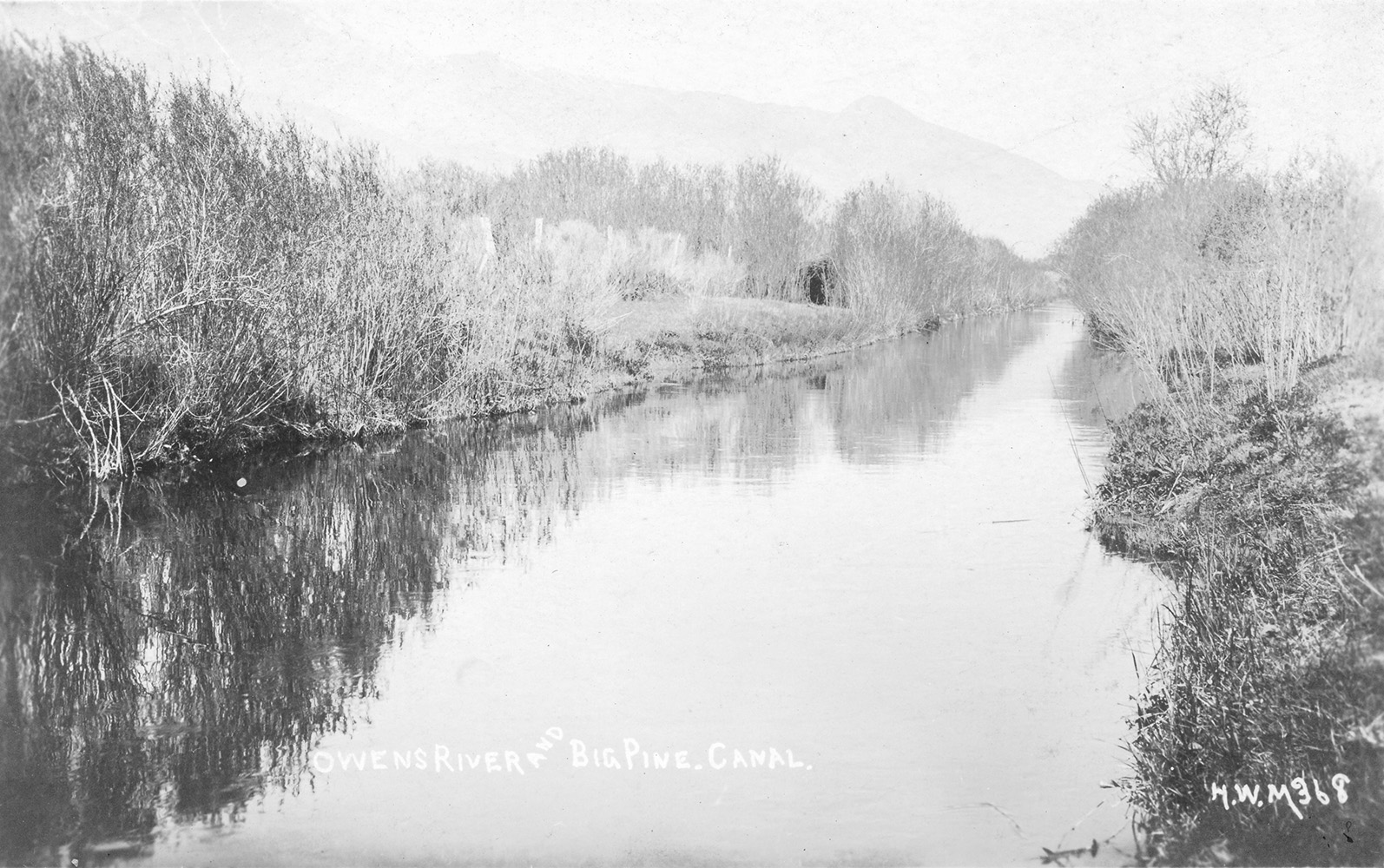 Owens River - Big Pine Canal |
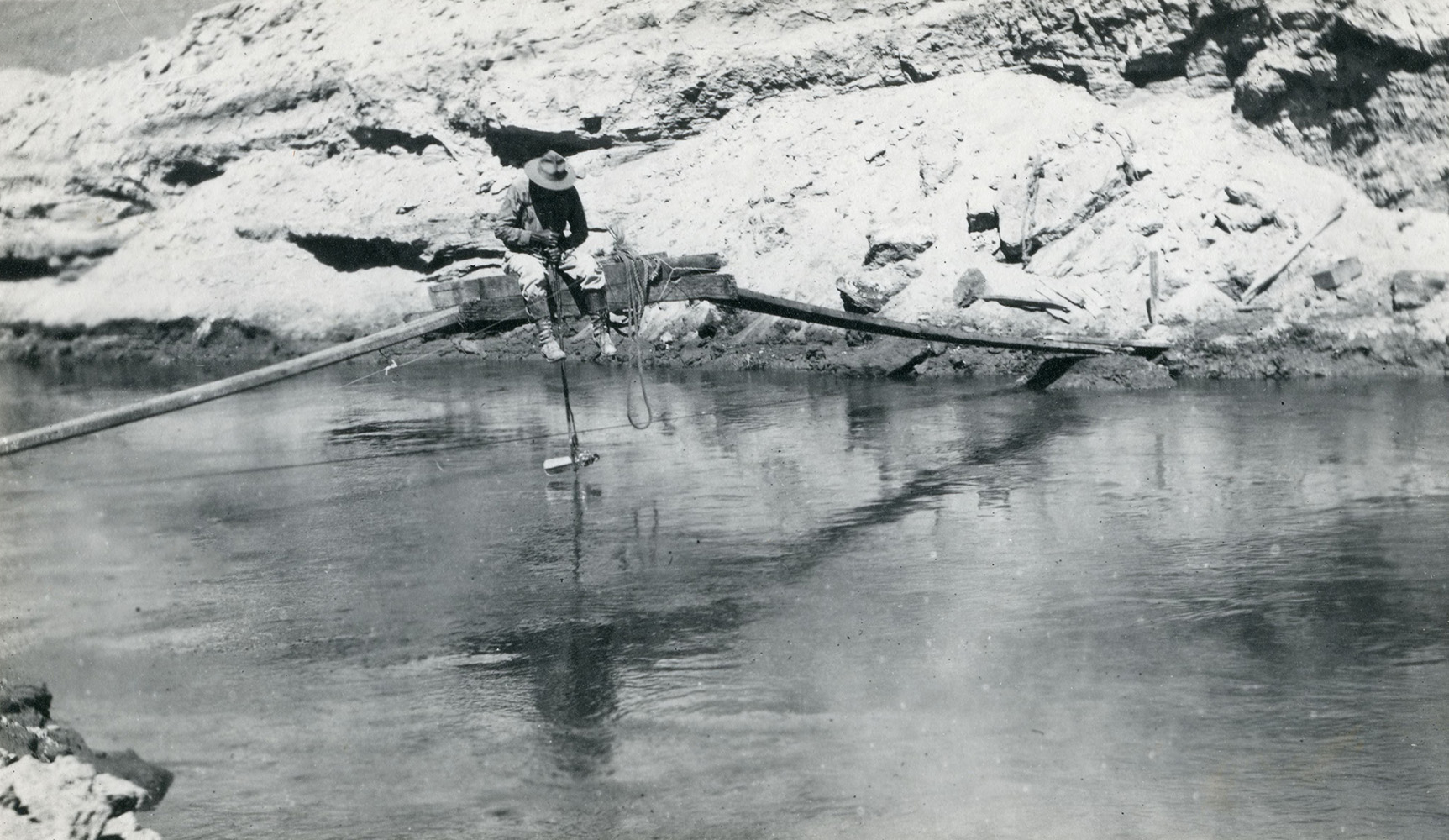
 Fisherman on the Owens River |
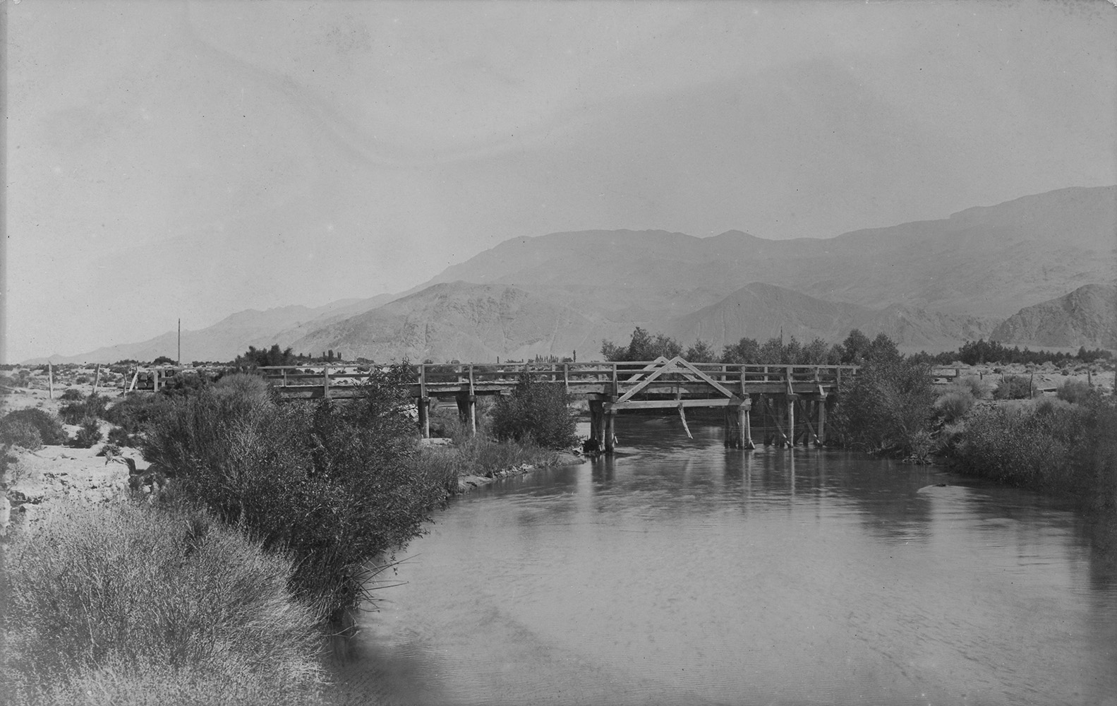
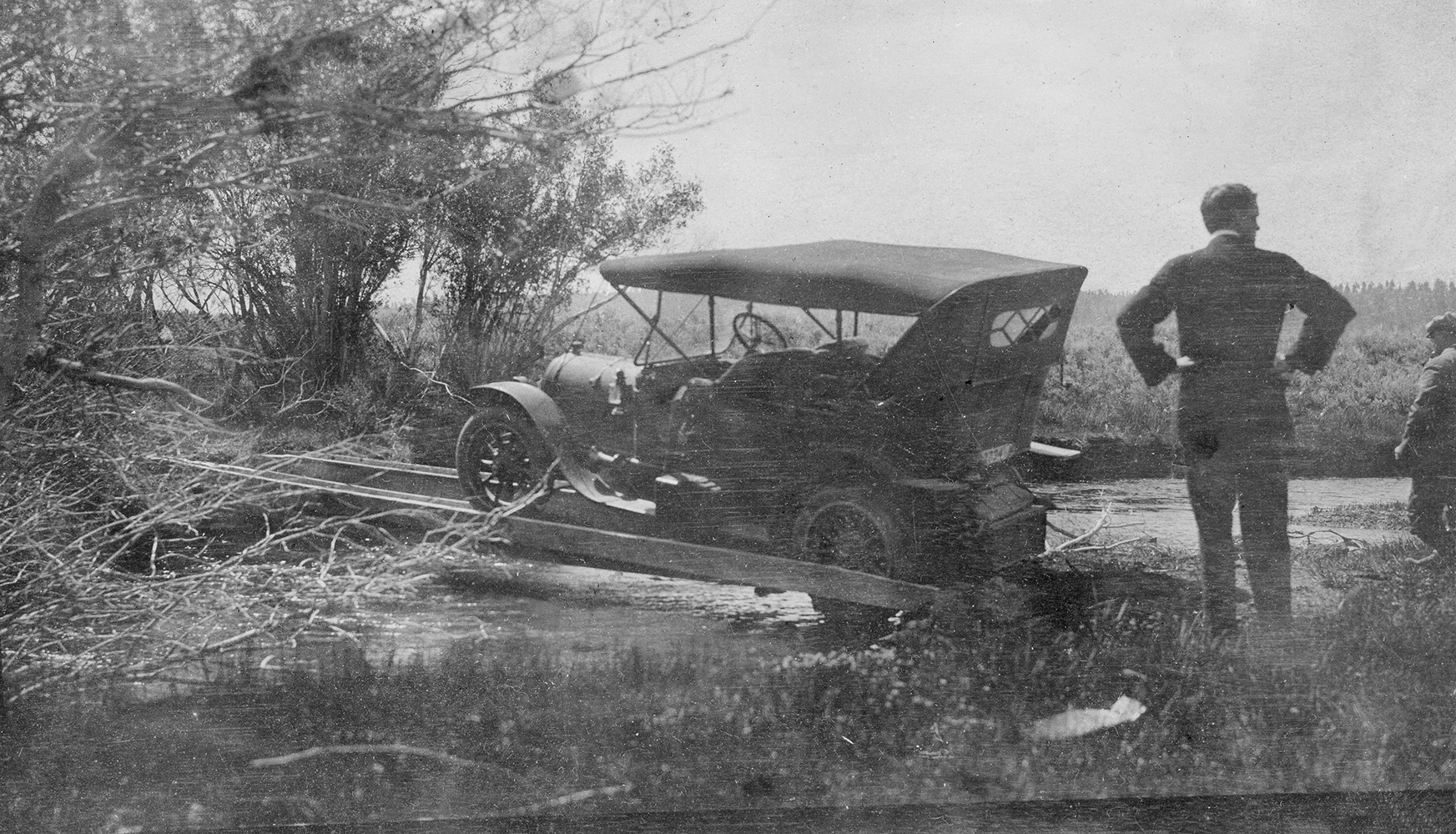 Attempting to cross the Owens River |
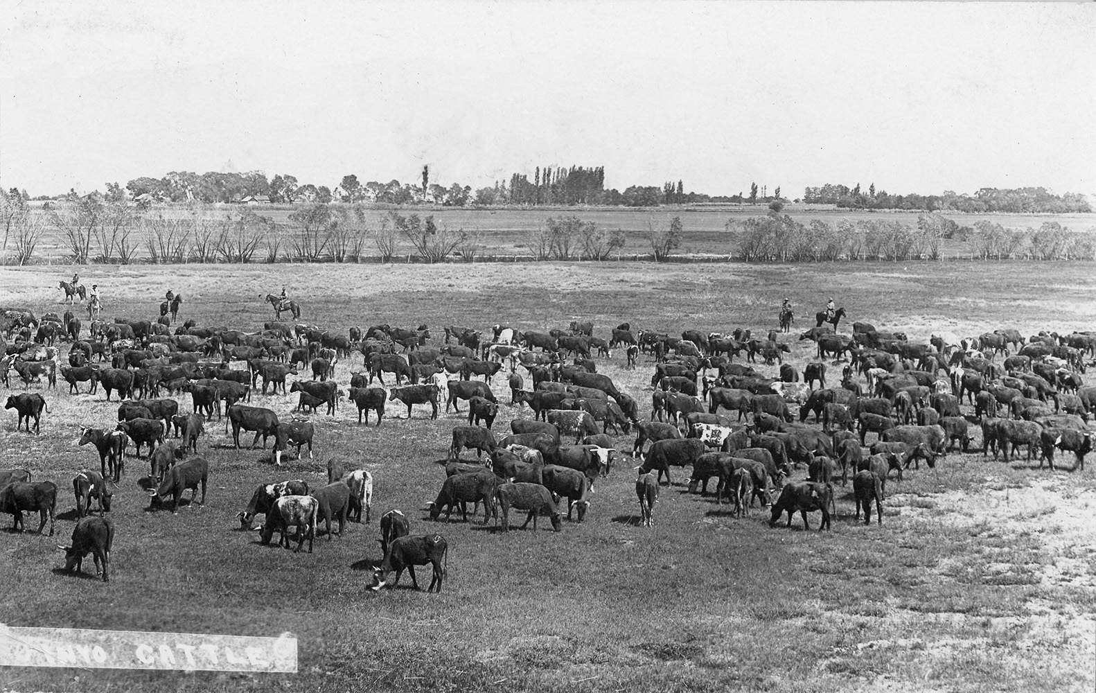 Owens River - Inyo Cattle |
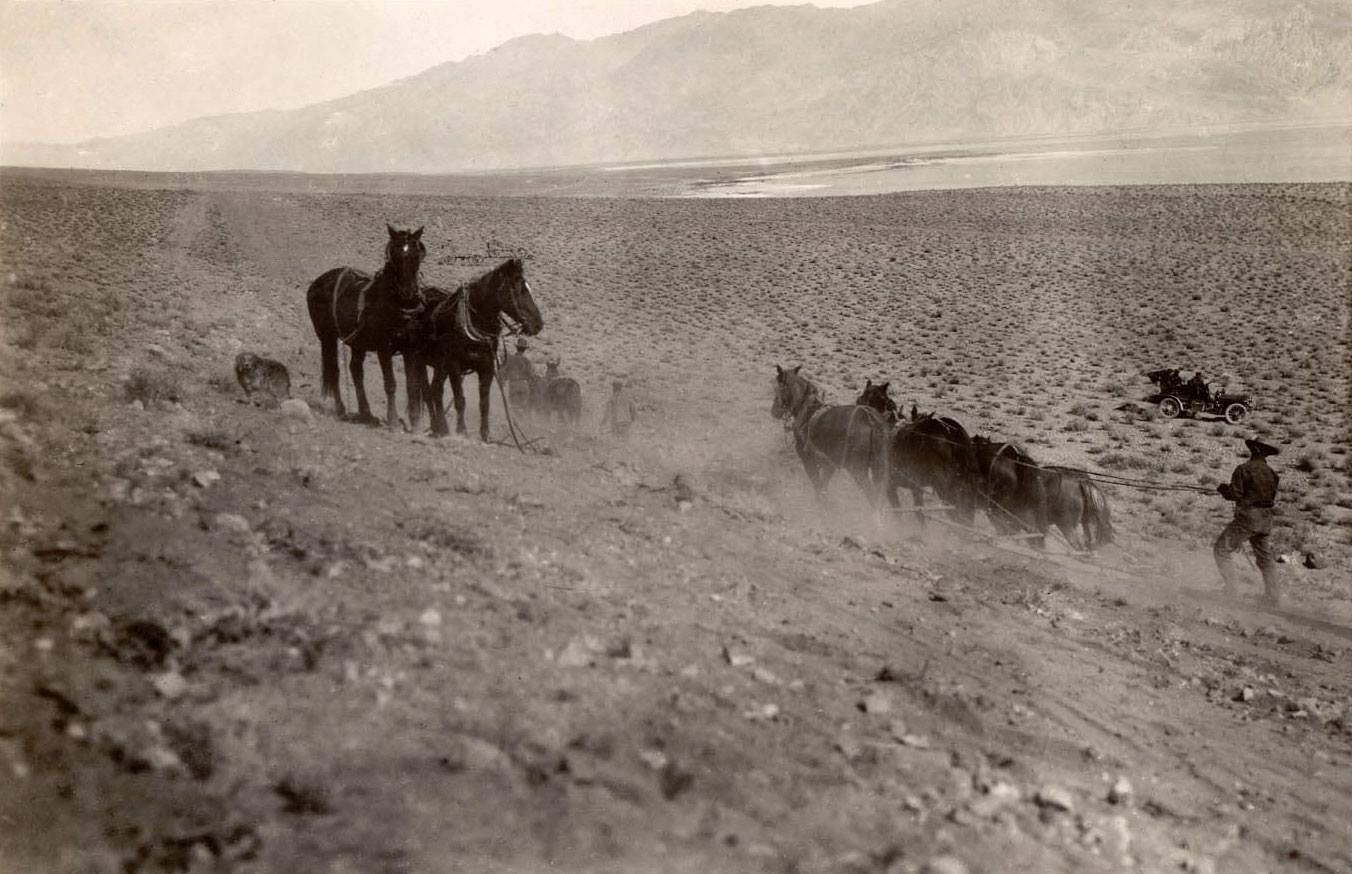
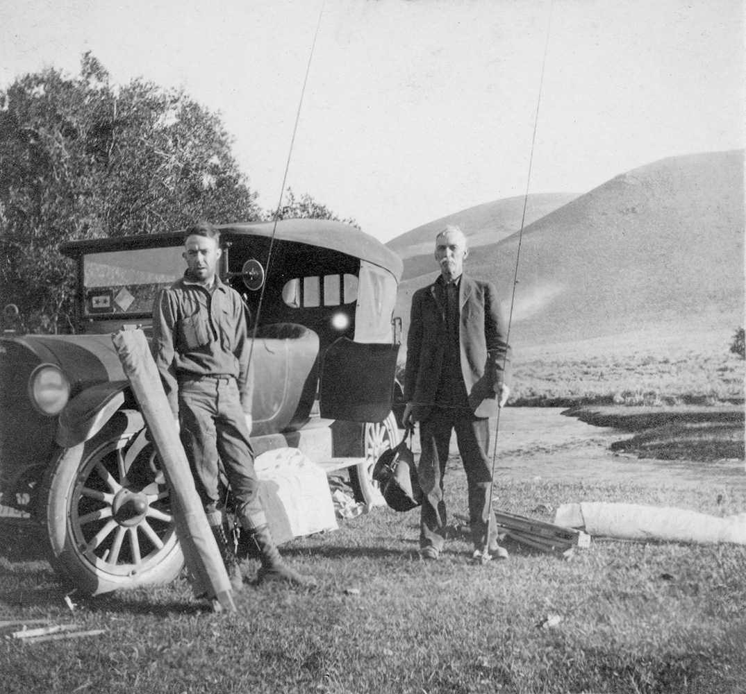
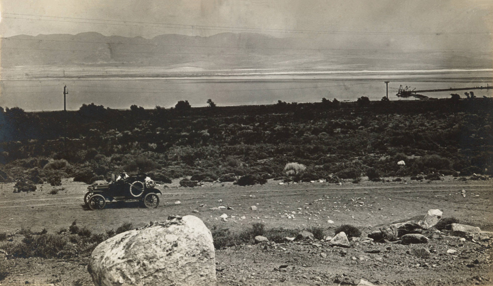
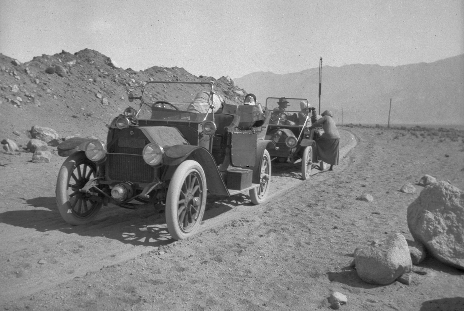
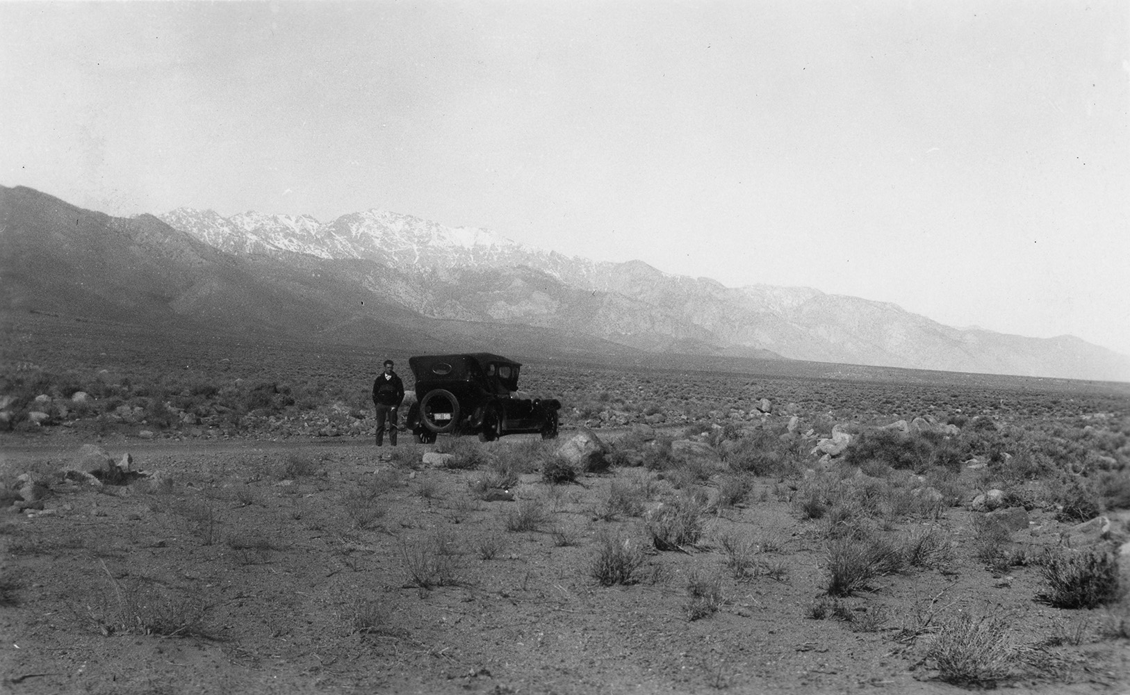 Motoring in Owens Valley before there was a paved road. |
(Courtesy Desert Magazine)
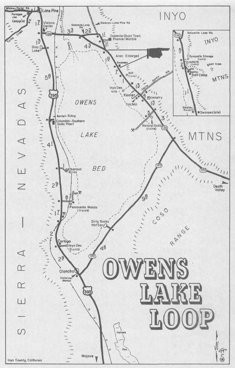
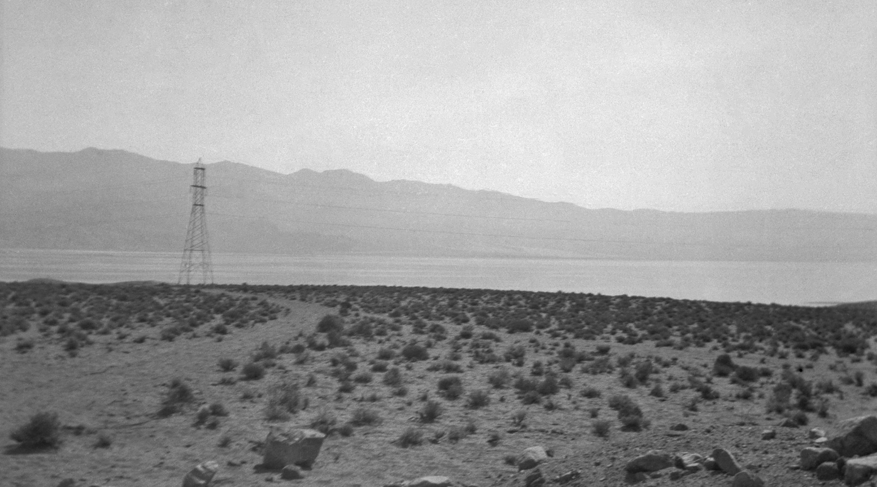
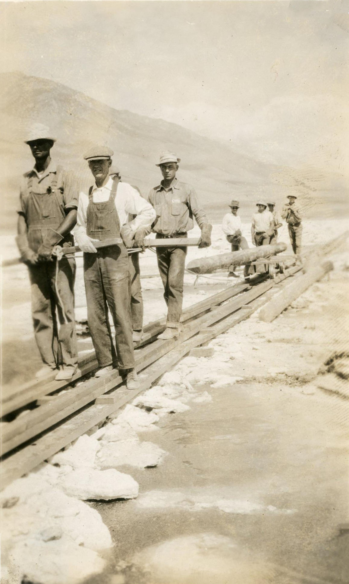 DWP workers erecting power lines across Owens Lake (Photo courtesy Inyo County Sesquicentennial) |
 DWP workers erecting power lines across Owens Lake (Photo courtesy Inyo County Sesquicentennial) |
 Inyo resident George Larry with some friends, taking his nice looking boat to Owens Lake for a day out on the water. (Photo courtesy of Tales Along El Camino Sierra) |
Vintage Map Courtesy of Hal Eaton |
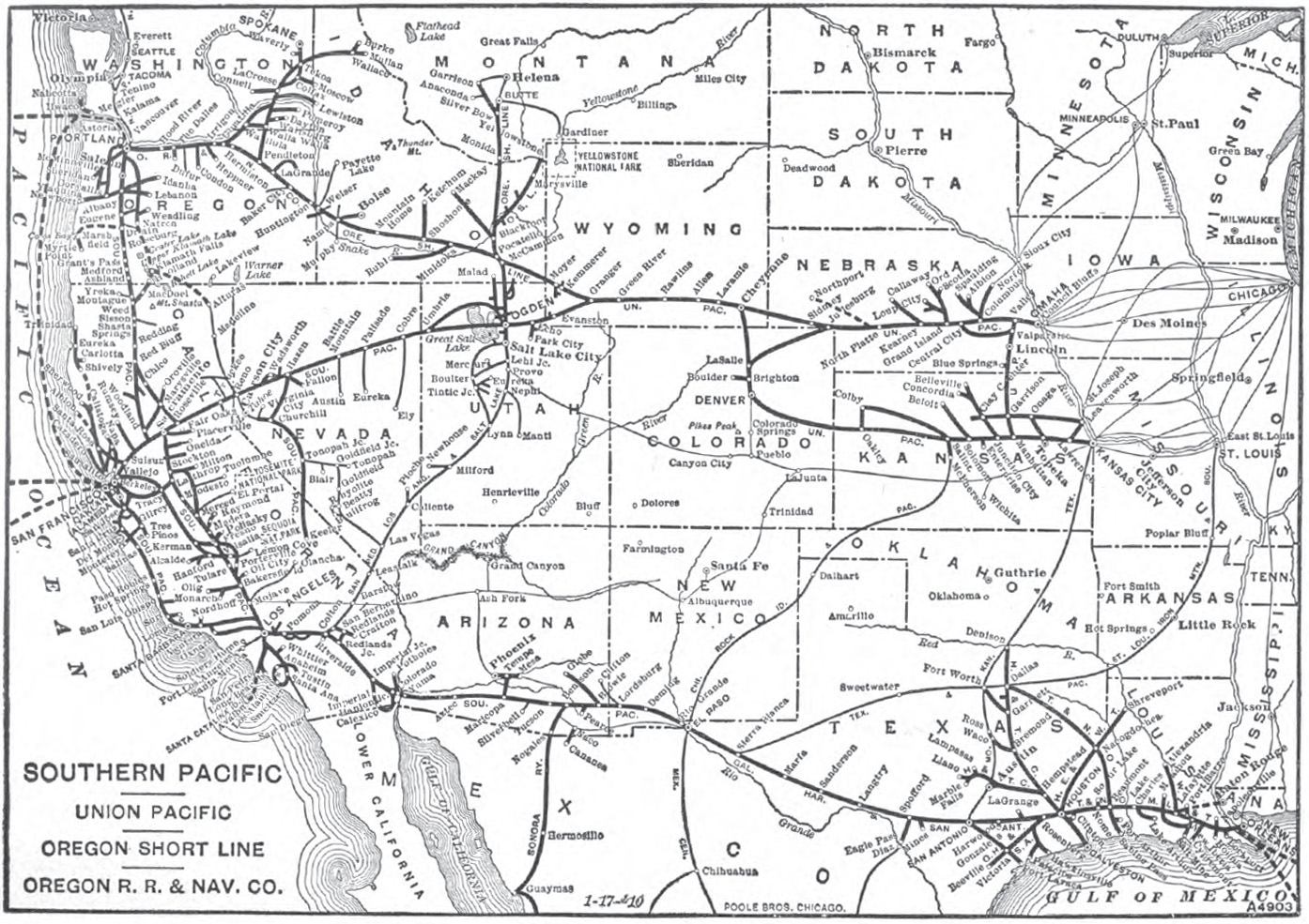
 Vintage 1910 railroad stops map - published by Sunset Magazine Homeseakers Bureau |
 Owens Lake - 1915 (Courtesy Calisphere - Report XV of the State Mineralogist, Mines and Mineral Resources of Portions of California, Inyo County: 1915-1916) |
Courtesy Calisphere (unless otherwise noted) |
|
 Owens Lake - 1969 |
|
 Owens Lake - unknown date: Photo taken from the Cottonwood Power House forebay (Photo courtesy of Charles H. Lee) |
|
 Owens Lake - unknown date: Photo taken from the Cottonwood Power House forebay (Photo courtesy of Charles H. Lee) |
|
Charles H. Lee photos of Owens Lake (Courtesy of the Online Archive of California) |
 |
 |
 |
 Owens Lake - circa 1926 (Photo courtesy of the California Department of Conservation / California Geological Survey) |
 Permanente Metals Alkali operations north of Cartago (Photo courtesy of Rick Olson) |
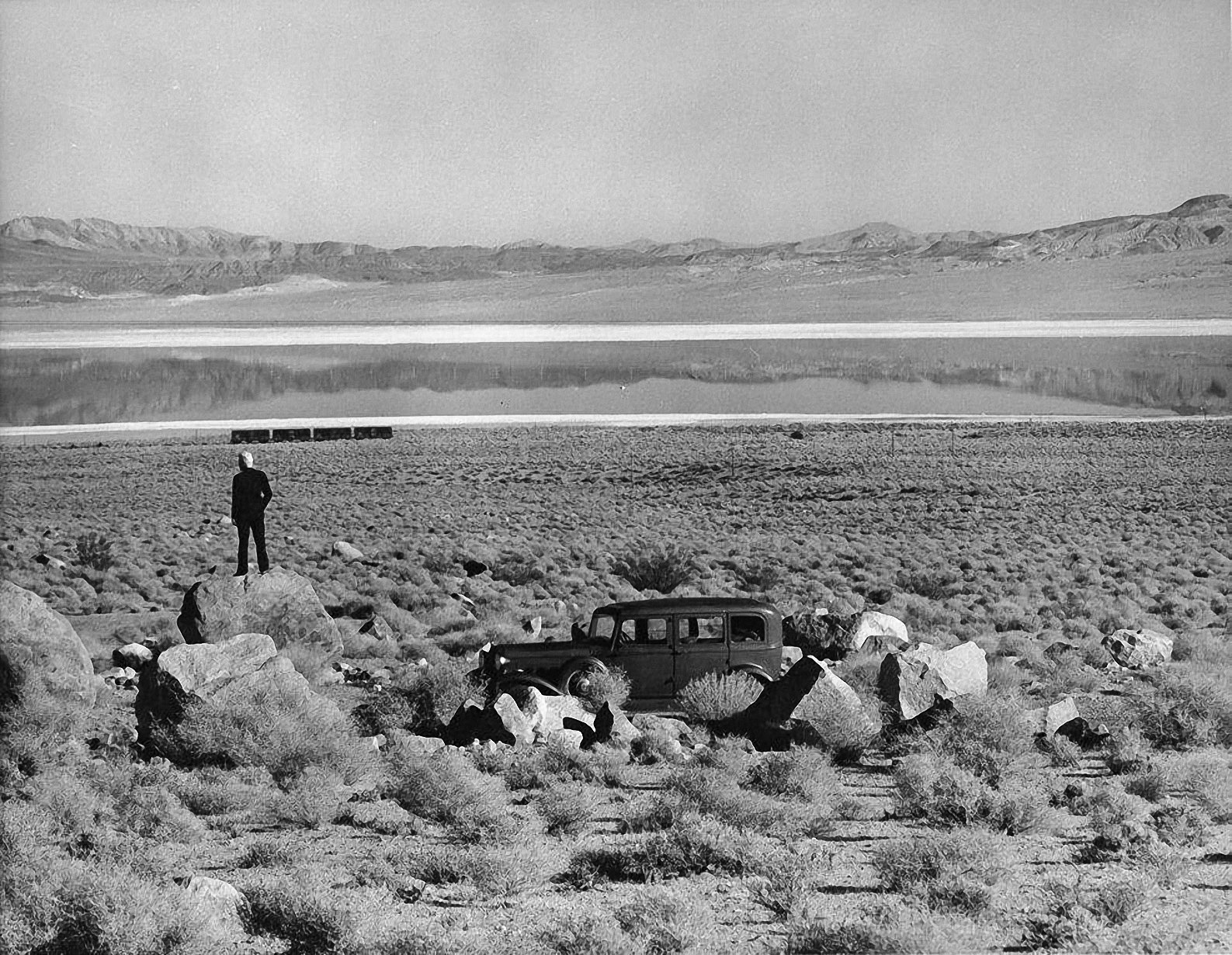
 Owens Lake - Circa 1917 Automobile trip taken by J. G. Oliver and W. H. Frick from Los Angeles to the Owens Valley. (Photo courtesy of the Huntington Digital Library) |
 Owens Lake (Photo courtesy of the Online Archive of California) |
Reconnaissance of the Borax Deposits of Death Valley and Mohave Desert - 1902
by Marius R. Campbell
Watterson Brothers, the Bankers of Owens Valley
(Article courtesy of Hal Eaton)
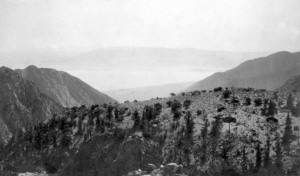
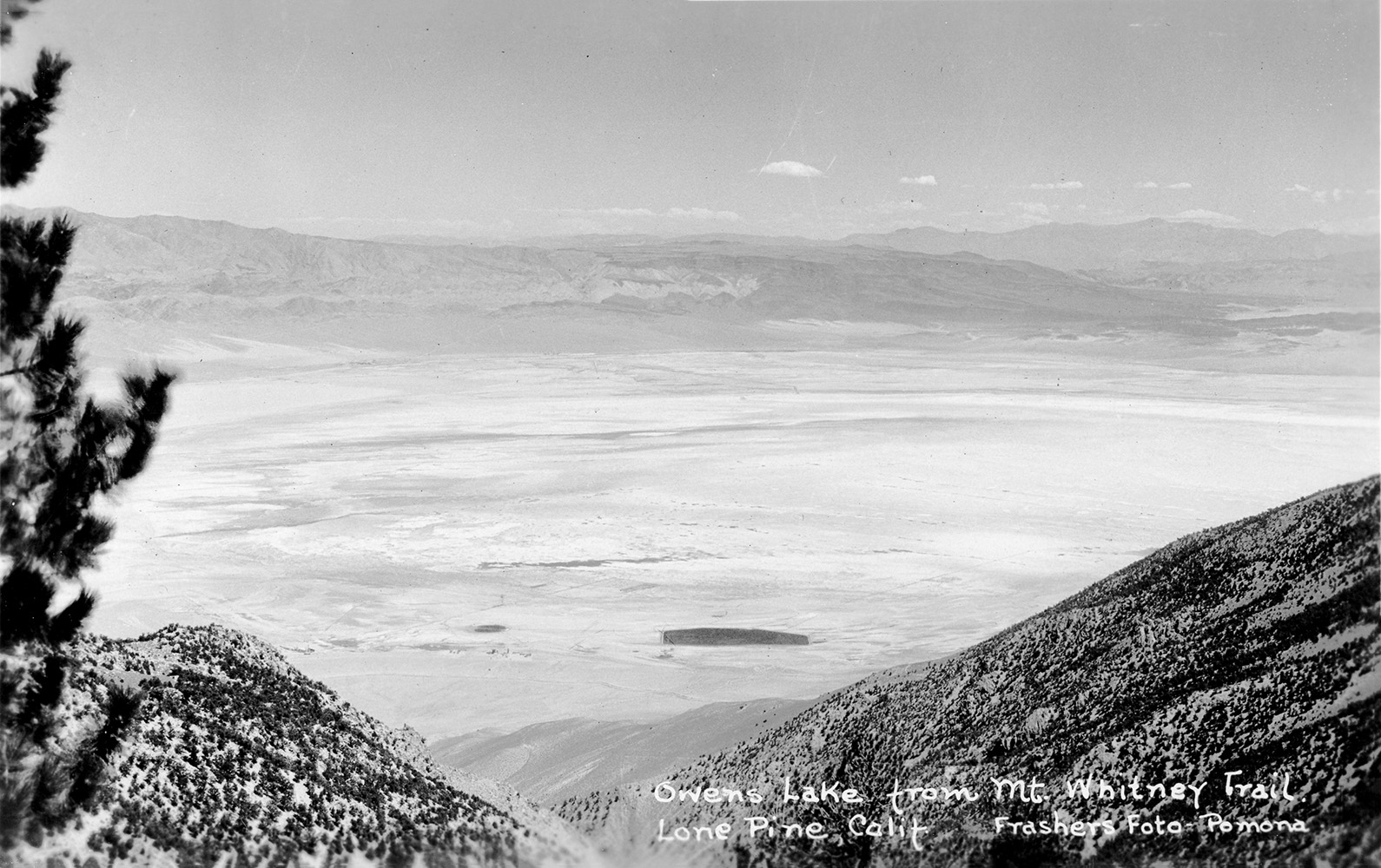
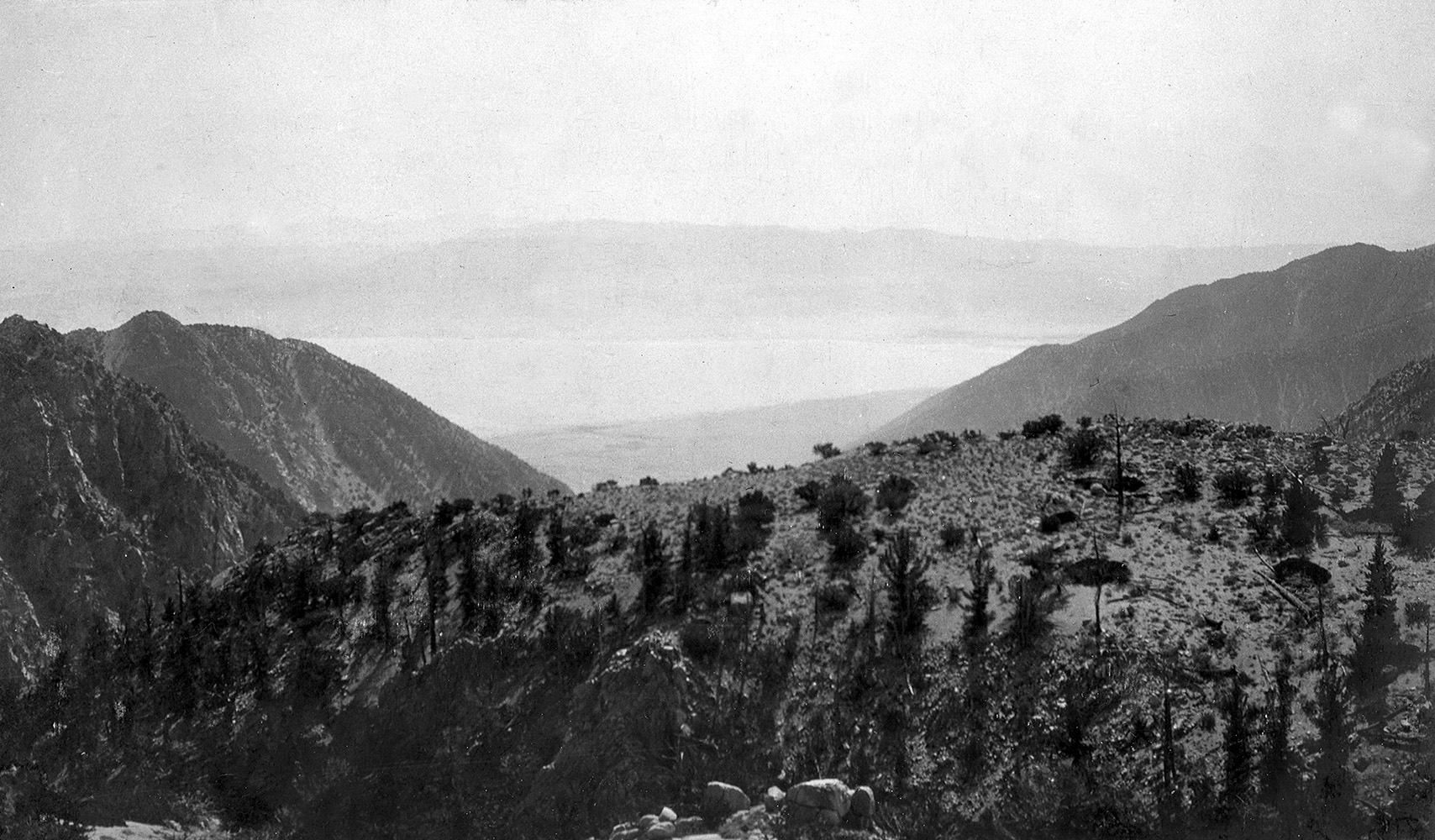
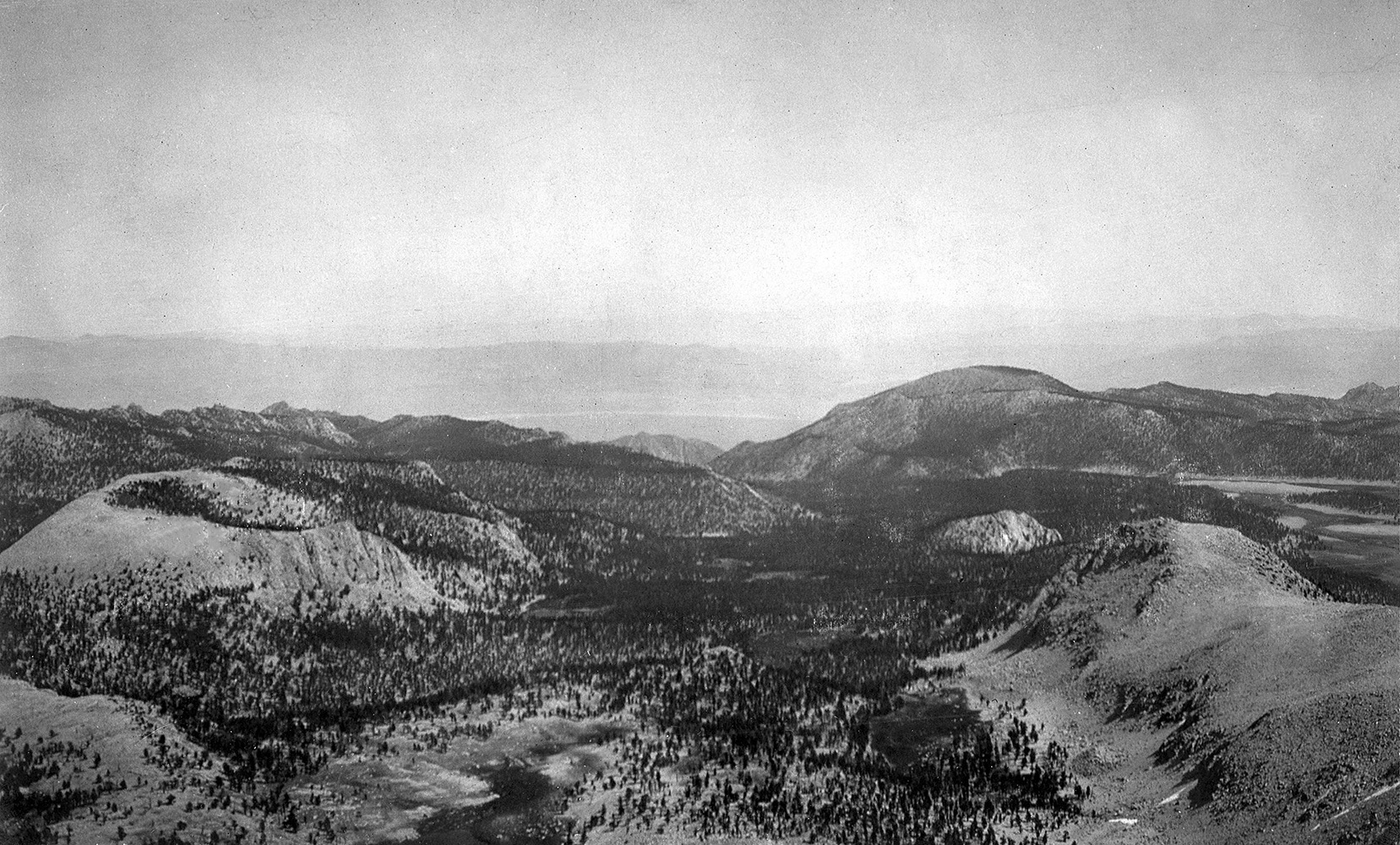 View of Owens Lake from Cirque Peak -1905 |
|
 View towards Owens Lake from the Cottonwood Canyon Trail -1905 |
|
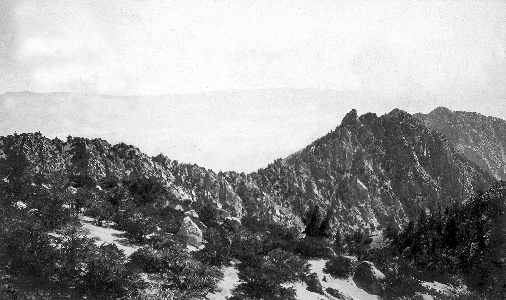 View towards Owens Lake from the Cottonwood Canyon Trail -1905 |
|
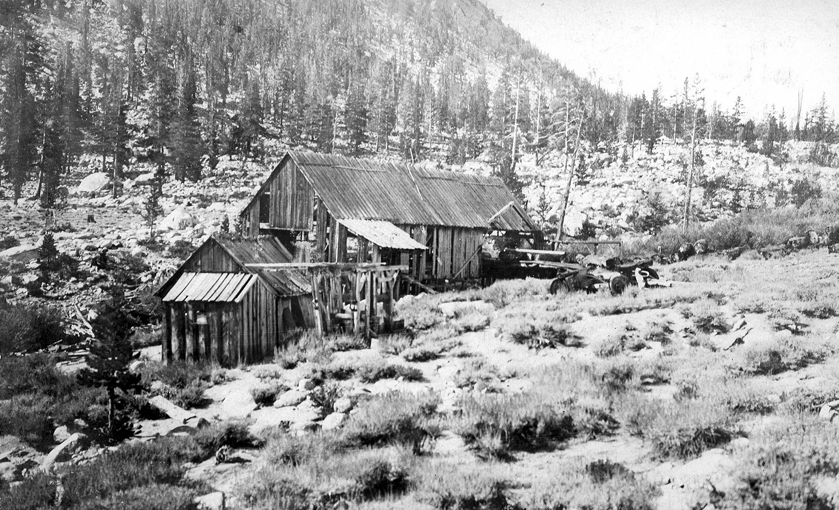 Colonel Sherman Stevens' Old Mill at lower end of Cottonwood Meadows, Sierra Nevada Mountains. Inyo Co., Calif. |
|
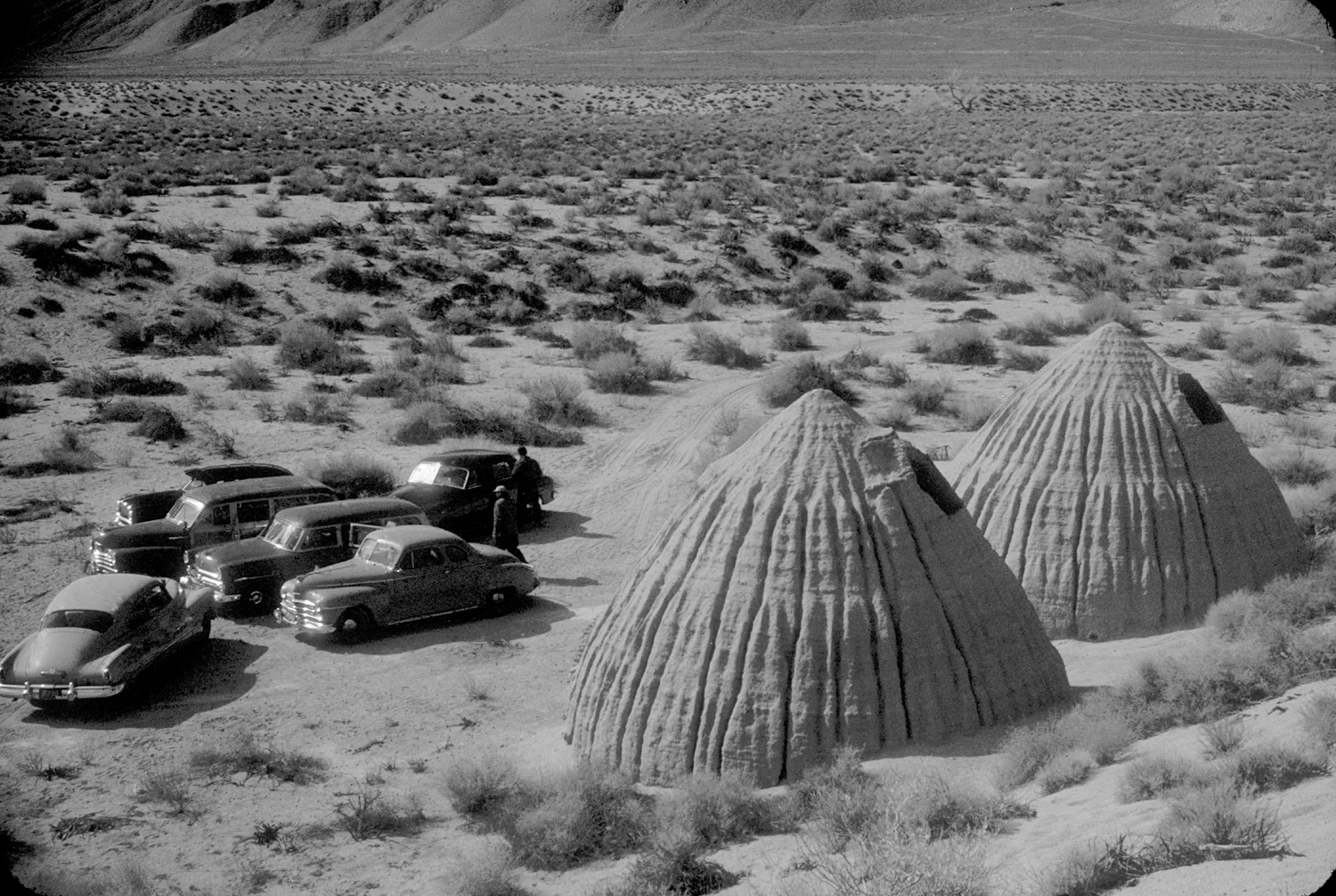
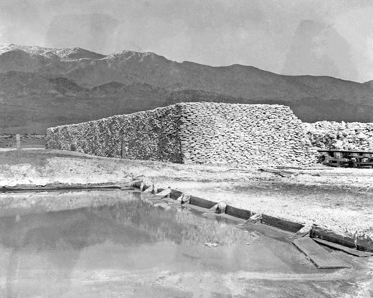 Crude sacks of soda at the National Soda Products facility about 1.5 miles south of Keeler - circa 1901 Hal Eaton writes: Neat thing about the 1902 USGS report is the map which shows the route the Marius Campbell (with his wife, Margaret Stevenson Campbell, along) took and how the photos follow in order. They went from Ballerat to Darwin through Shepherd's Canyon and then Keeler. So photo #230 is a great picture of his wagon in the tight canyon. #233 is "Soda works at Keeler at Owens Lake, California. Showing reservoirs into which the lake water is pumped and which it evaporates and leaves the soda crust. 1901." this photo is taken from elevated spot. 1951 USGS topographical map of the area |
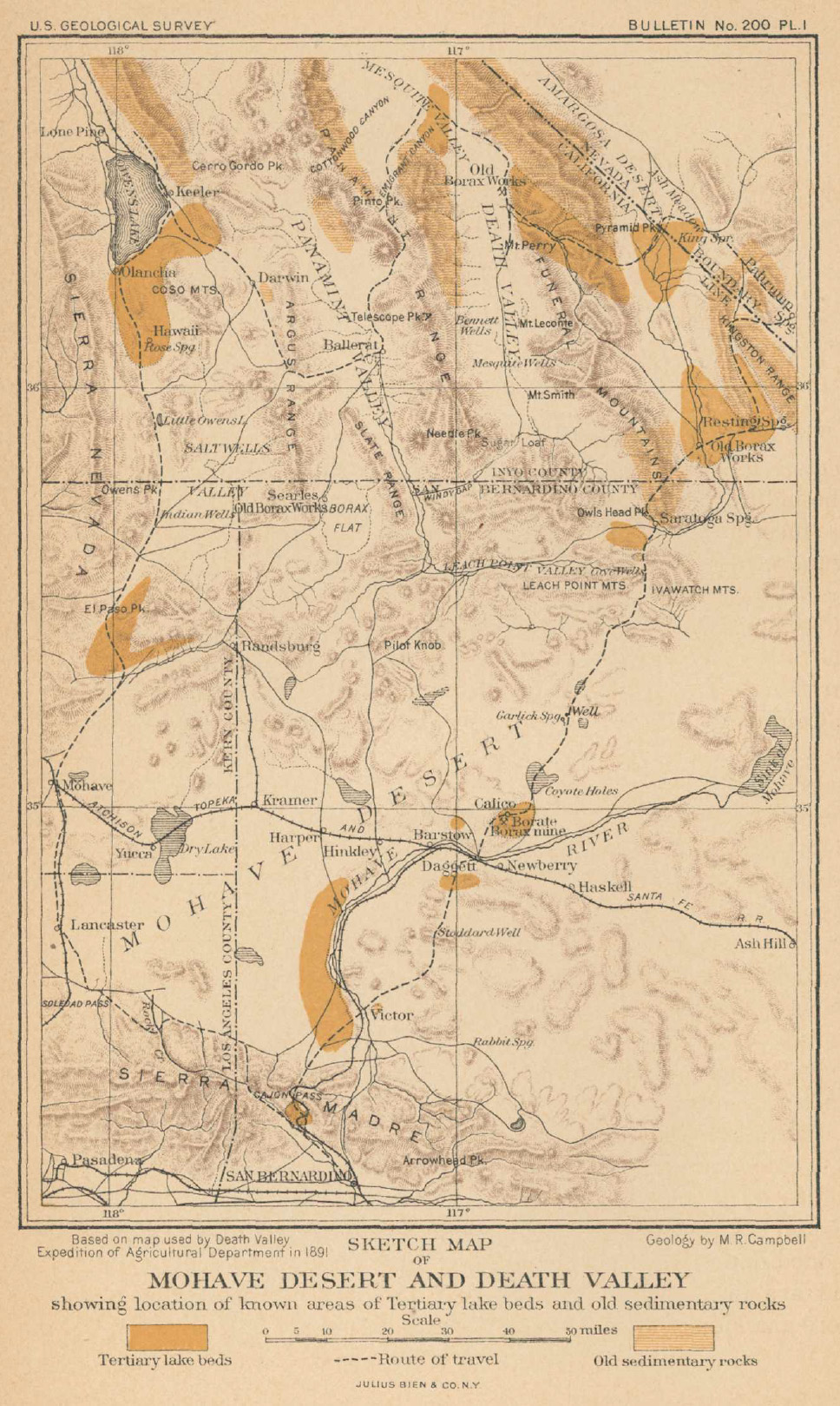 Marius Campbell U.S.G.S 1902 survey route. |
Courtesy Cecile Page Vargo and Roger W. Vargo (Photos from their 2012 book: Images of America - Cerro Gordo) |
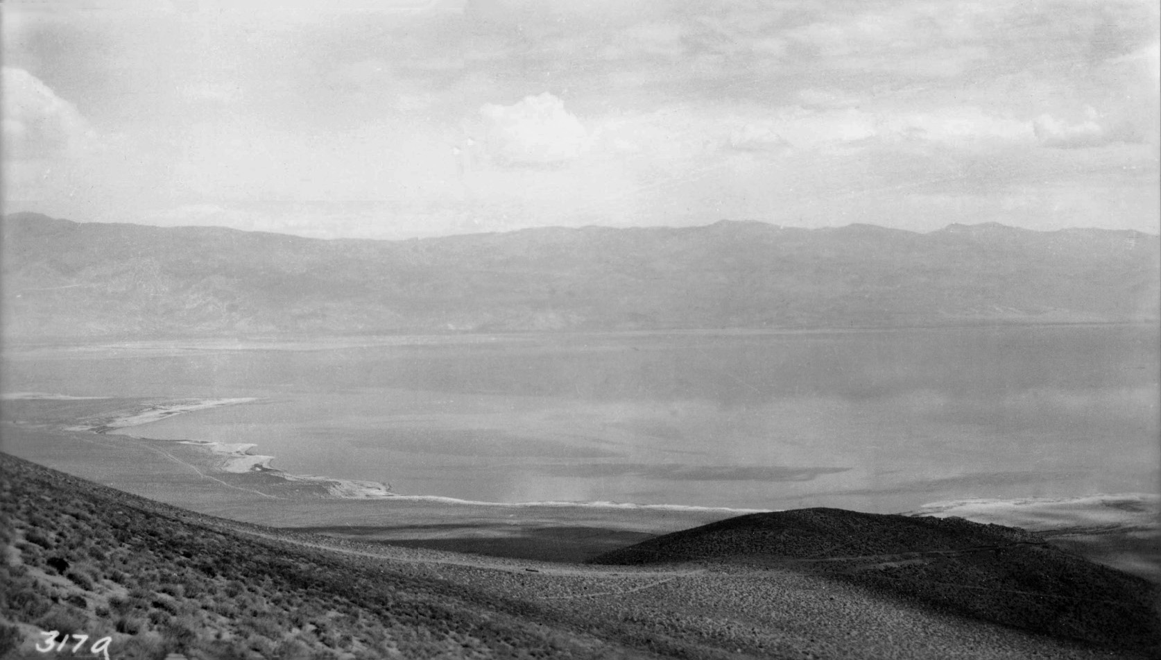
 Looking down on the large lake that once was Owens Lake from the snow covered hills of Cerro Gordo |
Owens Lake photos courtesy of UCLA Digital Library Collections Photos from the 1913 David F. Smith and Henry Hebard West Tour |
|
 Photograph of H.H. West's Buick and Dave F. Smith's EMF parked in tandem along the aqueduct road by Owens Lake |
 Owens Lake, viewed from the road |
Irrigation Map of Owens Valley - 1922
(Map courtesy of University of Wisconsin UWM Libraries)
Proceedings of the First International Soda Ash Conference: Volume I - 1998
by John R. Dyni and Richard W. Jones
 Bartlett (Photo courtesy of Larry Evans) |
 Bartlett (Photo courtesy of Jay Coberly) |
 Bartlett and revived Owens Lake - May 2023 (Photo courtesy of Kim Cash) |
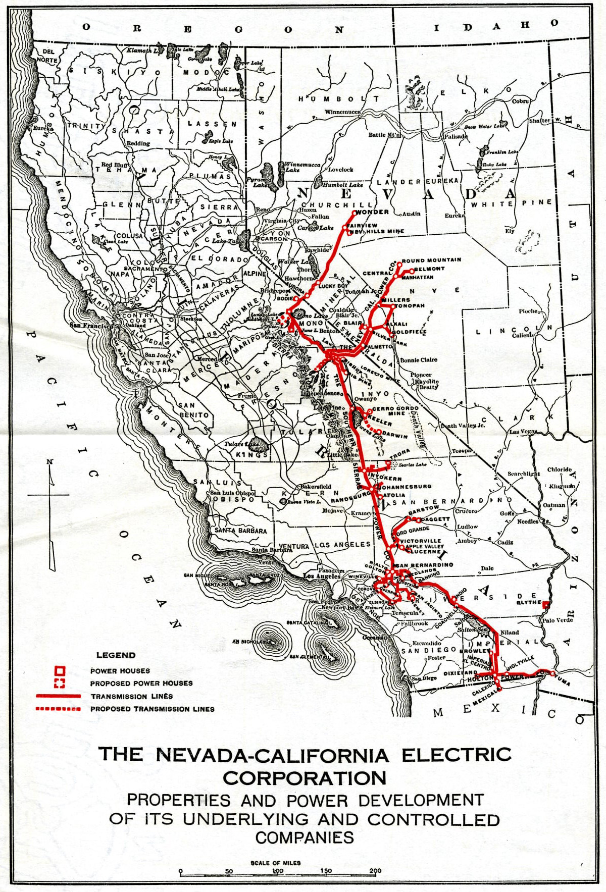 The Nevada-California Electric Corporation Map showing that most of the electricity for Eastern and Southern California at one time was being supplied solely by Owens Valley (Photo courtesy of Hal Eaton) |
Airports in Owens Valley History region circa 1929 from the Standard Oil LANDING FIELDS OF THE PACIFIC WEST (Photos courtesy of Hal Eaton) |
 |
 |
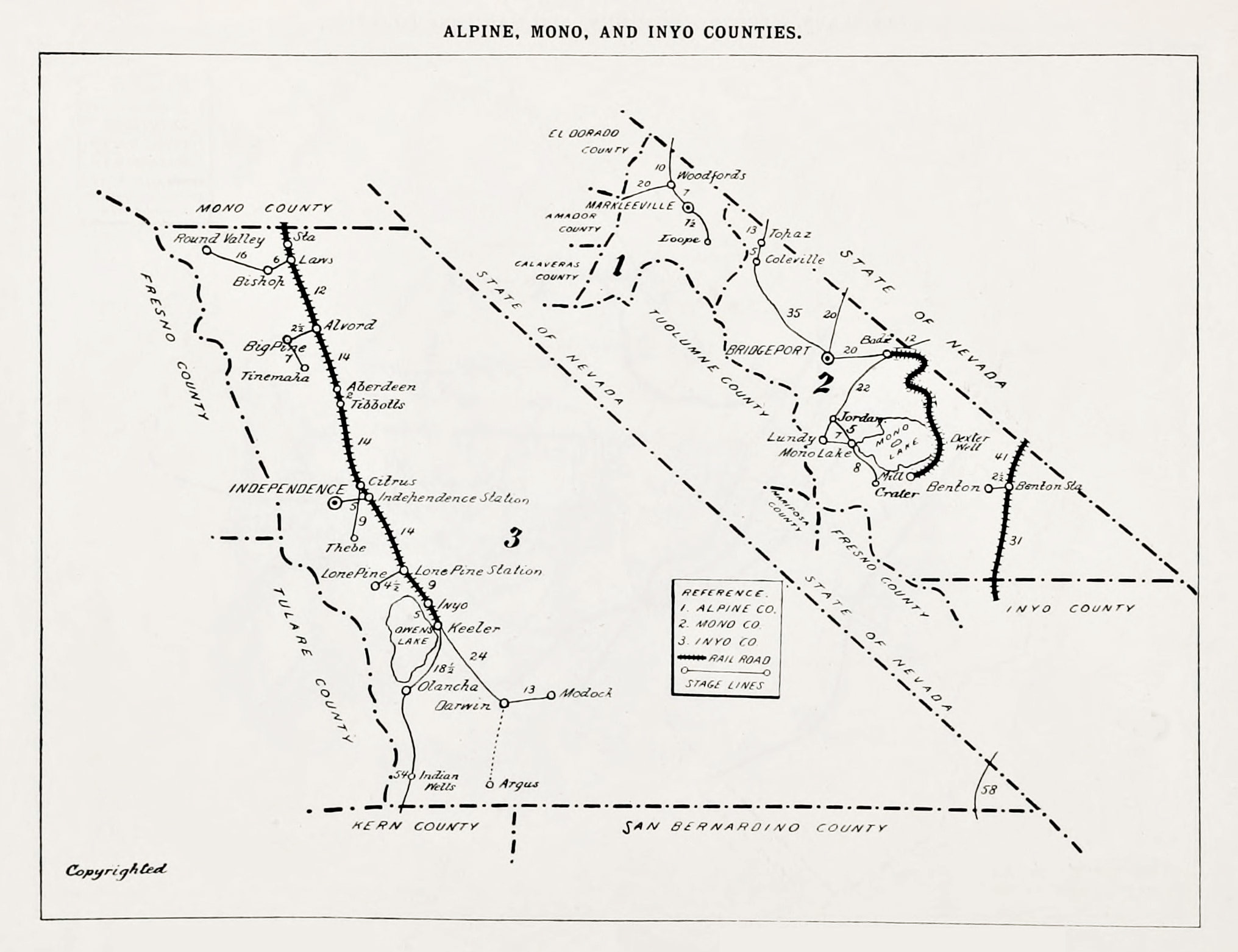 1903 Tri-Counties map from a California State Geology report showing the regular stage lines from the railroad stops to the major settlements. (Map and text courtesy Hal Eaton archives) |
 Southern Pacific Company map of California. (Map courtesy of the Yale Digital Archives) |
 Inyo County Map - 1939 - Printed by Chalfant Press (Photo courtesy of The Huntington Digital Library) (Henry J. Bruman Map Collection) |
 Sequoia/Inyo Map - 1940 - AAA Map Showing Eastern Sierra Nevada Pack Stations (Photo courtesy of The Huntington Digital Library) (Henry J. Bruman Map Collection) |
| Irene Kritz: Mt. Whitney Pack Trains Cook, Packer, Cowgirl, and Author | ||
The Album: Times & Tales of Inyo - Mono |
||
| Coso Hot Springs & Coso Junction | ||
Near Owens Valley |
||
Bishop Mule Days |
||
Lone Pine Stampede |
Sign Guestbook View Old Guest Book Entries Oct 1999 - Feb 2015 (MS Word) |
 CONTACT the Pigmy Packer |
View Guestbook View Old Guest Book Entries Oct 1999 - Feb 2015 (PDF) |