Carson & Colorado Engine #18 Restoration |
Independence, CA |
|
See USE NOTICE on Home Page. |
 |
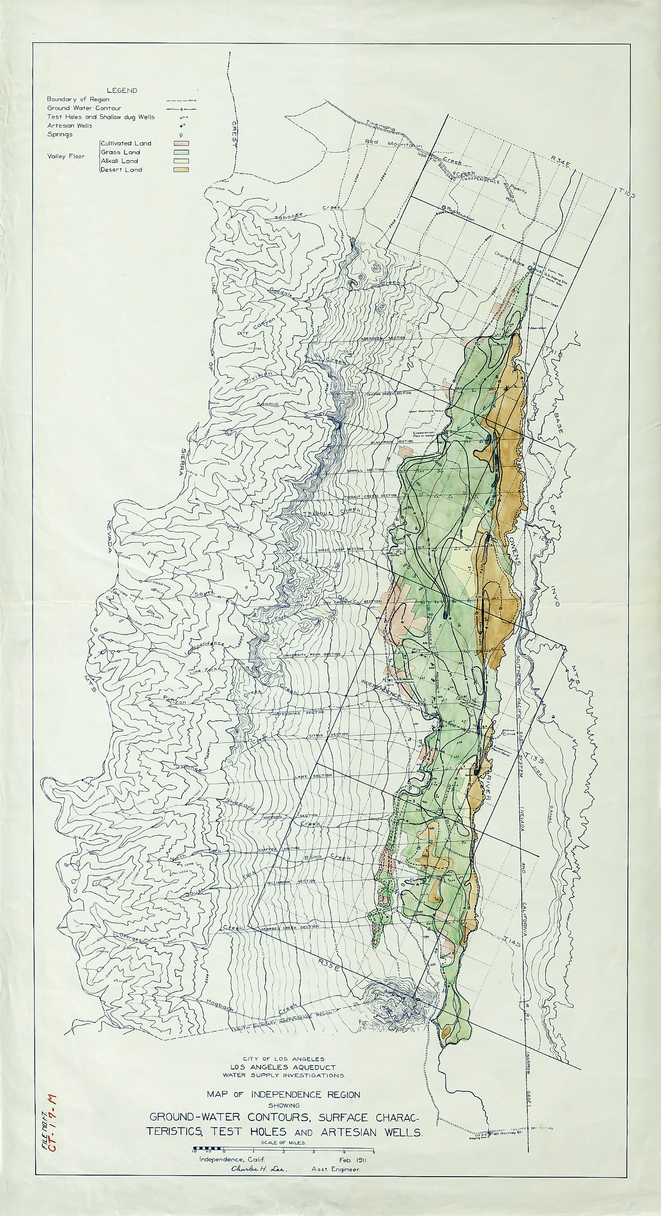
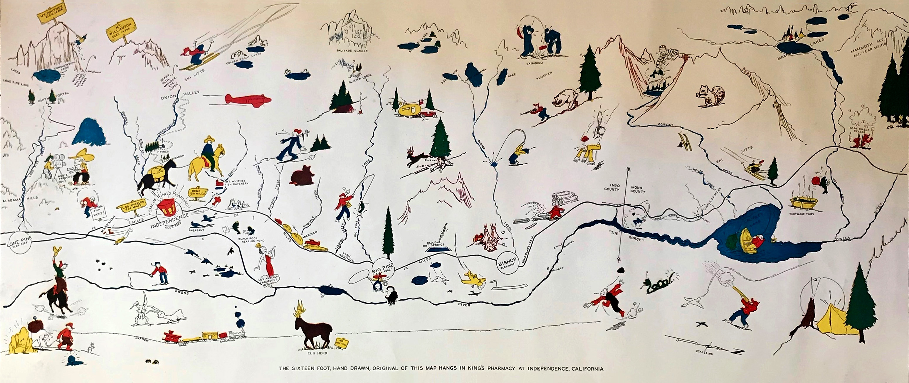 Map of Owens Valley that hangs in Kings Pharmacy in Independence, CA [Contributor - unknown] |
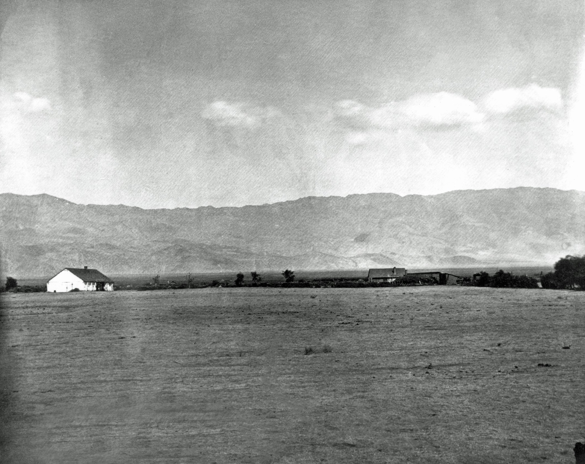
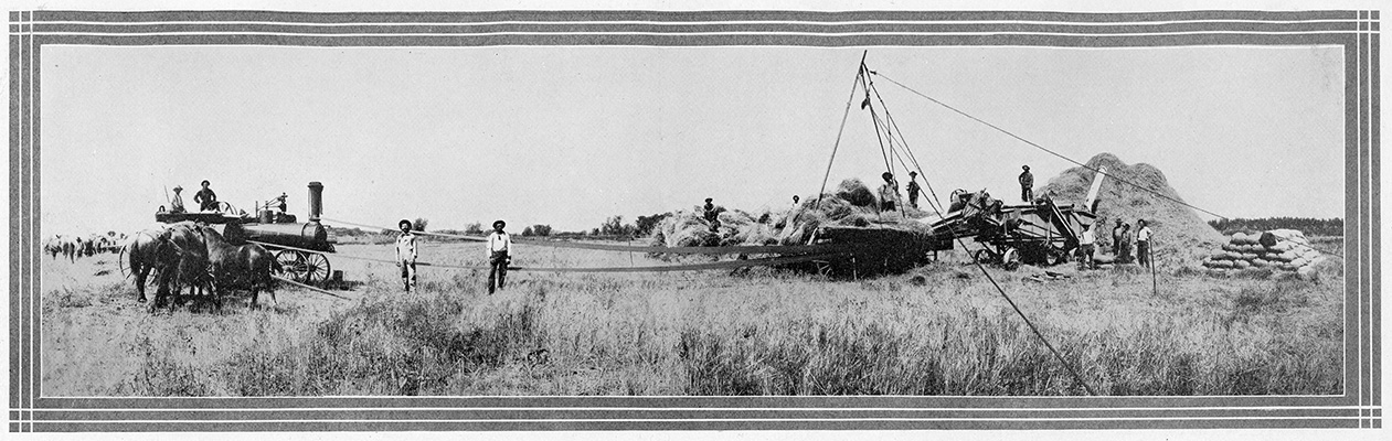 Threshing grain near Independence
|
||
 Thomas Edwards came to Owens Valley in 1863. He purchased the Putnam property and built a home. He laid out a town site eight blocks long and six blocks wide, naming the streets and alleys as this part of Independence is today. |
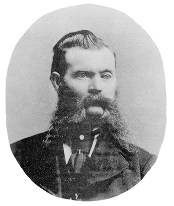
 T.F.A. Connelly Connelly was an original member of both the "George" and the "Darwin French" parties. He came to the area in 1860 and help form the "Russ Mining District" April, 20, 1860. It was in this District that new towns were established. |
|
 Independence in 1873 |
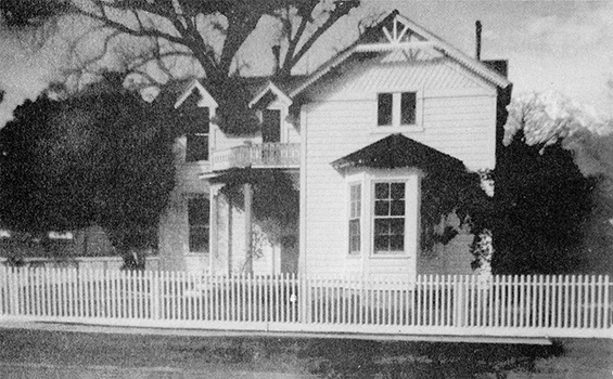 The Commander's House This house was built at the military post, Camp Independence, in 1872. The house was eventually sold to V. G. Thompson and moved to its present site in Independence. |
|
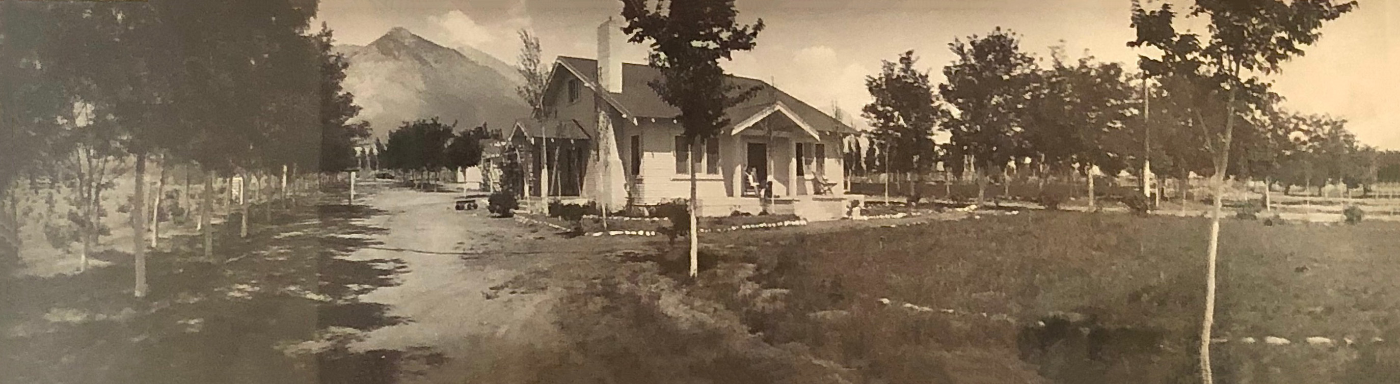 A panoramic photo of the 8 Mile Guest Ranch, Main House, taken in 1930 by the Frasher Foto Co. from Pomona, CA. My Grandmother and my Dad are on the front porch. [Photo and text courtesy of Linda Colton] |
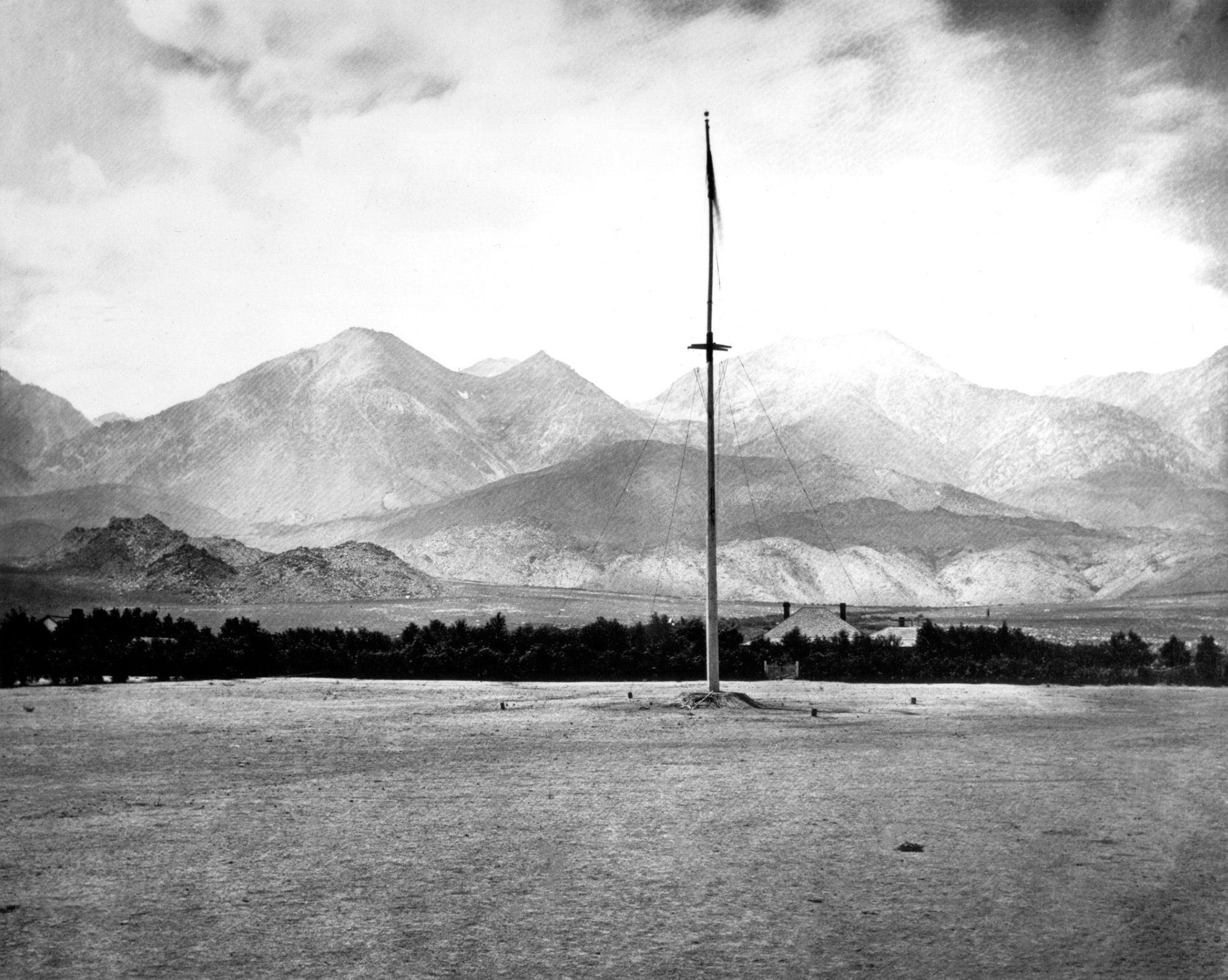
 Independence circa 1906 [Lippencott Collection - FID4] |
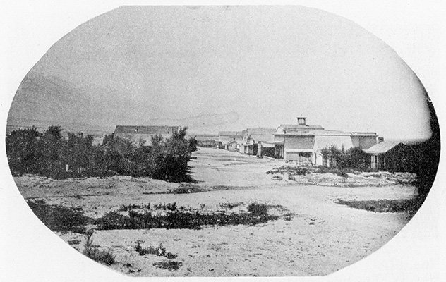
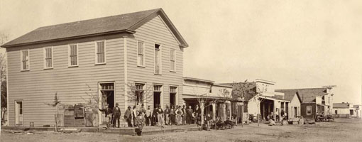 Downtown Independence, California circa 1865 [Eastern California Museum] |
The Beloved House
by Katharine Krater
|
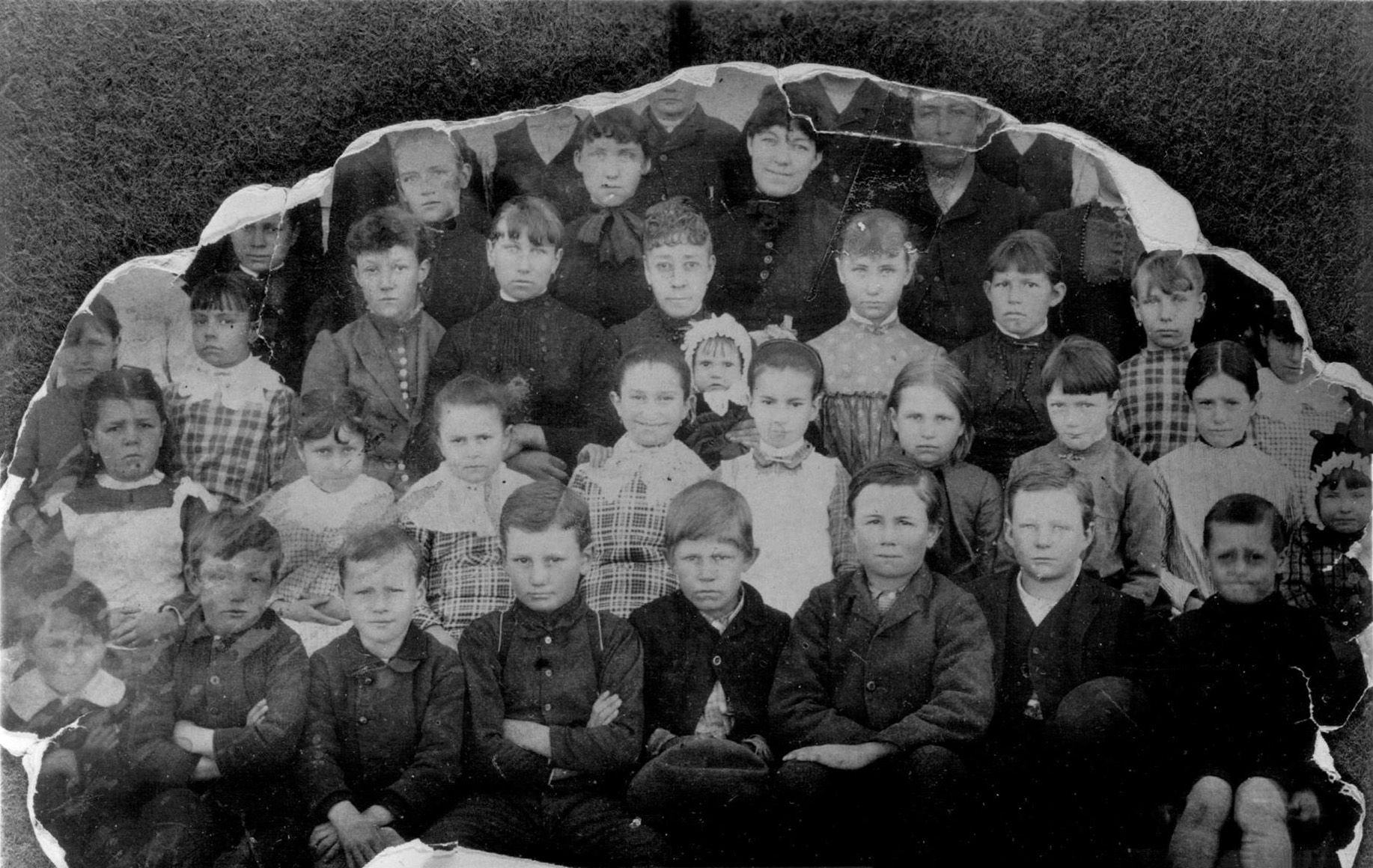
[Unfortunately, there are some people pictured here whose names did not appear on the list.] L/R (Back Row): Alice Zink, Mary Mulholland, Alice Rose Hodge, Sara James Meroney, Frank Schere L/R (2nd Row from Back): Edna Matlock Krater, Effie Roeper Lunt, Pary Parker, Nellie Roeper Fausel, Miss Barnes (Teacher) - Rita Church on her lap, Clara Willett Free, Carrie Gregg Crocker, Rose Roeper Mairs L/R (2nd Row from Front): Elsie Gill, Minnie Levy Mairs, Jeanette Wood Naylor, Etta Wood, Jennie Baxter Harper, Emily Conklin, Lizzie Thompson Bunny, Irma Webb L/R (Front Row): Joe Levy, Rollin Laird, Pete Mairs, Julian Eibeshutz, Steve Gregg, Arthur Robinson, Paul Mairs |
| Mary Ann Mairs writes: The house George Naylor owned was on the NW corner of Jackson and Main. My dad was born in that house. My grandfather was born in a house on the SE corner of Main and Washington. My nephew has the photo and wants to leave it with the broken glass etc. When it was too hot in the valley, the townsfolk would camp in the Sierra for a week or two. First stop, Gray's Meadow, then Onion Valley and my grandparent's camp was in Vidette Meadows. When I was young I remember these camps. There were cut logs for chairs, maybe a cabinet hanging on a tree, some even had little wood stove. My dad's favorite was Rae Lakes. He would take the Dodgers to Rae Lakes. In those days, a guide wasn't required. He would rent horses and mules from the pack station. My grandmother named Flower Lake December 2021 |
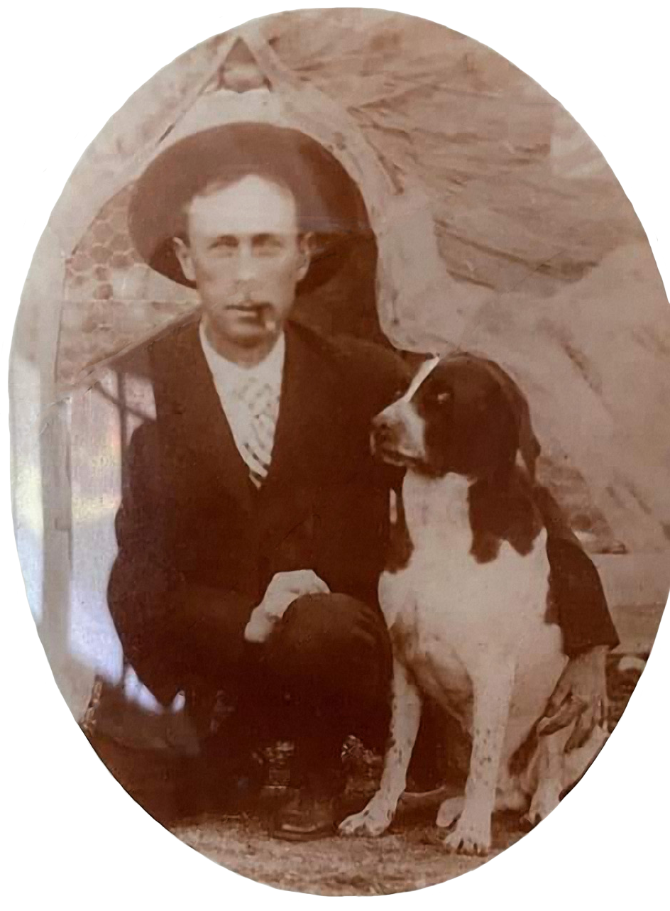 George Naylor - Supervisor of Inyo County for almost 30 years. Geroge was my great uncle. My Dad was so fond of him that he named my brother after him. (Photo courtesy of Mary Ann Mairs) |
 |
 Locomotive now in an Independence, CA. park. |
 |
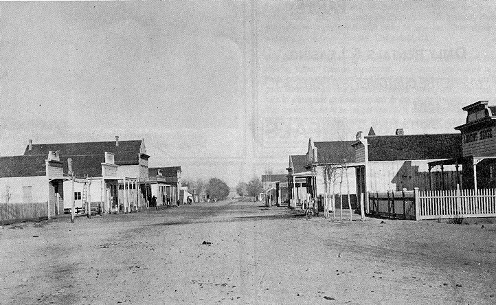 Downtown Independence, California circa 1888 |

 Independence 1910s |
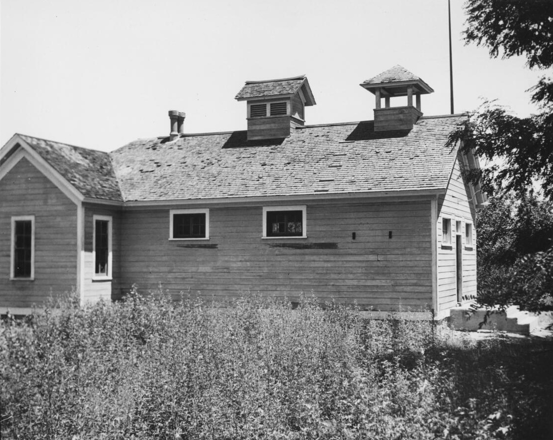 "This was one of the buildings of Fort Independence barracks for United States soldiers from 1865-1877. This building was later remodeled into a school. Part of the soldiers parade ground, now covered with weeds is seen in the foreground". - circa 1900 (Photo courtesy of USC Libraries Special Collections) |
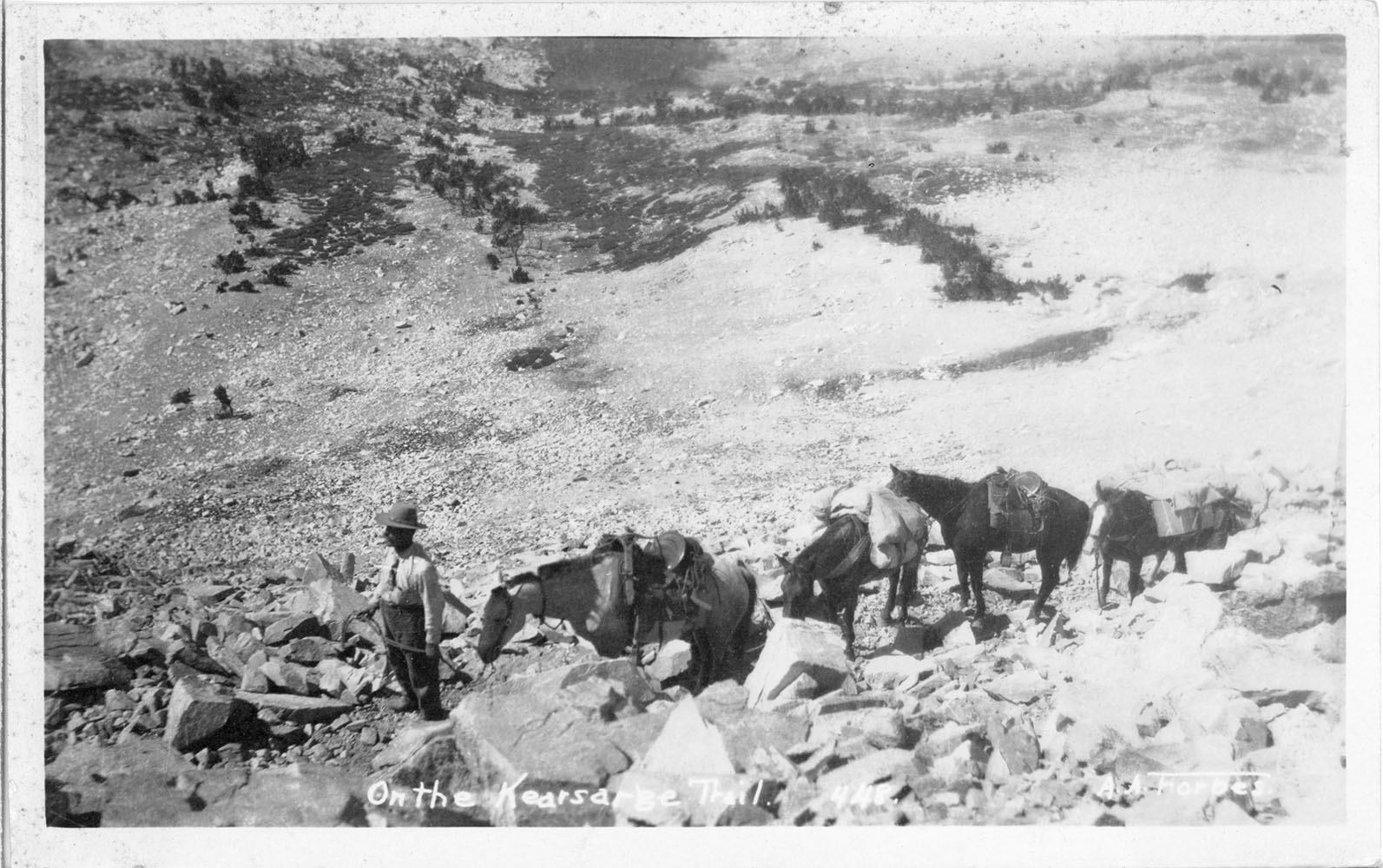 On the Kearsarge Pass Trail |
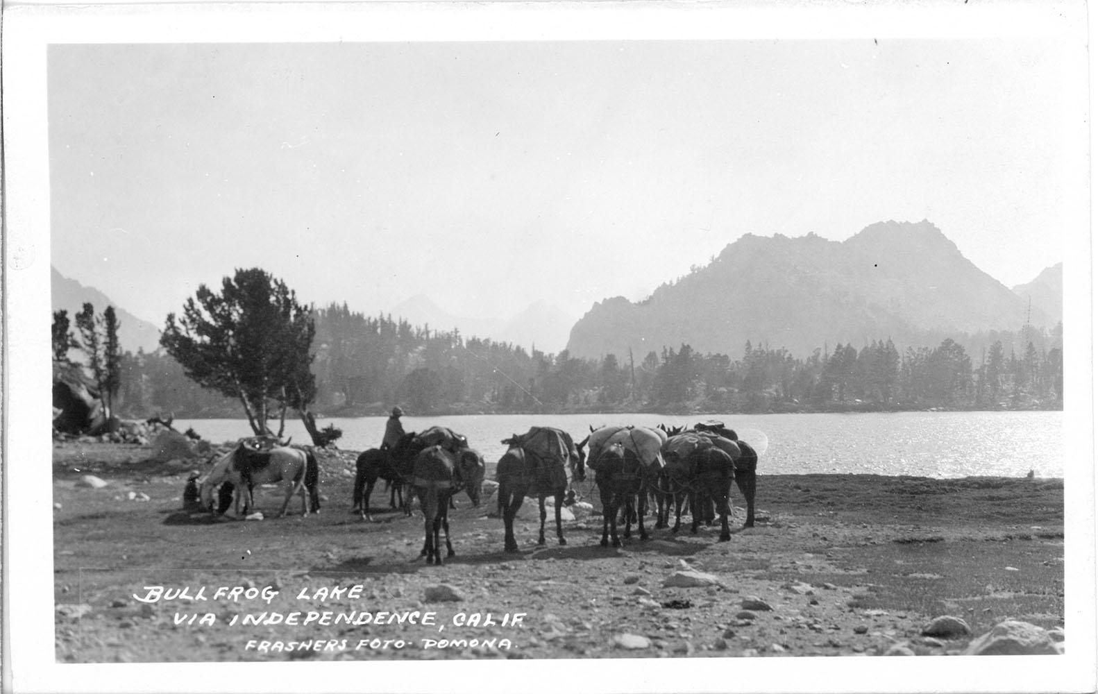 Bullfrog Lake on the western side of Kearsarge Pass |
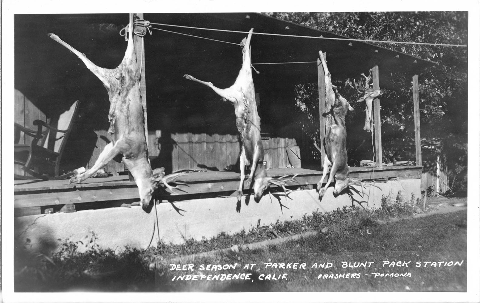 Parker & Blunt Pack Station - Independence, CA |
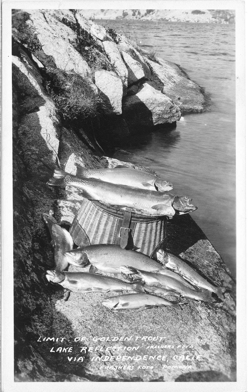 Golden Trout from Lake Reflection |
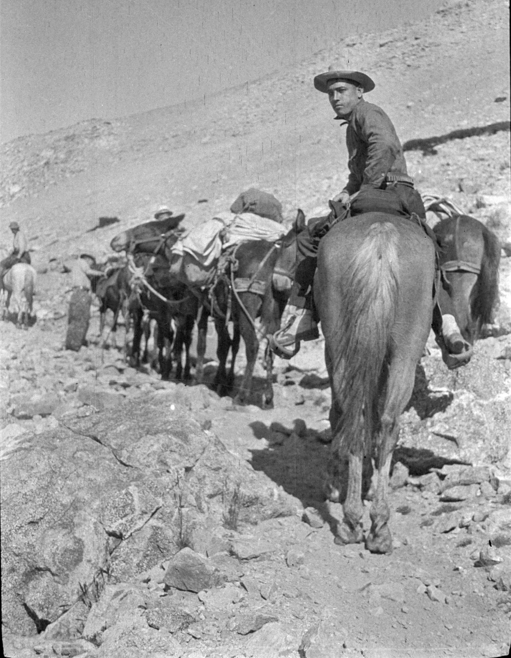
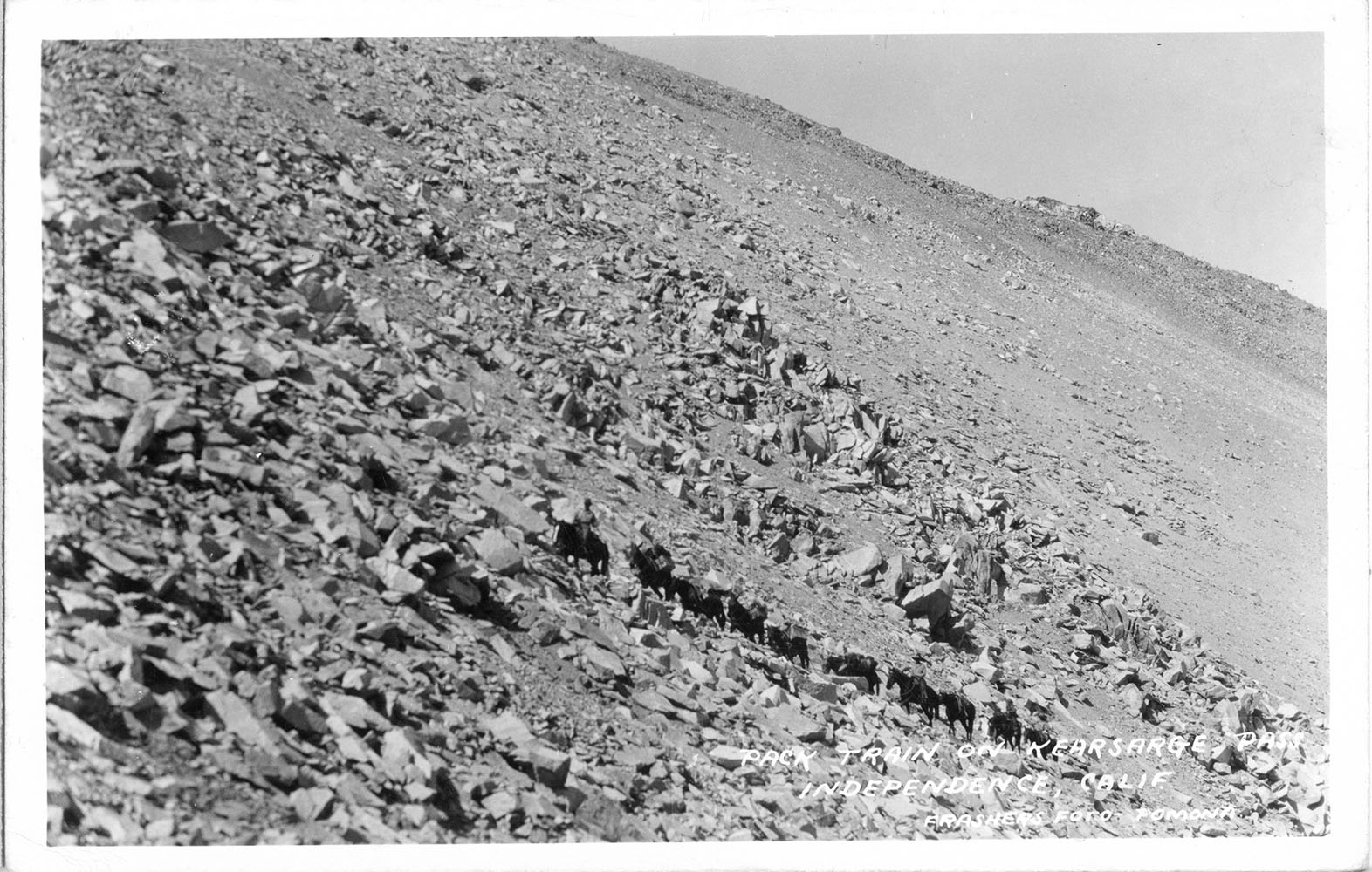 Pack Train heading up Kearsarge Pass |
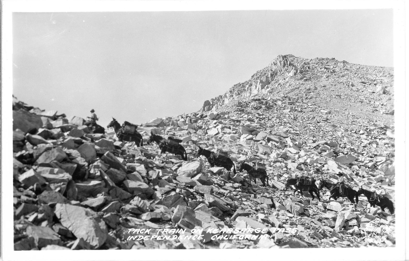 Pack Train heading up Kearsarge Pass |
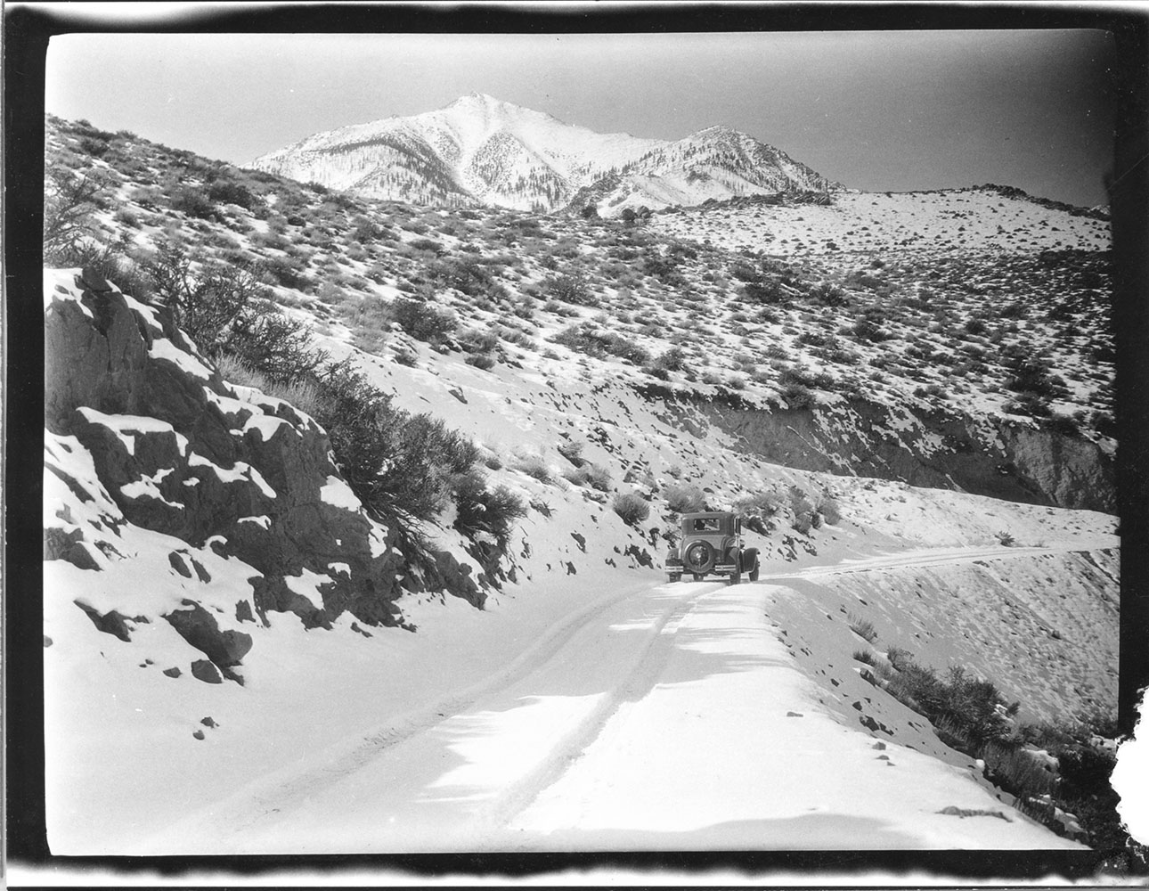
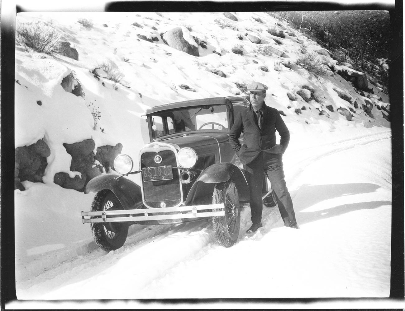 Snow covered Onion Valley Road Owens Valley - 1931 |
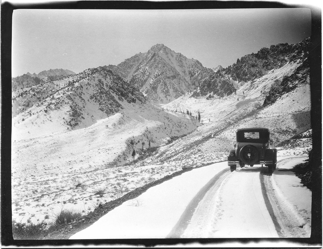 Snow covered Onion Valley Road Owens Valley - 1931 University Peak in the background. |
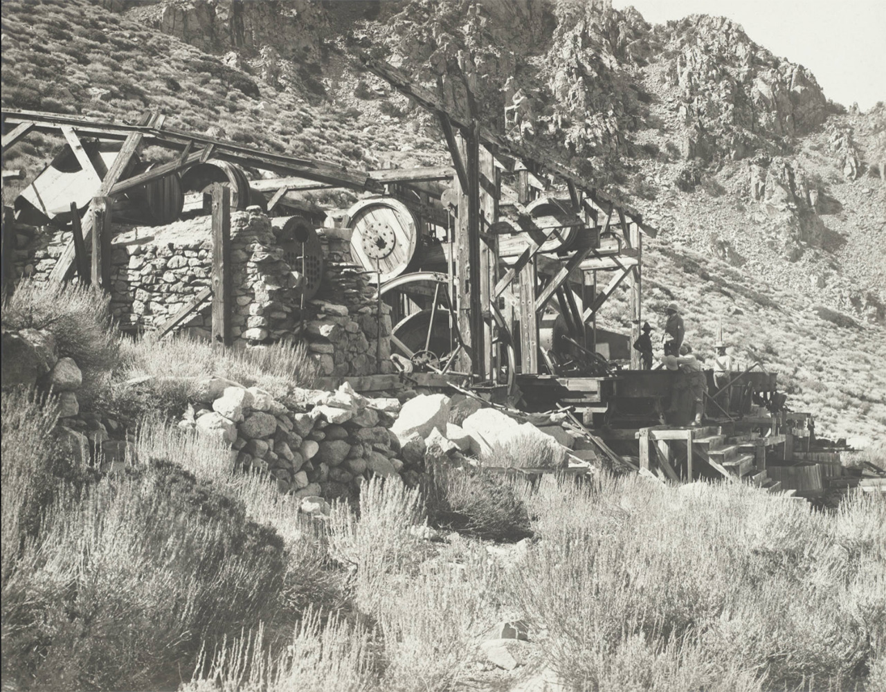
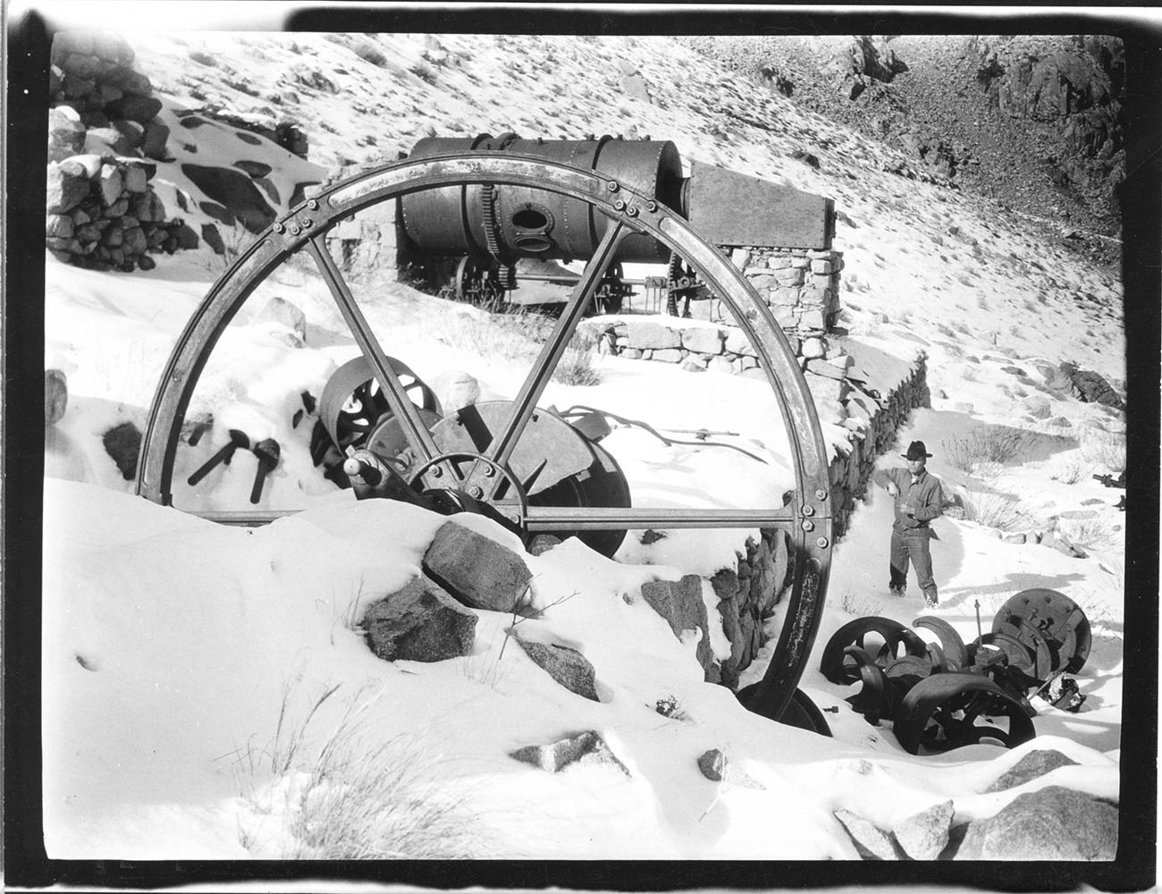 Mining equipment along the Onion Valley Road in Owens Valley - 1931 |
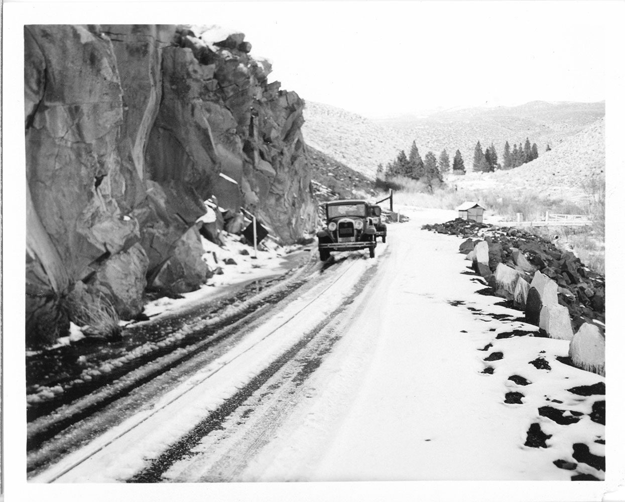 Snow covered Onion Valley Road Owens Valley - 1931 |
 Snow covered Onion Valley Road Owens Valley - 1931 |
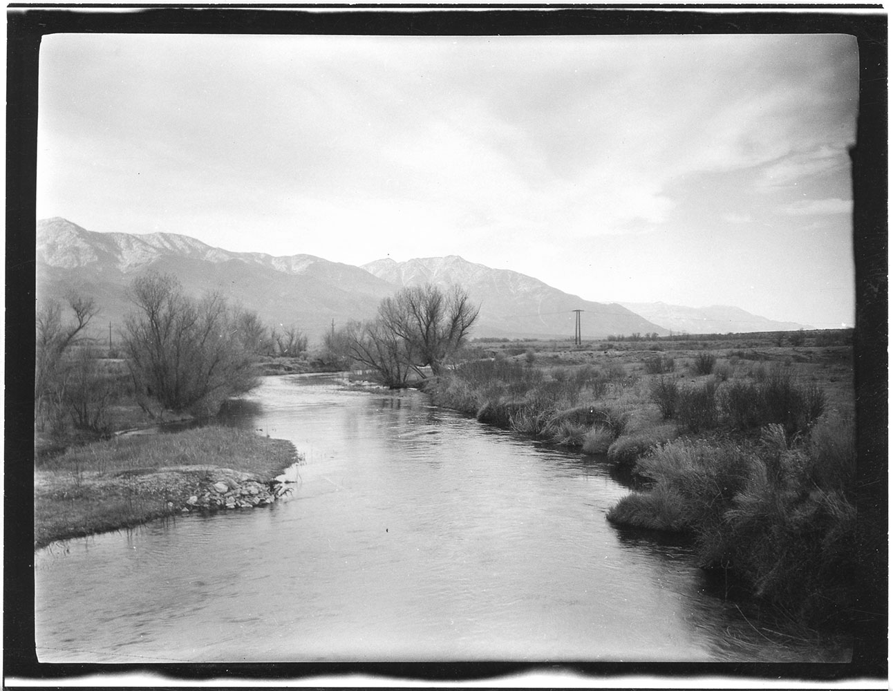
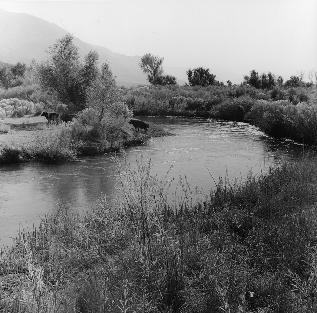 Owens River near Independence |
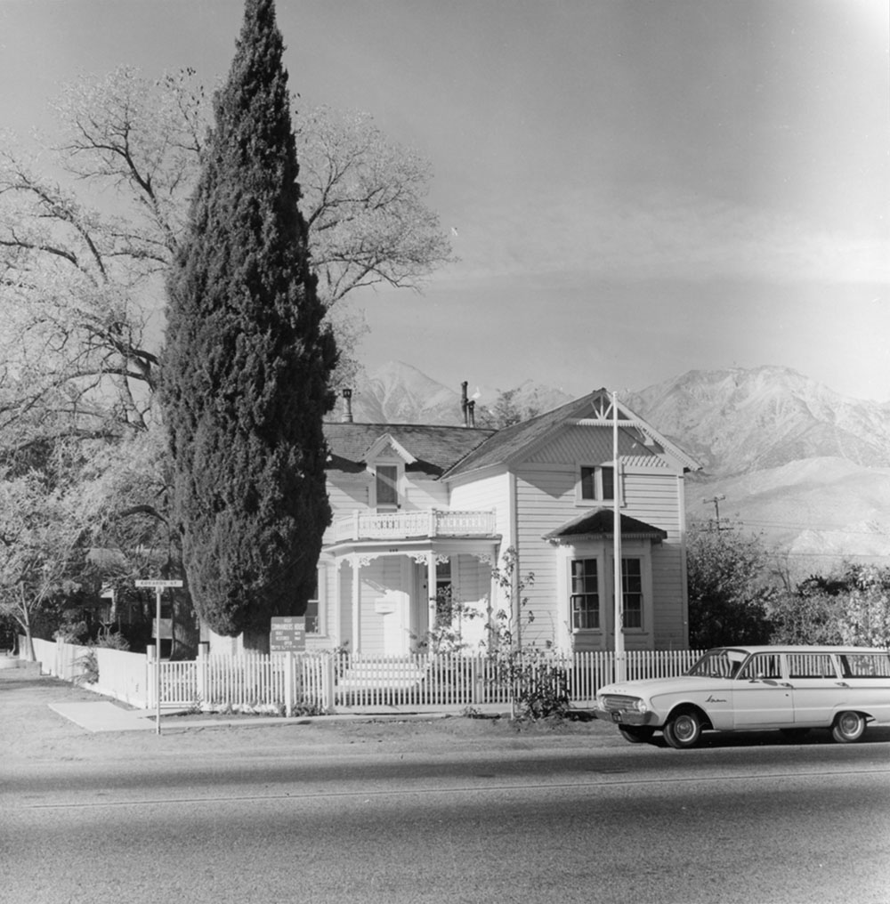 The Commander's House - Independence, CA |
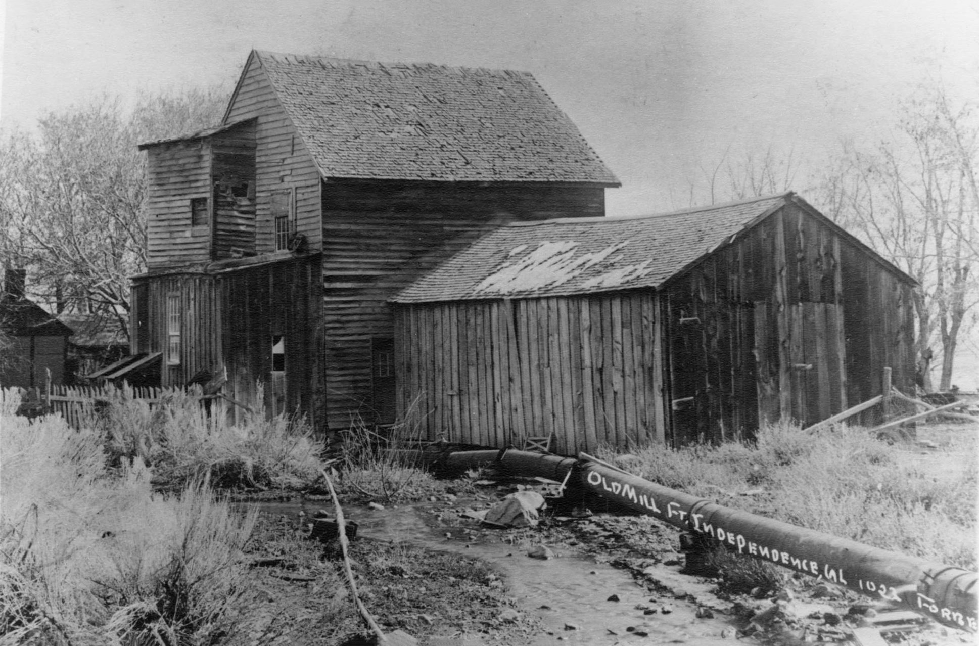 Oak Creek Mill at Fort Independence, Independence, CA (Photo courtesy of Inyo County Sesquicentennial) |
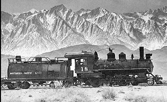
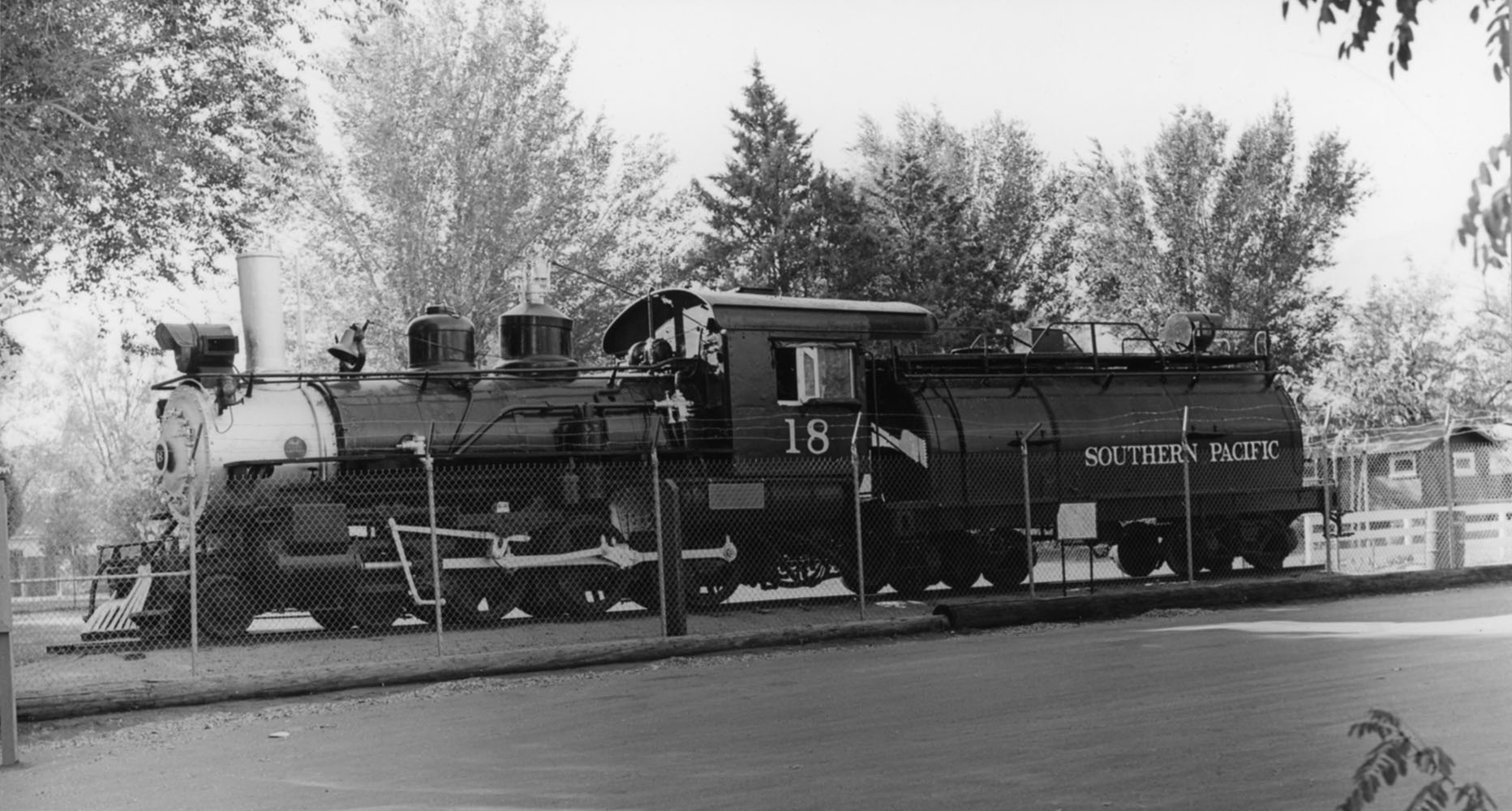 The Slim Princess, Engine No. 18 - Independence, CA - When it was in Dehy Park |
|
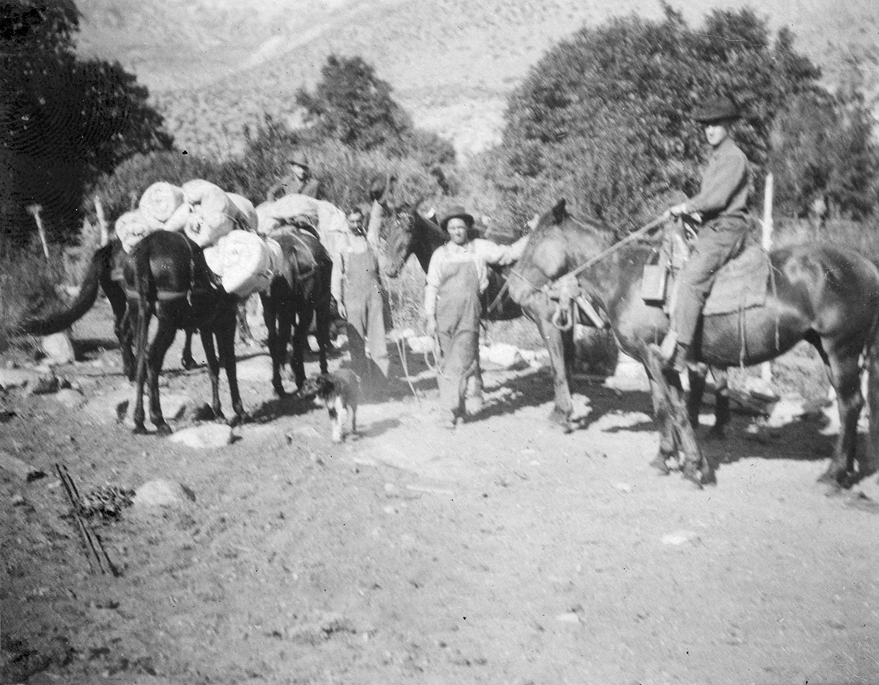 Pack train loading up out of Independence, CA - above Parker Ranch |
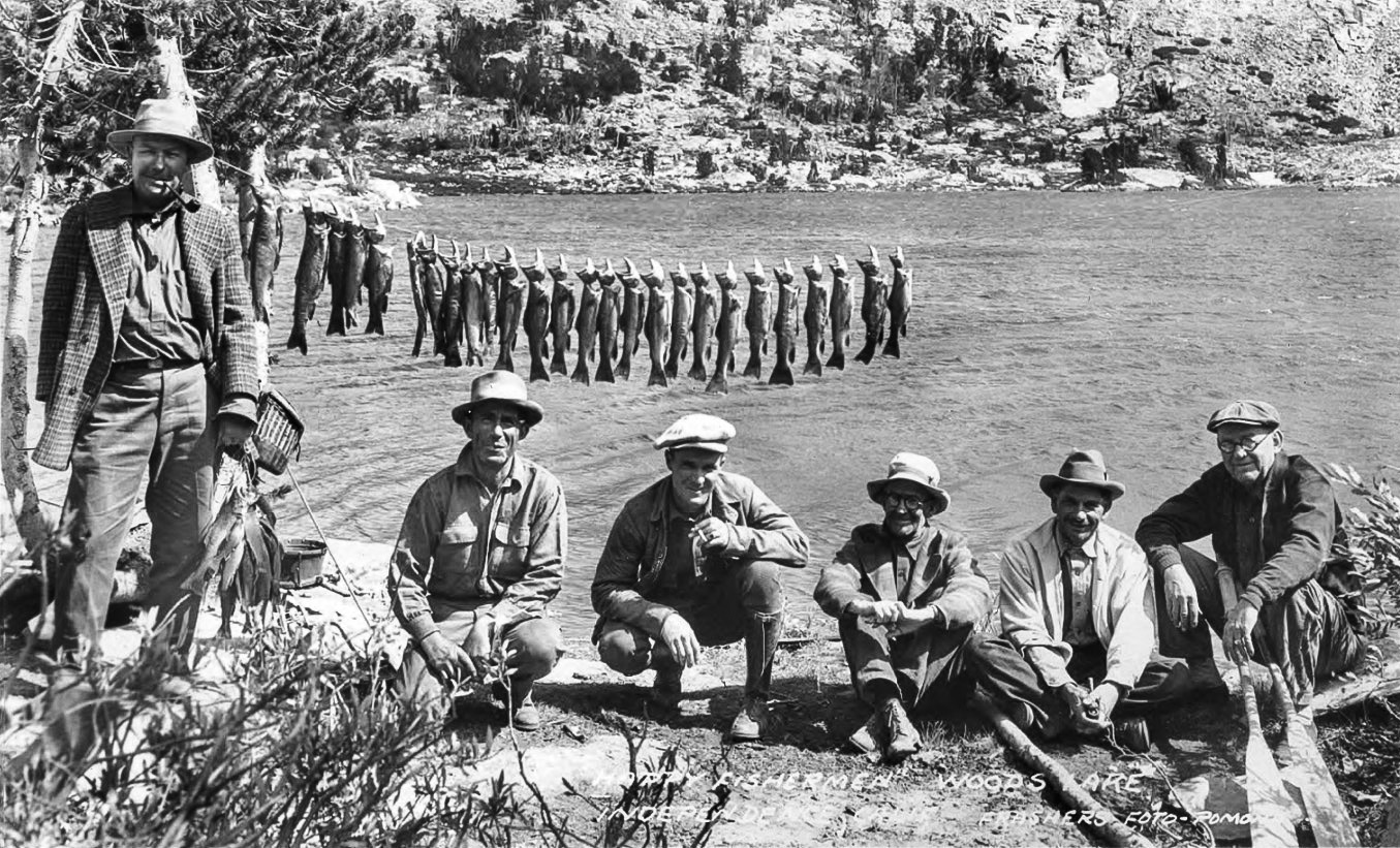
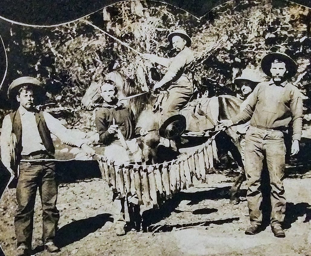
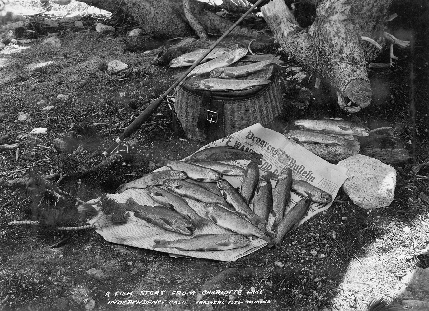 A fish story from Charlotte Lake |
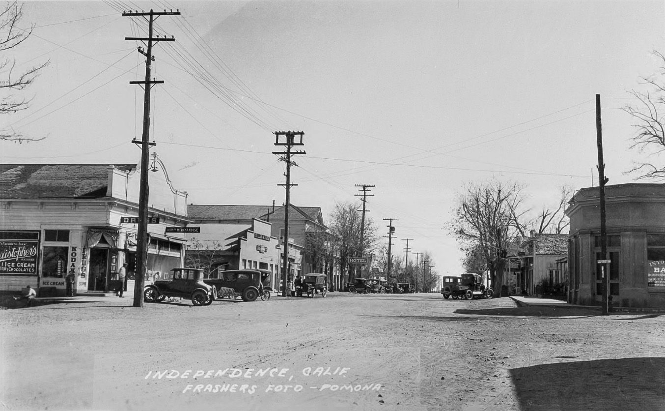
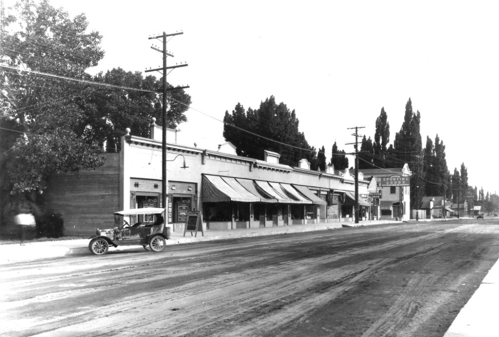
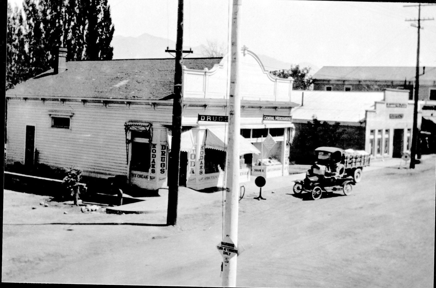
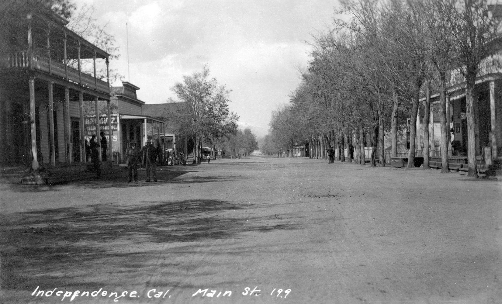 Main Street - Independence, CA |
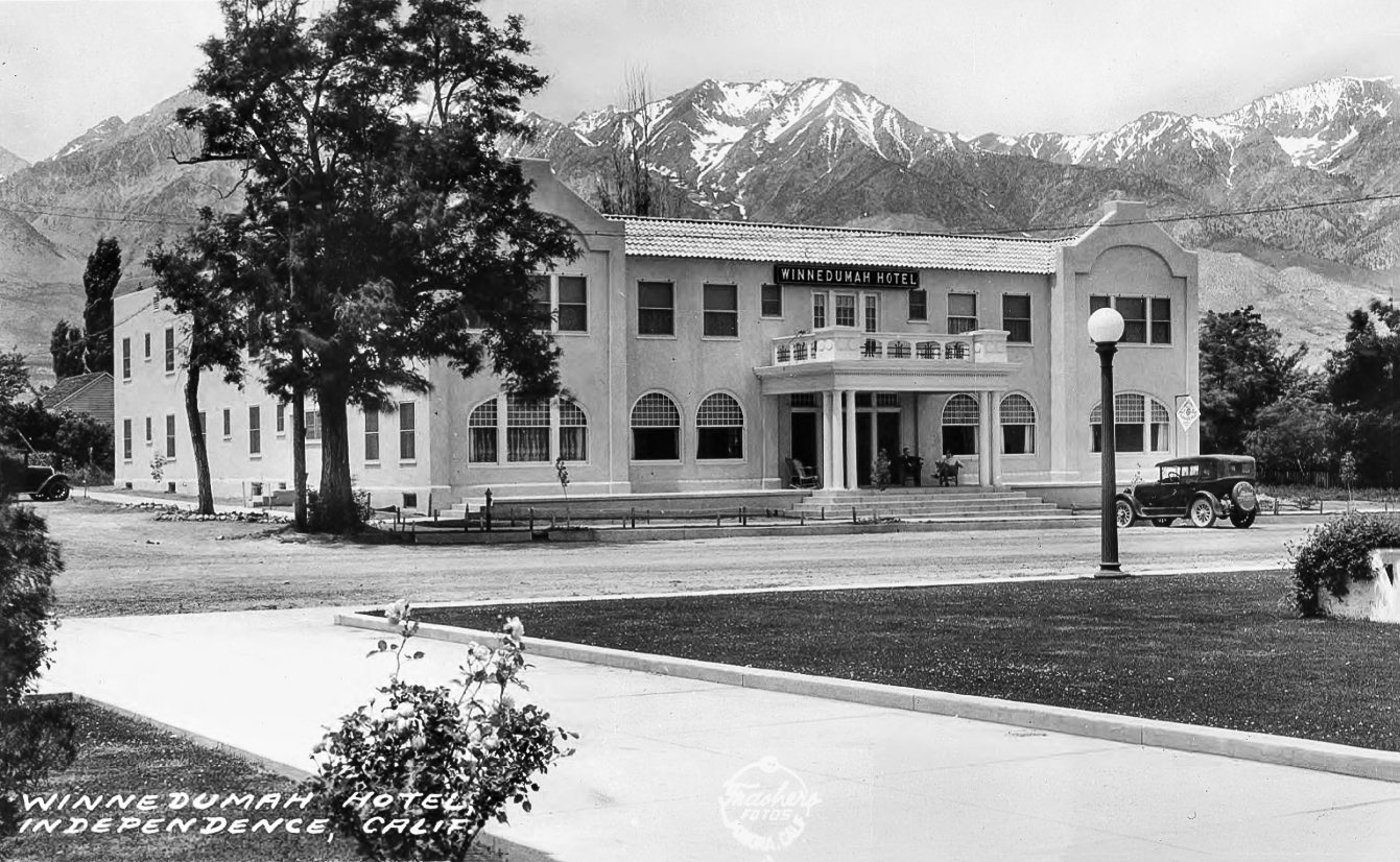
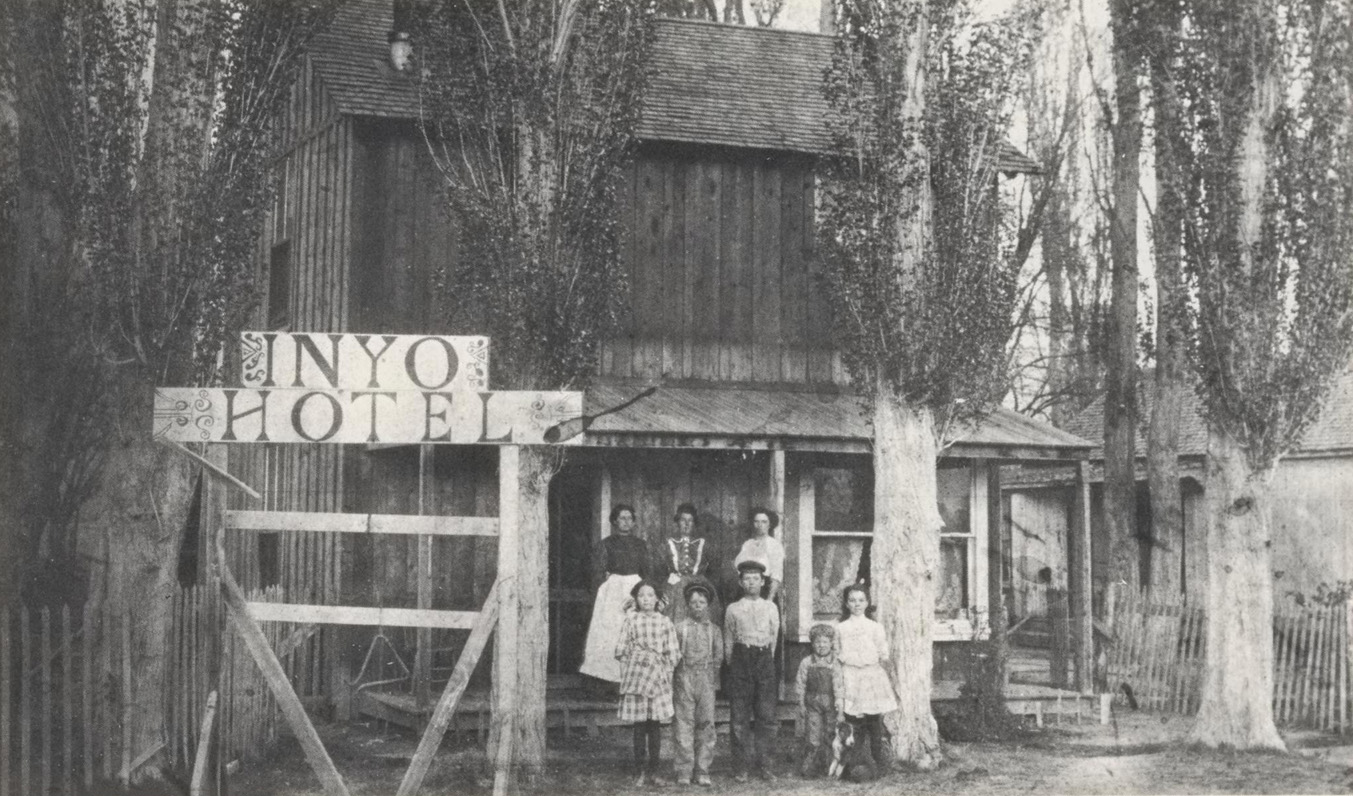
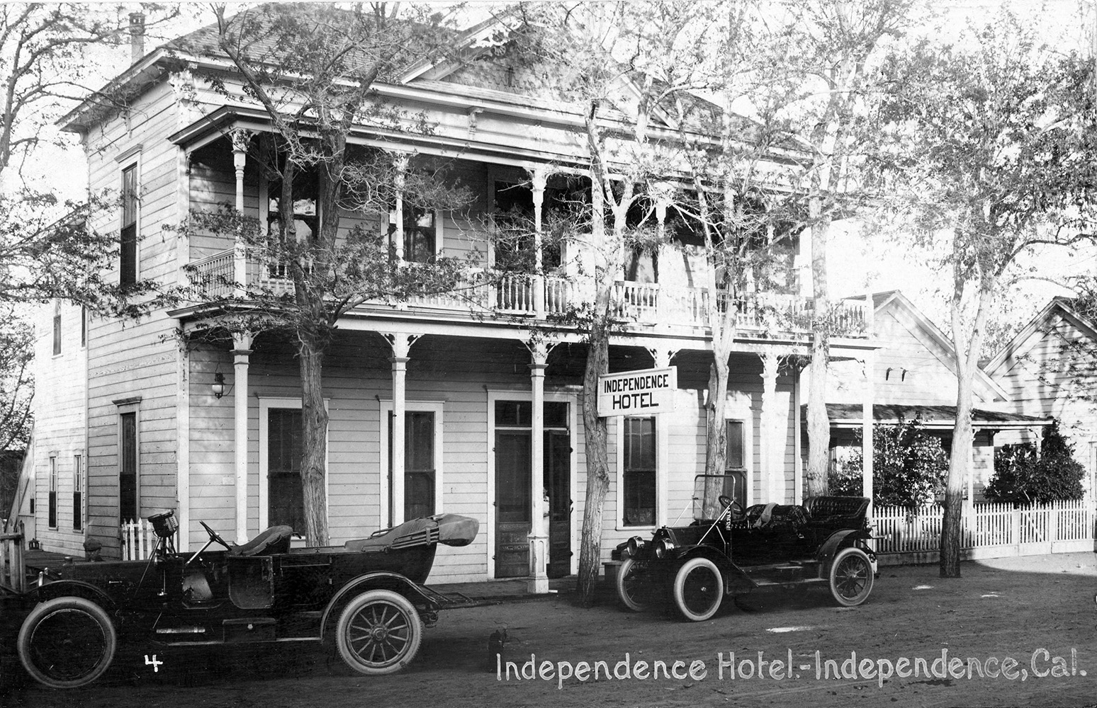 Independence Hotel - Independence, CA |
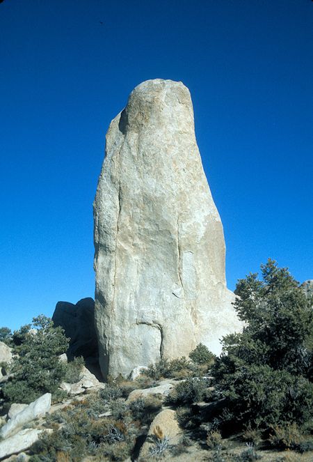
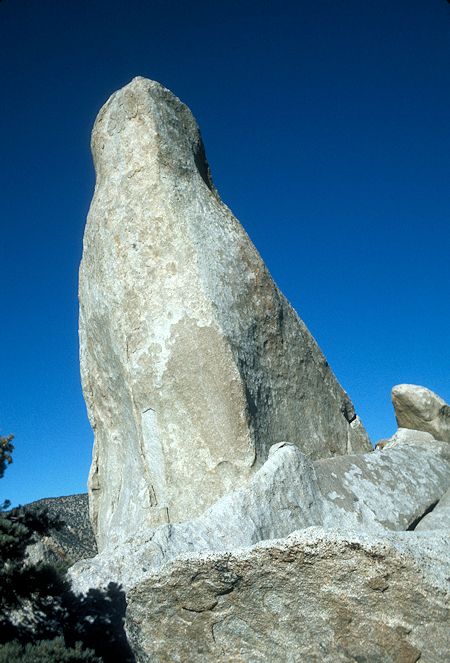
The Legend of Winnedumah From "The Story of Inyo" - 1933 Edition, Chapter V: Native Legends |
|
| Version 1: Long, long ago there lived in what the white man calls Owens River Valley, two tribes, one, the Paiutes, occupying the eastern side and the slopes of the Inyo Range, the other the Waucobas on the western side on the slopes of the Sierras and in particular the region about Mt. Williamson and extending westward to the valley now called San Joaquin. The roaring ocean backed up its waters and flooded the wonderful valley, so that the Indians had to signal to each other by fires, but the Great spirit sent a terrible earthquake which shook the mountains for many days, and the pale waters fled away and the green grass came again. The tribes were at war. One day on his lookout on Mt. Williamson, a Waucoba Brave, espying two Paiute brothers ascending the crest of the Inyo Range set to the sinewy bow-string of his mighty bow, an arrow made from a tree growing only in the western mountains. The arrow released from the twanging bow, winged its way fifteen miles across the valley and pierced the back of one of the Paiutes, who fell dead, his body turning to stone and lying face down across the crest. Head to the east, and feet to the west, terrified his brother started to run, but the Waucoba warrior in a voice of thunder shouted to him the command, Winnedumah! which means, STAY RIGHT WHERE YOU ARE. And lo, the Paiute instantly became the shaft of granite and has never since moved, awaiting his release by the great spirit. Marvelous to tell the fatal arrow took root in the stone body of its victim and grew into a tree, still living like that from which the arrow was made and the only one of its kind in the Inyo Range. |
|
Paiutes and Shoshones in Owens Valley, California by Lawrence F. Van Horn |
|
| Version 2: Long, long ago the great medicine man of the Paiutes was Winnedumah, brother of Tinnemaha, war chief of his people. The principal stronghold was in the Black Rocks, a great field of tumbled lava in middle Owens Valley. One day hordes of Diggers poured across the passes of Pahbatoya, the Sierra, to raid the Paiute hunting grounds. The owners resented the trespass, and then began a battle such as no Paiute has since witnessed. It lasted through days of the fiercest fighting. At last, the Paiutes were beaten and forced to flee. Many found refuge in the caves and recesses of the Black Rocks - which same cavities to this day may be viewed by whoever may doubt this tale. Others fled across the rugged mountains to the eastward. Among the fugitives was Winnedumah, whose medicine had been useless against the invaders. Surely pressed, exhausted and alone he gained the summit, where he stopped for a final view of the domain which he deemed lost, and to await the coming of his warrior brother. But Tinnemaha had fallen in the fray; and while Winnedumah invoked the aid of the Great Spirit for his stricken people, a great convulsion of nature came, and one of its effects was to transform him into a pillar of stone. The same natural manifestation so frightened the Diggers that they forthwith went back across the mountains, never again to dispute the ownership of Owens Valley. There to-day stands Winnedumah, faithful to the end of time. |
|
 |
Vintage Newspaper Articles Courtesy of Hal Eaton |
 Paul Ritch (Long time resident of Independence and Laurie's grandfather) and Tyron Power on a movie set in the Alabama Hills (Photo courtesy Laurie Ann Ritch Walker) |
 L/R: Henry Dearborn, ?, ?, ?, Ora C. Johnson (Laurie's uncle) Ora was the son of Albert & Cordelia Johnson and was born in 1876 (Photo courtesy Laurie Ann Ritch Walker) |
Photos courtesy of Charles Delwiche |
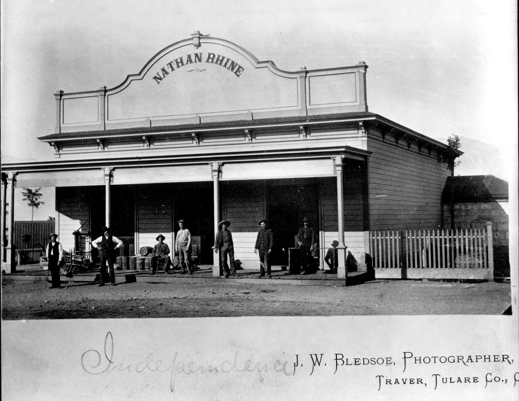 Nathan Rhine Store circa 1886/1887 (USC California Historical Society Collection) |
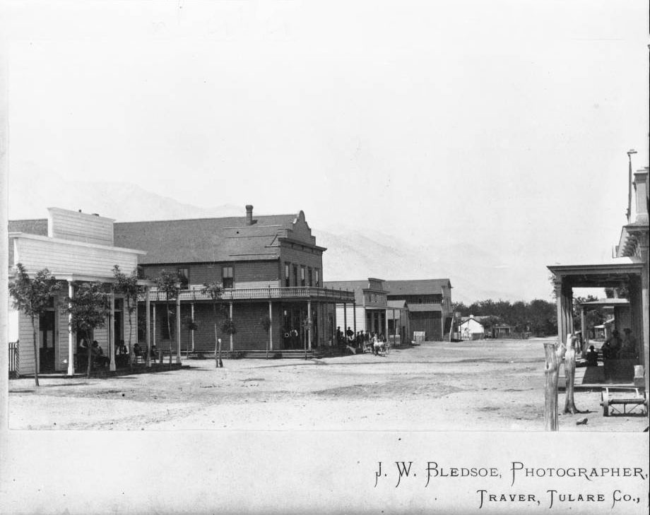 Mainstreet Independence circa 1887/1888 (USC California Historical Society Collection) |
 Mrs. Genevive Mowrer and and Mowrer Ranch of Independence |
Love to Chinese Cook Too Much for Hubby - July 3, 1912 |
Banker's Daughter Puts Her Unused License Away - January 10, 1916 |
Vintage Newspaper Articles Courtesy of Hal Eaton |
Hal Eaton writes: Pam Milligan Vaughan writes: My grandfather managed her affairs and the ranch. Yes, it was where Keoughs is now. The 3 stone pillars on the right as your enter Keoughs was her house that she built and was later occupied by Philip Keough. I did a lot of research about her and wrote an article for the Inyo Register. Her hubby was gone a lot because he was ambassador to Denmark. She fell in love with the Owens Valley and insisted on living here for a time. She is one of the more interesting women who lived in the Owens Valley. |
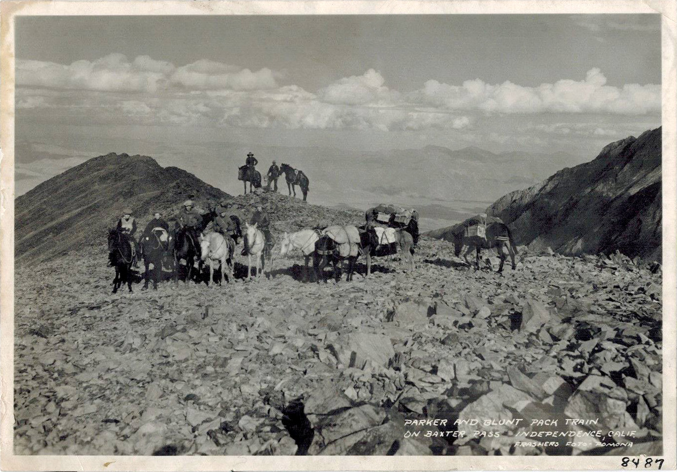 Parker and Blunt Pack Train on Baxter Pass - Independence, CA (Frasier Fotocard courtesy of Inyo County Sesquicentennial) |
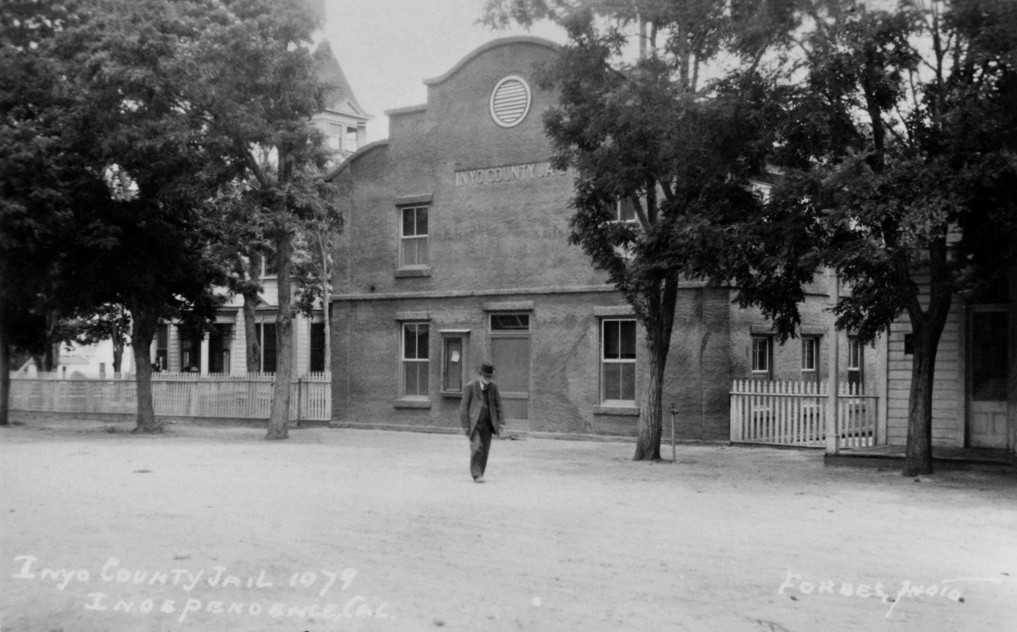 Inyo County Jail - Independence, CA (Forbes Fotocard courtesy of Inyo County Sesquicentennial) |
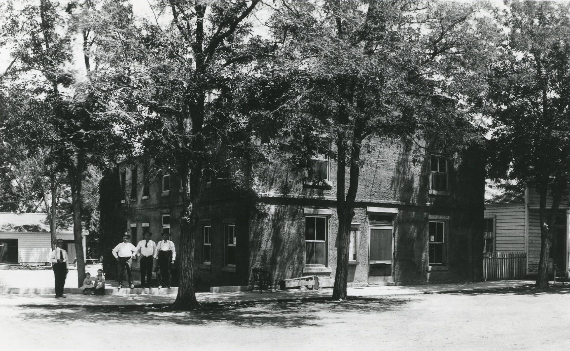 Inyo County Jail - Independence, CA (Courtesy of Inyo County Sesquicentennial) |
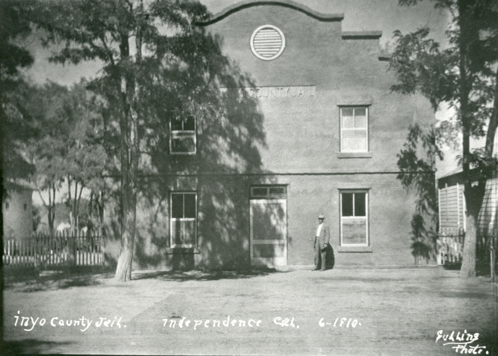 Inyo County Jail - Independence, CA (Courtesy of Inyo County Sesquicentennial) |
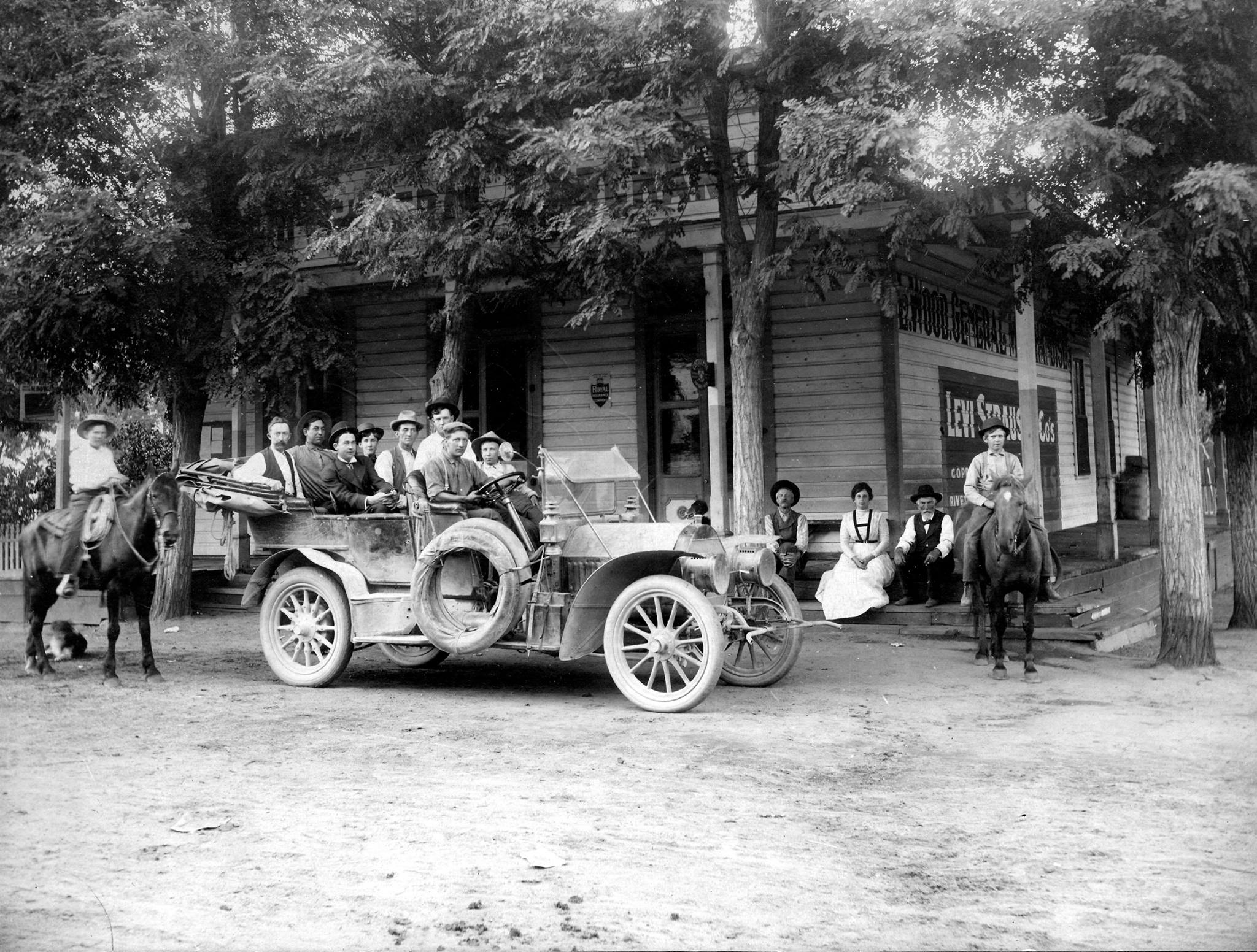 Woods Store - Independence, CA (Courtesy of Inyo County Sesquicentennial) |
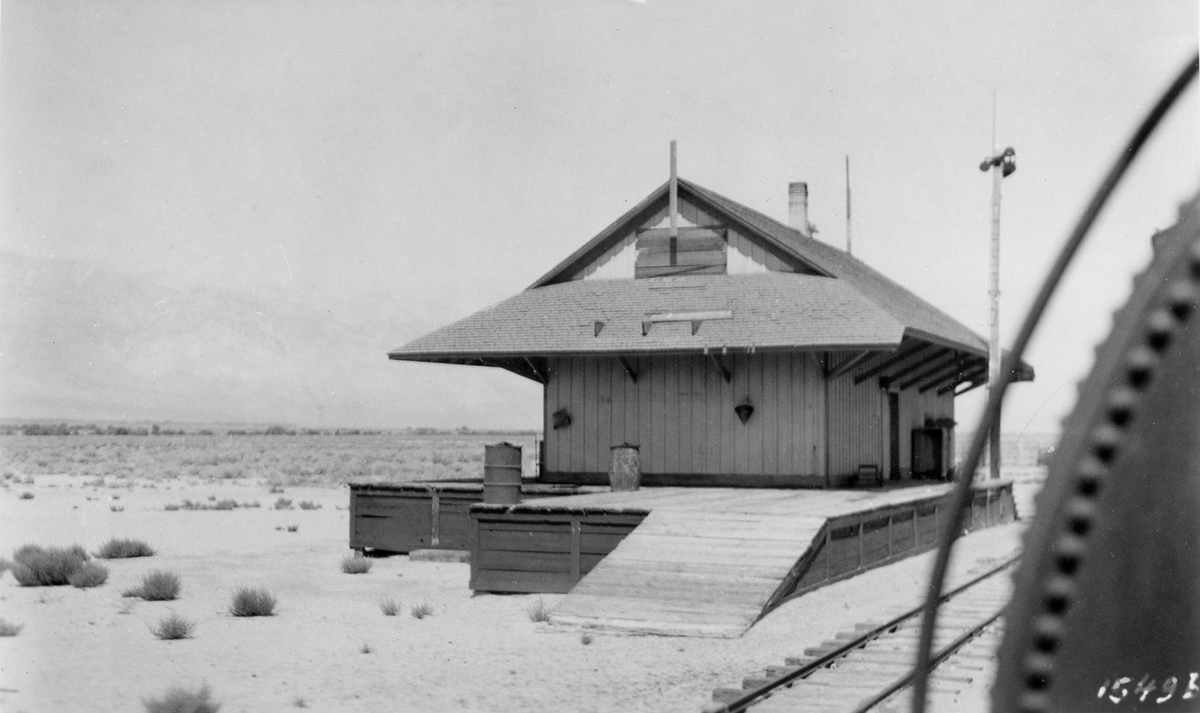 Kearsarge Station on S&P Narrow Gauge RR - Independence, CA |
Owens Lake photo from "Men, Medicine & Water" by friends of the LACMA Library Photos were taken by Raymond G. Taylor, M.D. on the occasion of the construction of the Los Angeles Aqueduct |
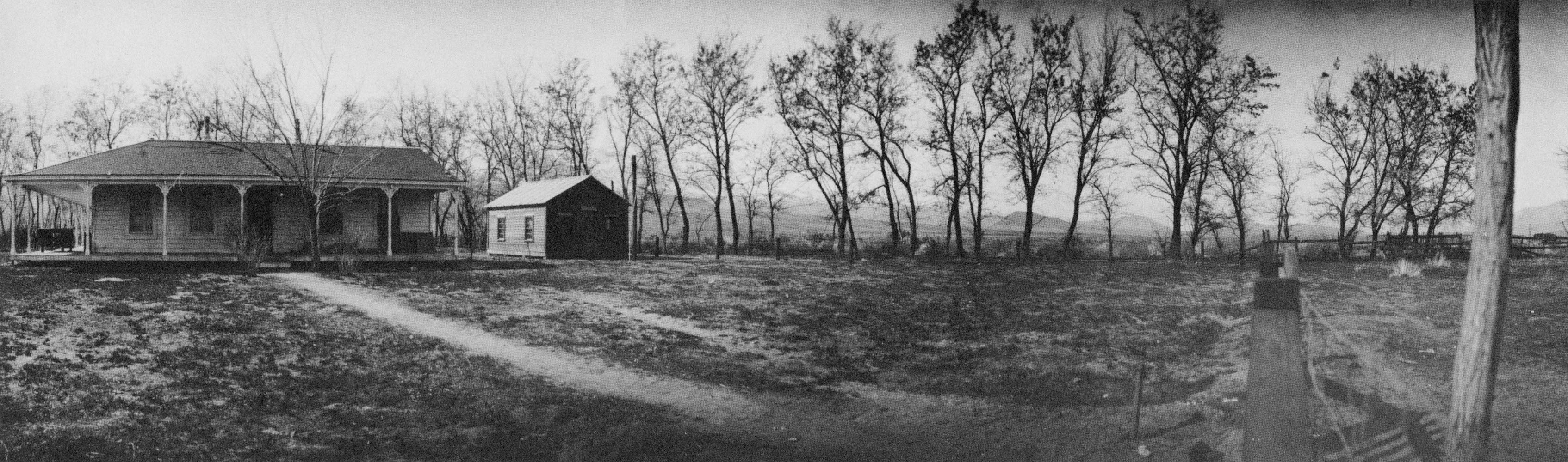 Rickey Ranch House, Winter 1909 - 1910 |
Hotel Tokens Courtesy of Craig Mason |
|
 Hotel Norman Token - Independence, CA |
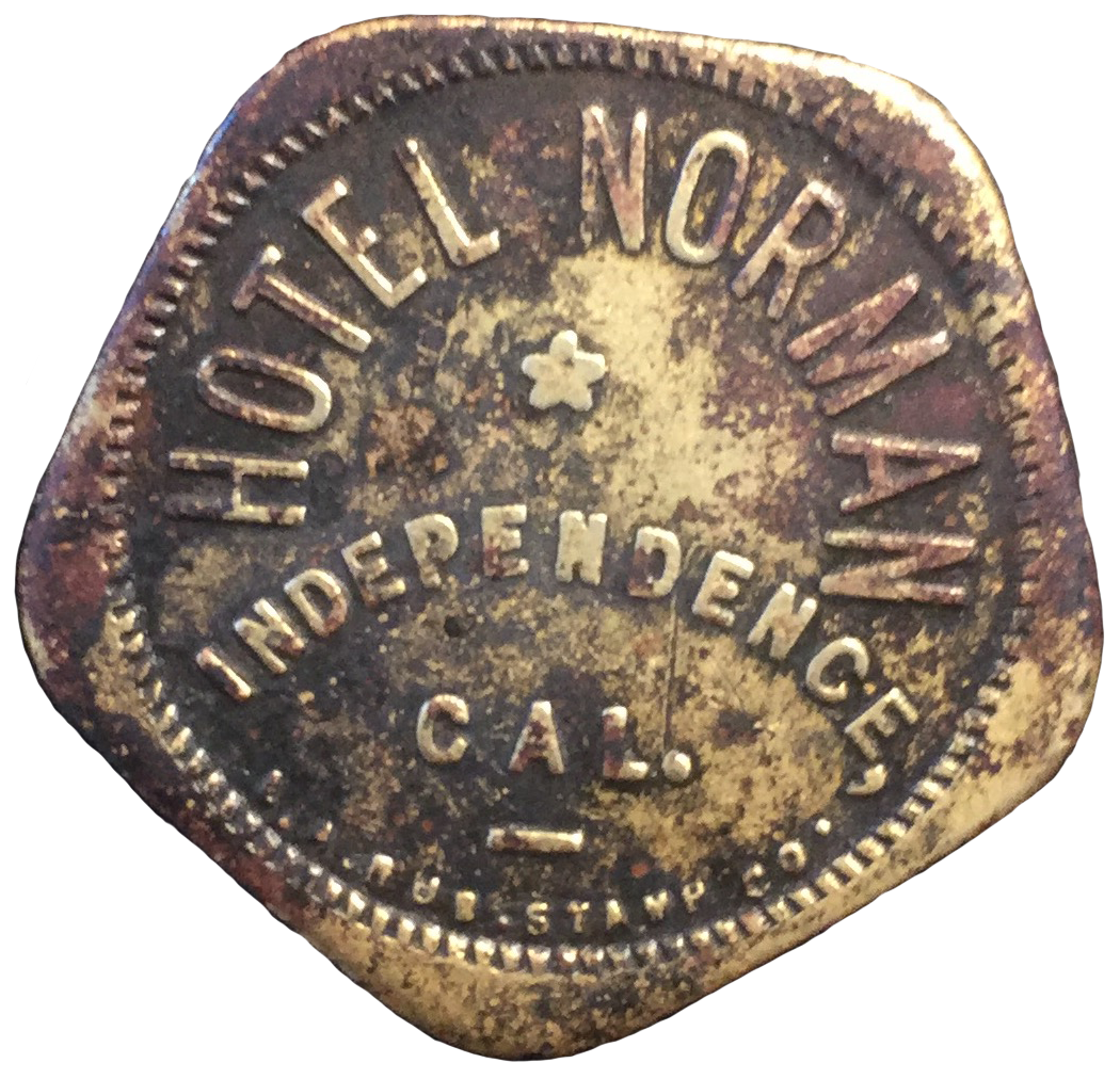 Hotel Norman Token - Independence, CA |
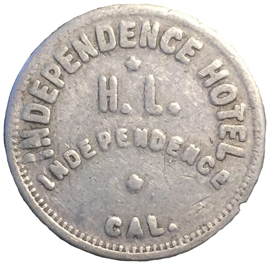 Independence Hotel Token - Independence, CA |
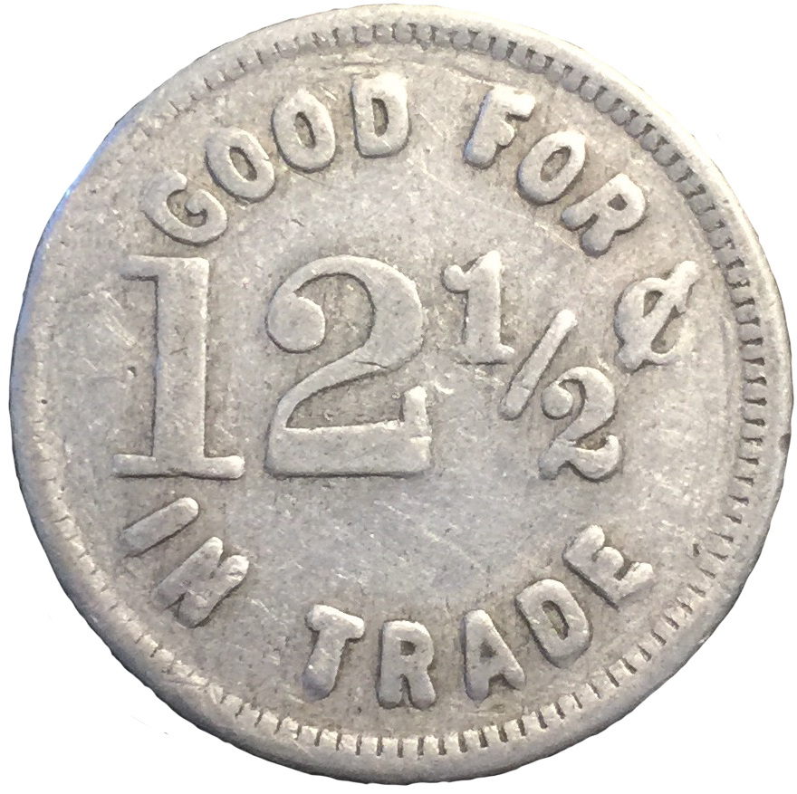 Independence Hotel Token - Independence, CA |
Tokens Courtesy of Rich McCutchan Token Collection |
|
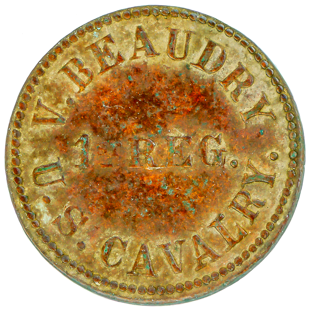
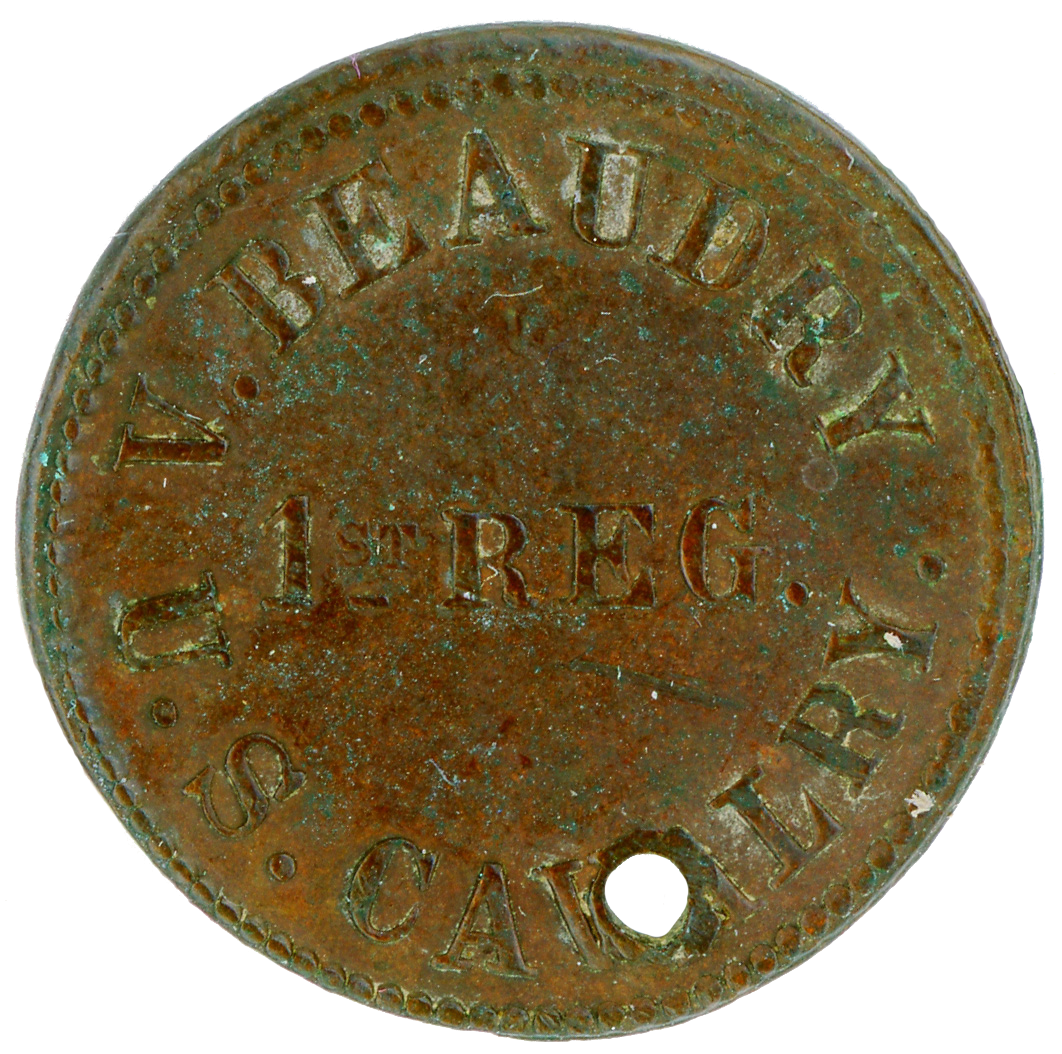
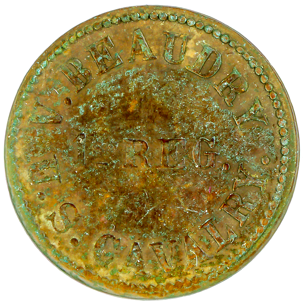 V. Beaudry - U.S. Cavalry - 1st Regiment - 50 Cents |
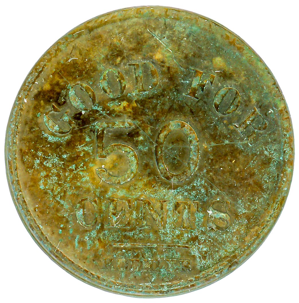 V. Beaudry - U.S. Cavalry - 1st Regiment - 50 Cents |
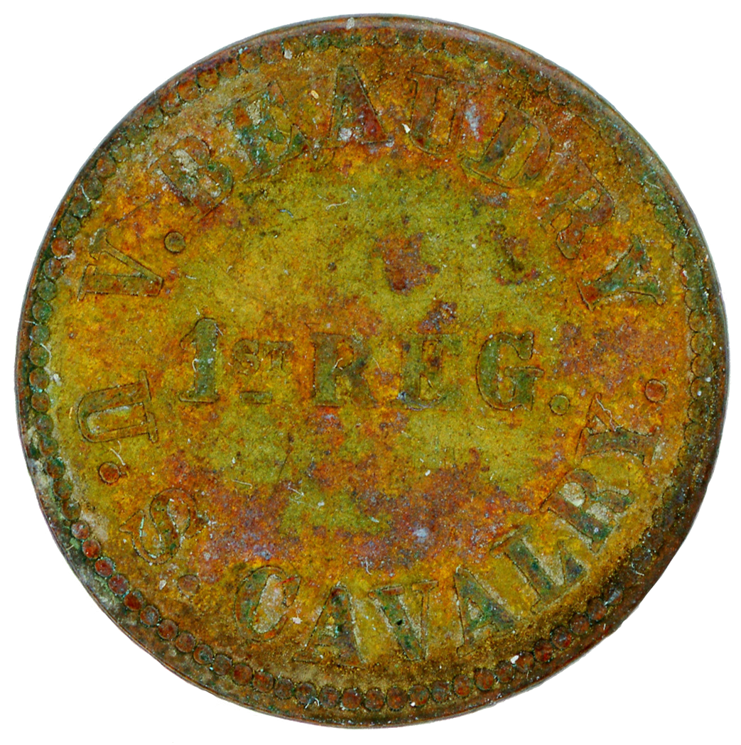
 V. Beaudry - U.S. Cavalry - 1st Regiment - 25 Cents |
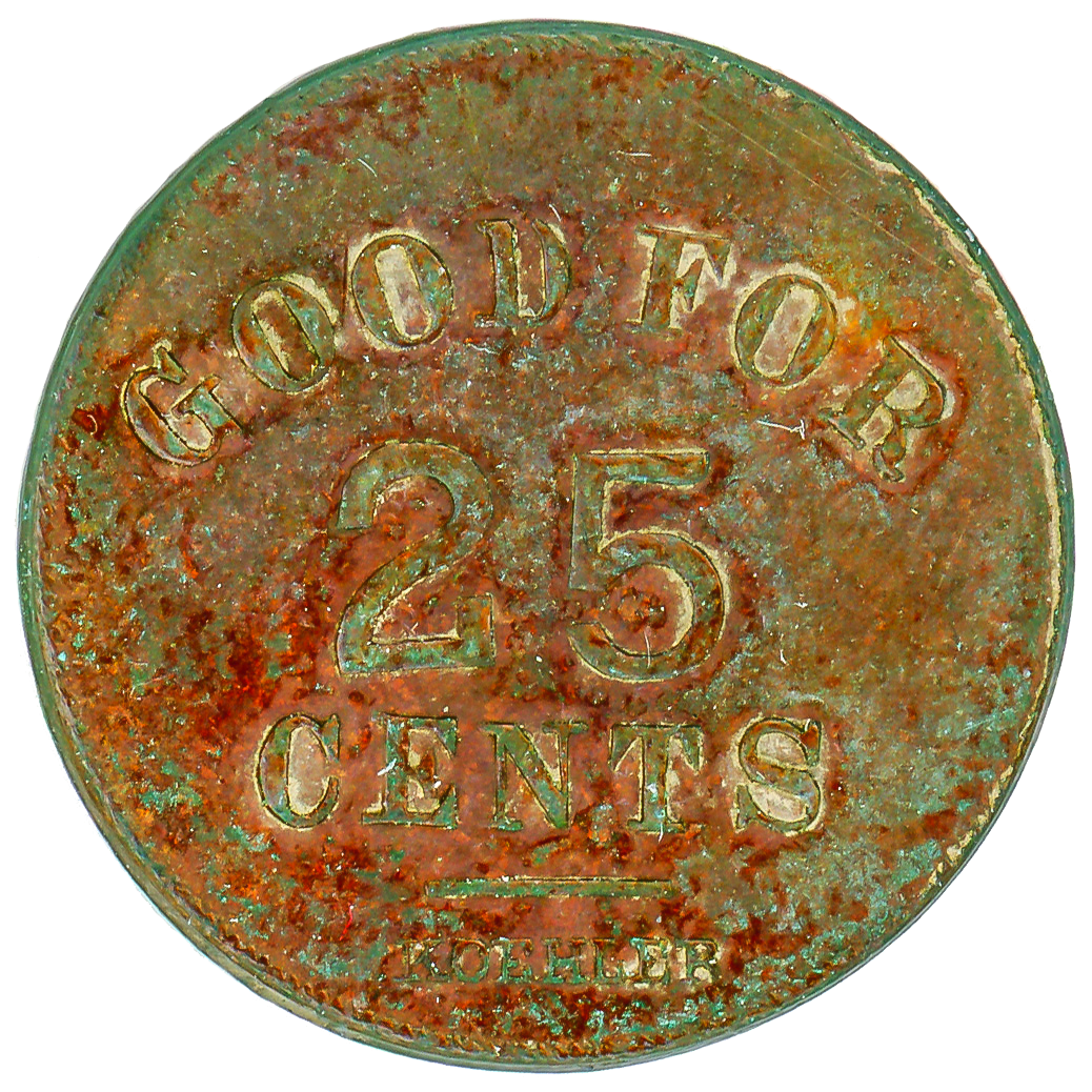 V. Beaudry - U.S. Cavalry - 1st Regiment - 25 Cents |
 V. Beaudry - U.S. Cavalry - 1st Regiment - 10 Cents |
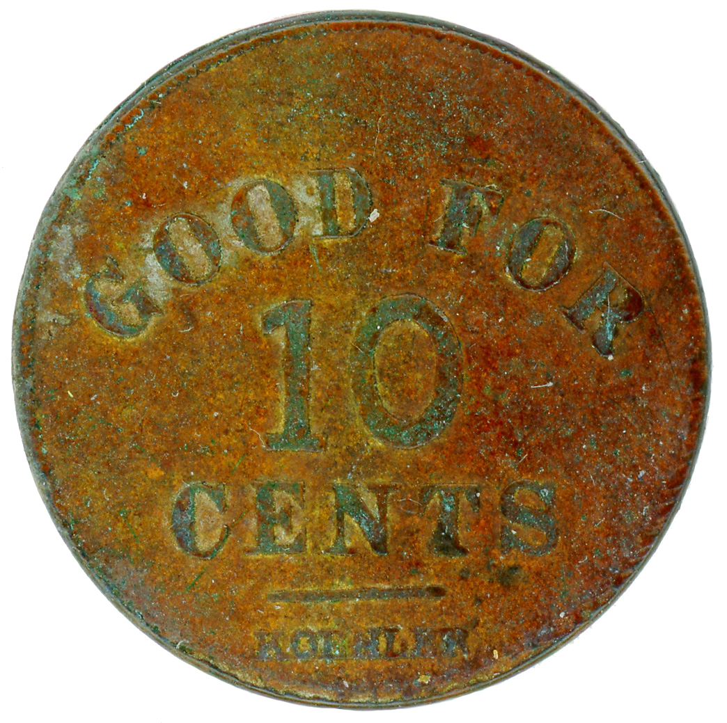 V. Beaudry - U.S. Cavalry - 1st Regiment - 10 Cents |
 V. Beaudry - U.S. Cavalry - 1st Regiment - 5 Cents |
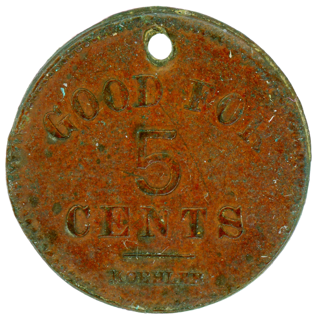 V. Beaudry - U.S. Cavalry - 1st Regiment - 5 Cents |
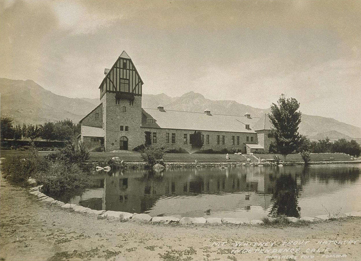
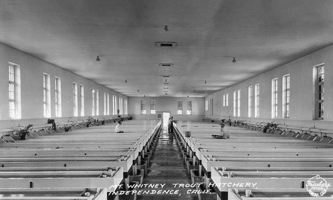
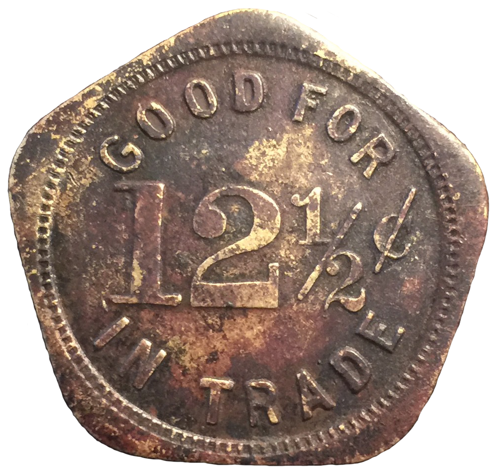
Rich McCutchan writes: Victor Beaudry ran a trading post immediately outside the front entrance of Camp Independence and used these tokens as “Good For” tokens. Camp Independence. Later Fort Independence, was located in the center part of the Owens Valley just north of what is now Independence and specifically built to protect miners and prospectors that worked the mines of Cerro Gordo in the adjacent White Mountains, as well as mills along the Owens River that treated ores from a number of small mines located up and down the valley. The U.S. Army post was active from 1862 to 1877. The camp / fort was on the creek just east of 395, west of Mt. Whitney Fish Hatchery and is within the reservation Fort Independence Indian Community of Paiute Indians. |
|
Photographs and text courtesy Tales Along El Camino Sierra |
||
 Fort Independence circa 1869 looking east towards the Inyo Mountains. It was garrison to several hundred troops at its peak. |
 Fort Independence circa 1869 looking west towards the Sierra Nevada mountains. |
|
 Old Independence |
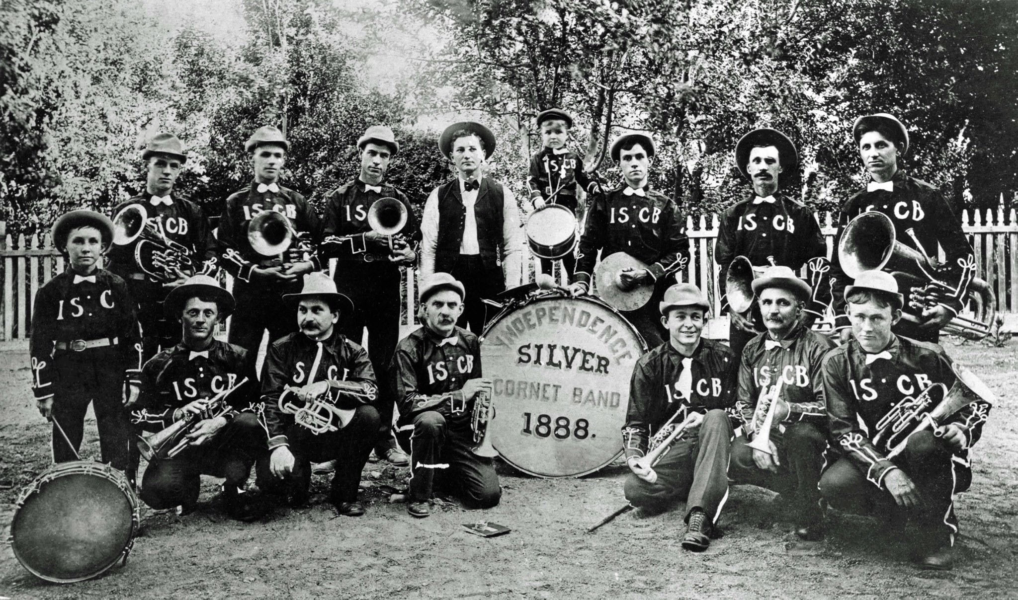 1888 Independence Silver Coronet Band |
|
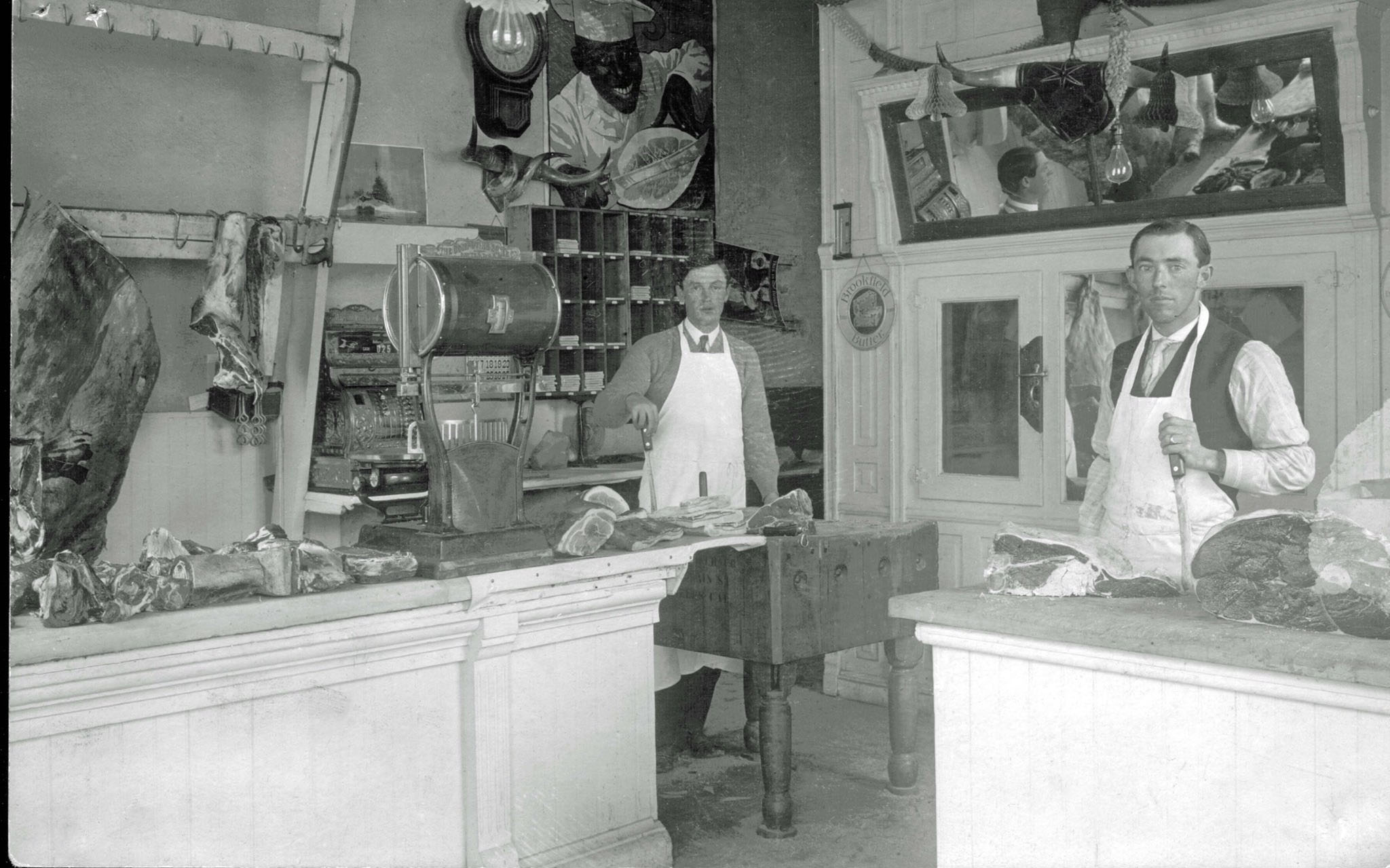 Mairs' Butcher Shop |
 Bill Muckel's house and pack station in Onion Valley - circa 1960 (Photo courtesy of the NPGallery Digital Asset Management System) |
|
| Diane Anthony writes: My family first packed with the Muckles in 1957 on a trip to Rae Lakes. My parents became friends with the family and I remember so many stories of the Muckles, their three sons, border collie Archie and milk cow Lorna. Ginny had a big wood stove in the kitchen and a red plaid tablecloth! Our last trip with them was about 1967 to East Lake. My parents remained in contact with them until 2010 or so. January 2022 |
||
| Barbara Langston writes: Thank you so much for posting the photo of the Muckel's house! My ex-husband Richard L. and I were working for Gene Burkhart and trying to buy it (the pack station) from him in 1969-1971, when he very correctly figured out we could never have run it and sold it to Gary and Cookie. True to his style of being closed-mouthed about business, I was cooking dinner for the packers when one of them came in and asked how we felt about Gary and Cookie buying it. First we heard of it! Best decision he could have made to sell it to them. It looks like Gene had it back twice? I thought he "only" had the Pines Cafe & Bar those years until he died? If I remember rightly, Gene and Lona Burkhart bought out Archie Dean's place and added those two passes (Taboose and Sawmill) to his Sequoia Kings Pack Trains. Lona and ..... shoot, I can't remember their names, but Mrs. Dean and her daughter Tansey Smith visited back and forth a lot -- oh my goodness - the stories they could tell! So many good memories of all those people. And, as a PS, Tansys maiden name was not Dean, it was Constable. But Lona introduced me to Tansy in 1969 as Archie and Mrs. Dean's daughter. Am I confused? We were on the porch looking at Tansy's bobcat in its big enclosure. July 2021 |
||
 Archie Dean's house and pack station in Onion Valley - pre-1940s (Photo courtesy Rich McCutchan Archives)
|
 Forest Service Supervisor Joe Radel and special use permitee Bill Muckle, operator of High Sierra Pack Train, in Onion Valley. July 1958 (Poto courtesy of Hal Eaton) (U.S. National Archives Photo) |
|
 Lyle's Grandpa & Grandma Meyers at Lyle's sheep ranch in Independence, CA (Photo courtesy Rich McCutchan Archives) |
||
Photographs and text courtesy Hal Eaton |
|
| In June 1900, Professor Joseph Le Conte joined his son on a six week trip up Kings River Canyon up to Kearsarge Pass. He wrote up the trip for the October 1900 issue of Sunset. This was his last camping trip as he died in Yosemite in 1901, while his son was on his wedding trip back in Kings Canyon where he went over the Pass and down to the Owens Valley. His son, Joe, was an excellent photographer and one copy of his photos probably from 1901 is available online at the Denver Public Library (Photo album 106) and includes a few pictures of Owens Valley. Here are some picture of the trip which includ the hedgery at Citrus and Mt. Whitney railroad stops. {See Correction Below) "Little Joe" Le Conte took picutres in 1900 with his father. He went back to Kings Canyon on his honeymoon trip in 1901, but while he was in the back country his father died and they could not quickly get the word to him, so he could not attend the funeral. The son, Le Conte, returned with a large party in 1903 sponsored by the railroad as written up in this news item. Folks in other pictures match the names listed. |
|
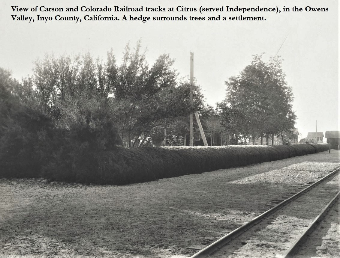 Carson & Colorado RR tracks at Citrus (later renamed to Kearsarge) |
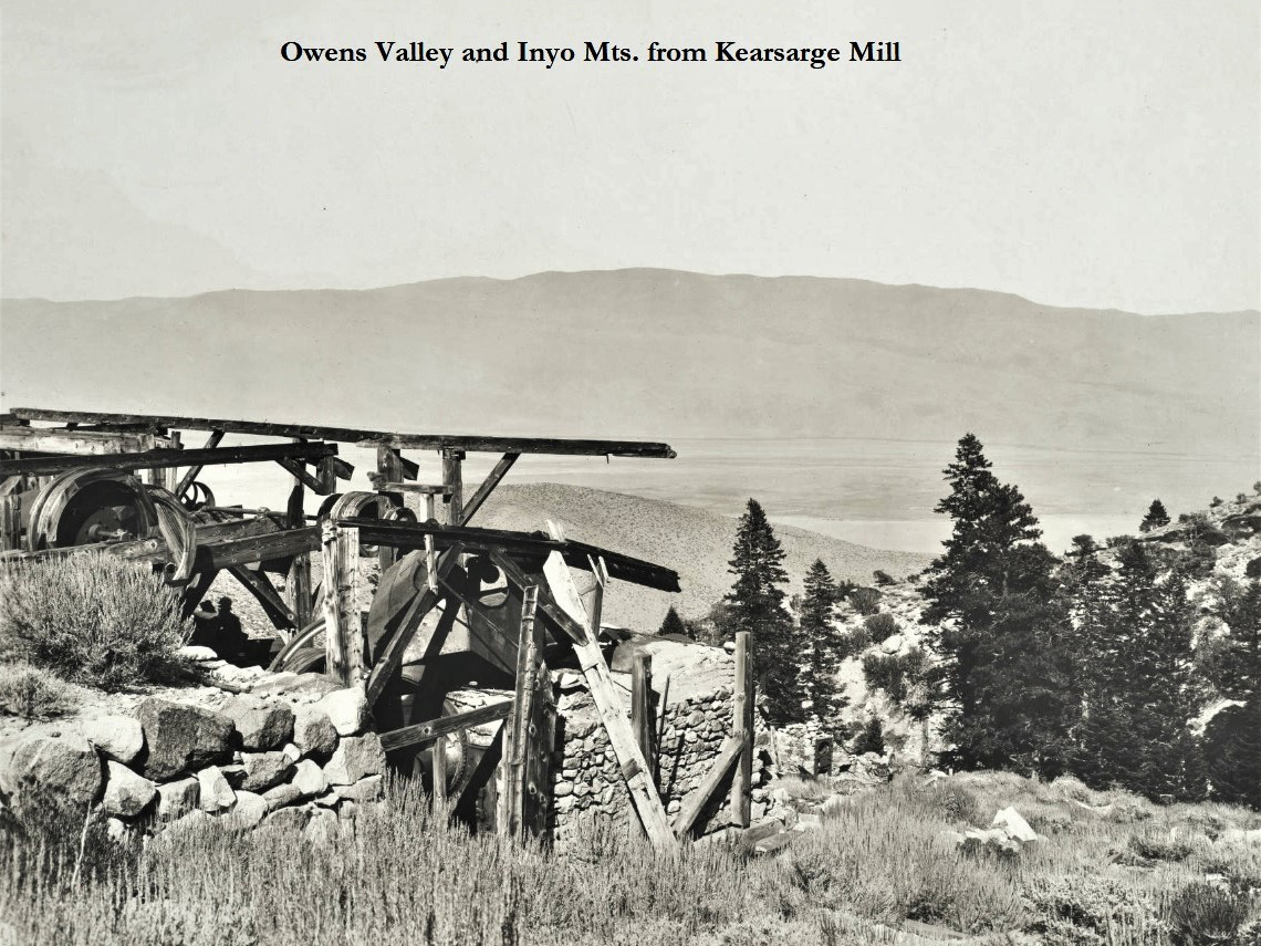 Owens Valley and Inyo Mountains from Kearsage Mill (8 miles west of Independence) |
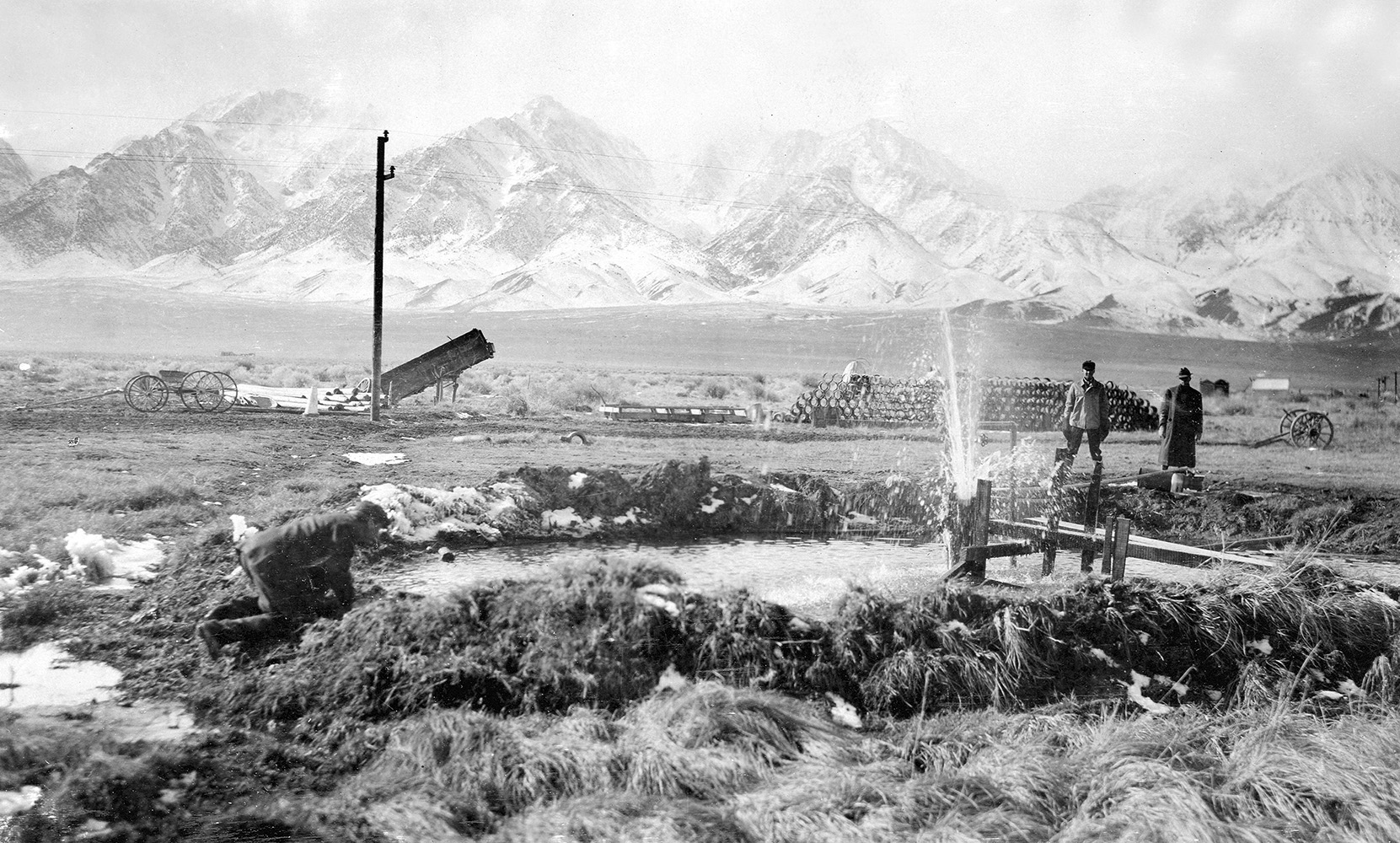 Flowing well belonging to the City of Los Angeles near Independence, Owens Valley. Inyo Co., California |
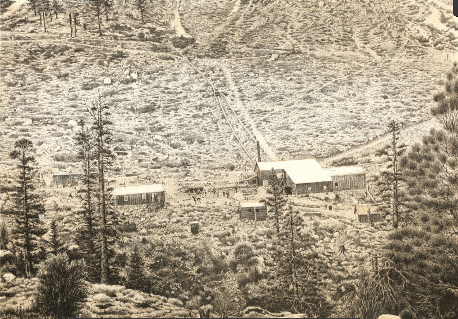 Kearsarge Mining Works, Kearsarge District, Eastern flank of the Sierra Nevada - 1871 Near Camp Independence This plate represents the surroundings of a typical mining enterprise, the Kearsarge, being the principal property high up among the eastern flanks of the Sierras, in proximity to and westward from Camp Independence, CAL., with which it is connected by wagon-road, terminating at the mines, far distant from railroad transportation, and where a turbine wheel of 13.5 inches in diameter, driven by a small stream diverted from its mountain course, and given a fall of 156 feet, accumulates the force required to operate a twenty-stamp quartz mill, and proves a most valuable substitute for steam power. The buildings, made of rough sawed pine, and the tramway to the mouth of the mine, appear in the foreground and center of the illustration. The rude, simple, at the same time wild and rugged exterior of these pioneer camps can readily be understood from the plate, which has been engraved from a photograph taken on the ground. The district contains fissure veins of silver-bearing ores, mostly carbonates. (Photo courtesy of Randy Stevenson) (Source: Hathitrust --- "United States Geographical Surveys West of the One Hundredth Meridian, by Captain Geo. M. Wheeler - 1889") |
 Kearsarge mill - circa 1890-1920 (Photo courtesy Denver Public Library) |
 Onion Valley Pack Station - circa 1960 (Photo courtesy Thomas Highberger) |
Independence photos courtesy of UCLA Digital Library Collections |
|
 Cleo Swain looking back after the H. H. West group tops Kearsarge Pass - 1919 |
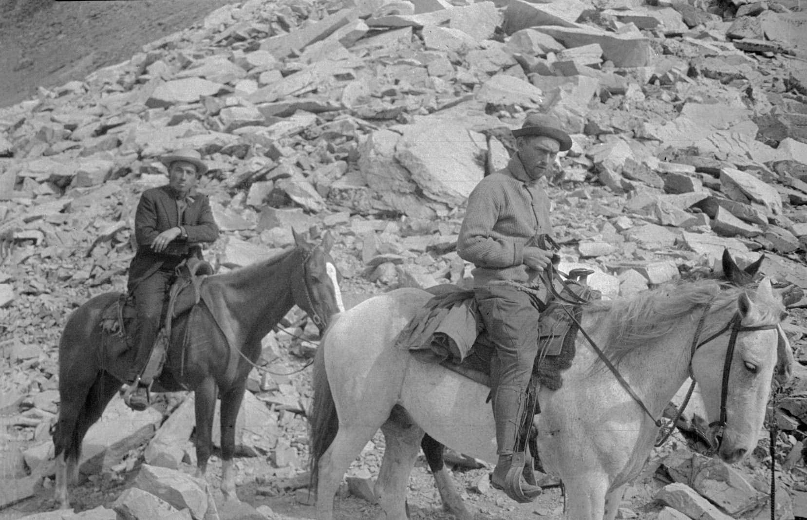
 L/R: H. H. West, Glen Velzy on the trail to Kearsarge Pass during a trip to Gardner Creek - 1919 |
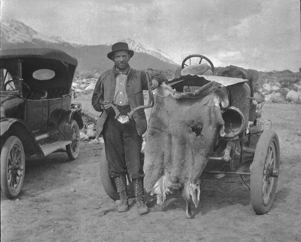 H.H. West stands by car posing with his deer skin - 1916 |
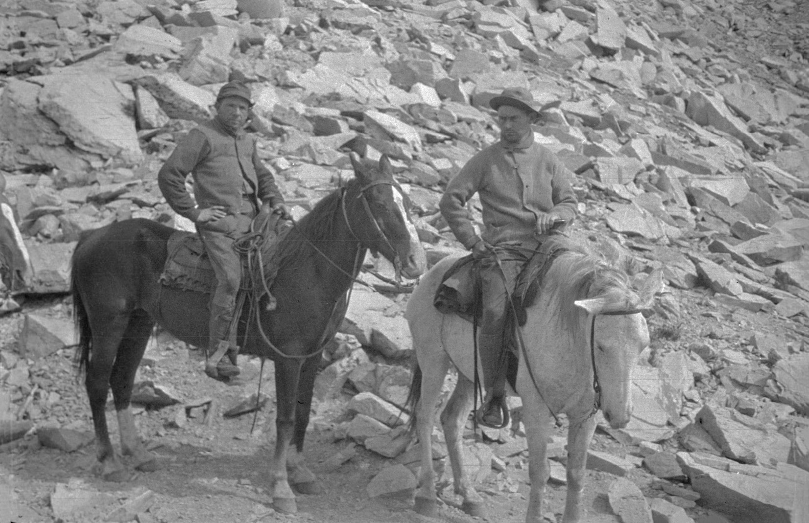
 L/R: CLeo Swain, Glen Velzy on the trail to Kearsarge Pass - 1919 |
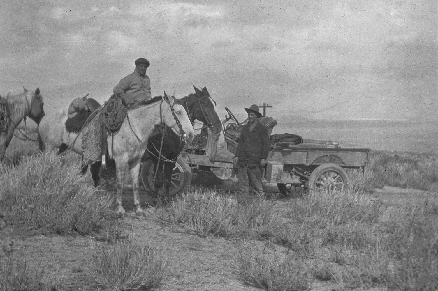 Chet Edgell standing near his truck and Leslie L. McAfee on horseback Near Division Creek during deer season - 1916 |
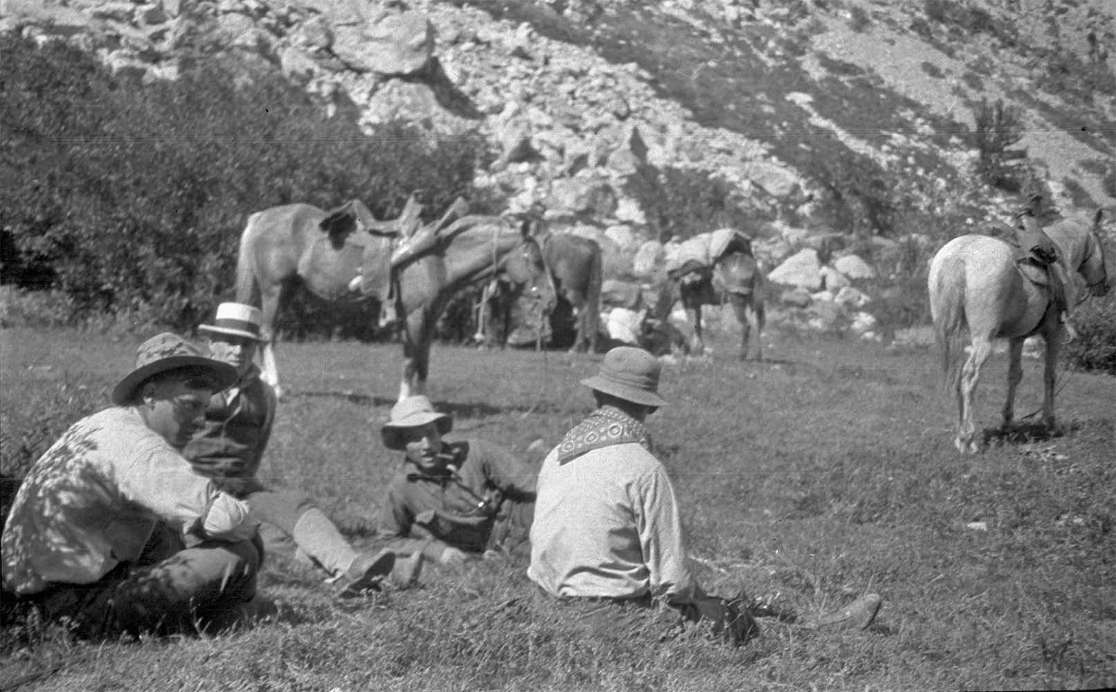 L/R: Guide Allie Robinson, Charles Stavnow, Cleo Swain, Glen Velzy Resting their train of horses at Onion Flat during a trip to Gardner Creek circa 1919 |
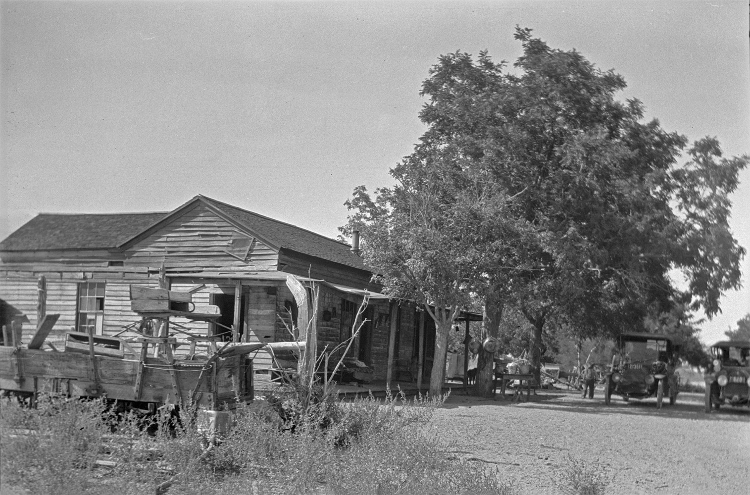 Halfway house between Independence and Big Pine - 1914 |
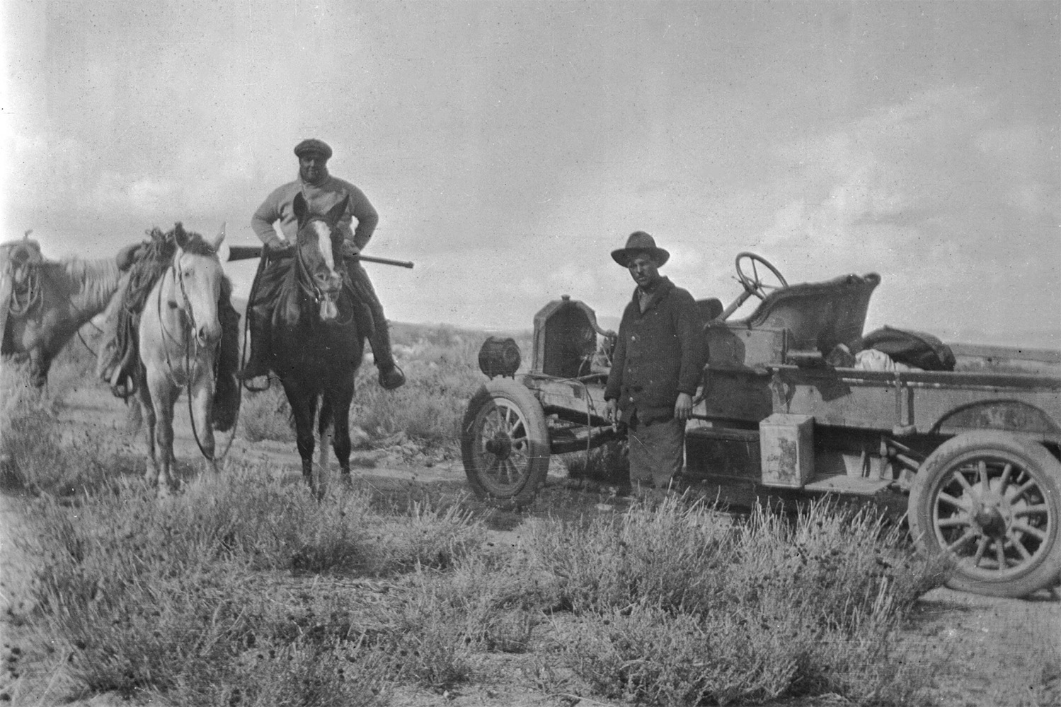 Leslie L. McAfee and Chet Edgell hunting near Division Creek - 1916 |
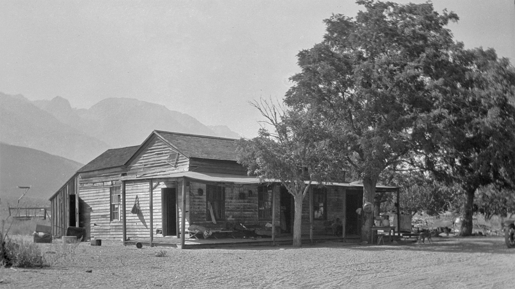 Halfway house between Independence and Big Pine - 1914 |
|
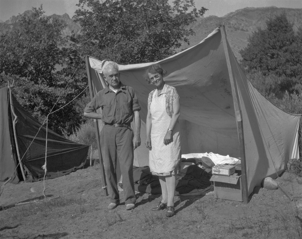 Forrest and Agnes Whitaker stand in front of a tent at camp - 1930 |
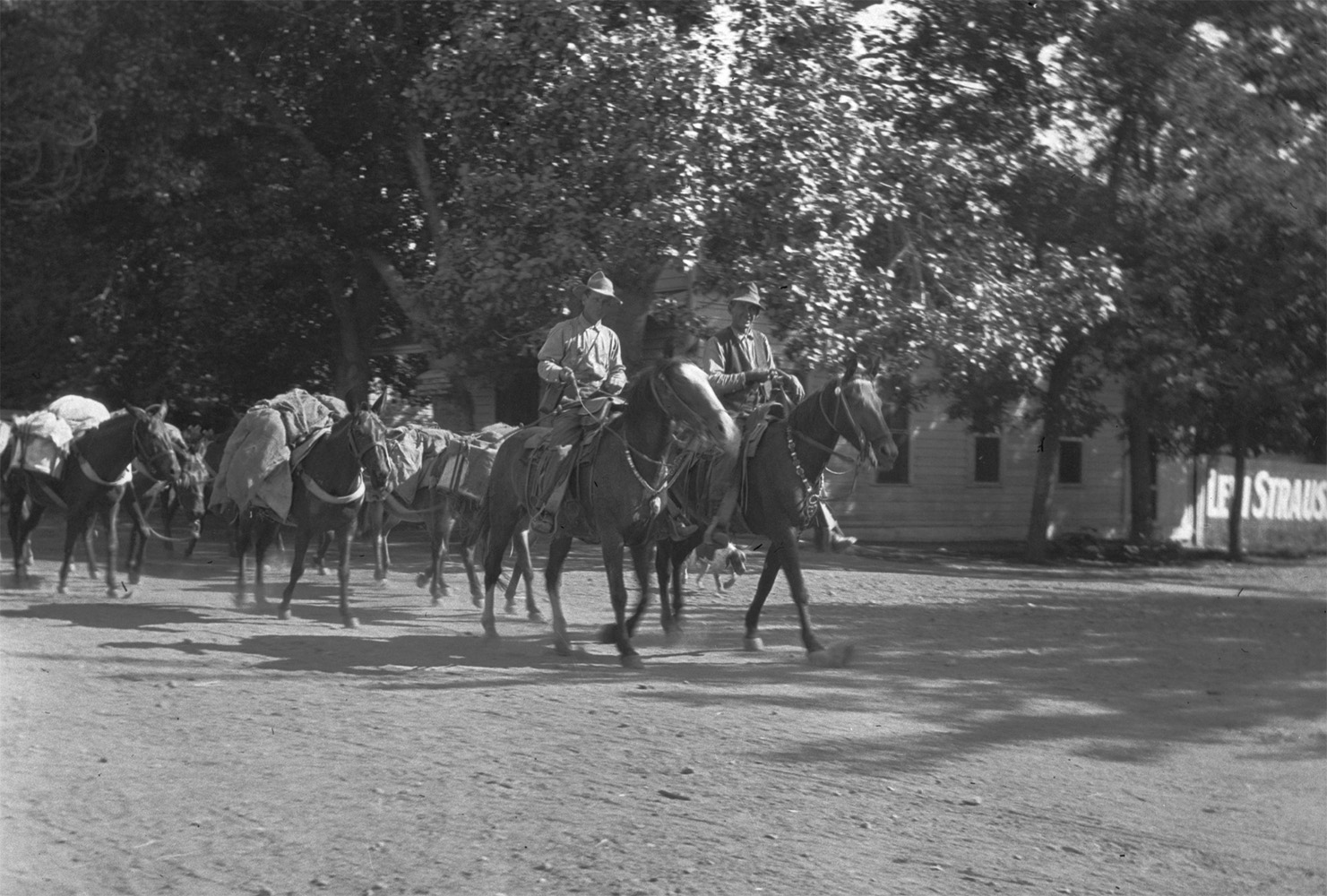 Packtrain leaves for the High Sierra - 1914 |
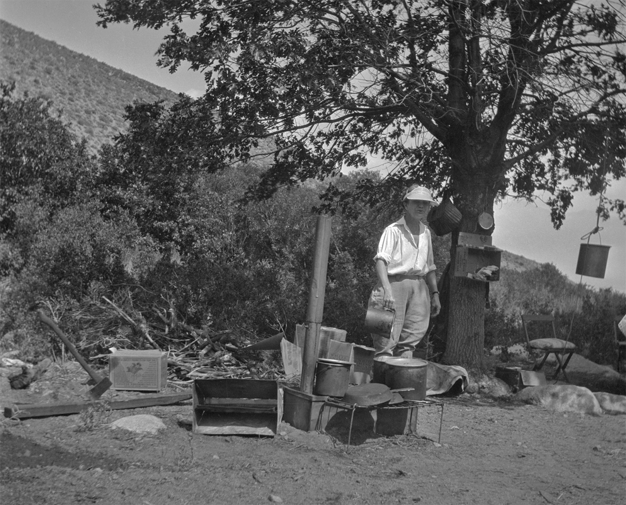 Mertie West at his campsite - 1930 |
|
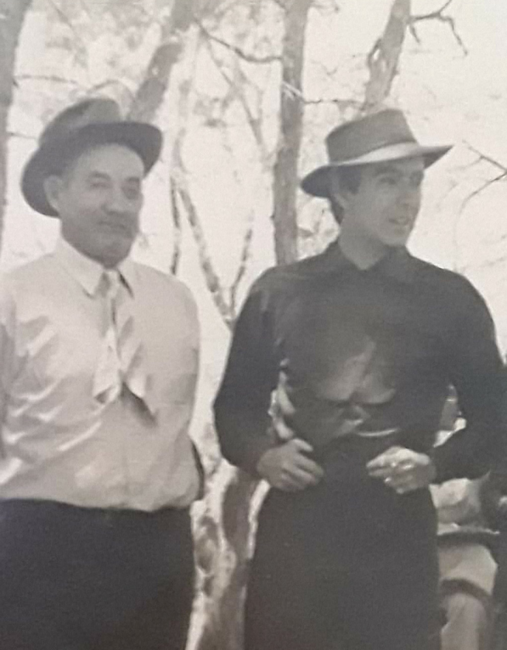
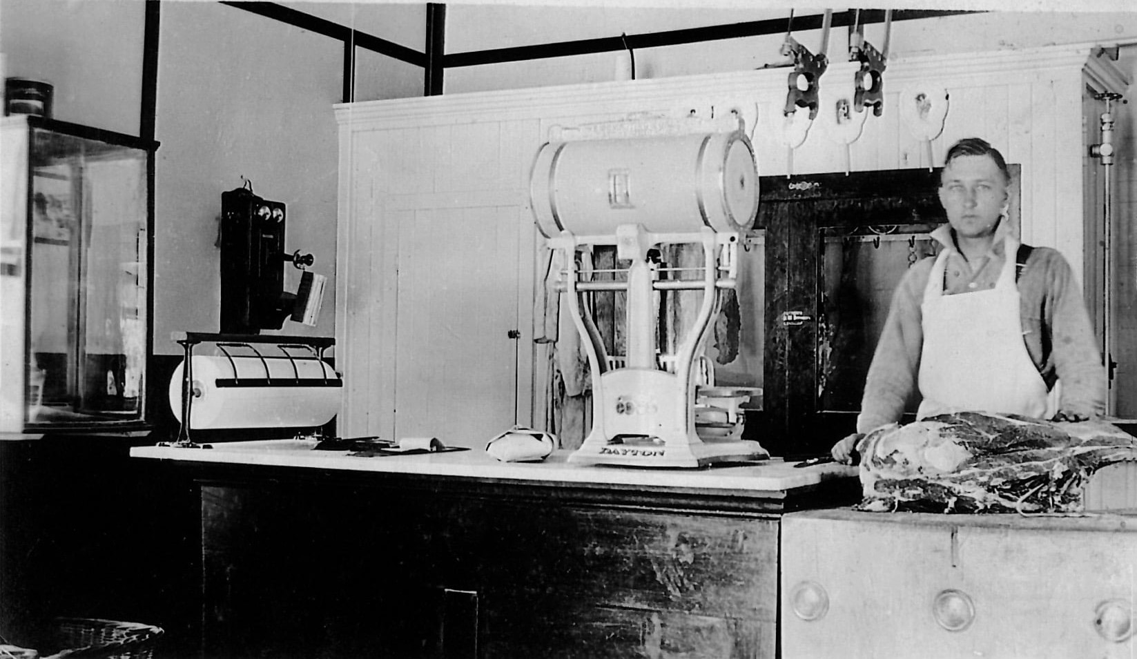 My granddaddy, Alex Krater, came to Independence in 1912 at age 16 to live with his brother Frank. Frank had the first ice house in the southern part of Owens Valley and later owned the meat market. Alex took over the meat market after WWI and then owned the grocery store for many years. He later sold it to Omie Mairs. Here is a young Alex working at the meat market. (Photo and text courtesy of Janet Lally) Don Nichols writes: Frank Krater was my great grandfather, by marriage. He married my widowed great grandmother, Edna. Frank went to work for the DWP but remained partners with Alex in Several ventures in the valley. |
|||
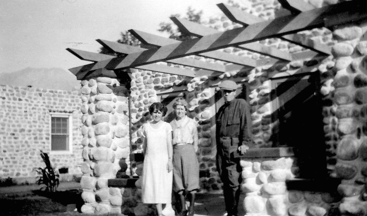
When my grandparents, Alex and Katharine Krater married in 1924, they lived in this little stone house in Independence. It was still there in the 1990s, not sure if it is still standing. (Photo and text courtesy of Janet Lally) Mary Anne Mairs writes: My grandmother and great aunt bought the house I think in the early 1940s..I'm not sure. When my parents married they lived in the "guillied" house behind the now courthouse motel. The house had no foundation and my mom stuffed rags around the door and windows to say warm. When my brother was born in 1949, they bought the house from my great aunt and my dad had a small house built for my grandma behind the house. The house had a flat roof and in 1969 we had a HUGE snow storm and the roof almost caved in. Water was pouring from the light sockets. My younger brother shoveled the snow from the roof as quickly as he could. My older brother and I were in college. That spring they had a pitched roof built. This rock house has beautiful rock work and plastering. The house next door is different. My parents added two back bedrooms in the 1950s when my 2nd brother was born, enlarged the living room by removing a wall to a bedroom and built a wash house connecting the house to the garage. Mono Cole writes: My great aunt Anna Kelly and her husband OK Kelly lived there for years. They opened a gas station on the south end of Independence that must have been put in later. They lived in the house at the same time. |
|||
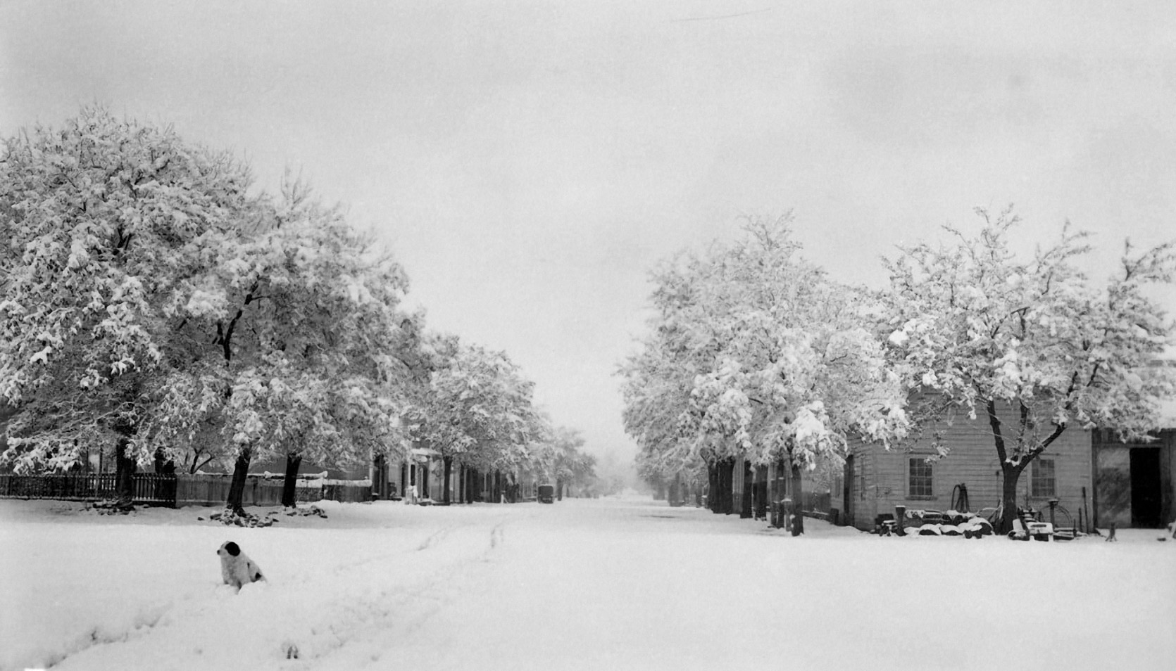 Independence in the winter of 1909 (Photo courtesy Mike Vredenburgh) |
|||
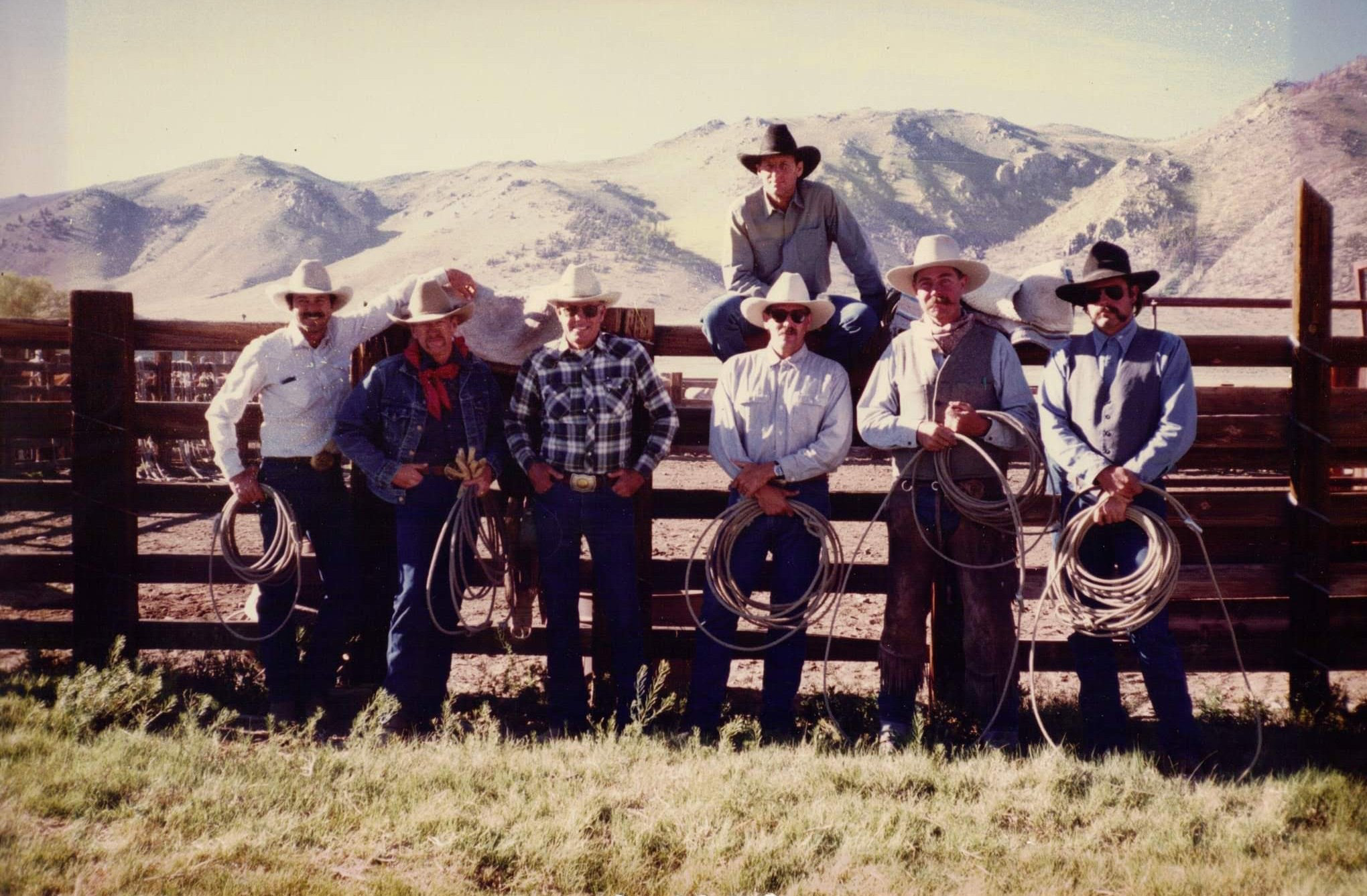 Independence cowboys at the end of a fall horse drive by the Mammoth Lakes Pack Outfit- circa 1990s L/R: Lee Roeser, Larry M., Lou R., Frank H.,Rene D., Ed (?), Scott L. sitting on the corral rail. (Photo courtesy Marye Roeser)) |
Photos courtesy of the National Park Service |
|
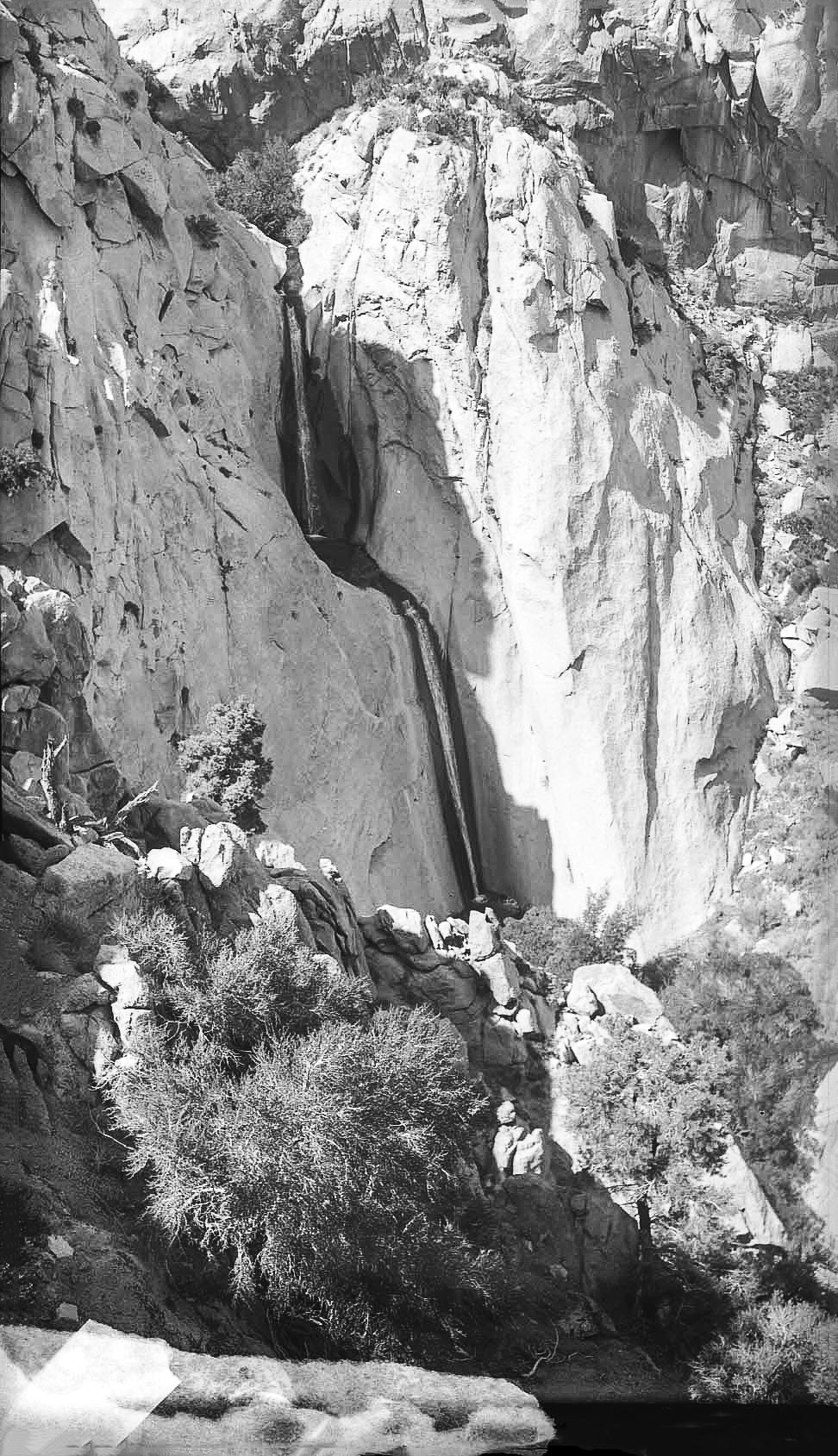 Black Canyon waterfall west of Independence, CA - 1935 |
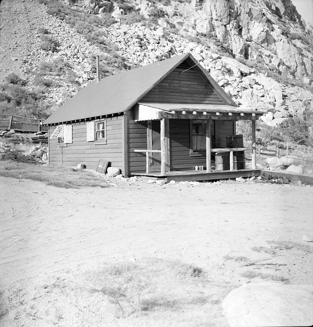
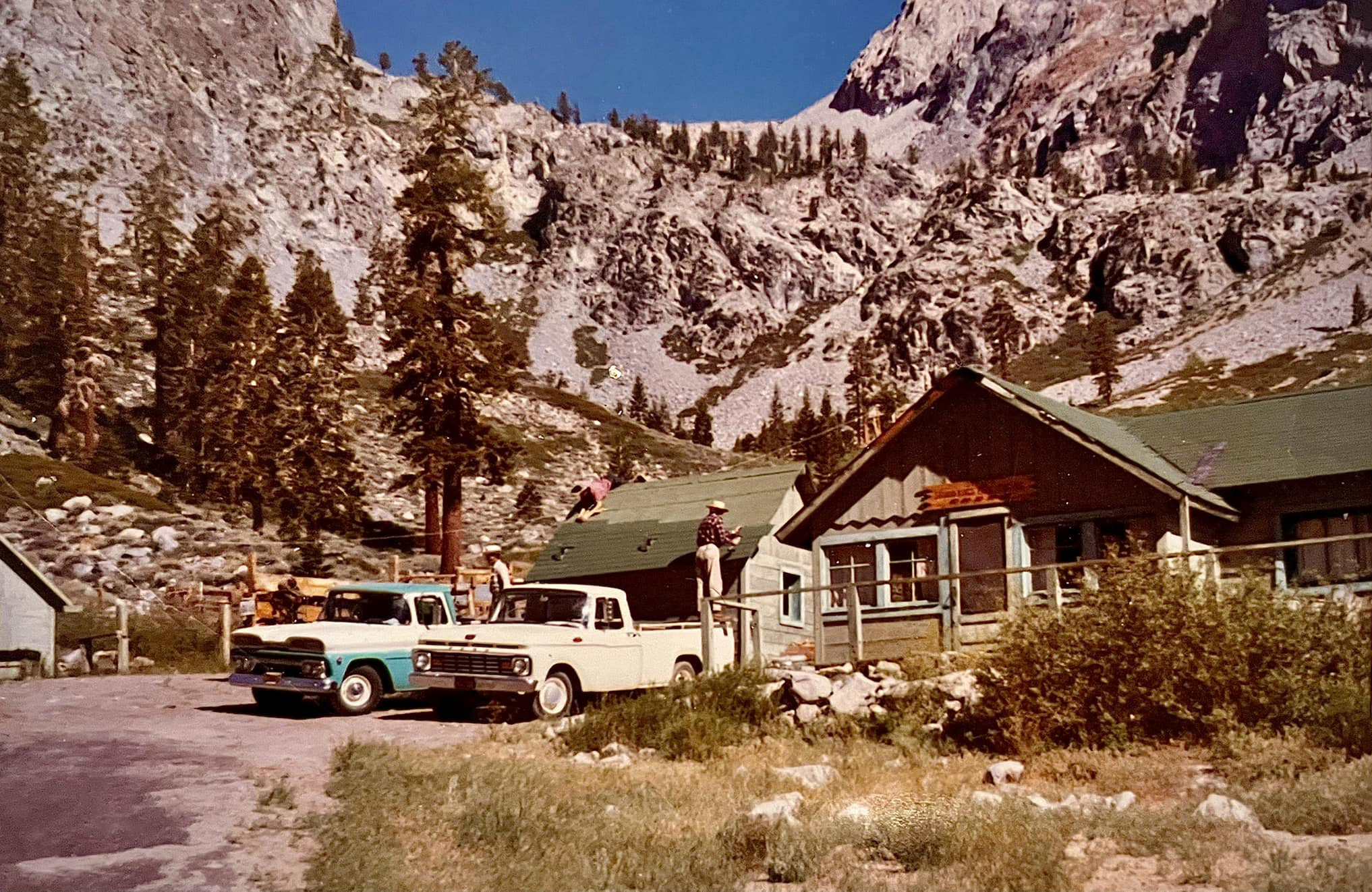
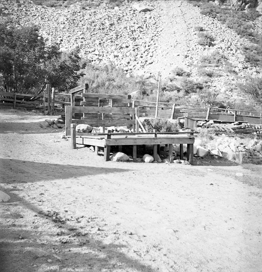 Concessioner facilities at the Burkhart Pack Station, Onion Valley |
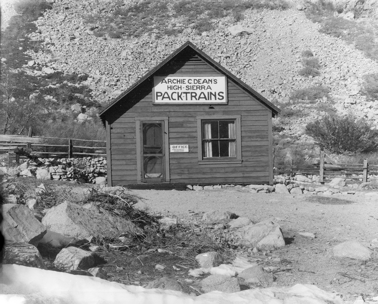
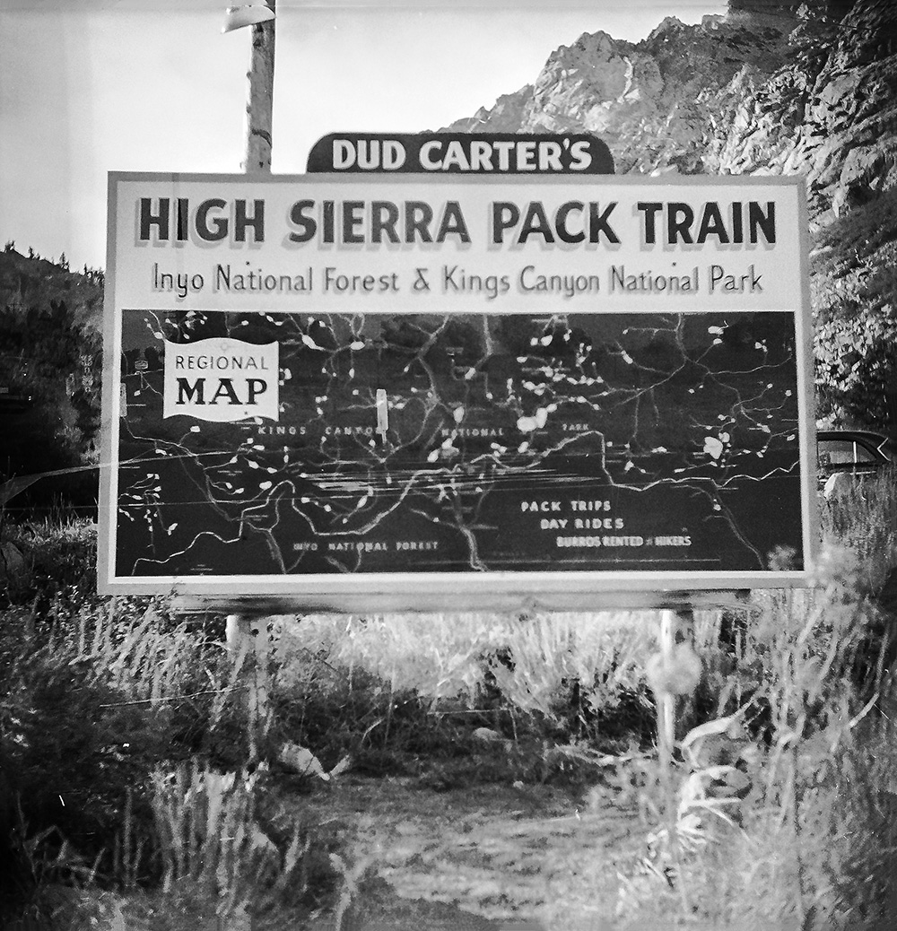 Dud Carter's High Sierra Pack Train sign |
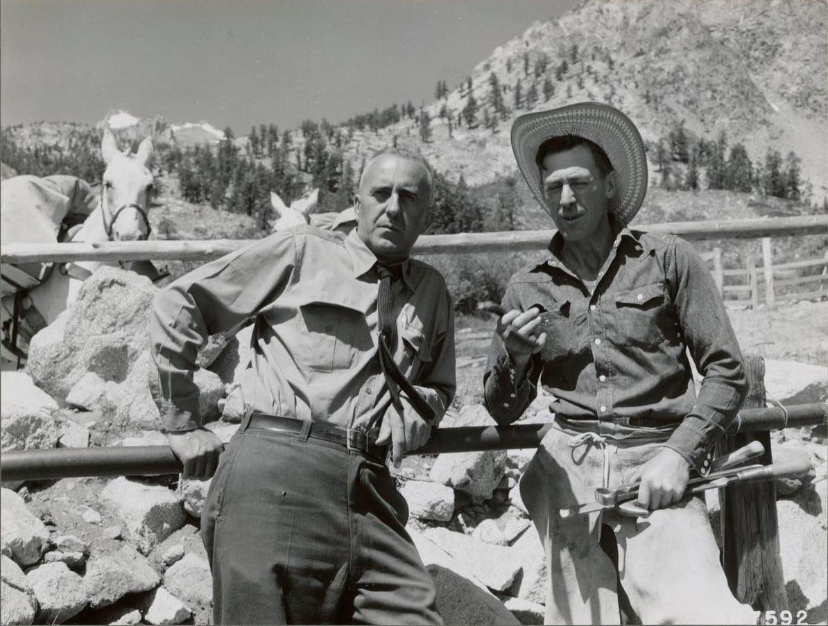
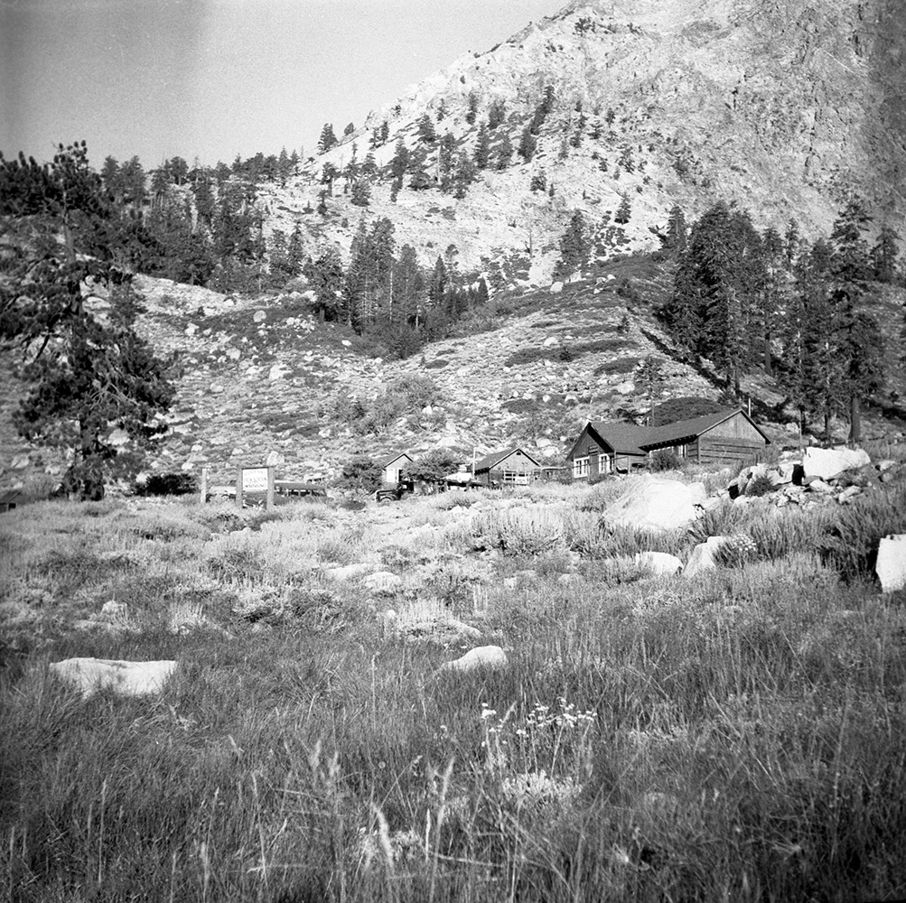 Onion Valley, Independence, CA Pack Train operations |
|
|
Sierra Names | |
|
|
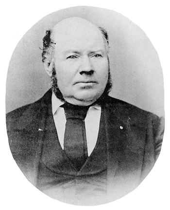
George Brown - Owens Valley Pioneer | |
|
|
To the Top of Mt. Whitney | |
More Independence |
||
|
The Wonacott Family |
|
|
|
Keeler |
|
|
|
Aberdeen |
|
Sign Guestbook View Old Guest Book Entries Oct 1999 - Feb 2015 (MS Word) |
 CONTACT the Pigmy Packer |
View Guestbook View Old Guest Book Entries Oct 1999 - Feb 2015 (PDF) |