 |
 |
|
|
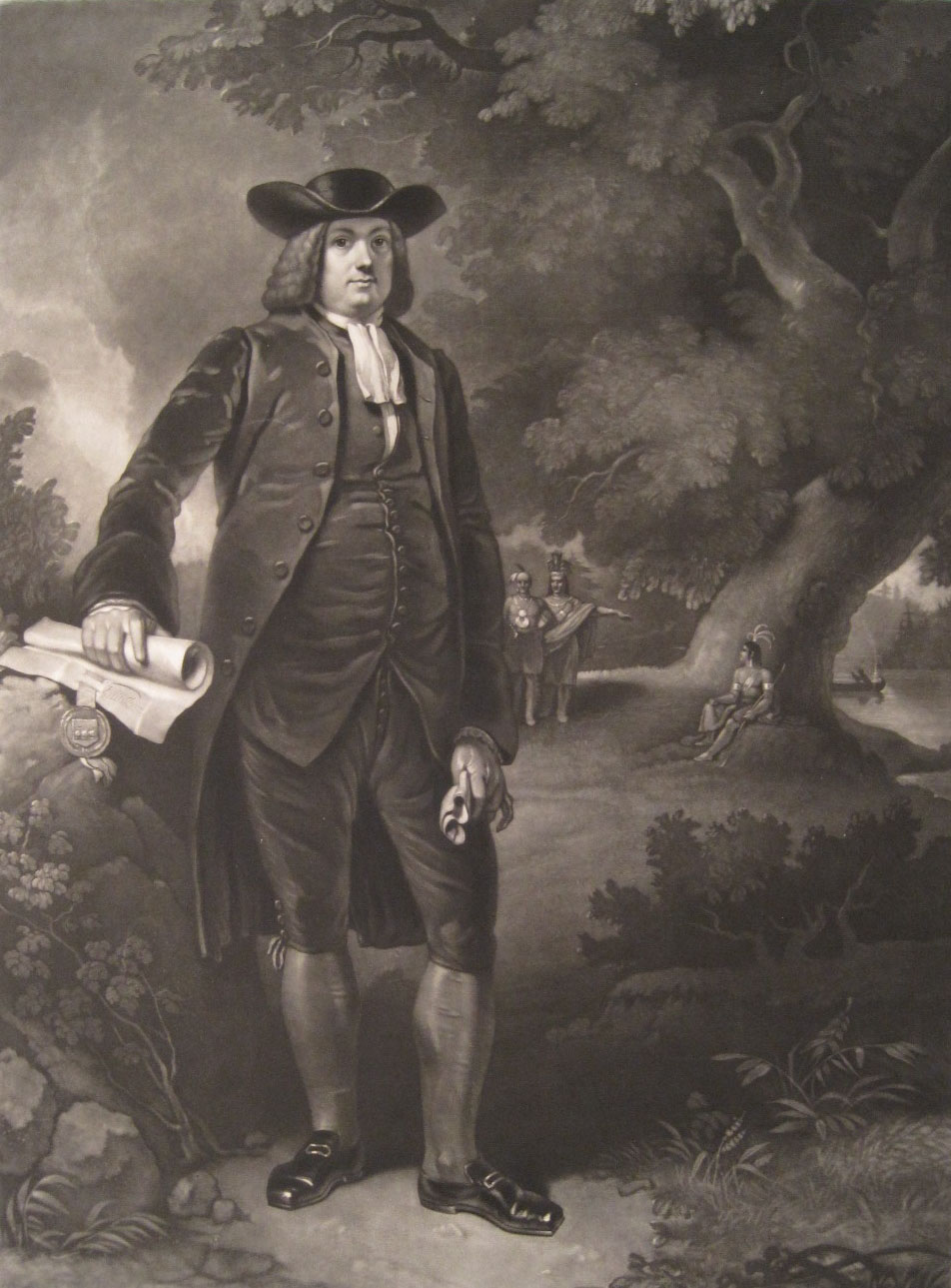
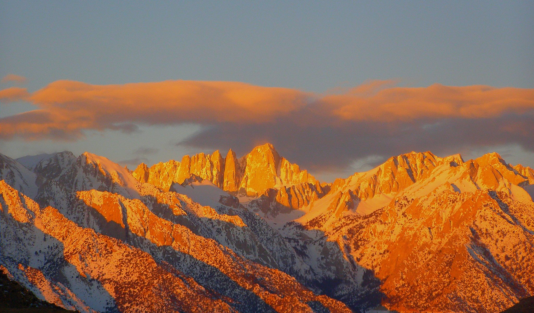 If the Eastern Sierra had no attractions other than Mt. Whitney itself, people would still flock to the area to see and experience the great mountain in numbers rivaling the population of a small state. There is a special magic about Mt. Whitney that has drawn people to it for 150 years. Whether gazing at the majestic peak from along El Camino Sierra, negotiating the twists and turns of Whitney Portal Road, or making the long climb to its summit-the highest spot in the contiguous United States the faithful seem to hear as John Muir once did, "The mountains are calling and I must go." At 14,505 feet, Mt. Whitney is the highest peak in the lower 48 states. In1864 while working in the Eastern Sierra, members of the California Geological Survey named the peak after their boss Josiah Whitney, the State Geologist of California at that time. Originally, this peak was referred to by local Paiute and Shoshone as "Tooman-i-goo-yah," which translates to "guardian spirit." Native Americans have inhabited the Owens Valley and Eastern Sierra for thousands of years and their ancestors were undoubtedly the first human beings to stand upon its summit. During the 1864 California Survey, geologist Clarence King attempted to climb Whitney from its west side, but was stopped just short of its summit. King returned in 1871 to attempt another climb to what he believed to be Mt. Whitney, but having taken a different approach, he actually summited nearby Mt. Langley. 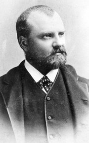 Learning he had a made a mistake, King struck out in September of 1873, to continue his quest to be the first non-Native American to reach its summit, but he was too late. In August of that year, three men from Lone Pine and Independence, Charles Begole, A.H. Johnson and John Lucas, had already made the first recorded ascent to its summit. They chose to name the mountain "Fishermans Peak." Learning he had a made a mistake, King struck out in September of 1873, to continue his quest to be the first non-Native American to reach its summit, but he was too late. In August of that year, three men from Lone Pine and Independence, Charles Begole, A.H. Johnson and John Lucas, had already made the first recorded ascent to its summit. They chose to name the mountain "Fishermans Peak." Residents of the Owens Valley liked the name "Fishermans Peak." King challenged the name and Lone Pine folks countered with the name "Dome of Inyo." A bill was introduced in the California State Legislature making Fishermans Peak the official name, but the governor vetoed the bill. Finally, after ten years of wrangling, the name Mt. Whitney was officially recognized by both the state and federal governments. Hiking alone from Independence in 1873, John Muir became the next person recorded to have made it to Whitney's summit. Muir approached the peak via its north face, by what now is called "the Mountaineer’s Route." For the next 20 years, the trip to the top was a dangerous one. A narrow trail was beaten out by boots but the upper part was dangerous for stock and pack animals. Realizing the huge tourism potential of having the nation's tallest peak in its front yard, the citizens of Lone Pine raised enough money to build a good trail for tourists to travel to Whitney's summit in 1904. Lone Pine local Gustave Marsh was hired to design and build a trail to the top, manageable by both humans and stock animals. The trail was completed and its opening celebrated on July 22, 1904. Firewood was hauled to the summit by mules and a huge bonfire was set. The fire, easily seen from Lone Pine, was meant to signal the townsfolk that the trail was completed. An employee from the U.S. Department of Fish and Wildlife was struck and killed by lightning on Whitney's summit just four days after the trail was completed. Because scientists would be using the summit of Mt. Whitney for conducting high altitude tests, the Smithsonian Institute and the Lick Observatory came up with funds to build a stone hut on its summit to protect the workers from the elements. Marsh was once again contracted to do the work. The 11 x 30-foot rock building still stands solidly at the summit, though high altitude testing is no longer conducted. The structure is listed on the U.S. National Register of Historic Places. 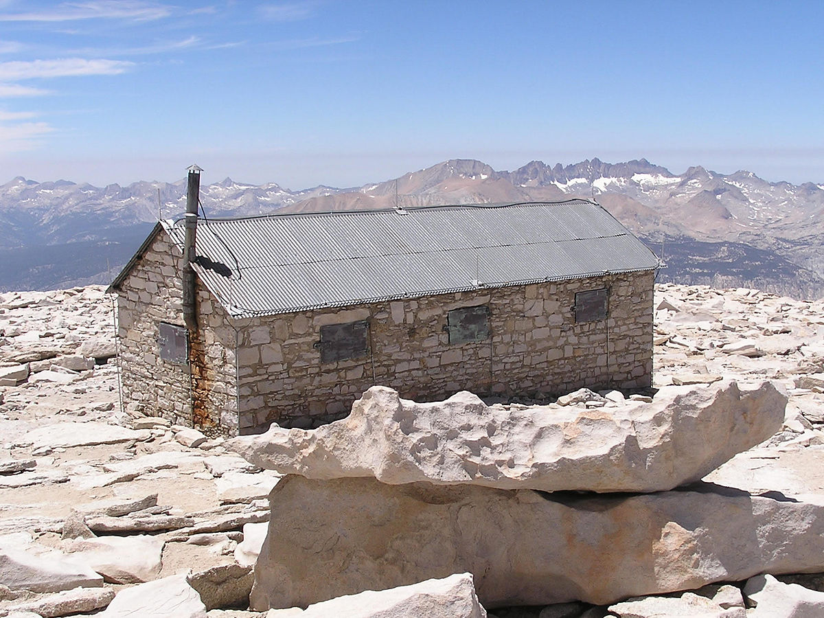 Marsh's trail started down at Lone Pine Campground since there was no road to Whitney Portal at that time. As part of Franklin Roosevelt's New Deal, the Civilian Conservation Corps (CCC) was brought in to construct a new "auto road" m 1936 to be called the Whitney Portal Road. The road was another of those marvels of engineering that seems to be almost commonplace m the Eastern Sierra. The CCC Lone Pine Camp worked on dozens of other Inyo National Forest and Eastern California projects. With increasing demands from visitors now able to drive further up the mountain, the Mt. Whitney Pack Trains built a store and corrals at Whitney Portal. In 1938, the Whitney Trail was rebuilt by the Forest Service with Chrysler and Cook's Mt. Whitney Pack Trains of Lone Pine hauling up all of the supplies for the trail crew. A back-country camp operated for a short period along the trail at Outpost Camp, providing comfortable beds and meals for travelers to Mt. Whitney. 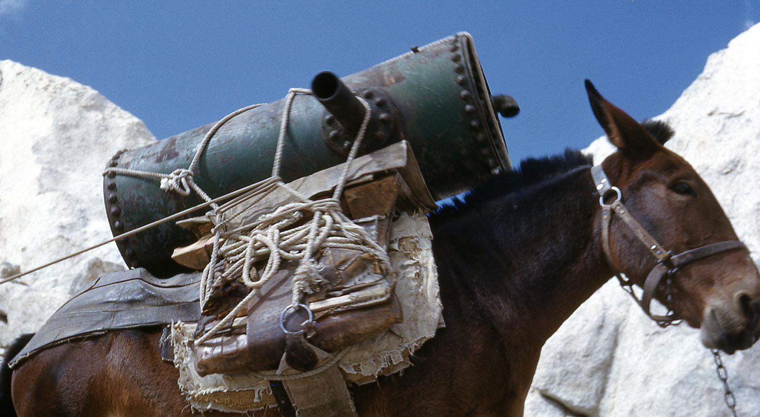 In the 1940s, the Forest Service wanted to rebuild and realign some of the steeper parts of the trail. Rock drills would be required for some of the work. A much needed 10,000-pound air compressor was taken apart and its pieces hauled eight miles up to the job site by mule-powerwhere it was reassembled. The largest single part was a crankshaft weighing 344 pounds! In the 1940s, the Forest Service wanted to rebuild and realign some of the steeper parts of the trail. Rock drills would be required for some of the work. A much needed 10,000-pound air compressor was taken apart and its pieces hauled eight miles up to the job site by mule-powerwhere it was reassembled. The largest single part was a crankshaft weighing 344 pounds!Hollywood movie-studios discovered the beautiful scenery at Whitney Portal would work perfectly for some of their films. The character of Mad Dog Earl, played by Humphrey Bogart in the movie High Sierra, met his fate at the hands of the law on the slopes above the Whitney Portal store. This is where they filmed the last scene, where Bogart uttered his famous final line, "That's what you think coppers" before being brought down by police sharpshooters. Lucille Ball and Desi Arnaz' character's fateful trip over the steep Sierra Mountain pass in the movie The Long, Long Trailer was skillfully filmed on the Whitney Portal Road. In the 1960s and '70s, as hiking and backpacking became more and more popular, so did attempts to get to the summit of Mt. Whitney On busy summer weekends, 300 people would often make it to the summit. On one Labor Day Saturday, 1,500 hikers arrived at the top. The numbers were overwhelming and caused the Forest Service to enlist the help of a helicopter to remove the garbage left behind by the mass 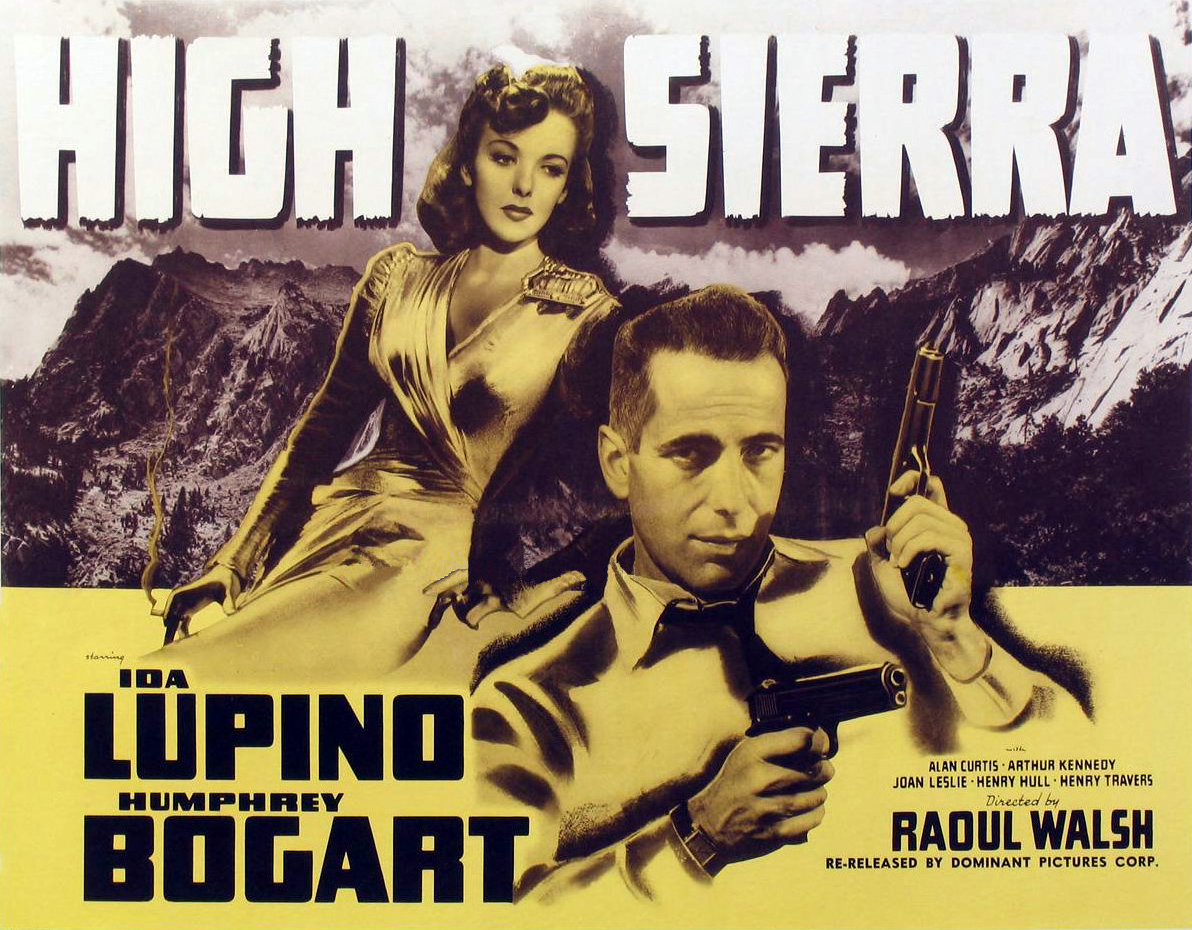 of humanity. of humanity. In 1971, Inyo National Forest implemented a wilderness permit system, which required hikers to state the number in party, point of entry, exit location, days of use etc. This information was analyzed and studied, and a quota permit system was developed. In an effort to minimize the human impact on this most popular of hiking destinations, the Forest Service implemented a variety of regulations. Currently, the number of people allowed to enter from the Whitney Portal trailhead is limited to 160 per day and are selected by a lottery. Camping along the trail is restricted to specific locations and hikers are required to carry out their solid human waste as well as their garbage. Mt. Whitney and Whitney Portal remain some of the most popular destinations m the Eastern Sierra. For nearly 150 years, whether it be lunch at the Portal Cafe or a climb to its lofty summit, visitors and locals alike make their personal pilgrimage to an often times life moving experience at this most magical of locations found along El Camino Sierra. |
|
|
 Americans had dug ditches by hand to divert streams to areas suitable to grow food, enabling them to feed their families for hundreds of years.
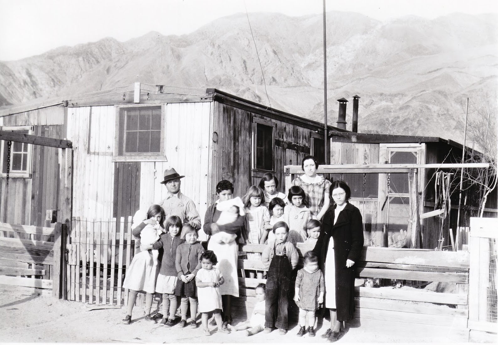
|
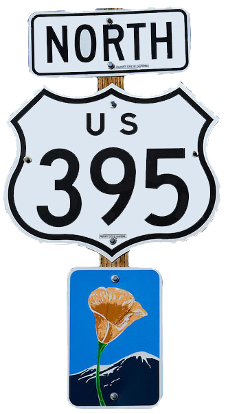
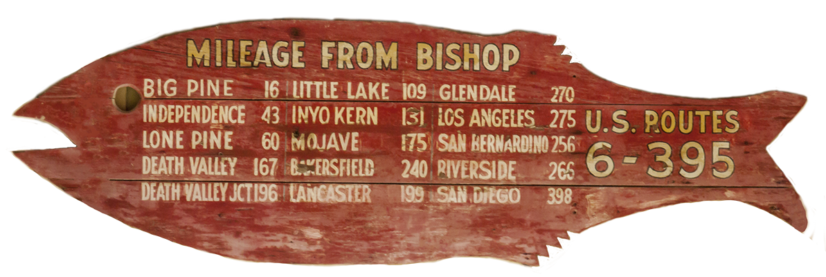 For decades, travelers who were headed to their favorite Eastern Sierra destination were guided by the friendly and welcoming profile of the "Red Fish." Erected at numerous spots along El Camino Sierra, the Red Fish was the brainchild of yet another of the brilliant Inyo Good Roads Club's forward thinkers and promoters extraordinaire. Lemoyne Hazard was an early member of the Inyo Good Roads Club. Hazard opened one of El Camino Sierra's first auto repair shops in Bishop. Knowing many of those who motored to the Eastern Sierra in those early days would greatly benefit from having as much information available as possible, Hazard posted hundreds of road signs in the shape of a big red fish, with the miles and distances to communities and destinations posted prominently upon them. The promotion came to be known simply as the "Red Fish." The nation had its Burma Shave signs, El Camino Sierra had its Red Fish. Hazard was also an Inyo County Deputy Sheriff. He served his community diligently until he met his mortal fate while responding to a domestic disturbance in 1925. Lemoyne is one of five Inyo County law enforcement officers who have lost their life in the line of duty. The Red Fish promotion was wildly successful. Travelers became as familiar with the crimson Pisces as they did with the silhouette of Mt. Whitney. Hazard's family not only continued the successful promotion after his death, they greatly expanded upon it as well. Decals were produced and tourists and locals alike would proudly display the Red Fish on their car's windows and bumpers. Beautify America programs eventually led to a dramatic decline in the number of signs posted along the nation's highways. The Eastern Sierra was no exception and the Red Fish signs soon became yet another fond memory and true tale found along El Camino Sierra. |
Kathy Jefferson-Bancroft Archives |
||
| Tommy Jefferson | ||
| Squawbuck Joe | ||
| Casa Vieja & Surrounding Areas | ||
Owens Valley Progress-Citizen Newspaper |
||
Lona Burkhart: Cow Tracks on the Land |
||
Heritage and Humble Pie |
Sign Guestbook View Old Guest Book Entries Oct 1999 - Feb 2015 (MS Word) |
 CONTACT the Pigmy Packer |
View Guestbook View Old Guest Book Entries Oct 1999 - Feb 2015 (PDF) |